Wetlands-What’s in a name?

Wetlands- What’s in a name?
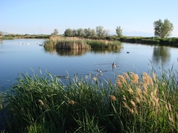
Wetlands- What’s in a name? Pond and marsh showing wetland plants with Canada geese goslings and pelicans. Photo Courtesy and Copyright Mark Larese-Casanova
Pond and marsh showing
wetland plants with
Canada geese goslings and pelicans.
Courtesy & Copyright ©
Mark Larese-Casanova
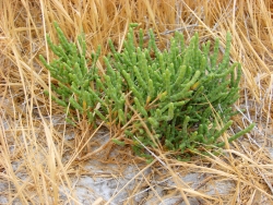
Wetlands- What’s in a name? Pickleweed growing in a salt playa is adapted to growing in saline soils. Photo Courtesy and Copyright Mark Larese-Casanova
Pickleweed growing in a salt playa
is adapted to growing in saline soils.
Courtesy & Copyright ©
Mark Larese-Casanova

Hi, this is Mark Larese-Casanova from the Utah Master Naturalist Program at Utah State University Extension.Wetlands- What’s in a name?

A wetland really is more than just ‘land that is wet’. There are certain key ingredients that need to go into a wetland for it to truly be a wetland. Of course, water needs to be present for at least part of the growing season. It can simply be in the form of temporarily saturated soils or even standing water a few feet deep.

As soil becomes saturated with water, oxygen levels are greatly reduced. Quite often, bacteria in saturated soils will create hydrogen sulfide, giving wetland soils that stinky odor of rotten eggs. As plants grow in a wetland over several years, their decaying matter helps to create a thick, dark layer of organic soil.

The presence of water in a wetland encourages the growth of hydrophytes, or ‘water-loving’ plants, that are specially adapted to living in wet environments. Many wetland plants have open spaces within the leaves and stems- often referred to as aerenchyma. This allows oxygen to diffuse down to the roots, sometimes creating an oxygen-rich environment in the soil around a plant. Also, many wetland plants reproduce both by floating or wind-dispersed seeds and by rhizomes, which are underground roots that can travel great distances. Some plants that grow in salty wetlands around the Great Salt Lake are able to control the salt in their tissues by depositing it on the outside of the leaf or containing it in chambers within their cells.

Like plants, specially adapted animals also call wetlands their home. Mammals and birds have oily fur or feathers that allow them to swim in cold water without losing much body heat. They also often have webbed feet to aid in swimming. Other animals, such as fish, amphibians, and insects, have gills to breathe in water.

Despite being the second driest state in the country, Utah has a high diversity of wetlands. Vast marshes surround the Great Salt Lake, providing habitat to enormous populations of migratory birds. Less obvious wet meadows provide unique habitat to butterflies and other insects. Salty playas, which are shallow basins with no outlet, are found throughout the West Desert, creating unique ecosystems of highly adapted plants. Riparian wetlands can grow along the edges of rivers, providing a unique transition between the swift water and upland habitats. Southern Utah is home to some peculiar wetlands such as potholes and hanging gardens, both associated with sandstone bedrock. A hanging garden clings to the side of a moist cliff, creating a microhabitat for rare plants, such as orchids and monkeyflower. Potholes can simply be eroded basins in the sandstone where water collects in spring. A pothole is an oasis that provides water for desert wildlife and a home for fairy shrimp and spadefoot toads.

Spring is the perfect time of year to visit a wetland. The constant chorus of birds, insects and amphibians are a testament to the importance of wetlands, teeming with life in the middle of a desert.

For Wild About Utah, I’m Mark Larese-Casanova.

Credits:

Images: Courtesy & Copyright © Mark Larese-Casanova

Text:     Mark Larese-Casanova, Utah Master Naturalist Program at Utah State University Extension.
Additional Reading:

Mitsch, W.J., and J.W. Gosselink. (1993). Wetlands. Van Nostrand Rheinhold.

Tiner, R. W. (1999). Wetland Indicators: A Guide to Wetland Identification, Delineation, Classification, and Mapping. CRC Press

Utah Division of Wildlife Resources. (1995). Playas to Marshes…Where Water Meets Land. Growing WILD Newsletter. https://www.wildlife.utah.gov/education/newsletters/95spring-gw.pdf

Utah Division of Wildlife Resources. (2003). Utah’s Wonderful Wetlands Activity Guide. https://wildlife.utah.gov/education/pdf/wetlands_activity_guide.pdf
Wetlands- What’s in a name?
The History of Our National Forests

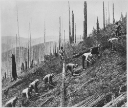
Civilian Conservation Corps
enrollees clearing the land
for soil conservation
Photo Courtesy National Archive
Franklin D. Roosevelt Library (NLFDR)

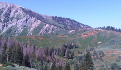
Terraces near Mount Nebo trailhead
Payson Canyon
Photo Courtesy & Copyright © 2011
Lyle W. Bingham, Photographer

Albert Potter
Photo Courtesy USDA Forest Service
The Greatest Good
A Forest Service Centennial Film

Hi, this is Mark Larese-Casanova from the Utah Master Naturalist Program at Utah State University Extension.

Warm springtime weather brings clear trails up in the mountains, and hiking through the shade of Douglas-fir on a warm weekend day had me wondering about Utah’s National Forests and how they came to be.

Back in the days of the early pioneers, Utah’s mountains were recognized as resources for survival, providing clean water for drinking and irrigation and lumber for building homes. The high mountain pastures were also valuable summer forage for livestock. In the late 1840’s, Parley Pratt declared, “The supply of pasture for grazing animals is without limit in every direction. Millions of people could live in these countries and raise cattle and sheep to any amount.” Many settlers shared this view, and unmanaged grazing resulted in deteriorated rangelands in just 20 to 30 years. By 1860, some Utah towns were experiencing regular flooding and heavy erosion due to insufficient vegetation to stabilize the soil. Unregulated wholesale timber harvesting during the same period also contributed to these conditions.

In 1881, the US Department of Agriculture’s Division of Forestry (later renamed the Forest Service) was established, and its first job was to gather information about the condition of the nation’s forests. In 1902, Albert F. Potter, who was the inspector of grazing for the General Land Office, conducted a survey of potential Forest Reserves in Utah. Potter stated that “the ranges of the State have suffered from a serious drought for several years past, and this, in addition to the very large number of livestock, especially of sheep, has caused the summer range to be left in a very barren…condition.”

The demand for lumber and wool during the First World War again led to increased timber harvesting and grazing on our forests. During the Great Depression of the 1930’s, Franklin D. Roosevelt established the Civilian Conservation Corps (CCC) to help implement conservation projects across the country. The CCC was fundamental in re-foresting much of the Wasatch and Uinta Mountain ranges, planting over three million trees in nine years.

Utah’s Forest Reserves were created in the years soon after Albert Potter’s surveys, and were gradually combined into Utah’s seven National Forests that now cover approximately 10,500,000 acres, or about 20%, of the state. Grazing and timber harvesting still occur on much of Utah’s National Forests, but our practices are supported by scientific research and over a century of experience, ensuring more sustainable multiple use and management of our forests today.

For Wild About Utah, I’m Mark Larese-Casanova.

Credits:
Images: Courtesy National Archives, Franklin D. Roosevelt Presidential Library
              and Courtesy and Copyright © 2011 Lyle W. Bingham
Text:     Mark Larese-Casanova, Utah Master Naturalist Program at Utah State University Extension.


Additional Reading:

Baldridge, K.W. The Civilian Conservation Corps in Utah. Utah History To Go.
https://historytogo.utah.gov/utah_chapters/from_war_to_war/thecivilianconservationcorps.html

Prevedel, D.A., and C.M. Johnson. 2005. Beginnings of Range Management: Albert F. Potter, First Chief of Grazing, U.S. Forest Service, and a Photographic Comparison of his 1902 Forest Reserve Survey in Utah with Conditions 100 Years Later. United States Department of Agriculture, US Forest Service. R4-VM 2005-01. https://www.fs.fed.us/rm/pubs_other/r4_vm20005_01.pdf

A Grand Old River

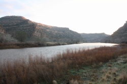
A Grand Old River: The Island Acres Part of James M. Robb Colorado River State Park Fruita, CO Courtesy Daniel Smith, Photographer
The Island Acres Part of
James M. Robb Colorado River State Park
Fruita, CO
Courtesy Daniel Smith, Photographer

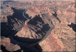
The Colorado River from Dead Horse Point State Park, near Moab,Utah, USA Courtesy Phil Armitage, Photographer The Colorado River from
Dead Horse Point State Park,
near Moab,Utah, USA
Courtesy Phil Armitage, Photographer

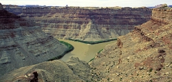
Confluence of the Colorado and Green Rivers in Canyonlands National Park Courtesy USGS Photo by Marli Miller, Photographer Confluence of the Colorado and Green Rivers
in Canyonlands National Park
Courtesy USGS
Photo by Marli Miller, Photographer

Confluence of the Colorado and Green Rivers in Canyonlands National Park Courtesy National Park Service Confluence of the Colorado and Green Rivers
in Canyonlands National Park
Courtesy National Park Service

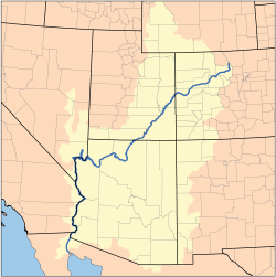
Map of the Colorado River Watershed by Karl Musser based on USGS data This file is licensed under the CCA ShareAlike 2.5 License. Map of the Colorado River Watershed
by Karl Musser based on USGS data
This file is licensed under the
CCA ShareAlike 2.5 License.

Hi, I’m Holly Strand of Stokes Nature Center in beautiful Logan Canyon.

The Colorado River is the largest waterway in the southwest. 1,450 miles long, the Colorado River basin drains 248,000 square miles in 7 large states. In Utah, the river enters near Cisco south of I-70, winds its way through Arches and Canyonlands National Parks, then flows through Glen Canyon and exits south into Arizona.

Less than 100 years ago, the Colorado River wasn’t in Utah or even in Colorado. Until 1920, “Colorado River” referred only to the river section downstream from Glen and Grand Canyons. Upstream, it was called the Grand River all the way up the headwaters in the Colorado Rockies. Thus we have Grand County in Utah and the town of Grand Junction in Colorado.

According to Jack Schmidt, professor in Utah State University’s Department of Watershed Sciences and a longtime scholar of the river, the good citizens of the state of Colorado weren’t pleased with the Colorado River’s location.
So in 1920, the Colorado Legislature renamed Colorado’s portion of the Grand River, with a somewhat awkward result: The Colorado River began in Colorado, became the Grand River at the border with Utah and then became the Colorado River again at the confluence with the Green.

This arrangement did not last long –again because of a Colorado legislator. U.S. Representative Edward T. Taylor, petitioned the Congressional Committee on Interstate and Foreign Commerce to rename the entire river as the Colorado. Despite objections from Utah and Wyoming representatives and the U.S. Geological Survey, the name change was made official by the U.S. Congress on July 25, 1921.

The objections were legitimate: In the 1890s the Federal Board on Geographic Names established the policy of naming rivers after their longest tributary. The former Grand River of Colorado and Utah was shorter than the Green River tributary by quite a bit. So the Green river should have prevailed and the Colorado should have been one of its tributaries.

However, if you judge tributary primacy by volume, the Colorado wins hands down. 100 years ago, the upper Colorado (or former Grand River) had a significantly higher total flow than the Green.

But what’s in a name? Prior to widespread European settlement, the Grand River was known as Rio Rafael and before that, different parts of the river had numerous Native American and Spanish names. A thousand years from now the rapidly evolving Colorado could have an entirely different identity. The main thing is that Utahns can enjoy and appreciate the habitat, scenery and many resources that this important waterway provides.

Thanks to the USU College of Natural Resources and the Rocky Mountain Power Foundation for supporting research and development of this Wild About Utah topic.

For Wild About Utah and Stokes Nature Center, I’m Holly Strand.

Credits:


Images:

JamesMRobbColorado_riverDanielSmith.jpg: Taken in the Island Acres Part of James M. Robb Colorado River State park by Daniel Smith and released into the Public domain.

DeadHorsePtSP_UtahPhilArmitage.jpg: The Colorado River from Dead Horse Point State Park, near Moab, Utah, USA. Photo by Phil Armitage (May be used for any purpose)

ConfluenceUSGSMarliMiller.jpg: Confluence of the Colorado and Green Rivers in Canyonlands National Park. USGS Photo by Marli Miller.

ConfluenceNPS.jpg: Confluence of the Colorado and Green Rivers in Canyonlands National Park. National Park Service.

Colorado River Watershed Map, by Karl Musser based on USGS data, licensed under the
Creative Commons Attribution ShareAlike 2.5 License: In short: you are free to share and make derivative works of the file under the conditions that you appropriately attribute it, and that you distribute it only under a license identical to this one. Official license


Text: Mary-Ann Muffoletto, Holly Strand, Content reviewed by Jack Schmidt of Utah State University’s Department of Watershed Sciences and a longtime scholar of the Colorado River.

Sources & Additional Reading:


Benke, A. C., and C. E. Cushing (editors). 2005. Rivers of North America. Academic/Elsevier. Amsterdam/Boston, 1168 pages.

Casey, Robert L. Journey to the High Southwest. Guilford, CT: Globe Pequot, 2007, p. 20.

Colorado Historical Society, Frontier Historical Society, www.bioguide.congress.gov

https://www.postindependent.com/article/20080325/VALLEYNEWS/68312863

”First Biennial Report of the Utah Conservation Commission, 1913,” Salt Lake City, Utah: The Arrow Press Tribune-Reporter Printing Co., 1913. p. 131.

McKinnon, Shaun. “River’s headwaters determined by politicians, not geography.” The Arizona Republic, 25 July 2004.

James, Ian, Scientists have long warned of a Colorado River crisis, The Los Angeles Times, July 15, 2022, https://www.latimes.com/california/story/2022-07-15/scientists-have-long-warned-of-a-colorado-river-crisis

Wilderness, Much Closer Than You Think

Wilderness, Much Closer Than You Think: Courtesy Wilderness.net and Copyright 2009 Cordell Andersen, Photographer
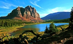
High Unitas Wilderness, Utah
Courtesy Wilderness.net
Copyright © 2009 Cordell Andersen, Photographer

Wilderness, Much Closer Than You Think: Courtesy Wilderness.net and Copyright 2011 Paul Gooch, PhotographerRed Butte Wilderness, Utah
Courtesy
Wilderness.net
Copyright © 2011 Paul Gooch, Photographer

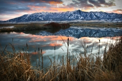
Courtesy Wilderness.net and Copyright 2011 Dusty Vaughn, PhotographerWellsville Mountain Wilderness, Utah
Courtesy Wilderness.net
Copyright © 2011 Dusty Vaughn, Photographer

Courtesy Wilderness.net and Copyright 2011 Mike Salamacha, BLM, PhotographerParia Canyon
Vermilion Cliffs Wilderness
Courtesy Wilderness.net
Copyright © 2011 Mike Salamacha, Paria Ranger, BLM, Photographer


The word conjures up romantic images of wide open landscapes teeming with birds, beasts, and plants. I imagine places untouched by human influence – truly wild and free. Places that are exotic and far away.

But wilderness exists much closer than you may think.

The United States Congress adopted the Wilderness Act with a nearly unanimous vote in 1964. Ours was the first country in the world to define and designate wilderness areas – lands valued enough to be set aside for the purpose of protection.

Currently, the Wilderness Act protects 757 individual wilderness areas across the United States – totaling more than 109 million acres. Thirty-three wilderness areas are found in Utah, and they protect a variety of unique landscapes from the red rock desert found in Red Butte Wilderness to the alpine forests of the High Uintas Wilderness. While the landscapes may look incredibly different from one wilderness area to the next, these lands share a number of qualities which can be described by adjectives such as peaceful, quiet, untouched, and pristine.

These areas protect some of the most unique and incredible landscapes that Utah has to offer, but that doesn’t mean they’re off limits. Our wilderness areas are just that – ours. They are public lands, accessible to anyone who wants to visit – so long as you tread lightly.

Areas that fall under its protection are described in the Wilderness Act as “lands designated for preservation and protection in their natural condition…” which “…shall be devoted to the public purposes of recreation, scenic, scientific, educational, conservation and historic use.” These amazing lands were set aside in 1964 with an eye to the future and because of it, should still be around for your grandchildren’s grandchildren to enjoy.

There is an ongoing effort to educate Americans about the immense value of preserving wilderness areas. For without education, they may one day be selfishly reclaimed and lost. One of these educational opportunities is coming to Logan on April 13th and 14th. The Arthur Carhart National Wilderness Training Center will be hosting a teacher training workshop in conjunction with the Stokes Nature Center and the Utah Society for Environmental Education. The workshop is aimed at teachers in grades 5-8, though anyone is welcome to attend. For more information, please contact the Stokes Nature Center at www.logannature.org

Not a teacher? The best way to learn about wilderness areas is to go visit one! Information, and photos of Utah Wilderness Areas, can be found at www.wildaboututah.org

For the Stokes Nature Center and Wild About Utah, this is Andrea Liberatore.

Credits:

Photos: Courtesy Wilderness.net, Steve Archibald, (Individual Copyrights noted)
Text:    Andrea Liberatore, Stokes Nature Center, logannature.org

Additional Reading:
The Arthur Carhart National Wilderness Training Center:
wilderness.net

Wilderness Investigations teacher training workshop:
logannature.org/wi_workshop

Public Law 88-577 a.k.a. Wilderness Act, Sept 3, 1964, U.S. Government Publishing Office: https://www.govinfo.gov/content/pkg/STATUTE-78/pdf/STATUTE-78-Pg890.pdf