Naomi Peak

Climbing Mt Naomi, Courtesy & Copyright Eric Newell, Photographer
Climbing Mt Naomi
Courtesy & Copyright Eric Newell, Photographer
Nature Journaling, Mt Naomi Hike, Courtesy & Copyright Eric Newell, Photographer
Nature Journaling
Mt Naomi Hike
Courtesy & Copyright Eric Newell, Photographer

Nature Journal Entries After Climbing Mt Naomi, Courtesy & Copyright Eric Newell, Photographer Nature Journal Entries After Climbing Mt Naomi
Courtesy & Copyright Eric Newell, Photographer

One September day when I was a fifth grader, my dad pulled me out of school to climb the Pfeifferhorn, an 11,000 foot peak in the Wasatch Range. That was the most meaningful and defining day of my elementary school experience.

Years later, when I first arrived in Logan, my younger sister Heather and I climbed Naomi Peak the day before our USU classes started. We made it an annual habit. At just under 10,000 feet elevation, Naomi Peak is the highest point in the Bear River Mountains.

Fast forward forty years from that day on the Pfeifferhorn and I’ve made a career of taking students out of class and into the mountains. Outdoor school programs are synonymous with science, but you can justify any destination with the language arts curriculum by having students write for authentic purposes and read meaningful texts.

When I taught at Mount Logan Middle School, we offered a literacy-based summer school program for incoming sixth graders. Part of that two-week experience was an overnight backing trip up to High Creek Lake. The next day we would climb Naomi Peak, then pack down the trail to Tony Grove. It is a grueling journey. We did it with student groups two to four times each summer for more than 15 years. Our strategy was simple, walk until our students were tired, then sit down, eat snacks, create word lists, and read and discuss a chapter of the book we were reading together. When students began to fidget, we’d hit the trail again. We repeated the pattern for eight hours, or however long it took to reach our destination. We wove science, math, and social studies concepts into the learning, but our main curriculum focus was literacy.

Four years ago, we decided to carry on these traditions with our sixth graders at Edith Bowen Laboratory School where I work, facilitating outdoor experiential learning opportunities for students. The second week of school each year we take four separate groups of students from Mr. Baggaley’s and Mrs. Jenkins’ classes to Naomi Peak to start off the school year. The round trip is just over 6 miles and it takes us 6 hours with our learning stops.

When we reach the summit, we have students pull out their field journals and use their word lists from the trail to create vivid descriptions of their journey. This is the best classroom to teach writing—where students can write with purpose about real emotions and experience. Writing forces students to slow down, to be still, and to be fully present with the landscape and with their thoughts. It allows them to construct meaning.

One student wrote, “I kept doubting myself, asking if I should turn back—my thighs aching, my feet sore, my stomach hungry. Every doubt was a new reason to quit, making me question if it is worth it. But I made it.”

Students huff and puff and we talk about the importance of pacing and controlling our breathing. We focus on being efficient, not fast. Students make new friends. They build confidence and they have fun along the way—even if they don’t want to admit it. One student wrote, “It was meh.”

As an educator I’m accountable to the state to connect learning to curriculum standards—I take that seriously. Outdoor programs give purpose to learning—making the state curriculum a means rather than an end. But I’m also accountable to these little humans to bring joy to the learning process, to nurture their curiosity, and give them a sense of belonging.

I do wonder what these kids will remember about Naomi Peak. I wonder if they will ever come back in the years ahead. Will they remember the adversity tree we stopped to talk about? The steep inclines? How tired they were? Or will they just remember the euphoria of standing on the summit while a cool breeze blows all their cares far away into Wyoming?

A student shared her journal entry with me on the summit: “I have never been so proud of myself and my mental self. The view is unreal. I am so lucky and happy, but I wish my mom was here because she pushed me to go. I’m so lucky to have my friend. She helped me and I helped her. I can live life accomplished. I am calm and I am free.” Underlined twice, in giant letters, she finished her entry: “I am amazing!”

I am Eric Newell and I am Wild About Utah.

Credits:
Images: Courtesy & Copyright Eric Newell
Featured Audio: Courtesy & Copyright Eric Newell
Text: Eric Newell, Edith Bowen Laboratory School, Utah State University
Additional Reading: Eric Newell & Lyle Bingham, Bridgerland Audubon

Additional Reading

Wild About Utah Pieces by Eric Newell

Morgan, Susan K, Geologic Tours of Northern Utah, 1992, Found on website hosted by Utah Geological Survey, Department of Natural Resources, State of Utah, https://ugspub.nr.utah.gov/publications/misc_pubs/mp-92-1.pdf

Mt Naomi Wilderness Map, Wilderness Connect, University of Montana, https://umontana.maps.arcgis.com/apps/webappviewer/index.html?id=a415bca07f0a4bee9f0e894b0db5c3b6&find=Mount%20Naomi%20Wilderness

Mountain Meadows

Mountain Meadows: Wild Flowers in Tony Grove Meadow
Courtesy USDA Forest Service, Teresa Prendusi, Photographer
Wild Flowers in Tony Grove Meadow
Courtesy USDA Forest Service
Teresa Prendusi, Photographer
Mountain meadows- where clouds of flowers can transport the human occupant to a state of nirvana, which enveloped my comrades and I on a recent hike in the Bear River Range of Northern Utah. I’ve experienced similar moments on many occasions from top to bottom of our meadowed state- Cedar Breaks National Monument, Mt. Timpanogos, Albion Basin in Little Cottonwood Canyon, Snow Basin, Uintah’s, Tony Grove – an endless list of bliss.

Wildflower Meadow below Brian's Head Peak, Courtesy USDA Forest Service, Cedar Breaks National Monument
Wildflower Meadow below Brian’s Head Peak
Courtesy USDA Forest Service, Cedar Breaks National Monument

Balsamorhiza macrophylla along Old Snowbasin Road. Courtesy USDA Forest Service, Teresa Prendusi, Photographer Balsamorhiza macrophylla along Old Snowbasin Road.
Courtesy USDA Forest Service
Teresa Prendusi, Photographer

Wasatch penstemon (Penstemon cyananthus) and Nuttall’s linanthus (Linanthus nuttallii) in an Albion Basin meadow. Courtesy USDA Forest Service
Teresa Prendusi, Photographer Wasatch penstemon (Penstemon cyananthus) and Nuttall’s linanthus (Linanthus nuttallii) in an Albion Basin meadow.
Courtesy USDA Forest Service
Teresa Prendusi, Photographer

Beyond the rapture and pure joy they provide, mountain meadows are critical ecosystems- biological hotspots. They are home to unique communities of plants that cannot survive under the forest canopy. Deer and elk depend on them for forage. Predatory birds, unimpeded by trees, use meadows for hunting grounds. And a diversity of butterflies, moths, and insects rely on meadow flowers for pollen and nectar. Meadows provide an important breeding ground for insects), a key food source for many birds, amphibians, and reptiles. Meadow plants also provide food and habitat for small mammals providing an important prey base for predators.

A healthy meadow has a diverse mosaic of habitats with wet meadow and riparian vegetation. Surface water flow from snowmelt spreads out across the meadow, allowing sediment deposition. A high ground water table that is fed from snowmelt percolates down allowing stream channels to flow later in the summer. By holding the water in the mountains, the risk of valley flooding is reduced significantly. Our water delivery systems are dependent on the role that meadows play in maintaining this flow.

The health of meadows can be degraded however, where activities interrupt or alter the natural flow and percolation of water within the meadow. Mountain meadows have a short growing season with relatively shallow soil and may be very sensitive to even small changes in water availability. An unhealthy meadow is one in which the natural storage of water is reduced, the groundwater table is lowered, wetland vegetation is replaced by xeric vegetation; stream channels are incised with increased sediment transport; and soils are compacted. Another threat results from forest encroachment due to climate change and mismanagement of fire and livestock grazing.

Other human-induced factors may include trampling, roads, non-native plants, altered fire regimes, air pollutants and altered precipitation (especially the timing and amount of snowmelt). Further, identifying roads and trails that intercept, divert, or disrupt natural surface and subsurface water flow allows meadow remediation to occur.

I’ve spent many hours recreating and working in meadows from the European Alps (alps meaning mountain meadow) to the Peruvian Andes, which has vastly heightened my appreciation for these mountain jewels. None have surpassed those in our Utah highlands for unadulterated splendor! So, consider adding a meadow visit to your calendar!

This is Jack Greene for Bridgerland Audubon Society, and I’m wild about wild Utah mountain meadows!

Credits:

Images: Courtesy US FWS, USDA Forest Service and US NPS. All photographers acknowledged with images
Featured Audio: Courtesy & Copyright © Kevin Colver, https://wildstore.wildsanctuary.com/collections/special-collections/kevin-colver and Anderson, Howe, Wakeman.
Text:     Jack Greene, Bridgerland Audubon, https://bridgerlandaudubon.org/
Additional Reading Links: Jack Greene & Lyle Bingham, https://bridgerlandaudubon.org/

Additional Reading:

Wild About Utah Pieces by Jack Greene, https://wildaboututah.org/author/jack/

A few mountain meadows with campgrounds in Utah:
Wetlands in Utah, Utah Geologic Survey, Utah Department of Natural Resources, State of Utah, https://geology.utah.gov/water/wetlands/wetlands-in-utah/

Christmas Meadows Campground, Uinta-Wasatch-Cache National Forest, USDA Forest Service, US Department of the Interior, https://www.fs.usda.gov/recarea/uwcnf/recreation/recarea/?recid=9129
also Recreation.gov: https://www.recreation.gov/camping/campgrounds/232029

Big Meadows, Uinta-Wasatch-Cache National Forest, USDA Forest Service, US Department of the Interior, https://www.fs.usda.gov/recarea/uwcnf/recreation/recarea/?recid=9045
also Recreation.gov: https://www.recreation.gov/camping/poi/247198

Ledgefork, Uinta-Wasatch-Cache National Forest, USDA Forest Service, US Department of the Interior, https://www.fs.usda.gov/recarea/uwcnf/recarea/?recid=9416
also Recreation.gov: https://www.recreation.gov/camping/campgrounds/231939

Freedom in a Land Called Utah…

Green River Meanders
Courtesy NASA, September 18, 2018
NASA Earth Observatory
Green River Meanders
Courtesy NASA, September 18, 2018
NASA Earth Observatory
I am sitting next to friends on top of the skeleton of an excavator from the 1950s at an abandoned uranium mining site. All around us are tamarisk chokes, redrock fortifications, and the bleached steel bones of Pittsburgh’s former glory. We descend off of what we imagine the remains of a great steel minotaur which used to rule this dead tributary, and head up the wash into a side canyon. Following old trails and roads, we find stone sculptures pitted and bored by wind, scorpions avoiding our misunderstood company, and the remains of camps left by those the scorpions take us for.

We scramble past ash mounds, graffitied rocks, and discarded tin cans to each find a perch on one of the many boulders which have in time broken and cascaded down from the high red cliffs above like magnificent apocalyptic rain. Each dwarfs what we think possible to exist surviving such a fall, yet it does and will continue to do so long after we have ceased. Our expectations cannot deny their reality.

I sit on one of these great cleaves, facing west, enjoying life as the last rays of the deadly August sun hits my cheeks. I close my eyes and hear three ravens. When I call, they call back. Their dialect is not like those back home, but we both understand and appreciate the good company. They call from on high, and I from on low. Together we fill the canyons around us with the joyful elixir of rendezvous comradery.

Those other humans with me begin to wander around, discovering where water once fell and may again, where the ancient deep sands have laid new claim to man’s tin and iron waste, seeking to bury it and create the world in its own granular image, and where hardy shades of greenery have used their roots like vices to cling first and drink second.

I stay upon my boulder. The ravens stay upon their wing. I dream of being nowhere but where I am.

There’s a place in Utah where the sun burns a bit hotter and the air smells like home. Down the Green River with her tangerine mornings lies Labyrinth Canyon and the lair of the steel minotaur. This Labyrinth, the river’s hand at Daedalus’s task, can also in the same make and destroy and make again. True to its name, the canyon allows all to meander into its fluid center, and gives opportunity for you to meander into your own if you’re willing to disconnect from what lies above the crests of those ancient concretized dunes, and see the world for what lies within a cradle older than time itself.

This wisened world, a world holding evidence of man’s potent messages in petroglyph, graffiti, and iron beast, holds an even greater message of hope found etched by the thumping course of the Green River. That message tells not of man’s stories looking back, but of the joy, warmth, honest decision, and echoes of time found in looking ahead.

By our freedom in this world we have license to hoot n’ holler like the wild animals we are into the amphitheaters given by the river’s mind. Let those without joy or heart file a noise complaint, for the river holds no objection. She responds back in our words, whispered to us with unbridled power by her own red and rough maw. Hearing me howl and the walls rebuttal, somewhere in the distance a beaver slaps its tail upon the water. The river calls back to him as well.

The world does not discriminate against those who choose to live within it and not simply upon it. It feels good to belong to such a place. It feels good to have such a place belong to no one, for who can be deserving of such creation but the riverine creator?

Lucky for us in Utah, our land still has more creation than not, even given the efforts of our minotaurs. Wherever you are right now, find a window. Look outside of it. There, just past where you’re looking, lies more of Utah to be found. Just past where you can see lies another labyrinth, another message of hope, another space to dream of being nowhere but where you are, where the sun burns a little hotter and the air smells like home. So go out and be free and wild as Utah makes all who live not just on it, but within. Find your freedom in the land that we call Utah.

My name is Patrick Kelly and I am Wild About Utah.
 
Credits:

Images: Image Courtesy NASA Earth Observatory, Public Domain
Audio: Contains audio Courtesy & Copyright Friend Weller, Utah Public Radio
Text:    Patrick Kelly, Director of Education, Stokes Nature Center, https://logannature.org
Included Links: Lyle Bingham, Webmaster, WildAboutUtah.org

Additional Reading

Wild About Utah Pieces by Patrick Kelly: https://wildaboututah.org/author/patrick-kelly/

The Uranium Mines of Bowknot Bend, Green River Utah, AZ Backcountry Adventures, Ernie Parks, 2014 Trips, http://www.azbackcountryadventures.com/uran.htm

Water Inspires Writing & Drawing to Learn

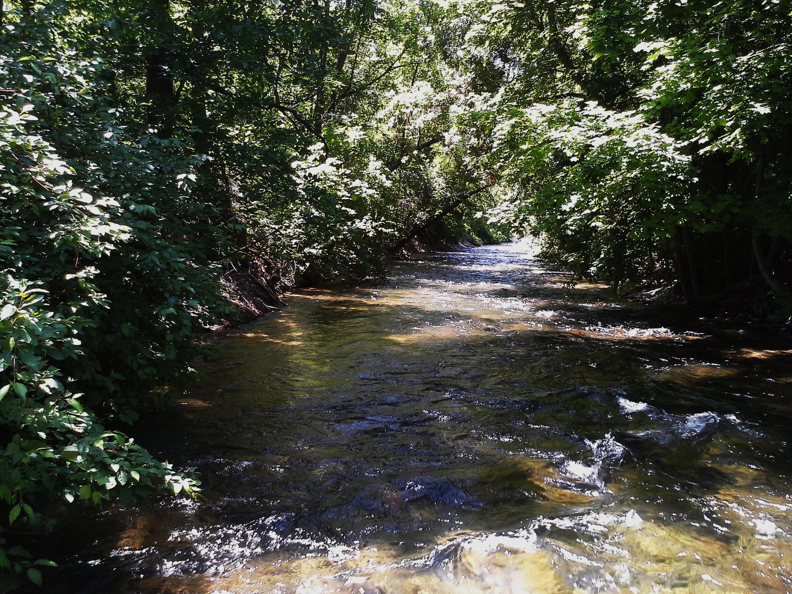
Water Inspires Writing & Drawing to Learn: The first reach of the Little Logan River at River Hollow Park. This is the river’s connection to the Logan River, and in the proposed Logan River Watershed Plan it will be an excavated to bury piped water, severing the historic Little Logan River from the Logan River forever. Courtesy & Copyright Hilary Shughart, Photographer
The first reach of the Little Logan River at River Hollow Park. This is the river’s connection to the Logan River, and in the proposed Logan River Watershed Plan it will be an excavated to bury piped water, severing the historic Little Logan River from the Logan River forever.
Courtesy & Copyright Hilary Shughart, Photographer
Water Inspires Writing & Drawing to Learn: The Little Logan River Anabranch & the PBS Utah Writers & Illustrators Contest for youth from Kindergarten through 6th Grade

Throughout history, cities and towns have often been established along the banks of rivers, because these waterways provide a source of drinking water, power, and transport links to other communities. The City of Logan, Utah, is no exception – in fact it was just over a century and a half ago, in the Spring of 1859, when the first white settlers chose to camp on the banks of the Little Logan River in what is now named Merlin Olsen Central Park. Right away, they began building mills and farming the fertile Island between the rivers. Our natural and cultural heritage are linked to water, so it’s an exciting opportunity to be inspired by the PBS KIDS Utah Writers & Illustrators Contest theme of “Our Water, Our Future”. Children in Kindergarten-6th Grade are invited to participate, and stories are accepted in English and Spanish, can be fiction or nonfiction, may be about your very own neighborhood or faraway lands. Anyone can take a look at the PBS Utah activity sheets and printable resources online.

Do you have a favorite neighborhood park where you go wading and tubing? Did you know that the Little Logan River flows through half a dozen beloved parks, including River Hollow Park which was established at the source, where the Little Logan River branches north from the Logan River. The Little Logan meanders through town where it used to power multiple mills, including Central Mills, established in 1867 and considered to be the oldest continuously-run business in the state. The river is an anabranch of the Logan River, a diverging branch of the river which re enters the main stream at the west edge of town. Fun Fact: In Australian Public Works Departments* an anabranch is called a billabong!

Speaking of water, if you put a shallow bowl of clean water out for birds you might see them flock to your little oasis for a drink and a careful Tai Chi-like bathing ritual, and with a heated bird bath in winter, you might witness a fascinating meeting of a variety of species gathering around the warm watering hole, perhaps sharing a quiet appreciation for the nutritious seeds in the nearby dried Sunflowers, Black-eyed Susans, and Indian Rice Grass.

Hearing the birds brings to mind the insightful observations by Terry Tempest Williams, that “Once upon a time, when women were birds, there was the simple understanding that to sing at dawn and to sing at dusk was to heal the world through joy. The birds still remember what we have forgotten, that the world is meant to be celebrated.”

Now is the time to celebrate the biodiversity supported by our rivers and lakes, and each and every life-sustaining drop of water in our watersheds.

I’m Hilary Shughart with the Bridgerland Audubon Society, and I am Wild About Utah!

Credits:
Images: Courtesy & Copyright, Hilary Shughart, Photographer
Featured Audio: Courtesy & Copyright © Kevin Colver, https://wildstore.wildsanctuary.com/collections/special-collections/kevin-colver AND Friend Weller, Retiring Engineer, Utah Public Radio, https://www.upr.org/people/friend-weller
Text: Hilary Shughart, President, https://bridgerlandaudubon.org/
Additional Reading: Hilary Shughart and Lyle Bingham, https://bridgerlandaudubon.org/

Additional Reading

WildAboutUtah pieces by Hilary Shughart, https://wildaboututah.org/author/hilary-shughart/

Full Power Flour: The relationship between the farmer, the miller and the baker are key to the success of Central Milling’s organic mission. By Darby Doyle https://www.visitutah.com/Articles/Full-Power-Flour

Little Logan River Topo Map https://www.topozone.com/utah/cache-ut/stream/little-logan-river/

An anabranch is a channel of water that leaves a river or stream and then rejoins again further downstream. An anabranch is considered to be part of the river or stream that it comes from.
An anabranch can be nearly half of a river’s flow of water. When there is an island in the river, an anabranch is created as water passes around the island. The smaller channel of water passing the island is an anabranch of the river. http://worldlandforms.com/landforms/anabranch/

PBS KIDS Utah Writers & Illustrators Contest: Our Water, Our Future https://www.pbsutah.org/kids/writers-illustrators-contest/?utm_source=sfmc&utm_medium=email&utm_campaign=03.21.24+E-news&utm_term=https%3a%2f%2fwww.pbsutah.org%2fkids%2fwriters-illustrators-contest%2f&utm_id=114875&sfmc_id=147746441

“Unlike Main Street, or Center Street, or 400 North Street, which are streets of commerce, the Little Logan River is the raison d’etre of the City of Logan. “
A History of Logan Island, by Virginia C. Parker, Logan, Utah, 2007, http://exhibits.usu.edu/exhibits/show/the-island-market/item/25944

Billabong https://cide.en-academic.com/dic.nsf/cide/17968/Billabong

Working Water in Cache Valley, Cache Pioneer Museum, Cache Chapter of the Daughters of the Utah Pioneers, https://cachedupmuseum.org/in-the-news.html

Terry Tempest Williams, When Women Were Birds: Fifty-four Variations on Voice, Sarah Crichton Books; First Edition (April 10, 2012) https://www.amazon.com/When-Women-Were-Birds-Fifty-four/dp/1250024110

ECONET April 2, Proposal to sever the Little Logan River from the Logan River, 5:30 p.m. Logan City Hall, 290 N 100 West Logan, UT, Bridgerland Audubon Society, March 29, 2024, https://bridgerlandaudubon.org/econet-proposal-to-sever-little-logan-river-from-logan-river/