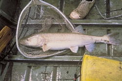
Colorado Pikeminnow

Colorado Pikeminnow, Image courtesy US FWS, J.E. Johnson, Photographer

Colorado Pikeminnow
Ptychocheilus lucius
Image courtesy US FWS,
J.E. Johnson, Photographer

One of the largest minnows in the world, the Colorado pikeminnow was once found throughout the Colorado River basin. This is no bait minnow. Also known as the Colorado squawfish, it reputedly grew to a whopping 6 feet in length with a weight topping 80 pounds and a life span of 40 years. The largest caught in recent times have been only 3 feet long and 9 pounds.

Colorado pikeminnows once flourished throughout the Colorado River and most of its major tributaries. Historically, these abundant, torpedo-shaped fish were prized for their fine flavor. They were an important food fish for Native Americans and welcomed at restaurants as far away as San Francisco. Also called white salmon by early settlers due to their migratory behavior, pikeminnows journeyed 200 miles to spawn in turbid backwaters.

Then we built dams which blocked the migratory runs of pikeminnows. Below the Grand Canyon, the last wild Colorado pikeminnow was caught in 1976. The proliferation of dams has drastically restricted their range. Moreover, reservoirs flood what was suitable river habitat, and their dams alter river flows and water temperature downstream.

The Colorado pikeminnow was one of the first fish given full protection under the Endangered Species Act in 1973. Today, there are two remaining wild populations. One resides in the upper reaches of the Colorado river system, the other in the Green River system. Efforts underway to restock Colorado pikeminnow in the San Juan River basin appear to be successful.

A broadly based coalition of partners established the Upper Colorado River Endangered Fish Recovery Program in 1988. This program focuses on 4 species of fish: humpback chub, bonytail, Colorado pikeminnow and razorback sucker. Their goal is to restore and manage stream flows and habitat, reduce competition from some non-native fish species and increase populations using hatchery raised young. If they are successful, this giant piscine predator will once again take its rightful place in the upper Colorado River ecosystem.

This is Linda Kervin for Bridgerland Audubon Society.

Credits:

Photos: Courtesy US FWS, images.fws.gov
Theme: Courtesy & Copyright Don Anderson Leaping Lulu
Text & Voice: Linda Kervin, Bridgerland Audubon Society

Additional Reading:

Other Wild About Utah Pieces by Linda Kervin

Colorado Pikeminnow, Wikipedia, wikipedia.org/wiki/Colorado_pikeminnow

Researchers Capture Fourth Largest Endangered Colorado Pikeminnow in San Juan River Since 1991, US Fish & Wildlife Service, December 13, 2010, https://www.fws.gov/mountain-prairie/pressrel/10-84.htm [Link Updated December 2023]

Colorado pikeminnow (Ptychocheilus lucius), Upper Colorado River Endangered Fish Recovery Program, 2012, https://www.coloradoriverrecovery.org/general-information/the-fish/colorado-pikeminnow.html [Link Updated December 2023]

Colorado Pikeminnow, Nevada Department of Wildlife, Formerly held at https://www.ndow.org:80/wild/animals/facts/fish_colorado_pike_minnow.shtm [Not working December 4, 2023]

Colorado Pikeminnow, Species, Utah Division of Wildlife Resources, https://fieldguide.wildlife.utah.gov/?species=ptychocheilus%20lucius [Link Updated December 2023]

https://wildlife.state.co.us/Fishing/SpeciesID/Pages/FishID.aspx [Not working December 4, 2023]

https://wildlife.utah.gov/fishing/nonnative/endangeredfishfacts.pdf [Not working December 4, 2023]

Colorado Pikeminnow endangered in Carbon, Daggett, Emery, Garfield, Grand, San Juan, Unitah and Wayne Counties, Utah’s Species of Greatest Conservation Need Species by County,
https://wildlife.utah.gov/pdf/WAP/utah-sgcn-list-by%20county-10-23.pdf
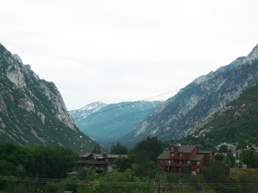
Utah’s Glacial History

Moraine with erratics, Photo Courtesy and Copyright Mark Larese-Casanova, Photographer
Moraine with erratics
Photo Courtesy & Copyright
Mark Larese-Casanova, Photographer

Little Cottonwood Canyon, Photo Courtesy and Copyright Mark Larese-Casanova, PhotographerLittle Cottonwood Canyon
Photo Courtesy & Copyright
Mark Larese-Casanova, Photographer

Hi, this is Mark Larese-Casanova from the Utah Master Naturalist Program at Utah State University Extension.

It is amazing to see just how much of an impact the large amount of snowfall from last winter still has on the annual cycle of nature. Of recent note, wildflower blooms in the mountains seem to be at least 2-3 weeks behind normal schedule. Hiking through snow in late July had me thinking about colder times when Utah’s mountains were covered with ice that flowed as glaciers.

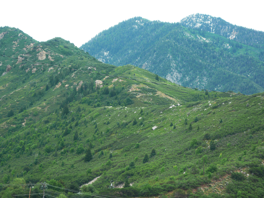
The most recent period of glaciation in Utah occurred between 30,000 and 15,000 years ago when Utah’s climate was, on average, up to 30?F cooler. At times during this period, much of the western half of Utah was covered by Lake Bonneville, which contributed tremendous amounts of moisture as snow throughout Utah’s mountain ranges. As the snow accumulated at high elevations, its sheer weight caused it to recrystallize into ice. Once the masses of ice became heavy enough, gravity pulled them down slope, carving out characteristic U-shaped valleys.

At the top of the valleys, where the glaciers formed, we can often find large, bowl-shaped cirques. In the Wasatch Range, the Little Cottonwood Canyon glacier formed at the top, creating Albion Basin, and reached the mouth of the canyon where calved icebergs into Lake Bonneville. The Uinta Mountains contained such large glaciers that even many of the mountain peaks are rounded.

As temperatures warmed during the end of the last ice age, glaciers receded and left behind large piles of soil and rocks, known as moraines. Terminal moraines at the end of a glacier’s path, can act as natural dams to create lakes. Enormous boulders, known as glacial erratics, can often be found discarded along canyons.

While glaciers don’t currently exist in Utah, there are several permanent snowfields in shaded high mountain areas. So, if you’re feeling a little nostalgic and missing that extra long winter we had this year, you still a chance to hike up above 9,000 feet and cool your toes in the snow.

For Wild About Utah, I’m Mark Larese-Casanova.

Credits:

Images: Courtesy & Copyright Mark Larese-Casanova
Text:     Mark Larese-Casanova, Utah Master Naturalist Program at Utah State University Extension.

Additional Reading:

Utah Geological Survey https://geology.utah.gov/surveynotes/gladasked/gladglaciers.htm

Parry, William T. 2005. A Hiking Guide to the Geology of the Wasatch and Uinta Mountains. University of Utah Press.

Stokes, William Lee. 1986. Geology of Utah. Utah Museum of Natural History.

The Amazing Uintas

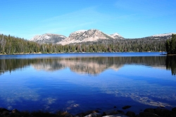
The Amazing Uintas: Mirror Lake in the Unitas, Courtesy Wyoming Department of Transportation, Talbot Hauffe, Photographer
Mirror Lake in the Unitas
Courtesy Wyoming Department
of Transportation
,
Talbot Hauffe, Photographer


The Amazing Uintas: Kings Peak, Courtesy Wikimedia, Hyrum K. Wright, PhotographerKings Peak
Courtesy Wikimedia
Hyrum K. Wright, Photographer
Licensed under GNU Free Documentation License,

Hi, I’m Holly Strand.

Coming from Colorado, I’m something of a mountain snob. So while I always found Utah’s mountains to be agreeable, I admit to thinking they were somewhat petite. Then I saw the Uintas. About 200 miles long and 30-40 miles wide, the Uintas lie south of the Wyoming border primarily in northeastern Utah but with its eastern flank extending into Colorado.

There are several interesting features that make these mountains stand out in my mind.

For one thing, the Uintas are one of very few east-west trending mountain ranges of significant size on the planet. The only other one in N. America is the Brooks Range. This east-westness can feel strange to someone who orients themselves on a north-south axis. Because the path the sun follows the range instead of crossing it, my sense of direction was thrown off. Perhaps this happens to others too and that’s why we often hear about people getting lost in the Uintas.

Glaciation is another interesting aspect. The Uintas were more heavily glaciated than any other part of Utah. The most recent glacial episode was approximately 30,000 to 10,000 years ago. These Pleistocene glaciers left wide-bowl shaped valleys and scooped steep-walled cirques near the main ridge line. Nowadays, sparkling lakes, streams and meadows grace the ice-carved basins and valleys.

Speaking of lakes, even a Minnesotan might be impressed with the density of the Uinta Mountains lakes. Of course, the total number depends upon what you define as a lake. But most sources say there are between 800-1000 heavily concentrated in the High Uintas.

Utahns gets a lot their water from the Uintas. The mountains are an important source for several Wasatch Front rivers and streams including the Bear, the Weber, and the Provo. Precipitation and snowmelt on southern slopes either flow into the Duchesne River or directly into the Green River.

Because they are below 14,000 feet, the Uintas didn’t fit my Colorado-derived definition of “real mountains.” However there are 17 peaks all over 13000 feet–the highest is King’s Peak at 13,528 feet. Considering the beauty and wildness and the water features in these 13ers and their surroundings, the Uintas definitely scored with me. I’m looking forward to returning to explore some more.

For Wild About Utah, I’m Holly Strand.

Credits:


Images: Courtesy Wyoming Department of Transportation, Talbot Hauffe, Photographer
Courtesy Wikimedia, Hyrum K. Wright, Photographer
Text: Holly Strand

Sources & Additional Reading


Map of the Mirror Lake Scenic Byway, https://www.fs.fed.us/wcnf/unit/kamas/mirror_lake_scenic_byway_map.shtml

Guide to the Mirror Lake Scenic Byway, https://www.fs.fed.us/wcnf/unit/kamas/mirror_lake_scenic_byway.shtml

Biek, Bob. Grant Willis, and Buck Ehler. 2010. Utah’s Glacial Geology.
https://geology.utah.gov/surveynotes/articles/pdf/utah_glacial_geology_42-3.pdf

Dehler, C.M., Pederson, J.L., Sprinkel, D.A., and Kowallis, B.J., editors, 2005. Uinta Mountain
Geology: Utah Geological Association Publication 33, 448 p. https://www.utahmapstore.com/uga33.html

Hamblin, Kenneth. 2004. Beyond the Visible Landscape: Aerial Panoramas of Utah’s Geology. Provo: BYU

Jeffrey S. Munroe, Benjamin J.C. Laabs, Joel L. Pederson, and Eric C. Carson. 2005.
From cirques to canyon cutting: New Quaternary research in the Uinta Mountains
Field Guides, 6, p. 53-78. https://fieldguides.gsapubs.org/content/6

Kirkland, Gordon L. Jr. , 1981. The Zoogeography of the Mammals of the Uinta Mountains Region. The Southwestern Naturalist Vol. 26, No. 4.

Shaw, John and James Long. 2007. Forest Ecology and Biogeography of the Uinta Mountains, USA. Arctic, Antarctic and Alpine Research, Research 39(4): 614-628.

Phragmites-Utah’s Grassy Invader

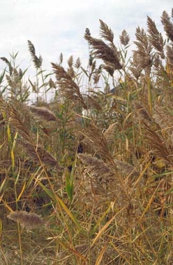
Invasive Phragmites
Phragmites australis
Photo Courtesy
Plant Conservation Alliance
Alien Plant Working Group
As found on
nps.gov/plants/alien/fact/phau1.htm
Photographers credited on Factsheet

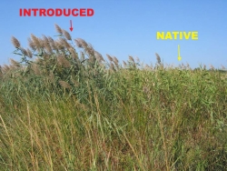
Invasive Phragmites vs. Native

Photo Courtesy
Plant Conservation Alliance
Alien Plant Working Group
As found on
nps.gov/plants/alien/fact/phau1.htm
See guide to distinguish
Invasive from Native plants
Photographers credited on Factsheet

Hi, this is Mark Larese-Casanova from the Utah Master Naturalist Program at Utah State University Extension.

When exploring wetlands, streambanks, and the shores of Great Salt Lake this time of year, it’s common to see tall grasses, over ten feet high, blowing in the breeze. While it is very abundant, the common reed known as Phragmites australis is anything but normal.

Phragmites was introduced from Europe over a century ago, and is now found in all 50 states and on every continent except Antarctica. It can grow to more than 15 feet in height, with long blade-like leaves. It flowers from July to October, producing dense, feathery clusters of small flowers that are purple while flowering and turn light brown after producing seeds. Each stem can produce up to 2,000 wind-dispersed seeds that are particularly effective at colonizing new areas. Because of this, Phragmites can take over a disturbed area quickly and prevent native plants, such as bulrush and cattail, from becoming established.

Like other invasive plants, Phragmites is successful at outcompeting native plants. Once a plant is established from seed, Phragmites spreads quickly through rhizomes, or underground stems, that can produce many additional stalks. While Phragmites may start growing among other wetland plants, it quickly outcompetes them for nutrients and sunlight. However, the native “Phragmites australis subspecies americanus” does not grow nearly as dense or tall, and tends to not be invasive.

Because introduced Phragmites can quickly grow into solid stands, it can greatly reduce plant diversity in wetlands, ultimately reducing the quality of wildlife habitat. Wetlands along the shore of Great Salt Lake are particularly important habitat for many migratory birds species, some of which occur here in the largest populations in North America or the world. The rapid takeover by Phragmites in these wetlands could eventually have dramatic impacts to the entire Great Salt Lake ecosystem.

In order to combat this threat, wetland managers have tried several methods for controlling or removing Phragmites, including spraying with herbicide, burning, livestock grazing, and mowing. Dr. Karin Kettenring, a Utah State University researcher, and her graduate students are currently studying the effects of several of these Phragmites control methods along the shores of Great Salt Lake. By experimenting with the timing of mowing and herbicide treatment, as well as covering mowed Phragmites with heavy black plastic, Dr. Kettenring and her team hope to find the most effective combination of treatments. With the continual conversion of native wetland habitats to a monoculture of Phragmites, Dr. Kettenring’s research is of particular importance to maintaining the health of the Great Salt Lake ecosystem- one of our state’s greatest natural wonders.

For Wild About Utah, I’m Mark Larese-Casanova.

Credits:
Images: Courtesy & Copyright
            Jil M. Swearingen, National Park Service, Center for Urban Ecology, Washington, DC
            Dr. Kristin Saltonstall, Adjunct Research Scientist, Horn Point Laboratory,
                  University of Maryland Center for Environmental Science, Solomon, MD
            Robert Meadows, Environmental Scientist, North DE Wetland Rehabilitation Program,
                  DE Mosquito Control Section, Newark, DE
            As found on https://www.nps.gov/plants/alien/fact/phau1.htm
Text:     Mark Larese-Casanova, Utah Master Naturalist Program at Utah State University Extension.


Additional Reading:

Evans K, Martinson W (2008) Utah’s featured birds and viewing sites: a conservation platform for Important Bird Areas and Bird Habitat Conservation Areas. Salt Lake City, Utah

Kulmatiski A, Beard KH, Meyerson LA, Gibson JR, Mock KE (2010) Nonnative Phragmites australis invasion into Utah wetlands. Western North American Naturalist 70:541-552

Long, A.L., C.M.U. Neale, and K.M. Kettenring. 2012. Management of Phragmites in the Great Salt Lake watershed. Final report to the Utah Department of Natural Resources, Division of Forestry, Fire & State Lands. 15 pp.