

Courtesy U.S. Geological Survey
Department of the Interior/USGS
Mike Freeman, Photographer
10 Nov 2015
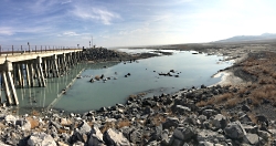
Water flowing through the Great Salt Lake breach in 2011, when lake levels were high due to above average snowfall in the Wasatch and Uinta Mountains. The Great Salt Lake breach is an area that allows water to travel between the southern and northern parts of the lake.
A Giant Among Us–The Great Salt Lake
Much of what follows is taken from a very recently released collaborative study titled “Impacts of Water Development on Great Salt Lake and the Wasatch Front” which was a collaborative effort from four institutions(Utah State University, Utah Division of Water Resources, Salt Lake Community College, and the Utah Division of Wildlife Resources.)
A 2012 analysis by Bioeconomics estimated the economic value of the lake at $1.32 billion per year for mineral extraction, brine shrimp cyst production, and recreation. The abundant food and wetlands of the lake attract 3 million shorebirds, as many as 1.7 million eared grebes, and hundreds of thousands of waterfowl during spring and fall migrations. Because of this, it has been designated as a Western Hemisphere Shorebird Reserve Network Site. Due to its enormous surface area, it produces the “lake affect” which enhances our snow pack by an estimated 8%, a significant amount for both skiers and our available water. But our giant is shrinking.
Since the arrival of 19th Century pioneers water diversions for irrigation have decreased its elevation by 11 feet exposing much of the lake bed. Natural fluctuations in rainfall and river flow cause the lake level to rise and fall, but there has been no significant long‐term change in precipitation and water supply from the main tributaries since their coming in 1847.
Credit: U.S. Geological Survey
Department of the Interior/USGS
Mike Freeman, Photographer
10 Nov 2015
For the first time since it was opened in 1984, water has stopped flowing through the Great Salt Lake causeway breach, an area that allows water to travel between the southern and northern parts of the lake.
We must look beyond the next few decades and decide how we value the lake for future generations. Lower lake levels will increase dust pollution and related human health impacts, and reduce industrial and environmental function of Great Salt Lake. We must be willing to make decisions now that preserve Great Salt Lake’s benefits and mitigate its negative impacts into the coming centuries.
John Muir, one of my favorite early American naturalists would most certainly agree with me. From his baptismal plunge into the Great Salt Lake. “I found myself undressed as someone else had taken me in hand and got myself into right lusty relationship with the brave old lake. I was conscious only of a joyous exhilaration….”
And where else could John and I have such a wonderfully buoyant experience?
This is Jack Greene reading for Wild About Utah.

Credit: U.S. Geological Survey
Department of the Interior/USGS
Mike Freeman, Photographer
10 Nov 2015
Image: Courtesy U.S. Department of the Interior, U.S. Geological Survey(USGS), gallery.usgs.gov
Text: Jack Greene, Bridgerland Audubon Society & USU Office of Sustainability
Additional Reading:
Great Salt Lake, Utah, Stephens, Doyle W. and Gardner, Joe, USGS Science for a Changing World, https://pubs.usgs.gov/wri/wri994189/PDF/WRI99-4189.pdf
Salt Lake Brine Shrimp, https://saltlakebrineshrimp.com/harvest/
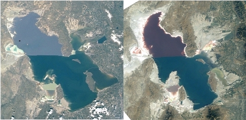
2001 vs 2003
Images Courtesy NASA
NASA’s Earth Observatory


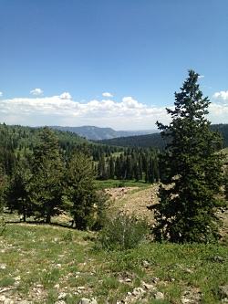
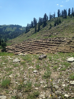 Devil’s Staircase, Tony Grove, Courtesy & Copyright Hilary Shughart
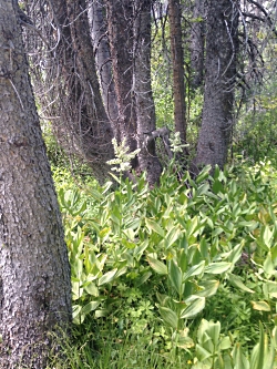 False Hellebore/Corn lily (Veratrum californicum), Tony Grove, Courtesy & Copyright Hilary Shughart
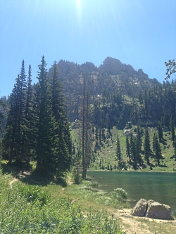 White Pine Lake and Mount Magog, Courtesy & Copyright Hilary Shughart
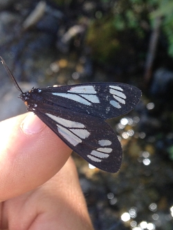 Police Car Moth on Rob Garrett’s thumb, White Pine Lake hike.
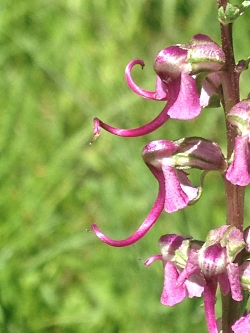 Elephanthead Lousewort (Pedicularis groenlandica), White Pine Lake hike.
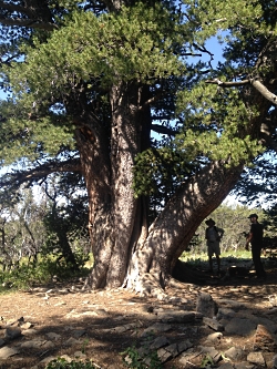 Rob & Jack & big tree, Limber Pine hike
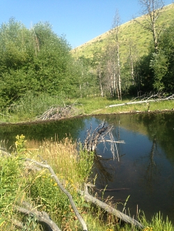 Beaver Dam at USU Forestry Camp (LCFS hike)
 Jack in 560 year old Limber Pine tree 7/27/16