Desert Rain

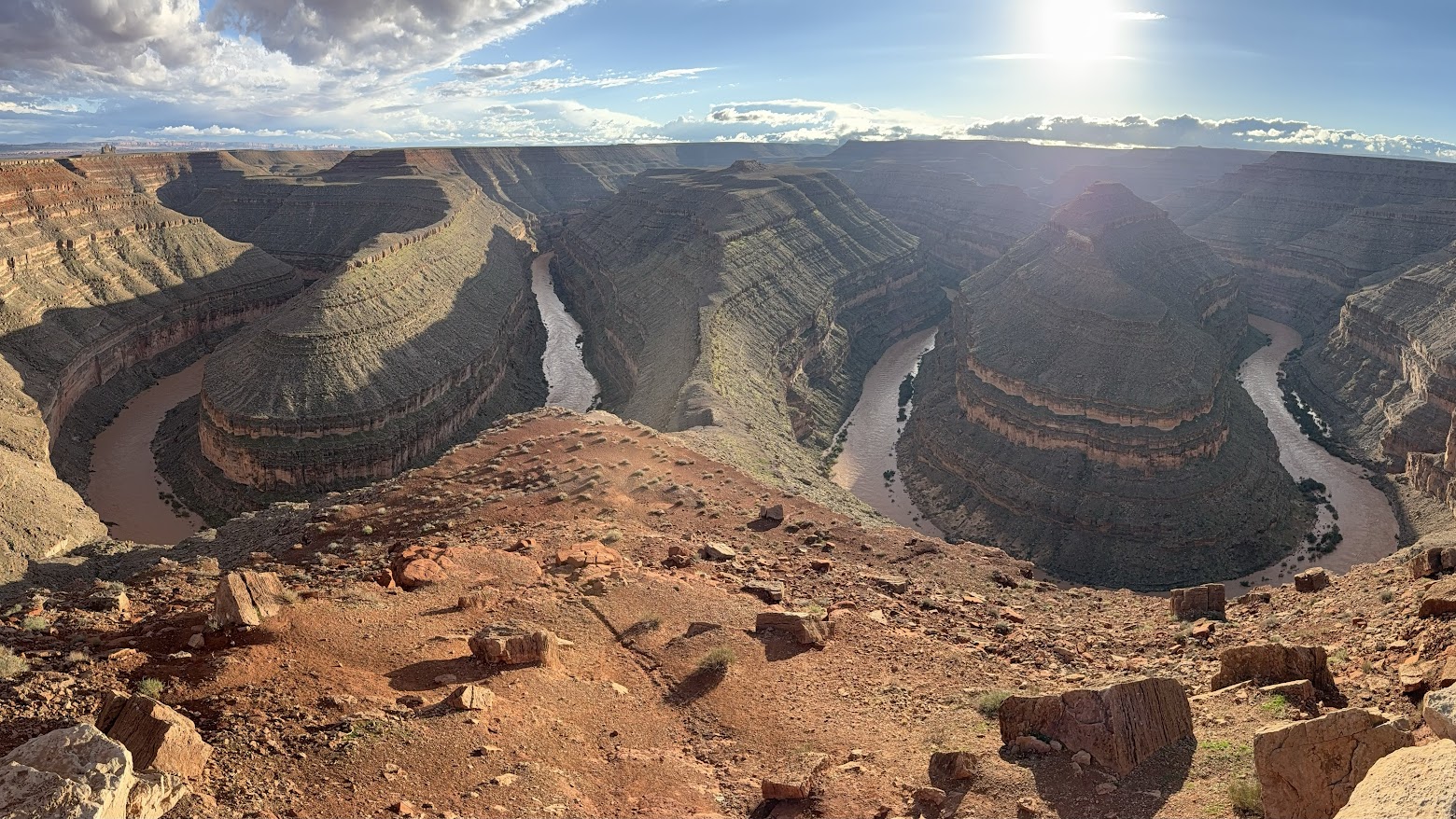
San Juan River from Goosenecks State Park
Courtesy & Copyright Eric Newell, Photographer
San Juan River from Goosenecks State Park
Courtesy & Copyright Eric Newell, Photographer
Rain in the desert heightens the senses.

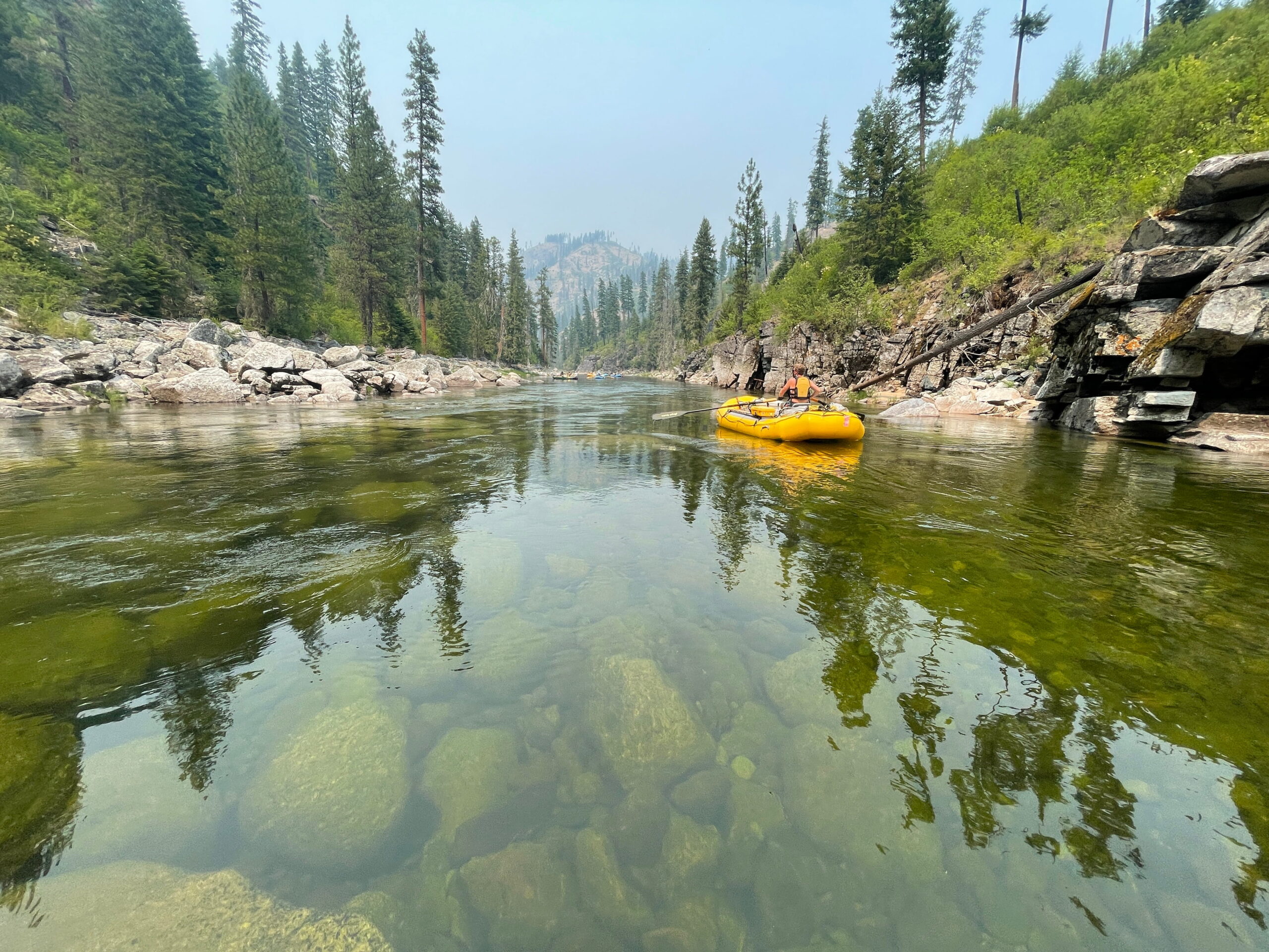
My hands loosely grip the oars. My rain jacket is zipped to my beard, and my ball cap is pulled down tightly on my head. Standing on the floor of my raft, I lean gently on the oars, pushing the raft downriver on choppy, strong current. A gentle upriver breeze pushes against my face. Random raindrops pelt my cheeks. The sounds of the river sloshing and swirling fill the air. Wet rocks glisten and every hue is enhanced.
The river is swollen and running heavy with sediment from monsoon rains that have arrived both in the form of violent, lightning-charged microbursts and broad, regional storms.
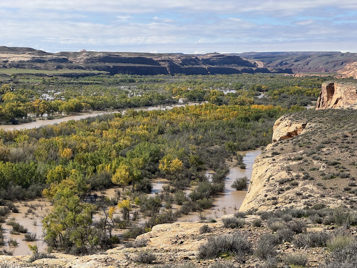
San Juan River Utilizing Its Floodplain Near Bluff Utah
Courtesy & Copyright Eric Newell, Photographer
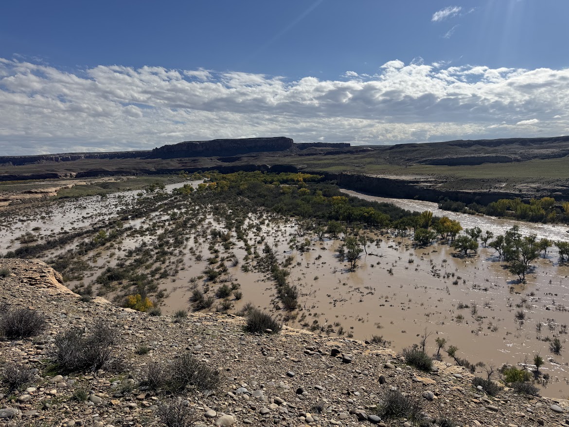
San Juan River Utilizing Its Floodplain Near Bluff Utah
Courtesy & Copyright Eric Newell, Photographer
The water smells pungently of dirt and is so heavy-laden with silt that it looks more like rusty sludge than water. Deposits of fine sediment remain everywhere water has splashed, coating the raft, our feet, and our clothing with grime.

San Juan River Flood Plain Near Bluff Utah
Courtesy & Copyright Eric Newell, Photographer
San Juan River Flood Plain Near Bluff Utah
Courtesy & Copyright Eric Newell, Photographer
The swath of sky between the canyon walls is a steel-gray plate of mammatus clouds. It will be another wet evening in camp. I crane my neck and my eyes follow the edge of sky along the canyon rims. I am dwarfed by layers of limestone and shale that were laid down as sediment eons ago, then hardened to stone, then thrust upward by the unhurried, relentless forces of a continent in motion. All the while, the river cut through the uplift, eating away one grain of bedrock at a time, carving this canyon.

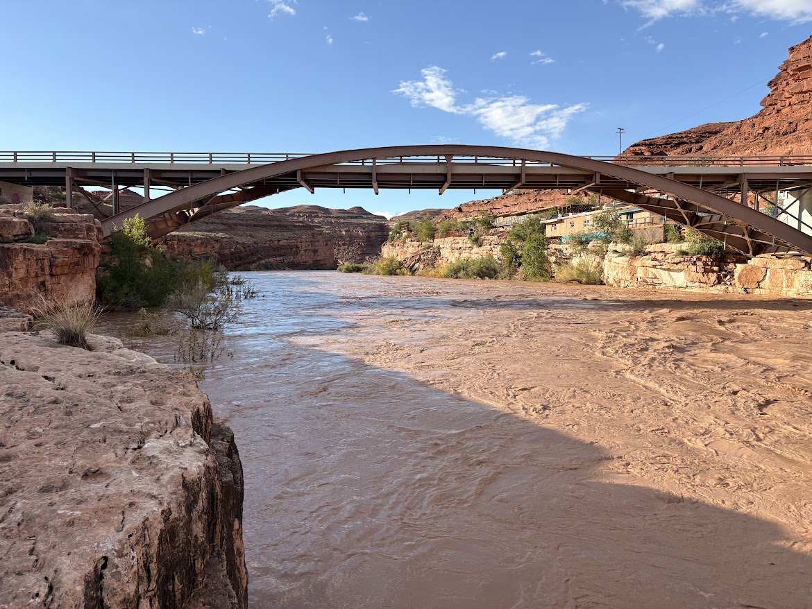
San Juan River In Mexican Hat At About 22000 CFS
Courtesy & Copyright Eric Newell, Photographer
San Juan River In Mexican Hat At About 22000 CFS
Courtesy & Copyright Eric Newell, Photographer
Beyond the clouds, I imagine billions of stars above—invisible in the daylight—and our vulnerable little planet traveling through the cosmos.

The pages of Lisa Kearsley’s San Juan River Guide, on the deck of my raft, have turned in the breeze. I could look up the geologic periods and names of the various layers—yet again. But right now, today, just being here, lost in the wonder and awe of this canyon, is enough. In the scope of geologic time, how did I get so lucky to be in this place, on this day, in this particular storm? This moment will be lost in the ages, but it is crystalized in time for me.

An ancestral Puebloan granary, concealed beneath an overhang, catches my attention. We drift past. No one else notices. A few bends later, a bighorn ram walks the edge of a ledge above the river. It pauses and turns its massive head to watch us drift along. People and creatures have inhabited this landscape for millennia. Each of us are just passing through.
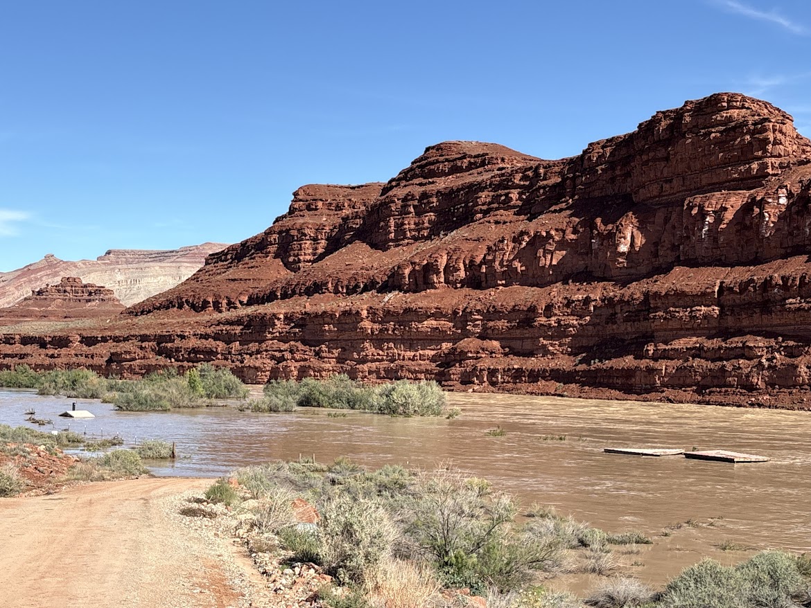
Mexican Hat Boat Ramp with the river running 41000 CFS
Courtesy & Copyright Anna Hart, Photographer
Mexican Hat Boat Ramp with the river running 41000 CFS
Courtesy & Copyright Anna Hart, Photographer
That was between Bluff and Mexican Hat, September 16, on about 4,000 cubic feet of water per second—or CFS.

A month later, on October 23, the San Juan Country Sheriff closed the river due to extreme high water. The river had breached several sewer treatment plants upstream and local agencies were overwhelmed mitigating flood damage. On October 26, the river peaked at about 41,000 CFS—flow levels not seen since the 1970’s. The river dropped to about 5,000 CFS for a few days, then peaked again at 34,000 CFS on November 3. Two separate fifty-year flood events occurred in an eight-day span, isolating and inundating communities in three states.

Above the river, on the outside bend of the canyon near mile sixteen, century-old cottonwood tree trunks, weathered to dark gray, rest one hundred and twenty feet above the river bottom. They were once adrift.

Analysis conducted by Lynn Orchard, under the direction of Bob Webb at the University of Arizona in 1999, indicate these logs were deposited by a flood in 1911. By radiocarbon dating debris from past floods in the canyon, they calculated the 1911 flood likely produced the largest flows in the lower San Juan canyons during the past 4,000 years, with maximum flows around 150,000 CFS.
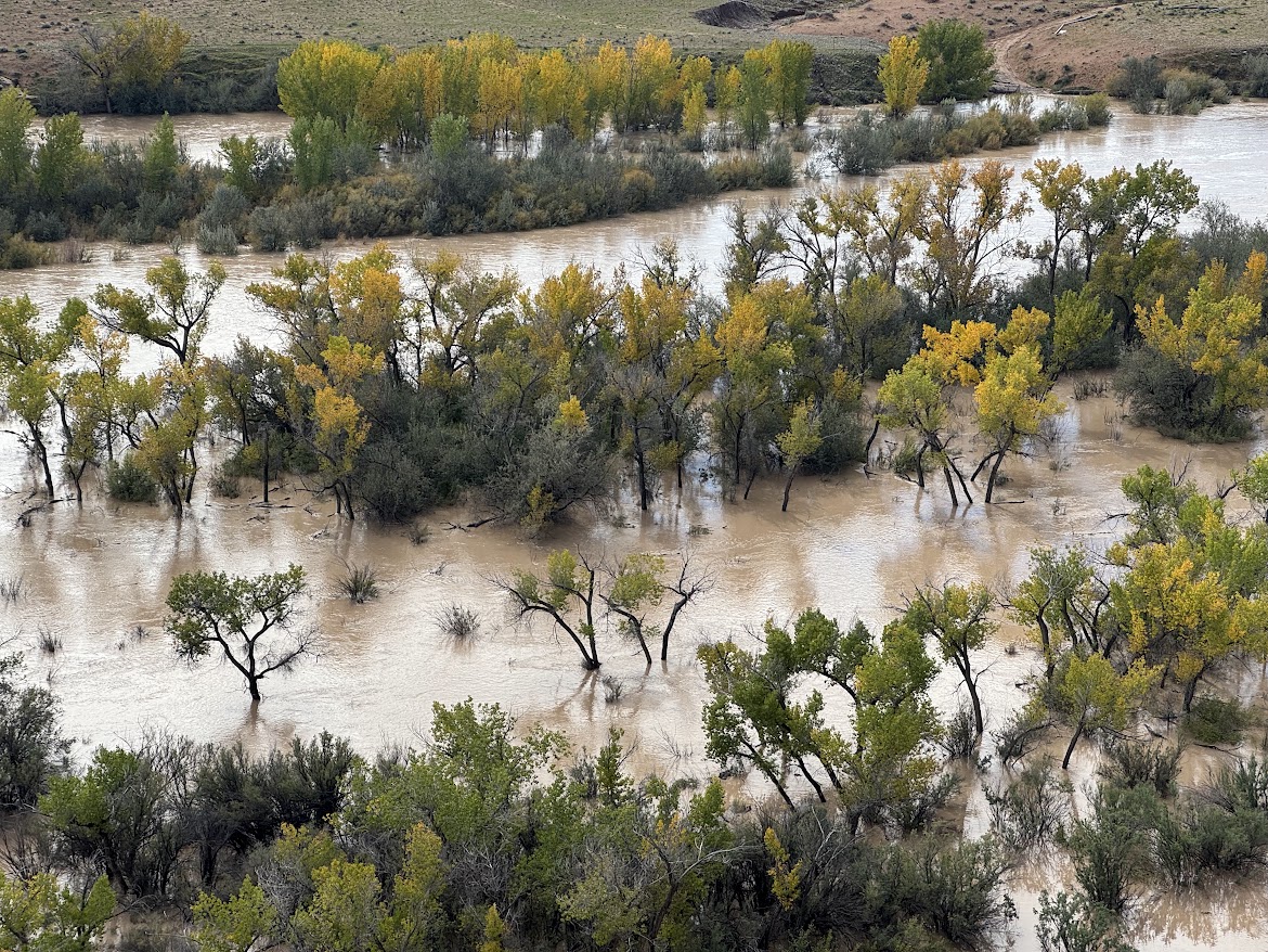
San Juan River Overflowing Its Banks
Courtesy & Copyright Eric Newell, Photographer
San Juan River Overflowing Its Banks
Courtesy & Copyright Eric Newell, Photographer
In an era of dams, diversions, and drought, watching the river overflow its banks and utilize its floodplain is a remarkable once-in-a-generation phenomenon. Every now and then the river rises up and reminds us that it has been here for eons, and will continue to run its course, carving its way through the canyons.

I am Eric Newell and I am wild about Utah and our wild rivers.

If you would like to contribute support for flood victims in and around Bluff, Utah, please consider https://bluffcommunityfoundation.org

Credits:

Images: Courtesy & Copyright Brandt & Anna Hart as well as Courtesy & Copyright Eric Newell
Featured Audio: Courtesy & Copyright © Friend Weller as well as J. Chase and K.W. Baldwin
Text: Eric Newell, Edith Bowen Lab School, Utah State University, https://edithbowen.usu.edu/
Voice: Eric Newell, Edith Bowen Lab School, Utah State University, https://edithbowen.usu.edu/

Additional Reading

A comprehensive look at the flooding, Explorer Vault, https://www.youtube.com/watch?v=JmxiGbdl0mQ

San Juan River Flows Near Bluff, Utah, USGS, https://waterdata.usgs.gov/monitoring-location/USGS-09379500/#dataTypeId=continuous-00065-0&period=P30D&showFieldMeasurements=true

The 1911 Four Corners Flood: Could it happen again? KUST, Four Corners Public Radio, https://www.ksut.org/history/2023-10-01/the-1911-four-corners-flood-could-it-happen-again

Orchard, Kenneth Lynn, Paleo Flood Hydrology of the San Juan River, The University of Arizona, https://repository.arizona.edu/items/b62d9d40-aede-4d19-9fc2-e837124bf4b6

How deep? Compare Sand Island Boat Launch images from Maps.Google.com with the 41000 CFS at Sand Island Boat Launch Gallery above, https://maps.app.goo.gl/xpzEHHa5k4Qtd7nr9

Don’t Move a Mussel

Quagga Mussels Exposed at Lake Powell Courtesy & Copyright Utah Division of Wildlife Resources, Phil Tuttle, Photographer
Quagga Mussels Exposed at Lake Powell
Courtesy & Copyright Utah Division of Wildlife Resources, Phil Tuttle, Photographer
You’ve heard the phrases, “Don’t move a mussel,” (spelled m-u-s-s-e-l) and “Stop aquatic hitch hikers.” If you have ever transported a watercraft, ranging in size from a paddle board to wake surf boat, you’ve probably been annoyed by the inconvenience of stopping at mandatory boat check stations for invasive species watercraft inspections. The threat is real and I hope this segment will make you a believer in inspection stations.

Let’s backtrack.

The opening of the St. Lawrence Seaway in 1959 allowed cargo ships to bypass the rapids on the St. Lawrence River and enter Lake Ontario. From there ships could access Canada’s Welland Canal, which also uses a series of locks to allow ships and barges to bypass Niagara Falls and access the rest of the Great Lakes. Proponents of the St. Lawrence Seaway sold the project on the grounds that it would turn the Great Lakes into a North American “Mediterranean” by transforming cities from Rochester, New York to Duluth, Minnesota into global ports.

They got what they wished for, but with a twist. “Salties,” or oceangoing cargo ships, traveling from the Mediterranean, Black, and Caspian Seas, emptied their ballast tanks in Great Lakes ports as cargo was loaded. In June of 1988 the first documented zebra mussel was found in Lake St. Clair—a small lake (in comparison to the Great Lakes) where the St. Clair River pools about halfway along its journey from Lake Huron to Lake Eire. This single, fingernail-sized mussel signaled a catastrophe. By the end of 1989, invasive zebra and quagga mussels were found in all five Great Lakes.

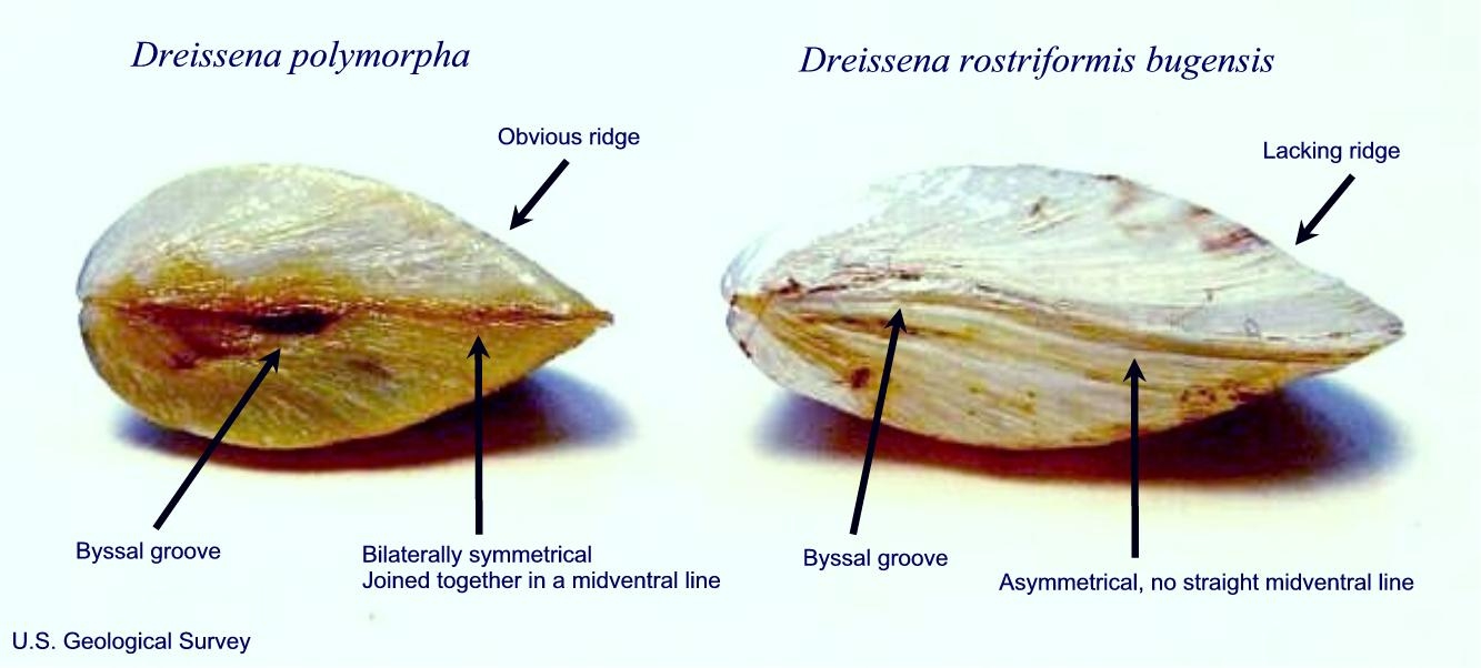
Zebra Mussel (Dreissena polymorpha) vs Quagga Mussel (Dreissena rostriformis bugensis). 
Courtesy USGS, Wetland and Aquatic Research Center, Amy J Benson, Photographer
Zebra Mussel (Dreissena polymorpha) vs Quagga Mussel (Dreissena rostriformis bugensis).
Courtesy USGS, Wetland and Aquatic Research Center,
Amy J Benson, Photographer
Zebra and quagga mussels are mollusks—soft-bodied invertebrates housed in hinged, two-part shells. They contain a muscular “foot” that allows them to move twelve to fourteen inches per hour—but that’s not how they travel most efficiently. Zebra and quagga mussels can produce a million eggs per year, that hatch into microscopic “veligers” which can swim efficiently for several weeks before their shell begins to form, sinking them to the bottom. Once a mature zebra mussel finds a suitable place for a home, the foot forms an epoxy-like bond with hard surfaces, making them difficult and expensive to remove from ship hulls, water intake pipes, docks, locks, and hydro-electric power infrastructure.

Zebra mussels thrive in water less than about fifty feet deep and on hard surfaces. Quagga mussels thrive in soft lake bottoms in water as deep as 500 feet. Together these invasive mollusks wreak havoc on aquatic ecosystems where they are most vulnerable—the bottom of the food chain.

Razor sharp zebra and quagga mussels filter microscopic nutrients from the water, This makes lakes clearer, while stripping them of nutrients aquatic species depend upon. By 2009 phytoplankton levels in the Great Lakes were diminished by 90% compared to pre-mussel levels. Clearer water makes for easier fishing for predatory birds and clearer water allows sunlight to penetrate deeper into lakes, warming them up faster and creating prime conditions for toxic algae blooms. Algae blooms deplete the water of oxygen and create ideal conditions for botulism, which then causes massive waterfowl die-offs. All of this has happened in the Great Lakes in a viscous cycle set in motion by zebra and quagga mussels.

Invasive mussels were found in Lake Mead in 2007 and in Lake Powell in 2013—transported from the Midwest recreational boats. What has happened in the Great Lakes can—and is—happening in the west.

Pristine waters that could be harmed by Aquatic Invasive Species
Courtesy & Copyright Eric Newell, Photographer
Pristine waters that could be harmed by Aquatic Invasive Species
Courtesy & Copyright Eric Newell, Photographer
So, the next time you have to wait in line at a boat-check station, know you are doing the right thing. Clean, drain, and dry your paddle boards, kayaks, whitewater rafts, fishing boats, and wake surfers before transporting them to other waterways and lakes. It only takes one contaminated watercraft to put the rest of the lakes and rivers that we all love in peril.

I am Eric Newell and I am wild about Utah’s lakes and rivers.

Credits:

Images: Quagga Mussels exposed at Lake Powell, Phil Tuttle, Photographer, Utah DWR
Boating, Eric Newell, Photographer
Featured Audio: Courtesy & Copyright J. Chase and K.W. Baldwin.
Text: Eric Newell, Edith Bowen Laboratory School, Utah State University & Lyle Bingham, Bridgerland Audubon Society

Additional Reading:

WildAboutUtah pieces by Eric Newell, https://www.upr.org/people/eric-newell

Egan, Dan, Zebra Mussels’ Takeover of the Great Lakes, January 2, 2019, https://www.discovermagazine.com/zebra-mussels-takeover-of-the-great-lakes-2626

What are Invasive Mussels?, Invasive Mussel Collaborative, Great Lakes Commission, https://invasivemusselcollaborative.net/about/mussel-facts/#:~:text=They%20were%20first%20discovered%20in,at%20the%20bottom%20of%20lakes

Howard, James, When Zebra Mussels Made the Great Lakes “Clean”, October 8, 2025, https://jameshoward.us/2025/10/08/when-zebra-mussels-made-the-great-lakes-clean

Zebra Mussels, BB-17, Environmental Fact Sheet, New Hampshire Department of Environmental Services, 2026, https://www.des.nh.go v/sites/g/files/ehbemt341/files/documents/2020-01/bb-17.pdf

Map of Lake St Clair, The Great Lakes, Google Maps, https://www.google.com/maps/place/Lake+St+Clair/@44.6782974,-87.146707,1192993m/data=!3m1!1e3!4m6!3m5!1s0x88253a42a07febbd:0x679a153523440e7c!8m2!3d42.4356504!4d-82.6915429!16zL20vMDJnMzdn?entry=ttu&g_ep=EgoyMDI2MDkwOS4wIKXMDSoASAFQAw%3D%3D

Great Lakes St. Lawrence Seaway Development Corporation, https://greatlakes-seaway.com/en/

Leahy, Colleen, Quadrillions of invasive mussels are damaging the Great Lakes, documentary shows, Wisconsin Public Radio, February 28, 2025, https://www.wpr.org/environment/drebert-melnick-documentary-quagga-mussels-great-lakes#:~:text=The%20quagga%20mussel%20has%20infiltrated,are%20felt%20throughout%20lake%20ecosystems.

Book recommendation:

Egan, Dan, The Death and Life of the Great Lakes, W. W. Norton & Company, 2017, https://www.betterworldbooks.com/product/detail/the-death-and-life-of-the-great-lakes-9780393355550

Summer School: How to Make Tent?

Writers at work. Jackson Lake sunset Grand Teton National Park Courtesy & Copyright Eric Newell, Photographer
Writers at work.
Jackson Lake sunset
Grand Teton National Park
Courtesy & Copyright Eric Newell, Photographer
Years ago, when I taught at Mount Logan Middle School in northern Utah, we ran two-week outdoor-based summer school programs. The model, “Bringing Literature to Life,” was the mastermind of two now-retired teachers, Dave Anderson and Bryce Passey.

Students on the move. High Creek Mount Naomi Wilderness Courtesy & Copyright Eric Newell, Photographer
Students on the move.
High Creek
Mount Naomi Wilderness
Courtesy & Copyright Eric Newell, Photographer

On the Trail Mount Naomi Wilderness Courtesy & Copyright Eric Newell, Photographer On the Trail
Mount Naomi Wilderness
Courtesy & Copyright Eric Newell, Photographer

High Creek Trail Mount Naomi Wilderness Courtesy & Copyright Eric Newell, Photographer High Creek Trail
Mount Naomi Wilderness
Courtesy & Copyright Eric Newell, Photographer

High Creek Trail Mount Naomi Wilderness Courtesy & Copyright Eric Newell, Photographer High Creek Trail
Mount Naomi Wilderness
Courtesy & Copyright Eric Newell, Photographer

A student reads a book during a trail break Mount Naomi Wilderness Courtesy & Copyright Eric Newell, Photographer A student reads a book during a trail break
Mount Naomi Wilderness
Courtesy & Copyright Eric Newell, Photographer

Writing on the trail Courtesy & Copyright Eric Newell, Photographer Writing on the trail
Courtesy & Copyright Eric Newell, Photographer

How to Make Tent Courtesy & Copyright Eric Newell, Photographer How to Make Tent
Courtesy & Copyright Eric Newell, Photographer

High Creek Lake Mount Naomi Wilderness Courtesy & Copyright Eric Newell, Photographer High Creek Lake
Mount Naomi Wilderness
Courtesy & Copyright Eric Newell, Photographer

Crossing the High Creek Mount Naomi Wilderness Courtesy & Copyright Eric Newell, Photographer Crossing the High Creek
Mount Naomi Wilderness
Courtesy & Copyright Eric Newell, Photographer

Sunset Moonrise Grand Teton National Park Courtesy & Copyright Eric Newell, Photographer Sunset Moonrise
Grand Teton National Park
Courtesy & Copyright Eric Newell, Photographer

Wes, the 6th grader who reshaped what I believed was possible Courtesy & Copyright Eric Newell, Photographer Wes, the 6th grader who reshaped
what I believed was possible
Courtesy & Copyright Eric Newell, Photographer

Teachers offered a variety of summer courses around this theme—all were funded by grants. Each session was based on a book. The idea was to bring the book to life. For example, a couple of technology teachers read October Sky with students and built and launched rockets on the soccer field. PE teachers offered a course called Extreme Sports. They read Maniac Magee and played all the sports Maniac plays in the book. Other courses, like “Say it with Puppets,” were offered based on teachers’ expertise and interests.

These summer school programs were offered to incoming sixth graders as a way to build their confidence, boost their reading skills, familiarize them with the middle school, foster friendships with peers, and build trust with teachers. Learning was fun and engaging and over the years, thousands of students fears and anxiety of transitioning to the middle school were dissolved.

Dave, Bryce, John Gregory, and I offered a course called “River Rats.” The first week students learned to canoe, hike, and spent two days backpacking up High Creek to Naomi Peak. This is a brutally hard trail for first time eleven and twelve-year-old backpackers, but we had a system. We’d walk until they were tired. Then we’d sit down in the shade, pass out snacks, and read a chapter or two of a book. When kids began to fidget, we’d shoulder our packs and hike again. We repeated the pattern for about eight hours until we arrived at our campsite. By the end of the day, kids didn’t realize how far they had traveled, they just knew they were tired. We also taught writing throughout the session—a favorite aspect of the curriculum for me.

The second week of “River Rats,” we camped in Grand Teton National Park for three days, paddling canoes on String Lake, hiking to Taggart Lake, and rafting mild sections of the Snake River. Weaving in our literacy theme all the while.

We ran two to four sessions of River Rats each summer for thirteen consecutive years. Memories abound of students who had major breakthroughs, of wildlife encounters, of learning moments, of rocks stashed in packs, and connections with people and the land.

A half dozen Cambodian refugees signed up for River Rats one summer. They spoke hardly a word of English and didn’t have any idea what they had actually signed up for. But they showed up every day and smiled and laughed and learned and made friends. I still remember their names and their faces. One, who I encountered years later, was completing her degree to become a teacher.

Another summer, three Chinese boys (whose parents were teaching Engineering courses at USU for a year), stood around a tangled mess of tent poles and tent parts in a high mountain meadow. Perplexed, one of them said to me, “How to…..make tent?” All of us burst out in laughter and I helped them “make” their tent in the yellow-orange alpenglow as a Cache Valley summer sunset lit up the sky.

We have stories of accommodating kids in wheelchairs, of kids building friendships across cultural barriers of all kinds. There were kids in tears who wanted to give up, kids who were terrified of water, kids who had never camped—but each found the strength to rise up and complete the journeys.

One summer a parent reached out to me before a session and said that his son had a prosthetic leg. I explained that his son should be able to do everything except for the overnight backpack.
“Oh, he’ll be fine,” the father said, “Just treat him like any other kid.” And we did. The boy didn’t mutter a single complaint the whole way, over ten miles of trail and 4,500 feet of elevation gain—with a full pack on his back.

I gained a new hero that week.

I became an educator because I hoped to have an impact on future generations—but I did not anticipate the profound impact my students would have on my own life.

I’m Eric Newell and I’m wild about Utah and the power of outdoor programs in public schools to change lives.

Team Work Courtesy & Copyright Eric Newell, Photographer
Team Work
Courtesy & Copyright Eric Newell, Photographer

Credits:
Images: Courtesy & Copyright Eric Newell, Photographer
Featured Audio: Courtesy & Copyright © J. Chase and K.W. Baldwin as well as Anderson, Howe, and Wakeman
Text: Eric Newell, Edith Bowen Laboratory School, Utah State University
Additional Reading: Eric Newell & Lyle Bingham

Additional Reading

Wild About Utah Pieces by Eric Newell

Spinelli, Jerry, Maniac Magee, Little, Brown Books for Young Readers, November 1999, https://www.amazon.com/Maniac-Magee-Jerry-Spinelli/dp/0316809063

Hickham, Homer, October Sky, Dell, February 16, 1999, https://www.amazon.com/October-Sky-Coalwood-Homer-Hickam/dp/0440235502

Mount Logan Discovery Google Site: http://MountLoganDiscovery.org/

Mount Logan Discovery on Facebook: https://www.facebook.com/mountlogan.discovery/

Mt Naomi Wilderness is part of the Uinta-Wasatch-Cache National Forest, USDA Forest Service, https://www.fs.usda.gov/r04/uinta-wasatch-cache

Grand Teton National Park, National Park Service, US Department of the Interior, https://www.nps.gov/grte/learn/index.htm

How to Set Up a Tent, Expert Advice, REI Co-op, https://www.rei.com/learn/expert-advice/tent-set-up.html

The Land of 10,000 Lakes

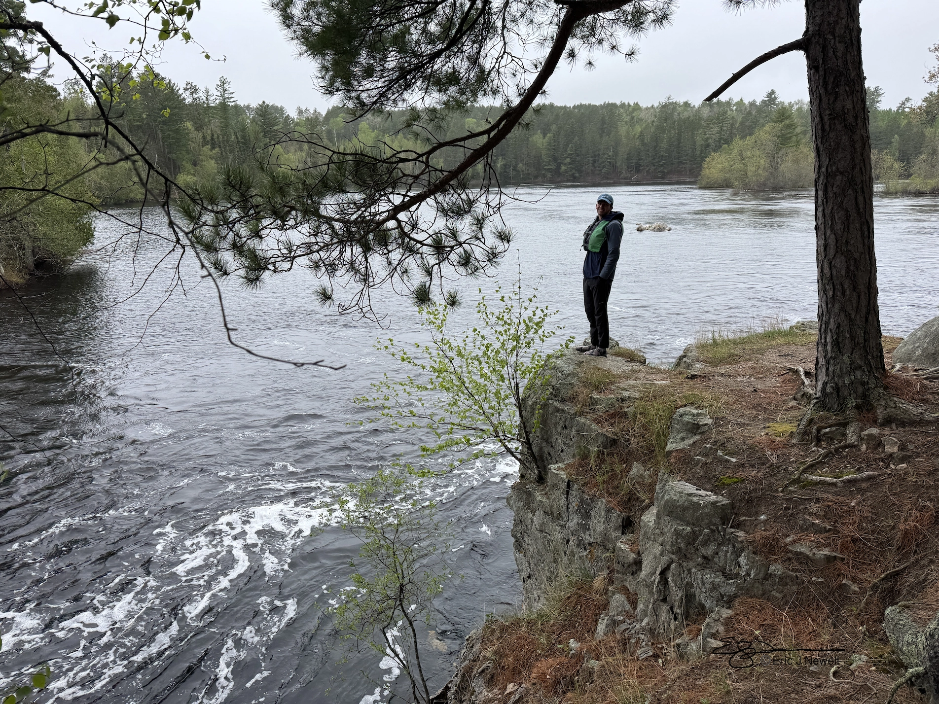
Eric views rapids Courtesy & Copyright Eric Newell
Nate Newell views rapids
Courtesy & Copyright Eric Newell

Nate Newell pulling in front of canoe Courtesy & Copyright Eric Newell
Nate Newell pulling in front of canoe
Courtesy & Copyright Eric Newell

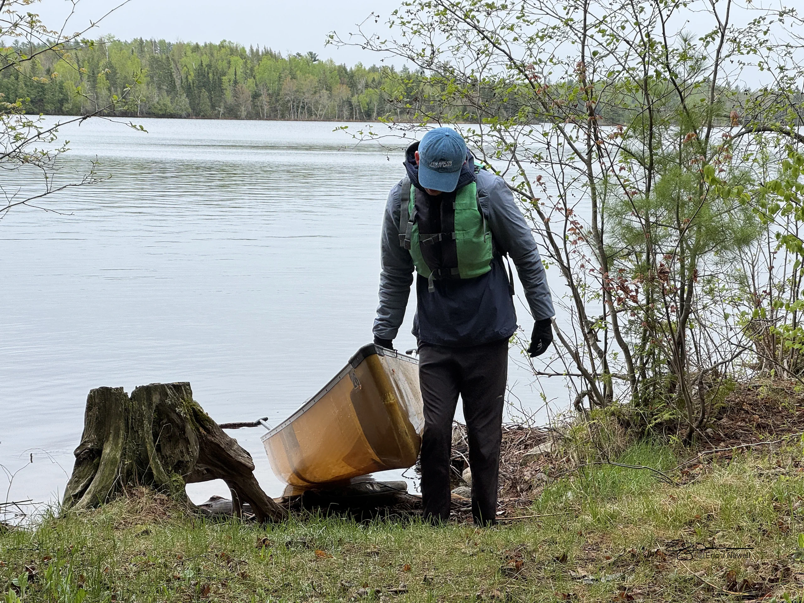
Nate pulls canoe on shore Courtesy & Copyright Eric Newell Nate pulls canoe on shore
Courtesy & Copyright Eric Newell

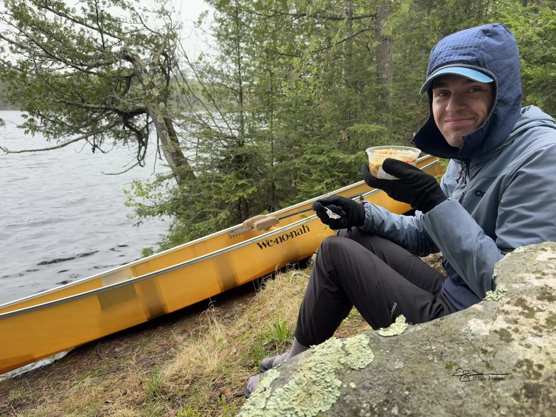
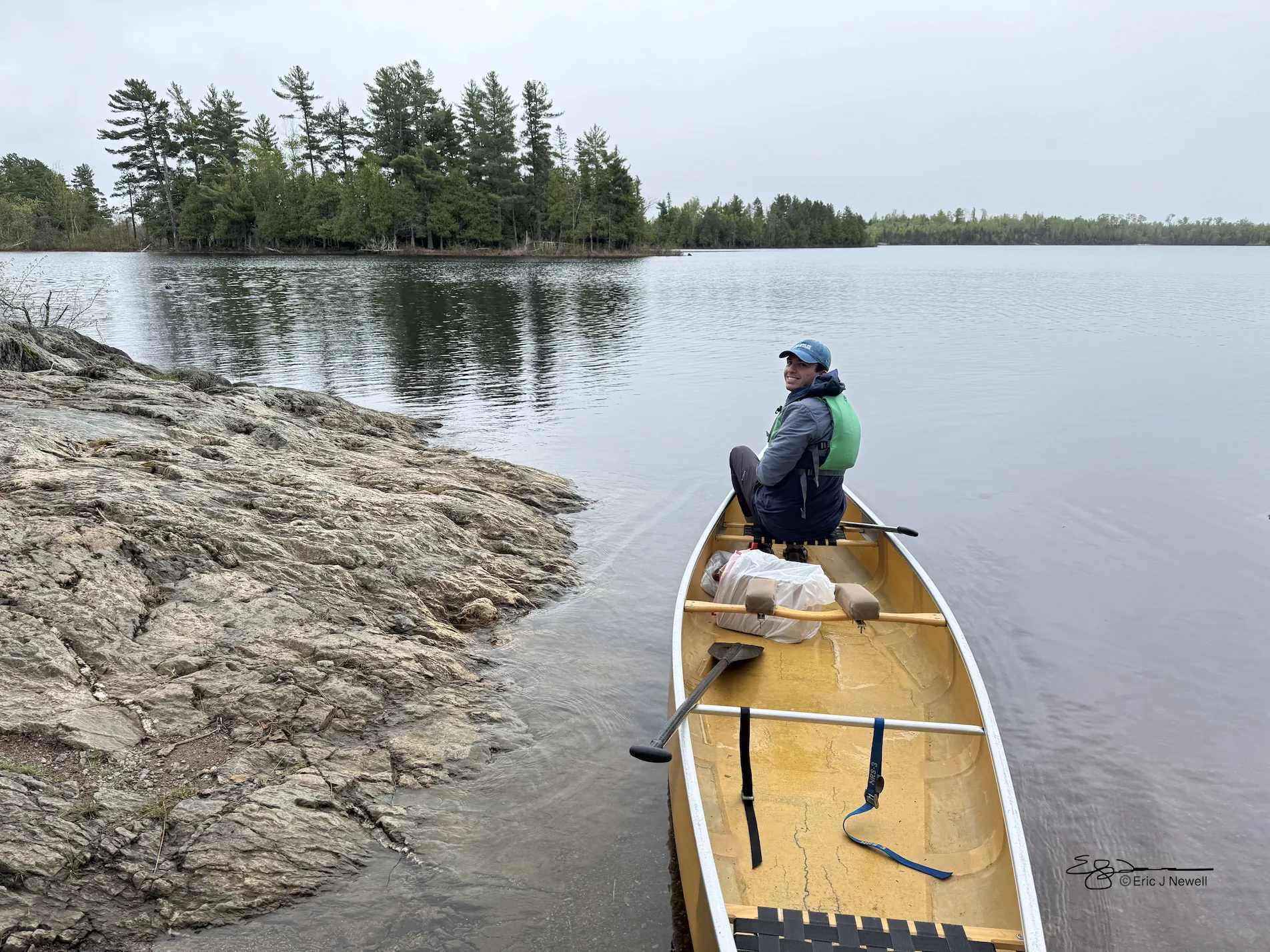
Nate takes a break Courtesy & Copyright Eric Newell Nate takes a break
Courtesy & Copyright Eric Newell

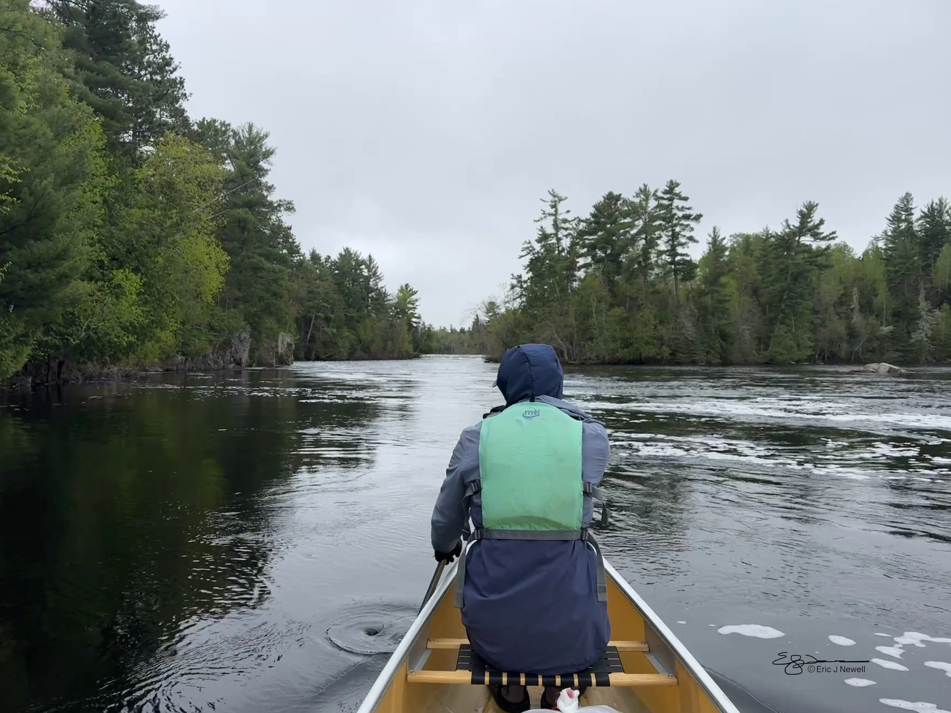
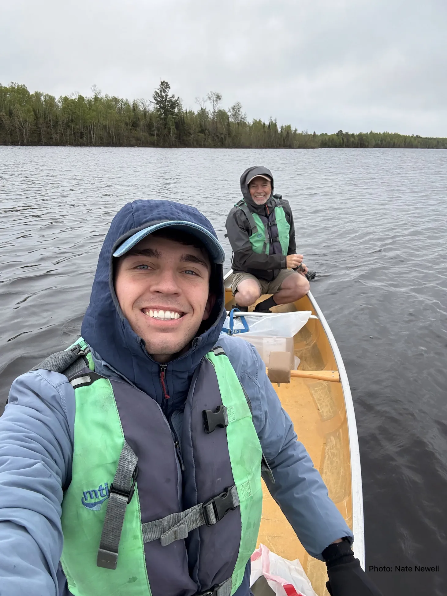
Nate Newell with Eric Newell providing rudder Courtesy & Copyright Eric Newell Nate Newell with Eric Newell providing rudder
Courtesy & Copyright Eric Newell

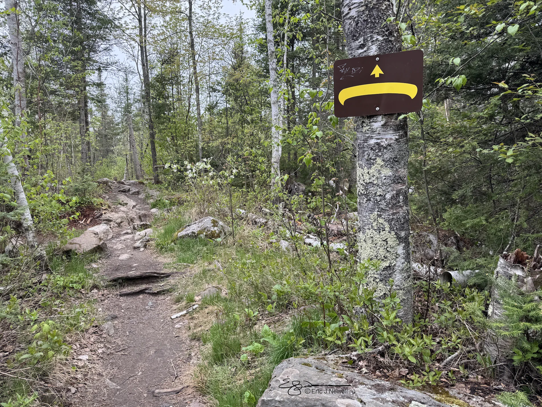
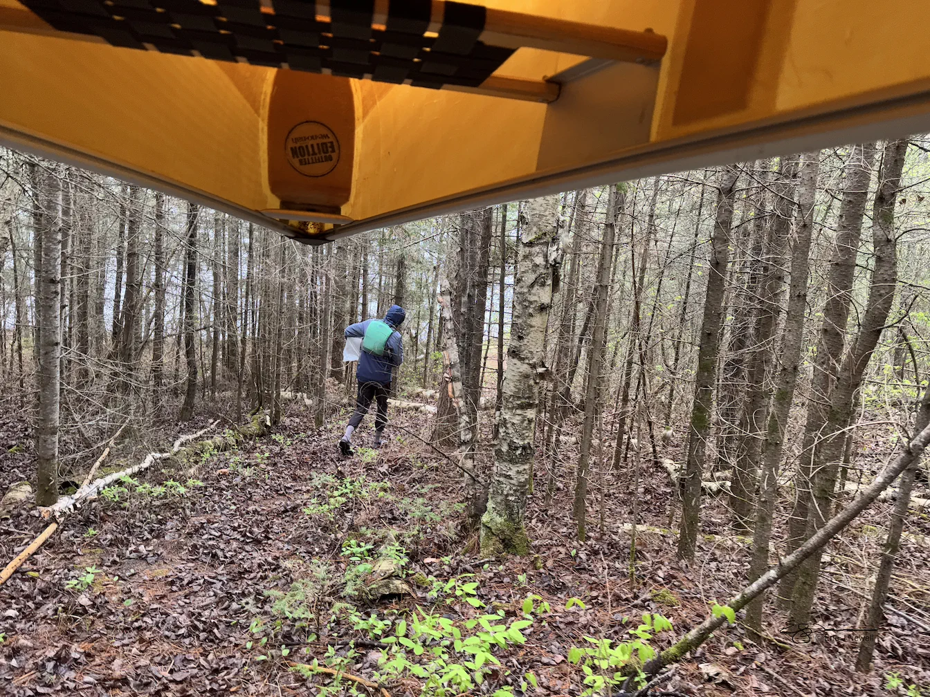
Portaging Path Courtesy & Copyright Eric Newell Portaging Path
Courtesy & Copyright Eric Newell

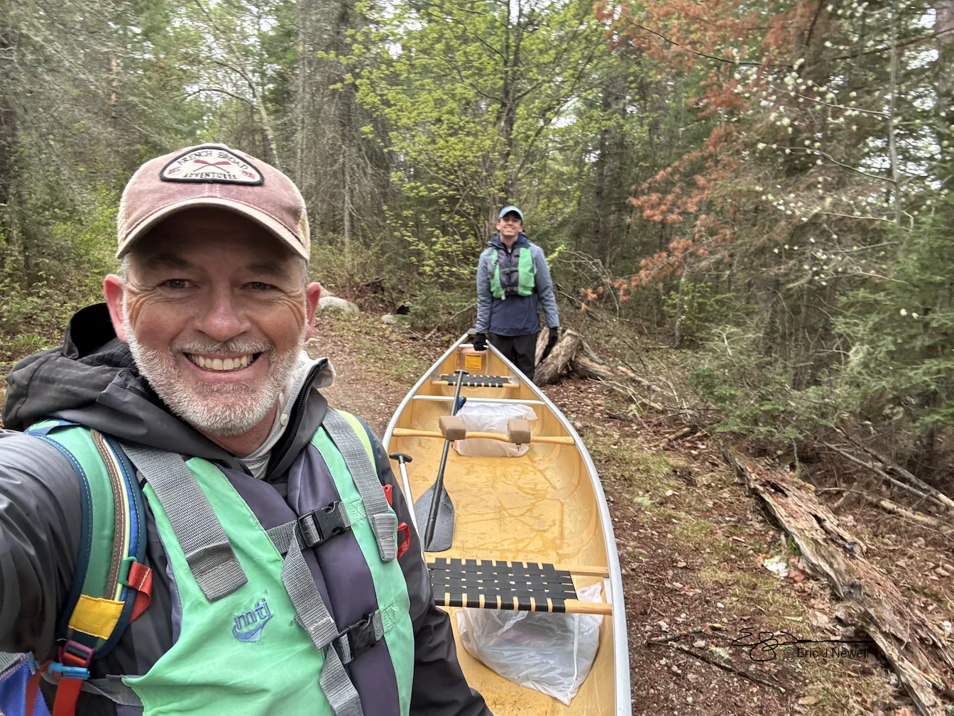
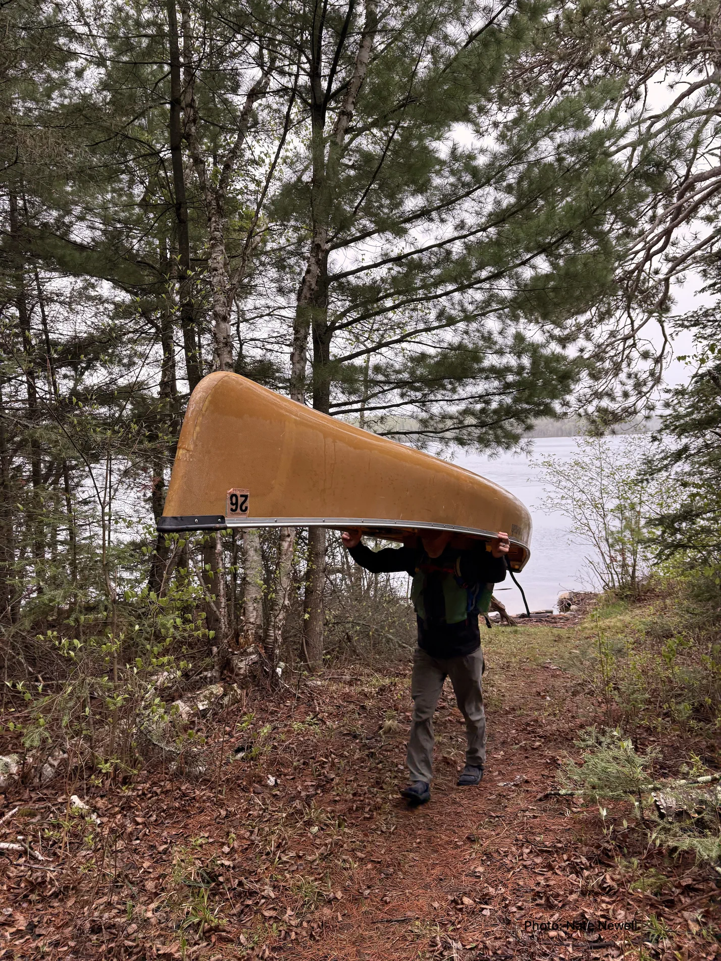
Eric and Nate Newell portage canoe Courtesy & Copyright Eric Newell Eric and Nate Newell portage canoe
Courtesy & Copyright Eric Newell

Portaging the Canoe & Contents Courtesy & Copyright Eric Newell Portaging the Canoe & Contents
Courtesy & Copyright Eric Newell

Eric portaging the Canoe Courtesy & Copyright Eric Newell Eric portaging the Canoe
Courtesy & Copyright Eric Newell

Nate in Front Courtesy & Copyright Eric Newell Nate in Front
Courtesy & Copyright Eric Newell

Minnesota, in the Dakota language (mnisota or mní sóta) translates to “sky-tinted water.”

A year ago, my alarm blared in the pitch-darkness of the bunkhouse at Packsack Canoe Trips on the edge of the Boundary Waters Canoe Area Wilderness.

5 AM comes fast.

I turned off the alarm, swung my legs out of my sleeping bag, and planted my bare feet on the cold plywood floor. I turned on the light. My adult son, Nate, squinted at me from the adjacent bunk. Flashing a groggy grin, he muttered, “That was a short night.”

The day before we drove from Minneapolis to Ely, Minnesota. After a late start and a dinner stop, we drove the last couple hours in the dark, down State Highway 1—the Voyageur Highway—a narrow two-lane strip of asphalt, with no shoulder, and crowded in on either side by endless forests.

Our forecast was for highs in the 40’s, a stiff wind, and scattered rain showers. If I didn’t live 1400 miles away, I would have been happy to wait to paddle for another day, but this was the window of time we had. And, as the Eagles sang so profoundly, “We may lose and we may win, but we may never be here again.”

Most canoe trips into the Boundary Waters are days to weeks long, but you can get a good sampling in a long day on the water.

By 7 AM we were at the Fall Lake boat ramp where our rented Kevlar canoe was waiting for us, as promised. All our good paddling gear was back in Utah, so we placed our day packs in garbage bags to keep them dry, and pushed off into a headwind, which also meant no mosquitos.

Traditionally the homelands of the Anishinaabe people—also known as the Ojibwe or Chippewa, the Boundary Waters Canoe Area Wilderness includes more than 1,000 interconnected lakes, extends for 150 miles along the US/Canadian border, and adjoins Canada’s Quetico Provincial Park. Combined with Voyageur National Park, the three areas create nearly 2.5 million acres of internationally protected land, lakes, forests, and waterways that connect to Hudson Bay and the Arctic Ocean. In April, a twenty-year mining ban in the vicinity was overturned that poses a risk to the pristine waters.

The Boundary Waters is the most visited Wilderness Area in the United States, but not on a day like this. Nate and I zipped our jackets up, put our heads down, and paddled towards an island ahead that provided some refuge from the wind and a chance to rest. We continued picking our route this way, finding the sheltered coves and shorelines when possible and powering into the wind when we had to.

We portaged Newton Falls in a drizzle, then worked our way across Newton Lake, and portaged Pipestone Falls to Pipestone Bay on Basswood Lake. We paddled to an obscure portage route that led us to Azion Lake—a small lake 150 vertical feet above Basswood Lake. We ate lunch on the shore in light rain. The wind died down and we paddled a lap around this double-lobed lake on glassy water with several loons.

For our return voyage we had a light tailwind or no wind. The portages were long enough that we were grateful we paid extra for the Kevlar canoe rental. All in all, we paddled twelve miles, made six portages (three each way), paddled on four lakes, and I plucked three ticks off my pants. Nate seemed unbothered that they liked me more than him.

Though we were a bit soggy, both of us were smiling as we finished out, just a father and son paddling in sync, moving across the dark glassy water, tinted by a gray sky overhead.

I am Eric Newell and I am wild about wild lands in Utah and beyond.

Credits:
Images: Courtesy & Copyright Eric Newell, Photographer
Featured Audio: Courtesy & Copyright J. Chase and K.W. Baldwin and Anderson, Howe, and Wakeman.
Text: Eric Newell, Edith Bowen Laboratory School, Utah State University
Additional Reading: Eric Newell

Additional Reading

Wild About Utah Pieces by Eric Newell

Boundary Waters Canoe Trips & Log Cabins In Ely, Minnesota, PackSack Canoe Trips and Log Cabins by Nicholas Ott, https://www.packsackcanoetrips.com/

Boundary Waters Canoe Area Wilderness, 2026 Explore Minnesota Tourism, MN.gov,
https://www.exploreminnesota.com/destinations/boundary-waters

Explore Boundary Waters Canoe Area, Friends of the Boundary Waters Wilderness,
https://www.friends-bwca.org/explore/

Quetico Provincial Park, Camp Quetico, Atikokan, Ontario, https://queticoprovincialpark.com/

Voyageurs National Park-Minnesota, US National Park System, US Department of the Interior, https://www.nps.gov/voya/index.htm

Save the Boundary Waters , SavetheBoundaryWaters.org, Northeastern Minnesotans for Wilderness (NMW), https://www.savetheboundarywaters.org/

Lawrence, Beatrice, Why mining in Minnesota’s Boundary Waters matters to Wisconsin, Wisconsin Public Radio, April 30, 2026, https://www.wpr.org/news/why-mining-minnesotas-boundary-waters-matters-wisconsin

Kraker, Dan, Trump ends ban on mining near the Boundary Waters, Minnesota Public Radio News, April 27, 2026, https://www.mprnews.org/story/2026/04/27/trump-ends-ban-on-mining-near-the-boundary-waters