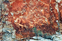
Utah’s Petroglyph Garden

Petroglyph Panel at Fremont Indian State Park & Museum
Photo Courtesy Sevier County
Kreig Rasmussen, Photographer

Hi, I’m Ru Mahoney with Stokes Nature Center in Logan Canyon.

Utah’s culture is rich with vestiges of our pioneer history, and the landscape is accented by visible signs of the European settlers who forged our modern communities. But the tapestry of Utah’s cultural heritage is interwoven with much older threads, as indelible and enduring as the landscape itself.

In the 1980’s, in the southwestern quadrant of central Utah, the construction of interstate 70 unearthed a secret over one thousand years old. The valleys and canyons of what is now Sevier County, already known as a seasonal thoroughfare for the Paiute, had an even older history as home to the largest community of Fremont Indians ever discovered. Influenced by their Anasazi cousins to the southwest, the Fremont culture encompassed a diverse group of tribes that inhabited the western Colorado Plateau and the Great Basin area from roughly 400 to 1350 A.D. Archaeologists tell us they were a people of ingenuity in their engineering, aggression in their social interactions, and lasting creativity in their artistic expression. Divergent theories on their fate suggest they drove the Anasazi out of the Four Corners region and eventually migrated to further landscapes, or that northern groups of Fremont peoples joined with bands of Shoshone and became the Ute Indians of the Uinta. Whatever the truth of their ultimate fate may be, nowhere is their history more tangible than at Fremont Indian State Park just south of Sevier, UT along I-70. This year-round state park offers visitors a treasure trove of artifacts and curated exhibits in an excellent visitor’s center. But the most authentic interaction with these past peoples comes from exploring the surrounding landscape.

Driving the winding road into Clear Creek Canyon, ghostly figures begin to emerge; pictographs painted in shades of ocher and umber, and pale petroglyphs carved into the canyon walls, reveal an archaic and epic account of Utah’s ancestral past. A unique creation story, in which a shrike leads the Fremont people from a dark and cold underworld through the stem of reed into the warm world above, plays out across the canyon walls. A craggy outcrop of rock in the shape of an eagle is said to be watching over the reed to the underworld below to insure nothing wicked escapes into our world. A concentric lunar calendar and an abundance of zoomorphics speak of a cultural identity conceived in relation to the broader astrological world, and a reverence for anthropomorphized neighbors such as bighorn sheep and elk. Spider Woman Rock juxtaposes a powerful figure of Native American mythology with the pedestrian humility of a nursing mother. And Cave of 100 Hands is a visceral exhibition of a humanity simultaneously reminiscent and divergent from our own.

While the Fremont culture is believed to have died out or been absorbed by other modern groups, Clear Creek Canyon and the rock art sites of Fremont Indian State Park are significant among the modern Kanosh and Koosharem Bands of the Paiute who began using the area and leaving their own indelible marks on the canyon walls after the disappearance of the Fremont peoples around 1400 A.D. On the vernal and autumnal equinox (occurring in the third or fourth week of March and September each year) the eagle rock casts its shadow over the reed rock at dawn, breathing life into ancient tales of our ancestral history.

Fremont Indian State Park is a notable destination for those interested in rock art sites, many of which are suited to families of all ages and mobility, including visitors with strollers and wheelchairs. Stop in the visitor’s center to borrow or purchase a guide to the petroglyphs and pictographs for deeper insight into the Fremont culture and an unforgettable glimpse into Utah’s past.

For Wild About Utah and Stokes Nature Center, I’m Ru Mahoney.

Credits:
Images: Courtesy Sevier County, Kreig Rasmussen, Photographer
Text:     Ru Mahoney, Stokes Nature Center in Logan Canyon.


Additional Reading:

https://stateparks.utah.gov/parks/fremont-indian/

https://stateparks.utah.gov/stateparks/wp-content/uploads/sites/26/2015/02/Fremont_IndianBrochure.pdf

https://www.nps.gov/grba/learn/historyculture/fremont-indians.htm

https://www.thefurtrapper.com/fremont_indians.htm

Take the Pledge to Protect the Past, Utah State Historical Preservation Office, Department of Cultural & Community Engagement, State of Utah, https://ushpo.utah.gov/shpo/upan/
Fossil Formation

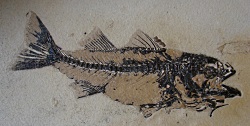
Fossil Formation: Click for a larger view of a fossil, Courtesy and copyright 2008 Stokes Nature Center, logannature.org
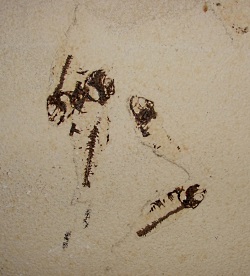
Fossilized fish
Mioplosus labracoides
Copyright 2013 Stokes Nature Center
Andrea Liberatore, Photographer

Fossil Formation: Click for a larger view of a fossil, Courtesy and copyright 2008 Stokes Nature Center, logannature.orgFossilized fish
Copyright 2013 Stokes Nature Center
Andrea Liberatore, Photographer

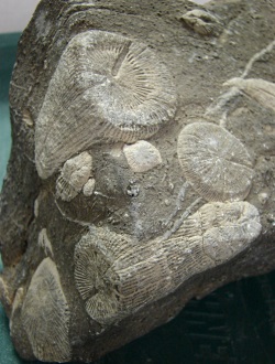
Fossil Formation: Horn Corals from Logan Canyon, Courtesy and copyright 2008 Stokes Nature Center, logannature.orgHorn Corals from Logan Canyon
Copyright 2013 Stokes Nature Center
Andrea Liberatore, Photographer

Fossilized leaf, Courtesy and copyright 2008 Stokes Nature Center, logannature.orgFossilized leaf
Copyright 2013 Stokes Nature Center
Andrea Liberatore, Photographer

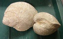
Fossilized shells
Copyright 2013 Stokes Nature Center
Andrea Liberatore, Photographer

Fossil Formation

The most popular school program that the Stokes Nature Center offers is a geology lesson for second grade. I’m not sure what happens between second grade and adulthood to make our general perception of geology go from exciting to boring, but you would be amazed at how excited second graders get over rocks, and especially, over fossils.

Fossils are really quite rare – a very specific set of conditions have to be met in order to create one. Most living things decompose fairly rapidly upon death, leaving no trace of their existence behind. In order to create a fossil, this process of decomposition needs to be halted fairly rapidly, which typically means that the body is quickly covered by some kind of sediment – like sand, or soil or mud. For this reason, most fossils are found embedded in sedimentary rock. If pressure and moisture levels are just right, over the course of millions of years the organism’s molecules will slowly be replaced by minerals from the surrounding sediments – eventually turning bone into stone.

Only somewhere around one in a billion bones will make it through this process. From there the fossil has to remain intact and identifiable through eons of tectonic plate movement, earthquakes, and mountain uplift. Then, in order to be found it has to be located near enough to the earth’s surface, and in such a place where a human might come across it. Some geologists estimate that only 1 in 10,000 species that have ever lived have made it into the known fossil record, which makes me wonder what discoveries still await us.

Fortunately for us, prehistoric Utah was a place where fossilization happened with some regularity, as evidenced by places like Dinosaur National Monument and the Escalante Petrified Forest. Did you know that Utah has a state fossil? That distinction goes to the allosaurus, a predatory dinosaur that thrived during the Late Jurassic period. Numerous skeletons found in east-central Utah range in size from 10 – 40 feet in length, meaning this fearsome creature may have rivaled it’s more famous cousin Tyrannosaurus Rex for top predator status.

With such a rich fossil history, it’s not out of the question that you might stumble onto something truly amazing during a routine hike. Can you keep your find? Well, that depends on two things: the type of fossil, and whose land it was found on. On public lands in Utah, fossils of vertebrates cannot be collected, while fossils of invertebrates and plants can be. Private land owners have full rights to the fossils found on their property. With all fossils, it’s a great idea to report your find to the US Geological Survey so that your discovery can be documented for public or scientific research, display or education.

Fossil creation is an incredible phenomenon that has allowed us to glimpse the earth’s history in ways that would otherwise be completely hidden. Thanks to fossils, we can envision a prehistoric landscape filled with giant ferns, enormous dragonflies, long-necked allosauruses, and flying pterodactyls. Without the evidence in the fossil record, I doubt that even the most imaginative person among us could have envisioned such an amazing array of life.

For the Stokes Nature Center and Wild About Utah, this is Andrea Liberatore.

Fossil Formation-Credits:

Photos: Courtesy & © Stokes Nature Center, logannature.org
Text:    Andrea Liberatore, Stokes Nature Center, logannature.org

Fossil Formation-Additional Reading:

State of Utah, Utah Geological Survey, Dinosaurs & Fossils (2011) https://geology.utah.gov/utahgeo/dinofossil/index.htm

McCalla, Carole and Eldredge, Sandy (2009) What should you do if you find a fossil? Utah Geological Survey. Accessible online at: https://geology.utah.gov/surveynotes/gladasked
/gladfossil_collecting.htm

Trefil, James (1996) 101 Things You Don’t Know About Science and Nobody Else Does Either. Houghton Mifflin Company: New York, NY, https://www.amazon.com/Things-Dont-About-Science-Either/dp/0395877407

Bryson, Bill (2003) A Short History of Nearly Everything. Broadway Books. New York, NY, https://www.amazon.com/Short-History-Nearly-Everything-Illustrated/dp/0307885151

Hylland, Rebecca, What are Igneous, Sedimentary & Metamorphic Rocks?, Glad You Asked, Utah Geological Survey, https://geology.utah.gov/map-pub/survey-notes/glad-you-asked/igneous-sedimentary-metamorphic-rocks/

A Safari through Utah’s Ice Age

Wave-cut platforms from
Lake Bonneville preserved on
Antelope Island, Great Salt Lake, Utah.
Photo Courtesy Wikimedia, Mark A. Wilson (Department of Geology, The College of Wooster), Photographer

Ground sloth of the Pleistocene
Paramylodon harlani
Texas Memorial Museum
University of Texas at Austin.
Photo Courtesy Wikimedia
Licensed CCA Share Alike 3.0 Unported

Lake Bonneville compared to the
State of Utah.
Photo Courtesy https://wildlife.utah.gov/gsl/history/


Hi, I’m Ru Mahoney with Stokes Nature Center in Logan Canyon. As winter approaches I find myself anticipating the first really good snow, when our valley floors and mountain passes will be transformed overnight, relinquishing autumn’s riot of color for a glacial monochrome. As little as 12,000 years ago winter white was Utah’s perennial favorite, donned at the launch of the Pleistocene Epoch, a roughly 2 million year long period (give or take 10,000 years) marked by widely recurring glaciations.

The west has a reputation for being vast, but Ice Age Utah was even bigger. The mountains where higher and sharper. And the Great Salt Lake was submerged beneath the glacial waters of Lake Bonneville. At its largest, this massive body of water covered 20,000 square miles and was more than 980 feet deep. To put that into perspective, that measures about 9.5 million football fields wide by 4.5 Salt Lake Temples deep. And the Ice Age wildlife? Well it was much more akin to an African safari than anything you’re likely to find on your favorite shoreline trail these days.

The megafauna of Pleistocene Utah included a menagerie of beasts that are the stuff of legend. Familiar species like bison and big-horn sheep grazed among herds of mammoths and mastodons. Camels and horses – destined for extinction in North America – were the prehistoric prey of dire wolves and saber-toothed cats. Giant ground sloths the size of modern day elephants stood on two powerful hind legs to browse on shoreline foliage. And herds of muskoxen kept a wary eye on Arctodus, the Short-faced bear, a formidable predator more than 50% larger than any bear species living today.

The last 30,000 years of Utah’s Ice Age were characterized by increasingly volatile shifts in climate. The changing norms in temperature and abundance of liquid water created cyclical periods of transitioning habitat. Forests and forest dwellers gave way to deserts and their specialist species, before shifting back to forests again, all in mere millennia. While nomadic and highly adaptable species like muskoxen eventually moved north to more stable climates, the less adaptable fauna of the Ice Age were increasingly relegated to sharing shoreline habitat diminished by the swollen banks of Lake Bonneville.

As fluctuating glaciers pushed southward and then retreated, canyons like Big and Little Cottonwood were gouged into existence. Spring and summer glacier melt carried an abundance of freshwater into the lake, sometimes sweeping along with it the remains of prehistoric animals that had not lasted through the winter, laying them to rest in shoreline deltas where their fossilized remains are now uncovered and studied in alluvial sediment. For many of Utah’s Ice Age animals, the end of the Pleistocene brought extinction.

Today the ancient shoreline of Lake Bonneville is one of the most distinguishable geological features along the Wasatch front. This “bench”, as it’s now commonly known, is easily identifiable in cities all along the Wasatch and frequently boasts fine homes and even finer views. Which might go to show that lakeside property retains its value whether the lake is still there or not. So as you enjoy a winter hike or cross country ski along a shoreline trail this season, think about Utah’s last Ice Age and how our rich fossil record, with some of earth’s largest land mammals, paints a picture of an even wilder west.

For Wild About Utah and Stokes Nature Center, I’m Ru Mahoney.

Credits:
Image1: Courtesy Wikimedia, Mark A. Wilson (Department of Geology, The College of Wooster), Photographer
Image2: Courtesy Wikimedia,as licensed through Creative Commons Attribution-Share Alike 3.0 Unported
Image3: Courtesy https://wildlife.utah.gov/gsl/history/
Text:     Ru Mahoney, Stokes Nature Center in Logan Canyon.


Additional Reading:
https://geology.utah.gov/popular/general-geology/ice-age/ice-age-animals-of-utah/

https://serc.carleton.edu/vignettes/collection/37942.html

https://hugefloods.com/Bonneville.html

https://geology.utah.gov/surveynotes/archives/snt42-3.pdf

https://geology.utah.gov/surveynotes/articles/pdf/pleistocene_fossils_42-3.pdf

Echoes of Lake Bonneville

Echoes of Lake Bonneville: North Spring, Fish Springs National Wildlife Refuge, Utah. Courtesy Utah Geological Survey
North Spring, Fish Springs National Wildlife Refuge, Utah. Courtesy Utah Geological Survey

Leland Harris wetlands, Snake Valley, Utah, Courtesy Utah Geological SurveyLeland Harris wetlands
Snake Valley, Utah
Courtesy Utah Geological Survey

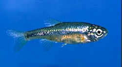
Least Chub, Courtesy and Copyright Mark C. Belk, PhotographerLeast Chub
Courtesy & © Mark C. Belk, Photographer
Echoes of Lake Bonneville

Hi, I’m Holly Strand of the Quinney College of Natural Resources at Utah State University.

Deserts are dry by definition receiving an average of less than 10 inches of precipitation a year. In Utah’s cold West Desert, this skimpy amount of moisture slakes the thirst of sagebrush, saltbush or greasewood, but not much else. However, just like the Sahara, the West Desert has its oases. In certain lowland valleys you’ll find complexes of pools and marshes. There isn’t enough rain to form these freshwater sanctuaries. The water comes from giant underground aquifers.

Underneath the West Desert, the aquifer system acts as a storehouse for runoff from the surrounding mountains. As rainwater or snow melt enters or “recharges” the aquifer system, water pressure can build up in some areas. This pressure moves water through cracks and tunnels within the aquifer, and sometimes this water flows out naturally in the form of springs.

These desert springs–and the resulting pools and marshes–permit concentrations of animals and plants not possible under normal desert conditions. You’ll find sedges, rushes cattails and many other wetland plants. Both migratory and year round birds congregate here. There are even a couple of frog species—the Colombian spotted frog and the northern leopard frog.

But most remarkable are the desert spring residents that have survived from the days when the West Desert formed the floor of giant Lake Bonneville. Surveys have revealed a number of relict snails and other mollusks that still persist from that time. Some, like the Black Canyon Pyrg exist at a single spring complex only; they are found nowhere else on earth.

Certain native fish were also left high and dry by Lake Bonneville’s recession. The least chub is a good example. Now the sole member of its genus, this 3-inch long survivor is an unassuming but attractive little minnow. It is olive-colored on top and sports a gold strip on its steel-blue sides. It swims in dense but orderly schools in either flowing or still water. It can withstand both temperature variations and high salinity. The ability to tolerate different physical conditions has undoubtedly helped the least chub survive the post-Lake Bonneville millennium. Even so, the least chub was hanging on in only six different locations until Utah’s Division of Wildlife Resources reintroduced it to several more sites within its historic range. The Division and its conservation partners are still working to reduce threats to the least chub, to other spring residents and to the spring habitats themselves.

For more information and pictures go to www.wildaboututah.org

Thanks to Chris Keleher of Utah’s Department of Natural Resources for his help in developing this Wild About Utah story.

For Wild About Utah, I’m Holly Strand.

Credits:

Theme: Courtesy & Copyright Don Anderson Leaping Lulu
Image: Least Chub, Mark C. Belk, Professor of Biology, Brigham Young University
Image: Wetlands, Courtesy Utah Geological Survey https://geology.utah.gov/
Text: Holly Strand, Quinney College of Natural Resources at Utah State University

Sources & Additional Reading

Bailey, Carmen L., Kristine W. Wilson Matthew E. Andersen. 2005. CONSERVATION AGREEMENT AND STRATEGY FOR LEAST CHUB (IOTICHTHYS PHLEGETHONTIS) IN THE STATE OF UTAH Publication Number 05-24 Utah Division of Wildlife Resources a division of Utah Department of Natural Resources https://wildlife.utah.gov/pdf/fish/least_chubs.pdf

Jones, Jennifer, Rich Emerson, and Toby Hooker. 2013. Characterizing Condition in At-risk
Wetlands of Western Utah: Phase I UTAH GEOLOGICAL SURVEY a division of Utah Department of Natural Resources,https://geodata.geology.utah.gov/pages/view.php?ref=8364

Nature Serve entry for Least Chub: https://explorer.natureserve.org/servlet/NatureServe?searchName=Iotichthys+phlegethontis

Hanks, Joseph H. and Mark C. Belk. 2004. Threatened fishes of the world: Iotichthys phlegethontis Cope, 1874 (Cyprinidae) in Environmental Biology of Fishes, Vol. 71. N. 4., Kluwer Academic Publishers. https://dx.doi.org/10.1007/s10641-004-1030-x

Sigler W. F. & J. W. Sigler. 1996. Fishes of Utah, A Natural History. University of Utah Press, Salt Lake City. 375 pp. https://www.amazon.com/Fishes-Utah-A-Natural-History/dp/0874804698

Wasatch Front Canyons Geologic Tour, Virtual Tour created from Published Booklet (pdf) Geologic Guide to the Central Wasatch Front Canyons, Utah Geological Survey, State of Utah, https://utahdnr.maps.arcgis.com/apps/MapTour/index.html?appid=5cf1570b998346d98478a5abd50bf096

Geologic guides to the central Wasatch Front Canyons, Utah Geological Survey, 2005, https://geology.utah.gov/popular/utah-landforms/virtual-tour-central-wasatch-front-canyons/ [updated January 2024]