by Justin Tolman
USU Museum of Geology
Courtesy & © Shannon Rhodes, Photographer
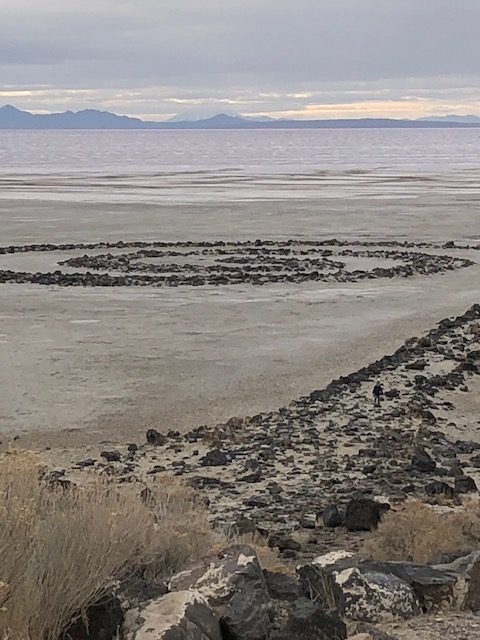
 Fossil Point in the San Rafael desert near Green River, Utah
https://www.blm.gov/visit/fossil-point-trailhead
Courtesy & © Shannon Rhodes, PhotographerIn their picture book “Everywhere, Wonder,” Matthew Swanson and Robbi Behr challenge readers to find a story in places and phenomena both ordinary and extraordinary. Black ants marching in a line have a story just as interesting as red-rock canyons and a footprint on the moon. Sunlight patterns through a window are just as beautiful as Brazilian jungles and wildebeests in Kenyan savannas. They remind us to keep our eyes open and weave the stories of our noticings. As I wander among Utah’s wild wonders, it’s easy.
This spring I realized the fun of finding my wonder story as I stumbled upon the sign for Fossil Point in the San Rafael desert near Green River, Utah. The odds were pretty good, I suspected, that I could find fossils there, but I didn’t know exactly what I was hunting. My eyes are always drawn to the fact-filled stories on interpretive signage, even if I’ve read them before, but at this spot all I knew was the title. No kiosks with hint-filled maps and tips for discovery or guardrail paths making it obvious where to walk. Just a pile of boulders.
Although I wouldn’t consider myself a dino-fanatic, I have been a frequent visitor throughout my life at the Dinosaur National Monument and other Utah fossil museums as well as more dinosaur trackways and quarries not housed in buildings. I’ve read hundreds of dino readers and scanned even more dinosaur books, but here I was without many clues to what I might find. Resisting the urge to look up internet hints, I started up the Fossil Point slope. Was it trilobites the size of dimes and quarters or prehistoric swamp ferns? I will not reveal what I found at Fossil Point so that you can discover the wonder yourself, but it motivated me to catch up on Utah’s contribution to the more than one hundred characters in the dinosaur story, as depicted beautifully in the Dinosaurs of Utah tools at the Utah Geological Survey website.
So many students I’ve met have been fascinated by the T-rex and Utah state fossil Allosaurus, and they know all sorts of theories about how the Utahraptor, our state dinosaur since 2018, might have had feathers and hunted in packs. Fossils provide hints to the size and shape of prehistoric life, but they leave a lot of the colors and textures to the imagination. Tucked in the back corner of the Geology Museum at Utah State University I found another story, this one titled “Percy.” While the stories of Percy’s relatives are preserved in the nine-ton Utahraptor Megablock extracted from the area that is emerging as Utahraptor State Park, this story took sculptor Justin Tolman an astounding 350 hours to create. This incredible replica sports colors resembling my grandbabies’ Easter egg-dying hands as they toddled along the base of Fossil Point with me hunting evidence of a Mesozoic story. It is a story I’m glad I found
almost all on my own.
For Wild About Utah, I am Shannon Rhodes.
Credits:
Images: Courtesy & Copyright Shannon Rhodes, Photographer
Audio: Courtesy & © Friend Weller, https://upr.org/
Text: Shannon Rhodes, Edith Bowen Laboratory School, Utah State University https://edithbowen.usu.edu/
Additional Reading Links: Shannon Rhodes
Additional Reading:
Wild About Utah Pieces by Shannon Rhodes, https://wildaboututah.org/author/shannon-rhodes/
Bureau of Land Management, Fossil Point trailhead, https://www.blm.gov/visit/fossil-point-trailhead
Rodgers, Bethany, Governor Spencer Cox signs bill to create Utahraptor State Park near Moab. 2021. The Salt Lake Tribune. https://www.sltrib.com/news/politics/2021/03/17/gov-spencer-cox-signs/
Sidwell, Owen. University student sculpts Utahraptor for USU Geology Museum. 2018. Utah Public Radio. https://www.upr.org/arts-and-culture/2018-04-12/university-student-sculpts-utahraptor-for-usu-geology-museum
Swanson, Matthew. Everywhere, Wonder. 2017. Imprint: New York. https://robbiandmatthew.com/everywhere-wonder/
USU Museum of Geology, Come meet Percy the Raptor, https://www.usu.edu/geo/info/geology-museum
Popular Geology: Dinosaurs and Fossils, Utah Geological Survey. https://geology.utah.gov/popular/dinosaurs-fossils/#:~:text=Utah%20also%20contains%20abundant%20fossils,of%20millions%20of%20years%20ago.