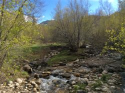
Courtesy and Copyright Bethany Neilson, Photographer
As an introductory activity, the Ranger asked each of us to name the animal we thought that had the greatest influence or impact on ecosystems. People mentioned Deer, Cougars, Moose, Wolves and so on until it was my turn. Without hesitation I said “Beavers”. One of the teachers laughed at me and mocked my answer trying to embarrass me. So I asked the Ranger to repeat the question: Which animal did we think had the greatest influence or impact on ecosystems.

Courtesy and Copyright Bethany Neilson, Photographer

Courtesy and Copyright Bethany Neilson, Photographer
Yes, they will take down some trees to build dams and lodges. Problems might include:
The potential flooding of homes, agricultural land, timber land or orchards;
Their abandoned dams can create floods as they collapse;
There is potential flooding of roads and blocking of culverts;
And the deterioration of stream banks can occur.
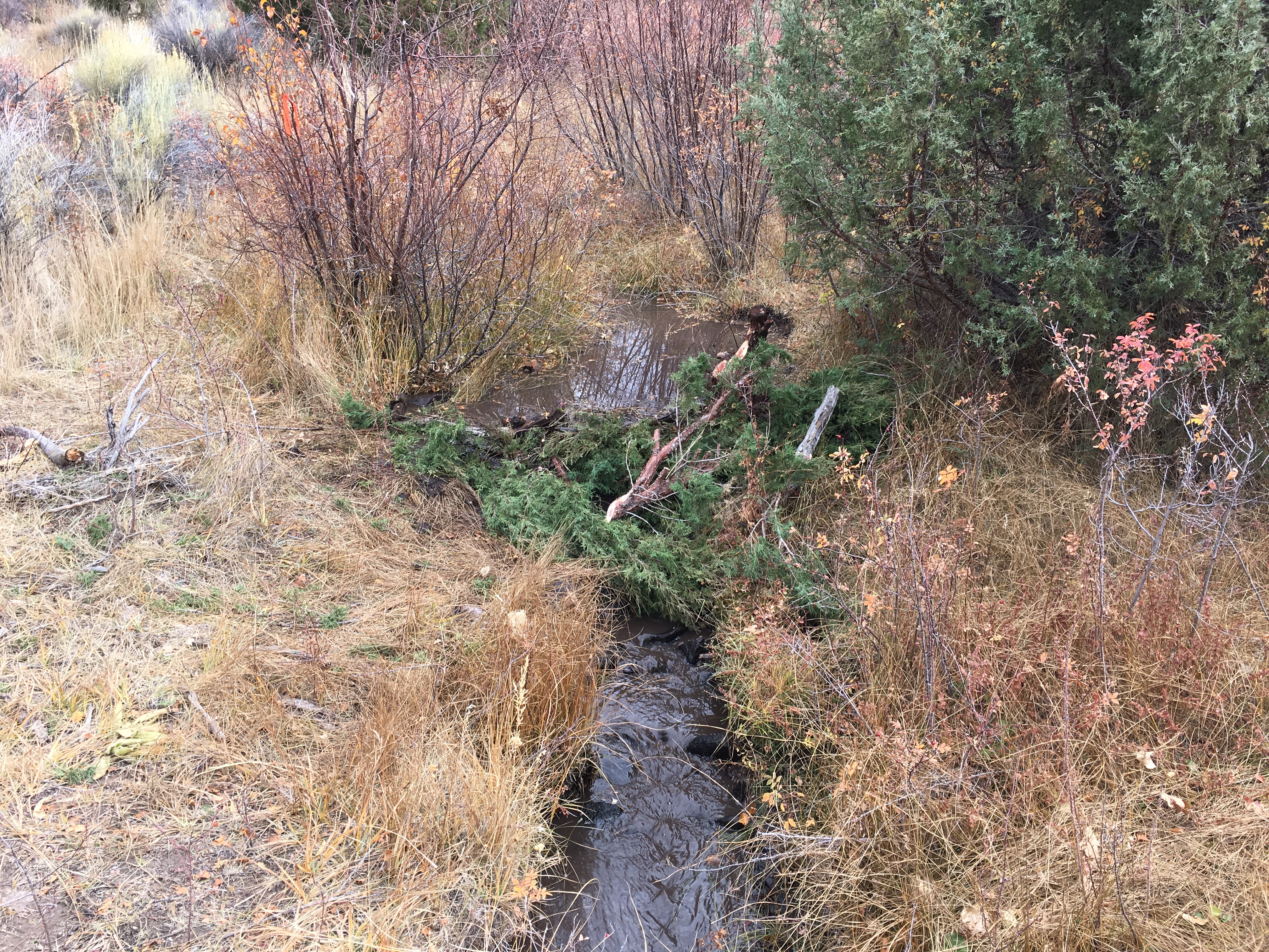
But in a natural setting, where they do not impact roads or developments, beavers can do amazing things.
On the positive side, they create ponds which:
Provide habitat for trout;
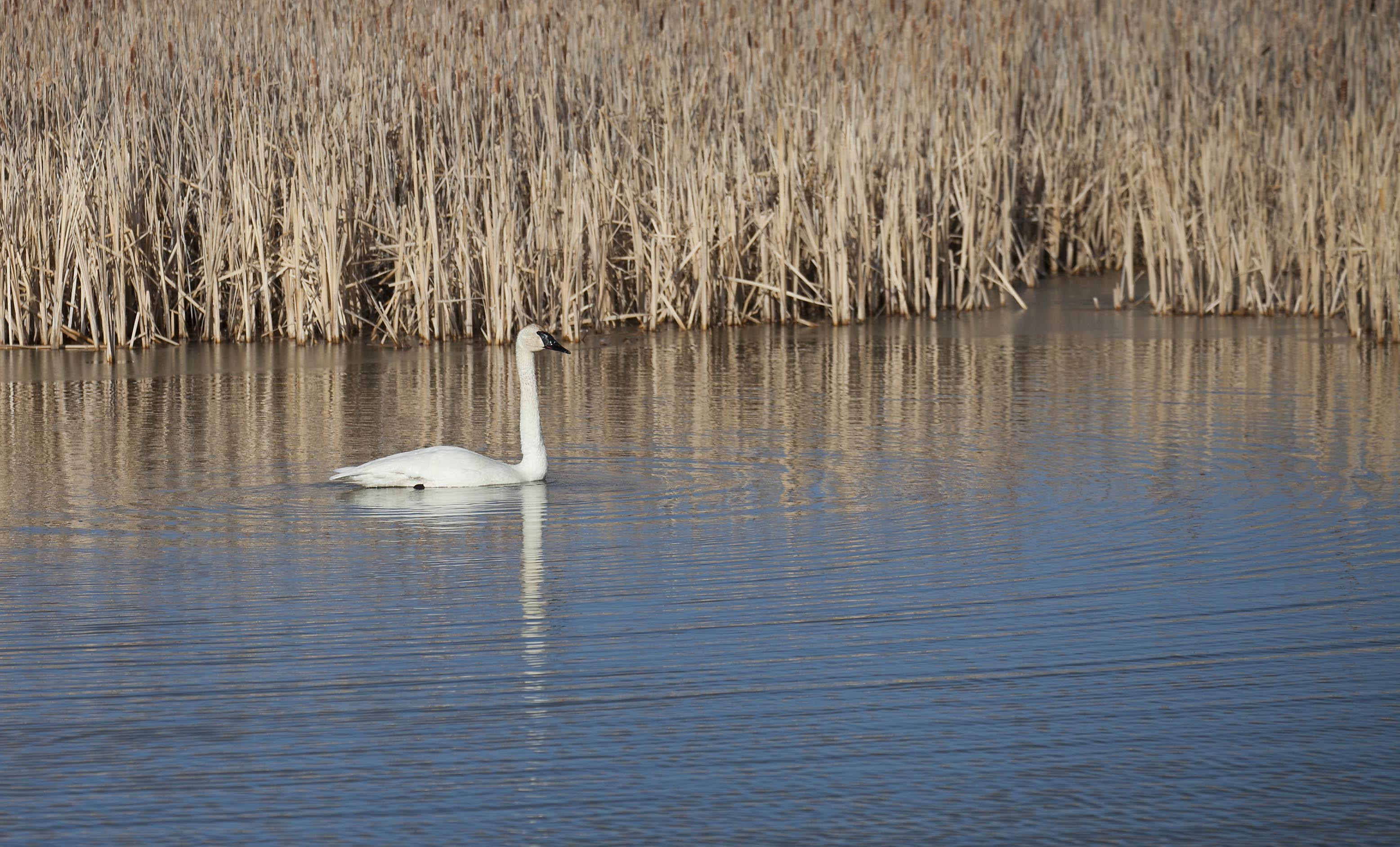
Provide drinking water for all the animals in the area, from birds to bears;
Provide a storage of water that could be critical in drought conditions;
Trap silt and control small floods;
Invigorate the sprouting of early riparian and wetland plants;
Can help combat the effects of continual rising temperatures and earlier Spring snowmelt by maintaining a water supply for ranching, wildlife and native vegetation;
And they are basically constructed and maintained at little or no cost to humans.
Utah State University, and the Division of Wildlife Resources, have been developing partnerships with landowners to help restore beavers in locations where they can succeed and provide benefits to the land, wildlife, and ranching efforts. In areas where there are few trees, they construct Beaver Dam Analogues by pounding fence posts across streams, weaving willow branches between them, and plugging the base with large rocks and mud. These are similar to natural beaver dams and give them a good start to build their own homes there.
If you are aware of any beavers in questionable areas, contact
USU Watershed Sciences or the DWR to help relocate them where they can impact ecosystems in positive ways.
This is Ron Hellstern, and I am Wild About Utah.
Credits:
Images: Courtesy and Copyright Bethany Neilson, Photographer https://uwrl.usu.edu/people/faculty/neilson-bethany
Audio: Courtesy Western Soundscape Archive, University of Utah, Sound provided by Jeff Rice, licensed under CCA-ND
Text: Ron Hellstern, Cache Valley Wildlife Association
Additional Reading
North American Beaver, Castor canadensis, Utah Division of Wildlife Resources, Wildlife Notebook Series No. 24,
https://digitallibrary.utah.gov/awweb/awarchive?type=download&item=56529
UTAH BEAVER MANAGEMENT PLAN 2010–2020, Developed with the Beaver Advisory Committee, DWR Publication 09-29, Utah Division of Wildlife Resources, 2010, https://wildlife.utah.gov/furbearer/pdf/beaver_plan_2010-2020.pdf
WATS 6860 – Partnering with Beaver in Restoration Design, University Catalog 2017-2018, Utah State University, https://catalog.usu.edu/preview_course_nopop.php?catoid=12&coid=93002
Beaver: Restoration liaison between riparian and upland systems. Joe Wheaton, Assistant Professor, Utah …, https://www.youtube.com/watch?v=62A3RqL7Xp8
WEBINAR: Cheap and Cheerful Stream Riparian Restoration with Beaver. Joe Wheaton …
https://www.youtube.com/watch?v=m1uysDrOI_w
Beaver Restoration Workshop, Partnering with Beaver in Restoration, https://beaver.joewheaton.org/
Webinar: Cheap & Cheerful Stream Restoration – With Beaver? https://beaver.joewheaton.org/beaver-news/webinar-cheap-cheerful-stream-restoration-with-beaver
Science Unwrapped Talk by Joe on Beaver
https://beaver.joewheaton.org/beaver-news/science-unwrapped-talk-by-joe-on-beaver
Videos & Movies
https://beaver.joewheaton.org/videos–movies.html
Joe Wheaton – Beaver: Restoration liaison between riparian and upland systems
https://beaver.joewheaton.org/
Dr. Joseph Michael Wheaton, Watershed Sciences, Associate Professor, https://qcnr.usu.edu/directory/wheaton_joseph
Utah Water Watch, Beaver Monitoring App, https://extension.usu.edu/utahwaterwatch/citizenscience/beavermonitoringapp/
Beaver Dam Mapping App Now Available for Citizen Scientists, https://www.exploreutahscience.org/science-topics/environment/item/148-citizen-scientists-can-now-use-an-app-to-help-map-beaver-dams-in-utah
ARKive Images of Life on Earth, Information Sheet on Castor Canadensis (including some outstanding videos) https://www.arkive.org/ – (BBC Natural History Unit)
-
- American Beaver – Overview
- American Beaver in the Lodge with Young
- American beaver felling trees and storing food for the winter
- American beaver scaring moose away from its lodge
- American beaver returning to its lodge with food
Collen, P. and R.J. Gibson. 2001. The general ecology of beavers (Castor spp.), as related to their influence on stream ecosystems and riparian habitats, and the subsequent effects on fish – a review. Reviews in Fish Biology and Fisheries 10: 439–461, 2001. https://web.archive.org/web/20230202160926/https://www.researchgate.net/publication/227028536_The_general_ecology_of_beavers_Castor_spp_as_related_to_their_influence_on_stream_ecosystems_and_riparian_habitats_and_the_subsequent_effects_on_fish_-_A_review [ Accessed May 1, 2010]
Prettyman, B. 2009. Utah wildlife: Leave it to the beavers. Article in Salt Lake Tribune, October 16, 2009. https://www.sltrib.com/ci_13570110 [ Accessed April 29, 2010]
Smithsonian Castor Canadensis Information Page https://www.mnh.si.edu/mna/image_info.cfm?species_id=32 [ Accessed April 29, 2010]
Big Bend Habitat Restoration Project: A Natural Work of Heart, Open Spaces-A Talk on the Wild Side, US FWS, https://www.fws.gov/news/blog/index.cfm/2016/3/25/Big-Bend-Habitat-Restoration-Project-A-Natural-Work-of-Heart [Accessed March 31, 2016]
Beaver Dams Strengthened by Humans Help Fish Rebound
60-Second Science – July 25, 2016 – By Jason G. Goldman02:29 https://www.scientificamerican.com/podcast/episode/beaver-dams-strengthened-by-humans-help-fish-rebound/ Also available through the podcast https://itunes.apple.com/us/podcast/60-second-science/id189330872?mt=2
Goldfarb, Ben, Eager: The Surprising, Secret Life of Beavers and Why They Matter, Chelsea Green Publishing, March 8, 2019, https://www.amazon.com/Eager-Surprising-Secret-Beavers-Matter/dp/1603589082/ref=asc_df_1603589082/