Desert Rain

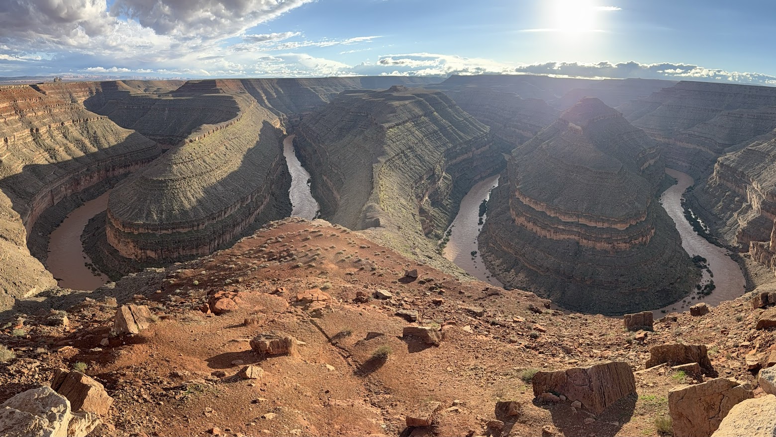
San Juan River from Goosenecks State Park
Courtesy & Copyright Eric Newell, Photographer
San Juan River from Goosenecks State Park
Courtesy & Copyright Eric Newell, Photographer
Rain in the desert heightens the senses.

My hands loosely grip the oars. My rain jacket is zipped to my beard, and my ball cap is pulled down tightly on my head. Standing on the floor of my raft, I lean gently on the oars, pushing the raft downriver on choppy, strong current. A gentle upriver breeze pushes against my face. Random raindrops pelt my cheeks. The sounds of the river sloshing and swirling fill the air. Wet rocks glisten and every hue is enhanced.
The river is swollen and running heavy with sediment from monsoon rains that have arrived both in the form of violent, lightning-charged microbursts and broad, regional storms.
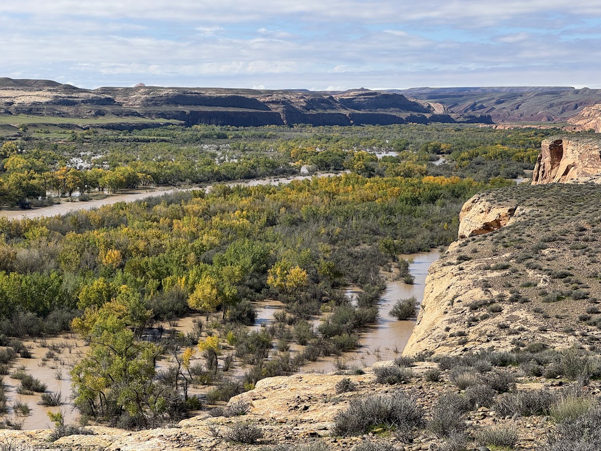
San Juan River Utilizing Its Floodplain Near Bluff Utah
Courtesy & Copyright Eric Newell, Photographer
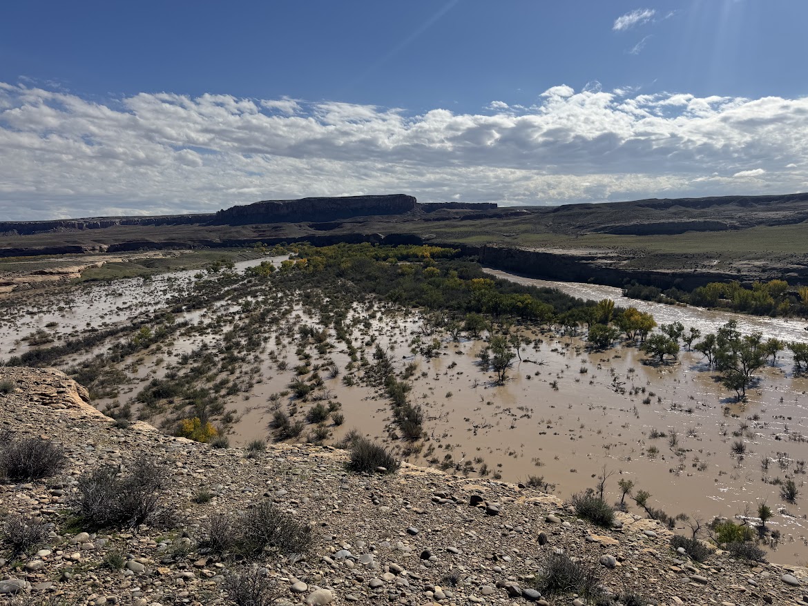
San Juan River Utilizing Its Floodplain Near Bluff Utah
Courtesy & Copyright Eric Newell, Photographer
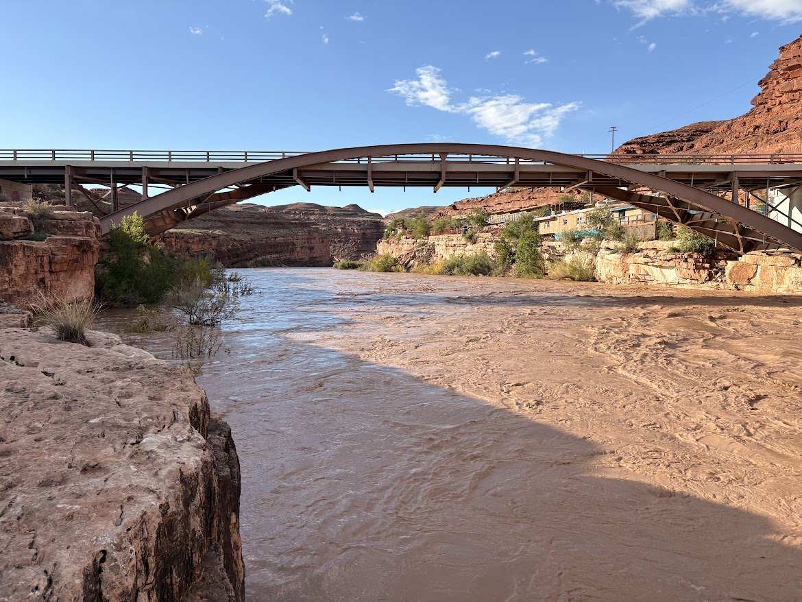
The water smells pungently of dirt and is so heavy-laden with silt that it looks more like rusty sludge than water. Deposits of fine sediment remain everywhere water has splashed, coating the raft, our feet, and our clothing with grime.

San Juan River Flood Plain Near Bluff Utah
Courtesy & Copyright Eric Newell, Photographer
San Juan River Flood Plain Near Bluff Utah
Courtesy & Copyright Eric Newell, Photographer
The swath of sky between the canyon walls is a steel-gray plate of mammatus clouds. It will be another wet evening in camp. I crane my neck and my eyes follow the edge of sky along the canyon rims. I am dwarfed by layers of limestone and shale that were laid down as sediment eons ago, then hardened to stone, then thrust upward by the unhurried, relentless forces of a continent in motion. All the while, the river cut through the uplift, eating away one grain of bedrock at a time, carving this canyon.

San Juan River In Mexican Hat At About 22000 CFS
Courtesy & Copyright Eric Newell, Photographer
San Juan River In Mexican Hat At About 22000 CFS
Courtesy & Copyright Eric Newell, Photographer
Beyond the clouds, I imagine billions of stars above—invisible in the daylight—and our vulnerable little planet traveling through the cosmos.

The pages of Lisa Kearsley’s San Juan River Guide, on the deck of my raft, have turned in the breeze. I could look up the geologic periods and names of the various layers—yet again. But right now, today, just being here, lost in the wonder and awe of this canyon, is enough. In the scope of geologic time, how did I get so lucky to be in this place, on this day, in this particular storm? This moment will be lost in the ages, but it is crystalized in time for me.

An ancestral Puebloan granary, concealed beneath an overhang, catches my attention. We drift past. No one else notices. A few bends later, a bighorn ram walks the edge of a ledge above the river. It pauses and turns its massive head to watch us drift along. People and creatures have inhabited this landscape for millennia. Each of us are just passing through.
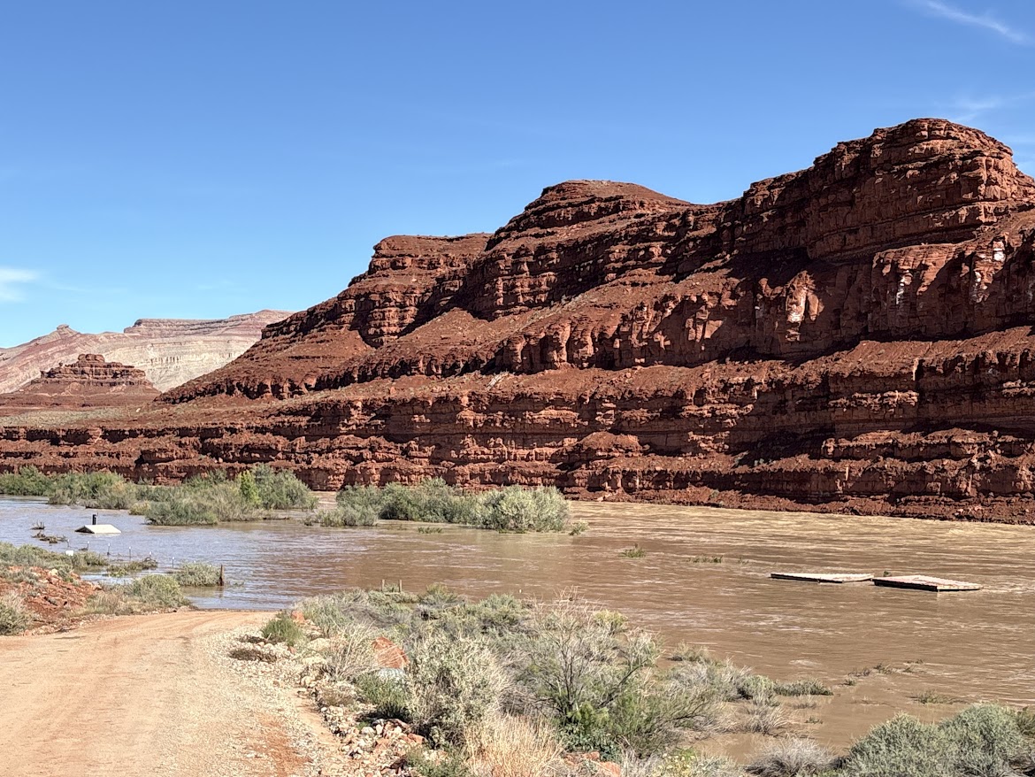
Mexican Hat Boat Ramp with the river running 41000 CFS
Courtesy & Copyright Anna Hart, Photographer
Mexican Hat Boat Ramp with the river running 41000 CFS
Courtesy & Copyright Anna Hart, Photographer
That was between Bluff and Mexican Hat, September 16, on about 4,000 cubic feet of water per second—or CFS.

A month later, on October 23, the San Juan Country Sheriff closed the river due to extreme high water. The river had breached several sewer treatment plants upstream and local agencies were overwhelmed mitigating flood damage. On October 26, the river peaked at about 41,000 CFS—flow levels not seen since the 1970’s. The river dropped to about 5,000 CFS for a few days, then peaked again at 34,000 CFS on November 3. Two separate fifty-year flood events occurred in an eight-day span, isolating and inundating communities in three states.

Above the river, on the outside bend of the canyon near mile sixteen, century-old cottonwood tree trunks, weathered to dark gray, rest one hundred and twenty feet above the river bottom. They were once adrift.

Analysis conducted by Lynn Orchard, under the direction of Bob Webb at the University of Arizona in 1999, indicate these logs were deposited by a flood in 1911. By radiocarbon dating debris from past floods in the canyon, they calculated the 1911 flood likely produced the largest flows in the lower San Juan canyons during the past 4,000 years, with maximum flows around 150,000 CFS.
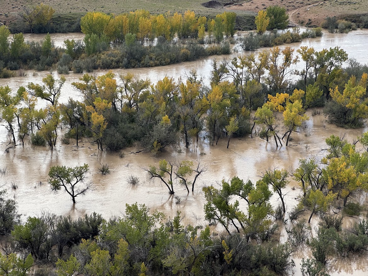
San Juan River Overflowing Its Banks
Courtesy & Copyright Eric Newell, Photographer
San Juan River Overflowing Its Banks
Courtesy & Copyright Eric Newell, Photographer
In an era of dams, diversions, and drought, watching the river overflow its banks and utilize its floodplain is a remarkable once-in-a-generation phenomenon. Every now and then the river rises up and reminds us that it has been here for eons, and will continue to run its course, carving its way through the canyons.

I am Eric Newell and I am wild about Utah and our wild rivers.

If you would like to contribute support for flood victims in and around Bluff, Utah, please consider https://bluffcommunityfoundation.org

Credits:

Images: Courtesy & Copyright Brandt & Anna Hart as well as Courtesy & Copyright Eric Newell
Featured Audio: Courtesy & Copyright © Friend Weller as well as J. Chase and K.W. Baldwin
Text: Eric Newell, Edith Bowen Lab School, Utah State University, https://edithbowen.usu.edu/
Voice: Eric Newell, Edith Bowen Lab School, Utah State University, https://edithbowen.usu.edu/

Additional Reading

A comprehensive look at the flooding, Explorer Vault, https://www.youtube.com/watch?v=JmxiGbdl0mQ

San Juan River Flows Near Bluff, Utah, USGS, https://waterdata.usgs.gov/monitoring-location/USGS-09379500/#dataTypeId=continuous-00065-0&period=P30D&showFieldMeasurements=true

The 1911 Four Corners Flood: Could it happen again? KUST, Four Corners Public Radio, https://www.ksut.org/history/2023-10-01/the-1911-four-corners-flood-could-it-happen-again

Orchard, Kenneth Lynn, Paleo Flood Hydrology of the San Juan River, The University of Arizona, https://repository.arizona.edu/items/b62d9d40-aede-4d19-9fc2-e837124bf4b6

How deep? Compare Sand Island Boat Launch images from Maps.Google.com with the 41000 CFS at Sand Island Boat Launch Gallery above, https://maps.app.goo.gl/xpzEHHa5k4Qtd7nr9

Climate Data Recording

USU Climate Measurement Instrument Courtesy & Copyright Mary Heers, Photographer
USU Climate Measurement Instrument
Courtesy & Copyright Mary Heers, Photographer
Last week while walking across the Utah State University campus, I rounded the Northeast corner of the University Inn and suddenly found myself face to face with a giant stick figure made of steel tubing. Painted a gleaming white, it looked like an elegant butler standing stiffly at attention. Planted firming on three sturdy legs, its rectangular body soared up 12 feet, and two of its outstretched arms seemed to be holding a bowl in one hand and a ball in the other.

Then I noticed the interactive display pedestal nearby. I discovered my “butler” was actually holding a rain gauge and an air temperature sensor. In fact, there were almost 30 sensors attached to the frame. Tapping on each picture of the sensor, I could see the exact measurement it was making at the moment. More tapping and I could look back as far as 500 days ago.

This magnificent machine was recording data so smoothly that I had to laugh when I remembered how in the early days of climate monitoring it wasn’t so easy.

In the 1980’s, after moving to Cache Valley, I was getting used to the cold temperatures and wondering how cold could it get. The engineers at Campbell Scientific, including my husband Art, had just developed a new temperature and wind sensor that could record its measurements into a box. The box would then send a radio signal to a relay station on top of Mt Logan, and then on to the base computer in Logan. They installed the sensor at Peter Sinks, near the summit overlooking Bear Lake. Then they sat down in front of the base computer to wait. They watched the temp drop, -55, -65. Then a tiny gust of air would blow by and the temperature would rise. Finally, they went to bed. But the datalogger kept working. In the morning, they looked at the data sheet – and there it was in black and white: -69.3 degrees Fahrenheit! In the early morning Feb 1, 1985, a record was set for the coldest temp ever recorded in Utah that still stands today.

But my favorite memory from the early days is the farm kid who bought one of the first Campbell Scientific dataloggers, the CR10. Art and I were on a road trip when he realized we were close by. We rang the doorbell. His mother told us to go upstairs. There was the young kid sitting on his bed. The CR10 was on the floor. He showed us how the datalogger was recording the level of oxygen in the water in his nearby catfish pond. When the Oxygen level dropped to a dangerous low, the CR10 would turn on a giant eggbeater-like machine that would throw the pond water high into the air. When the water fell down, it carried Oxygen with it into the pond. The kid was all smiles. Gone were the days when he had to get up every night at 3 am, march through heavy mud, check his Oxygen sensor, and manually turn on the eggbeater.

The kid pointed to the CR10 on the floor.

“Piece of your brain in there?” he asked Art.

“Yes,” answered Art, “And a piece of my heart.”

This is Mary Heers and I’m Wild About Utah.

Credits:
Photos: Courtesy and Copyright Mary Heers,
Featured Audio: Courtesy & © Anderson, Howe and Wakeman
Text: Mary Heers, https://cca.usu.edu/files/awards/art-and-mary-heers-citation.pdf
Additional Reading: Lyle Bingham, https://bridgerlandaudubon.org/

Additional Reading

Wild About Utah, Mary Heers’ Wild About Utah Postings

Peter Sinks Temperature Monitoring, Utah Climate Center at Utah State University, https://climate.usu.edu/PeterSinks/

Tonks, Sara, Peter Sinks, UT, Was Over 50 Degrees Below Zero Wednesday Morning. Here’s Why That’s Both Unusual And Normal, Weather News, The Weather Channel, February 13, 2025, https://weather.com/news/weather/news/2025-02-13-temperature-sinks-cold-explained-geography

Campbell Scientific, Inc., https://www.campbellsci.com/
Company History, https://www.campbellsci.com/history

Franchi, John, Man reflects on recording all-time Utah low temperature in 1985, Fox 13 News, Scripps Media, Inc., February 03, 2023, https://www.fox13now.com/news/local-news/man-reflects-on-recording-all-time-utah-low-temperature-in-1985

Davis, Jim, Where is the COOLEST Spot in Utah?, Survey Notes, v. 45 no. 3, September 2013, Utah Geological Service, Utah Department of Natural Resources, https://geology.utah.gov/map-pub/survey-notes/glad-you-asked/coolest-spot-in-utah/

Atmospheric Rivers

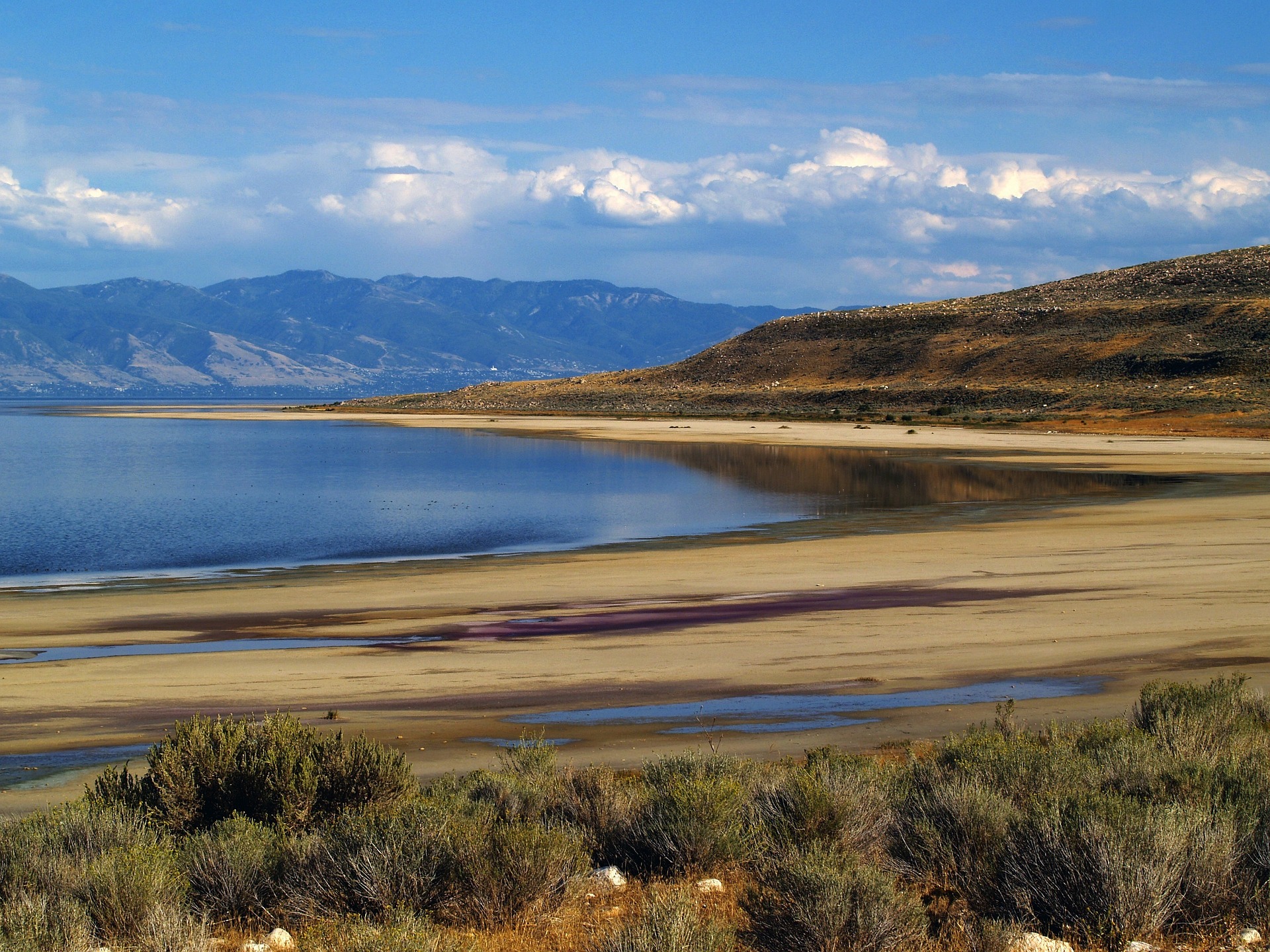
Atmospheric Rivers: The Great Salt Lake, Courtesy Pixabay, David Mark, Contributor
The Great Salt Lake
Courtesy Pixabay, David Mark, Contributor
I love rivers, especially atmospheric rivers, thanks Hawaii! Poor California. Will it ever end! As atmospheric rivers continue to destroy California, our mountains get the leftovers, which I’ve enjoyed immensely as an avid Nordic skier.

Having attended the USU Spring Runoff Conference, and the Northern Utah Water conference last week, driving streets which have become snow tunnels, an epic year of snowfall is all too apparent, possibly eclipsing the ‘011 epic year.

The Great Salt Lake welcomes every drop, while our cities brace for potential floods, a repeat of ’83 when Salt Lake City’s State Street became a favorite kayak route and trout fishery! Soil moisture is being replenished which is far more favorable to aquafer recharge and agriculture. Some reservoirs are even releasing water to prevent catastrophic overflow. We find ourselves filling sandbags anticipating the worst.

Atmospheric rivers, “giant conveyor belts of water in the sky”, cause the moisture-rich “Pineapple Express” storm systems that come from the Pacific Ocean, especially Hawaii, several times annually and are more common in the winter. From October 2018 to spring 2019, there were 47 atmospheric rivers, 12 of which were rated strong or extreme, in Washington, Oregon and California. In some parts of the world, changes in atmospheric humidity and heat caused by climate change are expected to increase the intensity and frequency of extreme weather and flood events caused by atmospheric rivers. This is expected to be especially prominent in the Western United States and Canada.

Atmospheric rivers have a central role in the global water cycle. On any given day, atmospheric rivers account for over 90% of the north-south water vapor transport. They are a major factor in extreme precipitation events that cause severe flooding in many mid-latitude, westerly coastal regions of the world. Equally, the absence of atmospheric rivers has been linked to the occurrence of droughts in several parts of the world.

Our Great Salt Lake has risen about 1 1/2 feet since it’s 2022 historic low. The LDS church is donating 20 thousand acre feet, about 0.3 % of what’s needed. They are hoping others will follow suite. Another 7 million acre feet of water is needed to create the once thriving salt lake ecosystem according to The Great Salt Lake Strike Team, a combination of two Utah research universities and three Utah agencies. They suggest water donations are one of the more cost-effective and efficient solutions for getting water back into the lake. Donations could help reduce this significant deficit, since human consumption accounts for about two-thirds of the lake’s decline.

Here in Cache Valley, our high school students will be competing with each other in “Saving the Great Salt Lake” to see which school can most effectively engage their schools and communities in reducing water consumption. Cash prizes will be awarded to all participating schools, along with a tree to plant on their school grounds or another public space. Contact jackisblue49@yahoo.com for further information.

This is Jack Greene for Bridgerland Audubon, and you guessed it-I’m wild about Utah and it’s Great Salty Lake!

Credits:
Ponderosa Pine Pictures: Courtesy Pixabay, David Mark, Contributor https://www.pixabay.com/
Audio: Courtesy & © Friend Weller, https://npr.org/ and Kevin Colver, https://wildstore.wildsanctuary.com/collections/special-collections
Text: Jack Greene, Bridgerland Audubon, https://bridgerlandaudubon.org/
Additional Reading: Lyle W Bingham, Webmaster, and Jack Greene, Author, Bridgerland Audubon, https://bridgerlandaudubon.org/

Additional Reading:

Jack Greene’s Postings on Wild About Utah, https://wildaboututah.org/author/jack/

Greene, Jack, The Great Salt Lake, Wild About Utah, April 11, 2016, https://wildaboututah.org/great-salt-lake/

Greene, Jack. 2020. I Love Snow. Wild About Utah, https://wildaboututah.org/i-love-snow/

Larese-Casanova, Mark. 2014. Utah’s Rich Skiing History. Wild About Utah, https://wildaboututah.org/utahs-rich-skiing-history/

Liberatore, Andrea. 2011. Snowflakes. Wild About Utah, https://wildaboututah.org/snowflakes/

Strand, Holly. 2009. A Utah Skier’s Snow Lexicon. Wild About Utah, https://wildaboututah.org/a-utah-skiers-snow-lexicon/

Wind and Sagebrush

Wind and Sagebrush

Wind and Sagebrush: Mountain big sagebrush (Artemisia tridentata subsp. Vaseyana) in flower - Photo Courtesy and Copyright Dr. Leila Shultz
Mountain big sagebrush (Artemisia tridentata subsp. Vaseyana) in flower – Photo Courtesy and Copyright Dr. Leila Shultz

Wind and Sagebrush:Three-tip sage (Artemisia tripartite) with visible yellow flowers. - Photo Courtesy and Copyright Dr. Leila ShultzThree-tip sage (Artemisia tripartite) with visible yellow flowers. – Photo Courtesy and Copyright Dr. Leila Shultz

Hi, I’m Holly Strand of the Quinney College of Natural Resources at Utah State University.

By late summer, most of Utah’s flowering plants have fizzled out for the year—those that remain are looking pretty spent. But not true for the sagebrush. It’s show time for over 20 types of sagebrush of the Intermountain West.

Like grasses and conifers, sagebrush plants are pollinated by the wind. They have no need for the specialized traits designed to attract live pollinators. Instead, they have evolved other strategies to survive and multiply.

For instance, wind-pollinated plants don’t need showy, colorful petals to attract insects or birds. The wind is going to do its job anyway regardless of visual cues. Thus sagebrush flowers are very small and nondescript. In fact, when passing by flowering sagebrush you might not even notice that it’s in bloom. Look for long spikes with clusters of tiny flower heads. The pale yellow flowers are concealed by petal-like bracts, which are the very same color as the rest of the plant.

While the flowers of sagebrush lack in beauty, they make up in quantity. A single flowering stem of the most common sagebrush—known simply as big sagebrush–can hold hundreds of flower heads that produce a massive amount of pollen. Most wind-blown pollen grains won’t end up anywhere near the female part of another plant. So to make up for this risky method of fertilization, individual plants must produce greater volumes of pollen. In contrast, plants with live pollinators get door to door service during fertilization. Far less pollen is needed to get the same job done.

Scent is another way for plants to attract live pollinators. Species pollinated by bees and flies have sweet scents, whereas those pollinated by beetles have strong musty, spicy, or fruity odors. However, the iconic western scent of the sagebrush has absolutely nothing to do with pollination. Instead, the pungent aroma of the sagebrush is a by-product of certain chemicals produced in the leaves. These chemicals evolved to repel animals and to reduce the odds of being eaten or grazed.

The chemicals—bitter terpenes, camphors and other secondary compounds–—peak in early spring. But as the late-summer flowering period approaches, the chemicals start to break down. By winter, browsers like deer and elk can nibble on the protein-rich seed heads without getting a nasty aftertaste.

Thanks to botanist Leila Shultz for sharing her knowledge of sagebrush. For a link to the online version of Leila’s book Pocket Guide to Sagebrush, go to www.wildaboututah.org
If you’d like a hard copy of this Pocket Guide, send an email to wildaboututah@gmail.com We have 5 copies to give away to listeners from across the state.

For Wild About Utah and the Quinney College of Natural Resources, I’m Holly Strand.

NOTE: The copies are gone. You can view the book as a .pdf here or check here for the next printing from https://www.sagestep.org/pubs/brushguide.html.

Credits:

Photo Courtesy & Copyright 2007 Dr. Leila Shultz
Text: Holly Strand, Quinney College of Natural Resources at Utah State University

Additional Reading:

Dudareva, Natalia. 2005. Why do flowers have scents? Scientific American April 18. https://www.scientificamerican.com/article/why-do-flowers-have-scent/

Shultz, Leila. 2012. Pocket Guide to Sagebrush. PRBO Conservation Science. https://digitalcommons.usu.edu/sagestep_reports/20/
As pdf: https://rdjzr2agvvkijm6n3b66365n-wpengine.netdna-ssl.com/wp-content/uploads/2018/06/sagebrush_pock_guide_reduced.pdf

Shultz, L. M. 2006. The Genus Artemisia (Asteraceae: Anthemideae). In The Flora of North America north of Mexico, vol. 19: Asterales, pp. 503–534. Flora of North America Editorial Committee, eds. Oxford University Press. New York and Oxford.

USDA, NRCS. 2012. The PLANTS Database, National Plant Data Team, United States Department of Agriculture (USDA), Natural Resource Conservation Service (NRCS): https://www.plants.usda.gov

VanBuren, R., J. C. Cooper, L. M. Shultz and K. T. Harper. 2011. Woody Plants of Utah. Utah State University Press & Univ. Colorado. 513 pp. https://upcolorado.com/utah-state-university-press/woody-plants-of-utah