Bear Lake Limestone

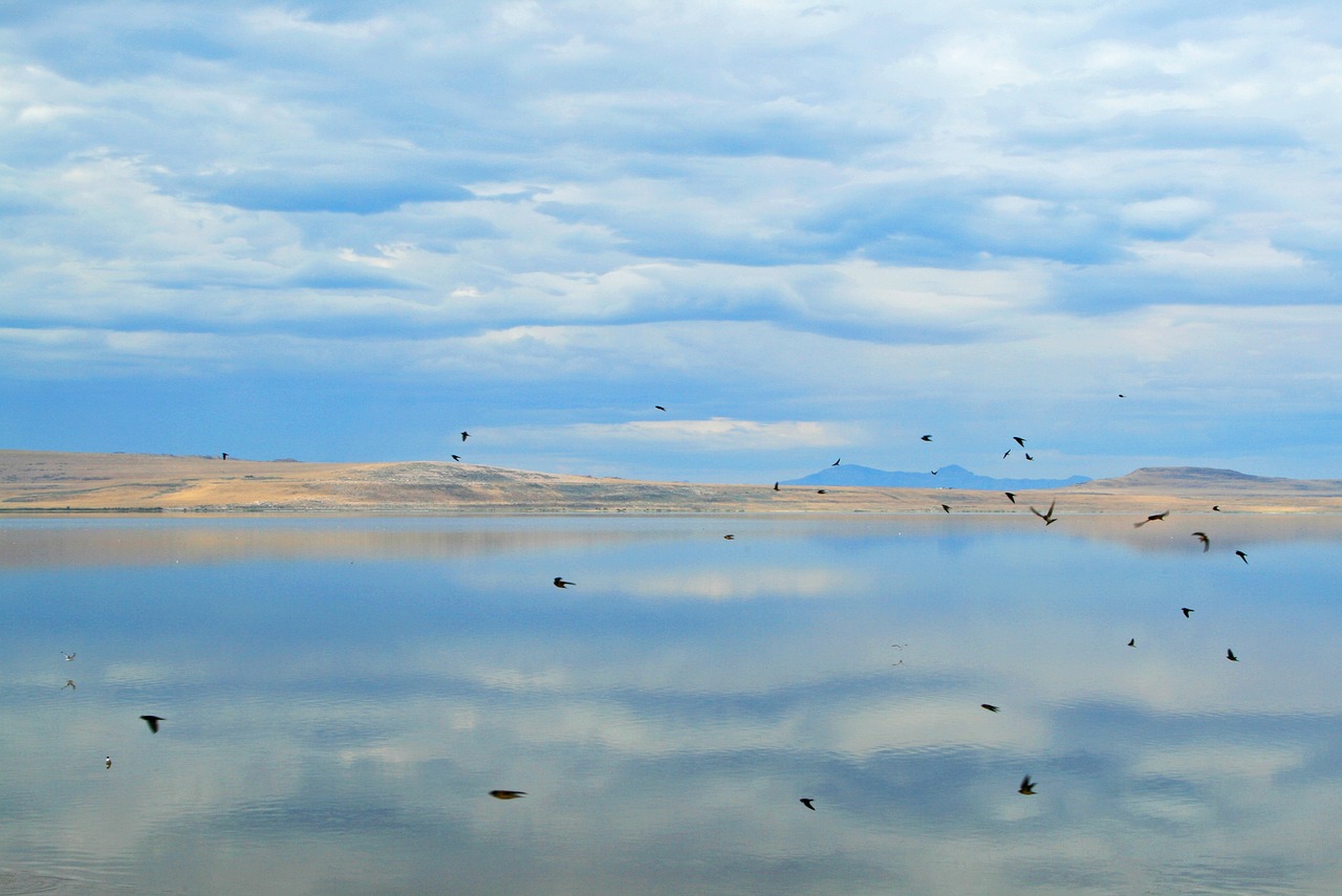
Bear Lake Limestone: Pale Blue Bear Lake from the Shore, Courtesy & Copyright Mary Heers, Photographer
Pale Blue Bear Lake from the Shore
Courtesy & Copyright Mary Heers, Photographer

Blue Sky Reflected on the Water of Bear Lake, Courtesy & Copyright Mary Heers, Photographer Blue Sky Reflected on the Water of Bear Lake
Courtesy & Copyright Mary Heers, Photographer

Stalagmites in Minnetonka Cave, St Charles Canyon, West of Bear Lake, Courtesy & Copyright Mary Heers, Photographer Stalagmites in Minnetonka Cave, St Charles Canyon, West of Bear Lake
Courtesy & Copyright Mary Heers, Photographer

Soda Straw Stalactites in Minnetonka Cave, St Charles Canyon, West of Bear Lake, Courtesy & Copyright Mary Heers, Photographer Soda Straw Stalactites in Minnetonka Cave, St Charles Canyon, West of Bear Lake
Courtesy & Copyright Mary Heers, Photographer

Small Ribbon  Stalactites in Minnetonka Cave, St Charles Canyon, West of Bear Lake, Courtesy & Copyright Mary Heers, Photographer Small Ribbon Stalactites in Minnetonka Cave, St Charles Canyon, West of Bear Lake
Courtesy & Copyright Mary Heers, Photographer

Stalagmite in Minnetonka Cave, St Charles Canyon, West of Bear Lake, Courtesy & Copyright Mary Heers, Photographer Stalagmite in Minnetonka Cave, St Charles Canyon, West of Bear Lake
Courtesy & Copyright Mary Heers, Photographer

If you stop at the overlook above Bear Lake on a sunny summer day, you may be as surprised as I was to find out that the gray limestone rocks in Logan Canyon are responsible for the brilliant blue color of the lake. Among the wealth of information displayed at the overlook is the fact that as rainwater and melting snow seeps down through the limestone, it picks up tiny bits of calcium. This calcium in the lake water acts as “millions of microscopic mirrors” that reflect the exact color of the blue sky.

Once I started thinking about water seeping through this limestone, I signed up to take a tour of the Minnetonka Caves located above St Charles towards the northern side of the lake. Millions of years ago, water began to seep into small fissures in the rock, widening into larger cracks and puddling into low spots. When the water table dropped, the water drained away, leaving large crevices and 9 open rooms behind.

The cave was discovered in 1906 by Edward Arnell, who was out hunting and shot a grouse that fell just over a nearby ledge. He scrambled down to retrieve the bird, and then he felt it: cold air. Pushing aside some rocks he found the hole in the hillside – just large enough for a man to crawl through.

He found a bear skeleton near the entrance, but no sign that humans had ever been inside the cave before.

In 1939 the WPA went to work enlarging the entrance. They chiseled 444 steps into the rock and paved a rough path between the rooms.

Today the cave is managed by the Montpelier Ranger Station, who lead tours into the cave in the summer months. When my turn came, I slipped on my hoodie, grabbed the ice cold railing, and started down the slippery steps with my group. A generator was keeping the path dimly lit while spotlighting some of the drip formations. I was expecting stalactites and stalagmites, but I was delighted to also see sheets of dripping water frozen in time and looking very much like drapes. Hollow tubes called “soda straws” hung from the ceiling.

About half a mile into the cave our guide stopped us and turned us around. The rest of the cave, he said, was reserved for the five species of bats that spend the winter here. The cave stays at a cool 40 degrees year round – a perfect temperature for hibernating bats who will lower their temperature to near freezing, slow their heartbeat from 200 to 10 beats a minute, and only take a breath every few minutes.

I guess I’ve always envied hibernating mammals like bats and bears who go to sleep fat, doze through the winter, and wake up thin in the spring.

Before we started back up the 444 steps, our guide had one more lesson for us. He turned off the lights to allow us to experience a few moments of utter darkness.

Just as the lights came back on, a drip of cold water fell from the cave ceiling and landed on me. I felt like I’d been kissed.

This is Mary Heers and I’m Wild About Utah.

Credits:

Photos:
Featured Audio: Courtesy & Copyright Patrick Kelly, Bird Sounds Courtesy & Copyright Kevin Colver and Water at end Courtesy FreeSound.org, Sclolex, contributor
Text: Mary Heers, https://cca.usu.edu/files/awards/art-and-mary-heers-citation.pdf
Additional Reading: Lyle Bingham, https://bridgerlandaudubon.org/

Additional Reading

Wild About Utah, Mary Heers’ Postings

Boling, Josh, Karst Topography, Wild About Utah, November 23, 2o2o, https://wildaboututah.org/karst-topography/

“It is a karst limestone cave, formed from ground water flowing through limestone and carving sink-holes and underground waterways.”
Minnetonka Cave, USDA Forest Service, US Department of the Interior, https://www.fs.usda.gov/recarea/ctnf/recarea/?recid=70736

Minnetonka Cave Brochure, USDA Forest Service, US Department of the Interior, 23.308.415.04/04, https://www.fs.usda.gov/Internet/FSE_DOCUMENTS/fsbdev3_015684.pdf

History of Minnetonka Cave, The Herald Journal, August 6, 2020, https://www.hjnews.com/bear_laker/history-of-minnetonka-cave/article_950c5030-d82d-11ea-9bf1-47556f110eed.html

Davis, Jim and Milligan, Mark, Why is Bear Lake so Blue? and other commonly asked questions, Public Information Series 96, Utah Geological Survey, Department of Natural Resources, 2011, https://ugspub.nr.utah.gov/publications/public_information/pi-96.pdf

Shorebirds

Shorebirds: Western Sandpiper (Calidris mauri), Shorebirds at Utah Lake, June 2, 2023, Courtesy & Copyright Utah Division of Wildlife Resources, Utah Department of Natural Resources, State of Utah
Western Sandpiper Calidris mauri
Shorebirds at Utah Lake, June 2, 2023
Courtesy & Copyright Utah Division of Wildlife Resources, Utah Department of Natural Resources, State of Utah
Shorebirds in August? I’d been told there was a robust migration during that time, but hadn’t tested the validity of such until a week ago. Three other young ladies joined me to do a count at the Salt Creek Wildlife Management Area near Tremonton Utah. And boy did I need their younger eyes and energy as we were inundated with shorebirds- avocets, stilts, curlews, greater and lesser yellowlegs, dowitchers, marbled godwit, western sandpipers, killdeer, and a flock of small peepes (short for small sandpipers).

Myriad other magnificent migrants joined the mixed flock- numerous duck species, juvenile black crown night herons by the dozens, herons, egrets, ibis, terns, etc., but they don’t qualify as shorebirds, so we enjoyed their presence, but they didn’t make the list.

A few other non-migrants were noteworthy- a burrowing owl that posed beautifully on a fence post emitting constant chatters, and a very fat, mature western rattler with many buttons on its tail./ The Salt Creek WMA is a jewel that gets few visitors given its “out there” location competing with the 80 thousand acre Bear River Migratory Bird Refuge next door, which boasts an outstanding visitor center, offering many resources and educational programs.

This was the first official fall shorebird survey conducted in 30 years at roughly 200 sites across 11 western states. These surveys fill a critical three-decade data gap in our understanding of migratory shorebird populations and their distribution. The results will inform management and policy efforts to ensure there are resources to support birds and the places they need during their migratory journeys.

The survey was organized by the Sageland [Collaborative] organization, Utah Division of Wildlife Resources, and several others, conducted by volunteers and biologists via airplane, vehicles, ATVs, boats and on our feet. This survey will occur for the next three years, during the same week each spring and fall, to coincide with the peak shorebird migration across the region.

We’re part of the Great Salt Lake ecosystem, whose wetlands support nearly one-third of the global population of Wilson's phalaropes, more than half of American avocets, 37 percent of black-necked stilts, and 21 percent of the North American population of snowy plovers.

Shorebirds are a diverse group of birds including sandpipers, plovers, avocets, oystercatchers, and phalaropes. There are approximately 217 recognized species globally, 81 of which occur in the Americas for all or part of their lifecycle with 52 species breeding in North America, many of whom visit Utah.

Shorebird are the endurance marathoner winners, some migrating 20,000 miles a year. Their remarkable hemispheric travels coincide with peak abundant food. In their global pursuit of food and breeding grounds, home is nowhere, yet everywhere. As a result, shorebirds are difficult to track, monitor, and protect. /Shorebirds are among a few groups of birds showing the most dramatic declines. Their decline began in the 1800s, in part due to market hunting. As humans have continued to alter the landscape, shorebird populations have further decreased, with declines increasing rapidly in recent decades.

Jack Greene for Bridgerland Audubon Society, and I’m Wild About Utah’s wild Shorebirds!

Credits:
Image: Courtesy & Copyright Utah Division of Wildlife Resources, Used by permission, https://www.wildlife.utah.gov/news_photos/2023-06-02-shorebirds-at-utah-lake.jpg
Audio: Courtesy & © Patrick Kelly, https://logannature.org/
Text: Jack Greene, Bridgerland Audubon, https://bridgerlandaudubon.org/
Additional Reading: Lyle W Bingham, Webmaster, Bridgerland Audubon, https://bridgerlandaudubon.org/

Additional Reading:

Jack Greene’s Postings on Wild About Utah, https://wildaboututah.org/author/jack/

Van Tatenhove, Aimee, The Quiet Importance of Brine Flies, Wild About Utah, Nov 15, 2021, https://wildaboututah.org/the-quiet-importance-of-brine-flies/

The Sageland Collaborative, https://sagelandcollaborative.org/

Migratory Shorebird Survey, The Sageland Collaborative, https://sagelandcollaborative.org/shorebirds?rq=shorebird

Statewide shorebird surveys restarted after 30-year hiatus; over 84,000 shorebirds counted during spring survey, Utah Division of Wildlife Resources, June 2, 2023, https://wildlife.utah.gov/news/utah-wildlife-news/1679-statewide-shorebird-surveys-restarted-after-30-year-hiatus.html

Salt Creek Wildlife Management Area:
Salt Creek Waterfowl Management Area, Utah Outdoor Activities, https://utahoutdooractivities.com/saltcreek.html
Salt Creek WMA, UtahBirds, Utah County Birders, https://www.utahbirds.org/counties/boxelder/BirdingSites.htm#SaltCreekWMA
1999-2001 Great Salt Lake Waterbird Survey: (Salt Creek is #33 under Survey Areas) https://wildlife.utah.gov/waterbirdsurvey/
Salt Creek Habitat, GeoData Archive, Utah Geological Survey, Utah Division of Natural Resources, State of Utah, https://geodata.geology.utah.gov/pages/view.php?ref=7975&search=%21collection104&offset=0&order_by=date&sort=DESC&archive=0

Slow Down, Paddle Backwards! An Educators Reflection on Instructional Style

EBLS faculty during a learning retreat to the San Juan River. The rapids called “The Ledge” were located just upstream of this photo. Courtesy & © Joseph Kozlowski, Photographer
EBLS faculty during a learning retreat to the San Juan River. The rapids called “The Ledge” were located just upstream of this photo.
Courtesy & © Joseph Kozlowski, Photographer
On an Edith Bowen Laboratory School teacher professional development retreat last summer rafting the San Juan River, a specific experience made me question my instructional style. I was sitting in the front of what they call a Ducky – a tandem inflatable raft with the passenger in the front and the experienced rower in the rear – with a vibrant and tough 6th grader named Kylie captaining from the rear. Although Kylie was in the captain’s seat, she was not an experienced rower. In fact, she was just learning, and I, from the front, was trying to teach her a thing or two from my very limited knowledge of rowing.

As I sat in the Ducky giving instructions, I reflected on my own instructional style and wondered how I would teach something that I had never taught before? I found myself giving her little challenges like “Try to get the nose of the boat to run straight over that gurgling water boil!” I also found myself showering her with positive, and specific reinforcement such as “I loved the way you corrected the steering by giving a tiny left forward paddle!” However, it wasn’t until we prepared to head down a set of rock smashing rapids called The Ledge that I found the golden nugget of self-knowledge I had been looking for.

Dr. Eric Newell, our guide and true rowing expert on the trip, was leading a separate 16ft. inflatable raft ahead of us. He called us over and was preparing Kylie and I for the upcoming rapid. “Stay pretty close behind me and let me run the rapid first so you can see the line.” All was agreed upon and Dr. Newell expertly launched toward the rapid with Kylie close on his heels. When the rapid was nearly upon us, Dr. Newell shouted backwards from his boat, “Give us a little more space!” In response, I shouted two important phrases back to my own young captain “Slow down,” then without allowing her time to think or react, I yelled “Paddle backwards!”

And this is where I stop the story, for those two phrases ended up being the key to my learning. The first phrase “slow down” was an objective, a goal. It was a problem to be solved and a self-driven adventure to be had by Kylie. You see, Kylie could have made any number of right or wrong decisions in response to the phrase “Slow down!” She could have spun the boat and went upstream, she could have dragged her paddles, or she could have even jumped out of the boat and anchored. There is no knowing, and no absolute safety or certainty in what Kylie could have done in response to the phrase “Slow down!” The only certainty is that she would have had to think, trust herself, and make a decision. In contrast, the second phrase “Paddle backwards!” was a directive, an order. It was a command to be followed and a prescription to be obeyed. There was nothing for Kylie to critically think about in response to this order. She had but one option which was to take the paddle, thrust it into the water, and heave in a reverse direction.

Ultimately, it was the distinction between these two phrases “Slow down!” and “Paddle backwards!” that forced me to reflect on my own instructional style. Am I the type of teacher to challenge my students to think critically by offering open-ended environments that yes, can be risky, but ultimately unmeasurably powerful? Or, do I merely pose teacher-centered directives that precipitate little more critical thinking and decision making than a person on a raft, being told to ‘paddle backwards.’

This is Dr. Joseph Kozlowski, and I am Wild About Utah!
Credits:

Images: Courtesy & Copyright Joseph Kozlowski, Photographer, Used by Permission
Audio: Courtesy & © Friend Weller, https://upr.org/
Text:     Joseph Kozlowski, Edith Bowen Laboratory School, Utah State University https://edithbowen.usu.edu/
Additional Reading Links: Joseph Kozlowski & Lyle Bingham

Additional Reading:

Joseph (Joey) Kozlowski’s pieces on Wild About Utah: https://wildaboututah.org/author/joseph-kowlowski/

San Juan River, Utah Office of Tourism, https://www.visitutah.com/things-to-do/River-Rafting/San-Juan-River

Salty Connections

Salty Connections: Drying Beds Surrounding the Great Salt Lake, Fall 2016, Courtesy NASA Earth Resources Observation and Science (EROS) Center
Drying Beds Surrounding the Great Salt Lake
Fall 2016
Courtesy NASA Earth Resources Observation and Science (EROS) Center

The Great Salt Lake Courtesy Pixabay https://pixabay.com/photos/utah-great-salt-lake-water-95570/ The Great Salt Lake
Courtesy Pixabay
https://pixabay.com/photos/utah-great-salt-lake-water-95570/

Salt with a Wooden Spoon, Courtesy Pixabay Salt with a Wooden Spoon, Courtesy Pixabay

Sevier Lake, a Saline Lake in Central UtahSevier Lake
Courtesy & Copyright 2013
Holly Strand, Photographer

Kyle Bosshardt Explains the Origins of the Redmond Minerals Mine June 2018 Courtesy & © Lyle Bingham Kyle Bosshardt Explains the Origins of the Redmond Minerals Mine
June 2018
Courtesy & © Lyle Bingham

Kyle Bosshardt Explains Redmond Salt Mineral Composition to a Tour June 2013 Courtesy & © Lyle Bingham Kyle Bosshardt Explains Redmond Salt Mineral Composition to a Tour
June 2013
Courtesy & © Lyle Bingham

Here in Utah, early explorers and native peoples knew of saline deposits, springs and lakes long before the pioneers arrived in 1847. For example, more than 1300 years ago,
the Fremont traded salt, found near Redmond, Utah, to the cliff-dwelling Anasazi of Mesa Verde. Necessary for life, salt is found across the State of Utah, where it is harvested, mined, processed and traded worldwide for various applications.

In a geologic recycling story that crosses many epochs, different salt compounds are often mixed and then move in water or under pressure. Normal table salt, the mineral halite, is chemically described as sodium chloride. Often found together in different concentrations are the bitter salts of potassium and magnesium. All these salts leach from rocks and soil, then wash downstream to oceans and land-locked lakes, such as Sevier Lake and the Great Salt Lake. In many cases, an ancient inland sea or lake deposited a layer of salt followed by layers of clay, sediment or lava. Then geologic forces uplifted the layers to repeat the cycle and make the salt accessible.

Lehi Hintze, in Utah’s Spectacular Geology, wrote, “Rock salt has two characteristics that promote upward movement. First, it is soft and flows plastically like ice does in a glacier. Second, it is less dense than other rocks and tends to migrate upward through the denser surrounding rocks….”

When the pioneers moved to Utah, salt rendering became one of the first industries established for external trade. They boiled Great Salt Lake water over wood fires until only salt remained. However, this lake salt tasted bitter due to impurities in the water. Fortunately, it could be sold to mines in Montana where salt was used to refine silver. Today, salt from the Great Salt Lake continues to be harvested mostly for industrial purposes including metal extraction, water softening and road de-icing.

For early salt entrepreneurs, boiling proved expensive. In time, the sun was put to work and evaporation ponds were built on the shores of the lake. At first the ponds filled when the wind blew, sometimes resulting in wall collapses. These failures led to better walls and brine pumps to repeatedly fill the ponds. Anyone flying west from Salt Lake City has seen these multicolored drying beds. Harvested mountains of dried salt, seen at the Morton and Cargill sites when driving I-80 towards Nevada, are loaded on trucks and rail cars for nationwide distribution.

More recently developed, is the salt mine west of Redmond, Utah, near Salina. The Redmond salt deposit predates the Great Salt Lake, which came from the drying of Lake Bonneville. Redmond Minerals is mining the first 800 feet of a 5000-foot diapir, an extruded mound forced up from salt beds deposited by the Jurassic Sundance Sea. In digging more than 18 miles of tunnels, Redmond has identified several grades of salt. Their culinary salt is sold worldwide as Real Salt, but the majority of their production is for agriculture, animal health and de-icing.

Salt production in Utah is possible because of the geologic and historic past. Just as the Fremont gathered and traded salt anciently, modern methods of harvesting and mining allow companies to distribute products worldwide. As such, salt continues to contribute to Utah’s role as the Crossroads of the West.

This is Lyle Bingham and I’m Wild About Utah and its 15 years on Utah Public Radio.

Credits:
Photos: Great Salt Lake Photos Courtesy NASA Earth Resources Observation and Science (EROS) Center
Great Salt Lake and Salt with a Wooden Spoon, Photos Courtesy Pixabay
Redmond Photos Courtesy & Copyright Lyle Bingham, Photographer
Featured Audio: Courtesy & © Kevin Colver, https://wildstore.wildsanctuary.com/collections/special-collections
Text: Lyle Bingham, https://bridgerlandaudubon.org/
Additional Reading: Lyle Bingham, https://bridgerlandaudubon.org/

Additional Reading

Lyle Bingham’s Wild About Utah Postings

Strand, Holly, Utah is Worth its Salt, Wild About Utah, November 21, 2013, https://wildaboututah.org/utah-is-worth-its-salt/

The Great Salt Lake, Hassibe, W.R. & Keck, W.G., USGS, US Department of the Interior, https://pubs.usgs.gov/gip/70039229/report.pdf

Cabrero, Alex, Redmond salt mine supplies Utah’s roads and chef’s kitchens, KSL TV, December 18, 2022, https://www.ksl.com/article/50540322/redmond-salt-mine-supplies-utahs-roads-and-chefs-kitchens

The Mineral Industry of Utah, National Minerals Information Center, USGS, US Department of the Interior, https://www.usgs.gov/centers/national-minerals-information-center/mineral-industry-utah

Salt Providers in Utah:

Other Salt-related mineral extractors in Utah:

Above lists may not be complete. Please send recommendations to wildaboututah@gmail.com

The Great Salt Lake, Utah Division of Water Resources, Utah Department of Natural Resources, https://water.utah.gov/great-salt-lake/

Great Salt Lake Plans, Utah Division of Forestry, Fire & State Lands, Utah Department of Natural Resources, https://ffsl.utah.gov/state-lands/great-salt-lake/great-salt-lake-plans/

Clark, John L., History of Utah’s Salt Industry 1847-1970, August 1971, Thesis, BYU Dept of History, https://scholarsarchive.byu.edu/cgi/viewcontent.cgi?article=5602&context=etd

Coloring the Great Salt Lake, The Earth Observatory, EOS Project Science Office, NASA Goddard Space Flight Center, https://earthobservatory.nasa.gov/images/147355/coloring-the-great-salt-lake

Hintze, Lehi F, Utah’s Spectacular Geology and How It Came to Be, Department of Geology, Brigham Young University, 2005, https://archive.org/details/utahsspectacular0000hint/mode/2up

Follow-up:
Winslow, Ben, Compass Minerals to abandon lithium extraction on Great Salt Lake, Great Salt Lake Collaborative, Fox13, Scripps Media, Inc, https://www.fox13now.com/news/great-salt-lake-collaborative/compass-minerals-to-abandon-lithium-extraction-on-great-salt-lake