Dust in the Wind

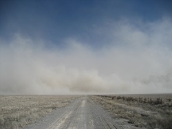
Dust Storm Milford Flats
4 March 2009
US Geological Survey photo by Mark Miller


Hi, I’m Holly Strand of the Quinney College of Natural Resources at Utah State University.

American paleontologist Roy Chapman Andrews was a frequent visitor to the Gobi Desert. This is how he described being caught in a Gobi desert dust storm: “Seemingly a raging devil stood beside my head with buckets of sand, ready to dash them into my face…” “…after each raging attack it would draw off for a few moments’ rest. Then suddenly the storm devil was on us again, clawing, striking, ripping, seeming to roar in fury that any of the tents still stood.”

Andrews didn’t have to go so far to feel the rage of a dust storm. He could have come to western Utah. While we don’t have the monstrous storms of the Sahara and the Gobi/Manchurian deserts, the eastern Great Basin–which is essentially western Utah–sits secure on any global list of dust storm hotspots.

Let’s consider why this is so…

First and foremost, western Utah has the dust. In scientific terms, dust is any particle—organic or inorganic—that is less than .63 microns or smaller in diameter. .63 microns is about half the width of a single human hair. In geological terms think silt or clay particles. A grain of sand is much larger. If you are the size of a dust particle, then a relatively small puff of wind will release you into the air. And you’ll stay there until it’s completely calm or rain forces you down.

A great place to find geologic dust is in desert playas. For runoff sediments collect in these dry lake depressions. Western Utah has several of these desert dust bins. And satellite data have confirmed that playas such as Sevier Dry Lake, Tule Dry Lake, and Great Salt Lake Desert are major sources of dust plumes. The alluvial fans of the Great Basin mountains provide an additional source of dust.

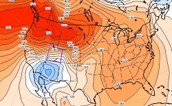
To get this dust airborne you need wind which is also plentiful in western Utah. This region typically experiences strong south and southerwesterly winds called “hatu winds.” That’s Utah spelled backwards. The name was coined by colorful Utah meteorologist Mark Eubank. These hatu winds blow south to north or to the northwest. They pick up speed and dust as they race along the north-south trending Great Basin ridges. They can reach speeds of over 90 miles per hour.

Utah’s hatu winds peak in the spring months with a secondary peak in August-September. In spring these windy freight trains full of dust can hit the populated Wasatch Front wreaking havoc with air quality and human health.

Sometimes raindrops capture dust in the airstream and splat them onto our windshields and windows. These mud rains are most common in spring when the hatus are at their peak. And this is why saavy Utahns never bother washing their home windows until June.

While dust storms can be considered natural events, the fact that they are increasing in number and severity is definitely unnatural. The increase is caused by human-related activities that remove vegetation or break the biological soil crusts that help stabilize dust and soil. Overgrazing, water withdrawals, military operations, farming on marginal lands, off-road vehicle riding, fires, even restoration activities all release dust to be carried off by the next significant wind.

Thanks to Atmospheric Scientist Maura Hahnenberger for her help with this Wild About Utah story.

For Wild About Utah, and the Quinney College of Natural Resources, I’m Holly Strand.

Credits:

Images: Courtesy USGS.gov and NRCS.gov
Sound: Wind sound effect from Sound Bible.com Recorded by Mark DiAngelo https://soundbible.com/1810-Wind.html
Text: Holly Strand

Sources & Additional Reading

Hahnenberger, M. and K. Nicoll. Geomorphic and land use characteristics of dust sources in the eastern Great Basin of Utah, U.S.A. Accepted Geomorphology.

Hahnenberger, M. and K. Nicoll, 2012. Meteorological characteristics of dust storm events in the eastern Great Basin of Utah, U.S.A. Atmospheric Environment, 60, 601-612.

Jason P Field, Jayne Belnap, David D Breshears, Jason C Neff, Gregory S Okin, Jeffrey J Whicker, Thomas H Painter, Sujith Ravi, Marith C Reheis, and Richard L Reynolds The ecology of dust Front Ecol Environ 2010; 8(8): 423–430, doi:10.1890/090050 (published online 12 Oct 2009)https://www.esajournals.org/doi/pdf/10.1890/090050

Neff, J. C., A. P. Ballantyne, G. L. Farmer, N. M. Mahowald, J. L. Conroy, C. C. Landry, J. T. Overpeck, T. H. Painter, C. R. Lawrence, and R. L. Reynolds, 2008: Increasing eolian dust deposition in the western United States linked to human activity. Nature, 1, 189-195

Warner, Thomas T. 2004. Desert Meteorology. NY: Cambridge University Press

Washington, R., M. Todd, N. J. Middleton and A. S. Goudie, 2003. Dust-storm source areas determined by the Total Ozone Mapping Spectrometer and Surface Observations, Annals of the Association of American Geographers, 93(2), 297-313.

Miller, M. E., et al. (2012). “Post-fire land treatments and wind erosion – Lessons from the Milford Flat Fire, UT, USA.” Aeolian Research 7: 29-44.

Steenburgh, W. J., et al. (2012). “Episodic Dust Events of Utah’s Wasatch Front and Adjoining Region.” Journal of Applied Meteorology and Climatology 51(9): 1654-1669.
Cloud classification

Cloud classification: Wispy high-flying cirrus clouds made of ice crystals. Courtesy & © Jim Cane, Photographer
Wispy high-flying cirrus clouds
made of ice crystals.

Courtesy & © Jim Cane, Photographer
 
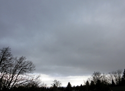
Cloud classification: A dark monotonous low deck of stratus clouds. Courtesy and Copyright Jim Cane, PhotographerA dark monotonous low deck
of stratus clouds.
Courtesy & © Jim Cane, Photographer
 
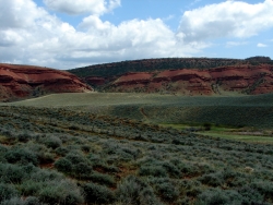
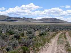
Cloud classification: Fair-weather cumulus clouds with flat bottoms and puffy tops.Fair-weather cumulus clouds
with flat bottoms and puffy tops.
Courtesy & © Jim Cane, Photographer
 
Fair-weather cumulus clouds with flat bottoms and puffy tops.Fair-weather cumulus clouds
with flat bottoms and puffy tops.
Courtesy & © Jim Cane, Photographer

 
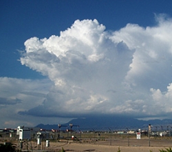
A dense cloud that grows upward, looks like a cauliflower, anvil, or tower, and usually has lightning, thunder, and rain.Cumulonimbus
A dense cloud that grows upward, looks like a cauliflower, anvil, or tower, and usually has lightning, thunder, and rain.
Courtesy NOAA


Who has not indulged in the idle pastime of watching puffy white clouds pass overhead, naming their shapes as they form? Of course, such whimsical names do not serve comparative description and understanding. For this, a lexicon of clouds is needed. Our formal cloud classification system traces back to 1803, when an Englishman, Luke Howard, published “An essay on the modifications of clouds”. Luke Howard owned a profitable pharmaceutical company, which funded his gentlemanly meteorological pursuits. Mr. Howard wisely chose a Latin cloud vocabulary to name and illustrate three fundamental cloud types.

The highest flying clouds he named cirrus, meaning curl or tuft, as of hair. These wispy clouds often resemble fibers; one form is the aptly named horse-tail cirrus. Composed of ice crystals, cirrus clouds form at around 30,000 feet, about the cruising altitude of passenger jets. Wispy cirrus clouds often portend a stormy Pacific low-pressure system en route to Utah.

Howard dubbed a type of lower elevation cloud cumulus, meaning mass or heap. These grow from mere puffs to big flat-bottomed clouds with white cauliflower tops. For sheer meteorological beauty, nothing beats legions of fair weather cumulus scudding across a bluebird sky atop a montane backdrop.

The lowest cloud form is stratus. Forming below 8000 feet, they appear as an extensive deck of unbroken gray. Stratus clouds often bring Utah’s winter snowstorms and spring rains. Nimbostratus are responsible for Seattle and Portland’s endless winter drizzle. In contrast, our Utah summer rains fall from towering cumulonimbus thunder heads. These ominous clouds are powered by hot summer updrafts and the steamy humidity that flows northward with the North American monsoon.

Luke Howard’s cloud-naming convention includes 10 principal types in all which easily lend themselves to naming combinations. You can now envision the height and appearance of cirrocumulus clouds, for instance. Cirrus, cumulus, stratus, nimbus, the cloud lexicon of amateur meteorologist Luke Howard has endured for over 200 years. Pictures of these cloud types with a link to the pages of Howard’s original published treatise can be found at our Wild About Utah website.

This is Linda Kervin for Bridgerland Audubon Society.

Credits:
Images: Courtesy NOAA and
             Courtesy & Copyright Jim Cane
Text: Jim Cane

Additional Reading:

Luke Howard. 1803. “Essay on the modifications of clouds by “3rd ed. Published 1865 by John Churchill & Sons in London .
https://archive.org/details/essayonmodifica00howagoog and
https://books.google.com/books?id=7BbPAAAAMAAJ&printsec=frontcover#v=onepage&q&f=false

Riehl, Herbert. 1978. “Introduction to the Atmosphere.” McGraw-Hill, NY.
https://www.amazon.com/Introduction-Atmosphere-Herbert-Riehl/dp/0070526567

International Cloud Atlas, World Meteorological Organization,https://cloudatlas.wmo.int/home.html

Those Howling East Winds

Those Howling East Winds: Normal Diurnal Wind Shift Along the Wasatch Front, Courtesy Utah Division of Air Quality
Normal Diurnal Wind Shift
Along the Wasatch Front
Courtesy Utah Division of Air Quality

Those Howling East Winds: Air Pressure at the Surface, A Bit of a Blow..., Utah Climate Notes, January 2012, Courtesy Utah Climate Center, Utah State University Air Pressure at the Surface, 1 Dec 2011
Blue=Low Pressure, Red=High Pressure
The spacing of the lines is a measure of the pressure gradient: the closer the lines, the higher the pressure gradient. https://climate.usurf.usu.edu/news/010512Utah%20Climate%20Update%20(Jan%2012).pdf[Feb 6, 2014]
Read: A Bit of a Blow…
Courtesy Utah Climate Center, Utah State University

Wind is inevitable on a spinning planet with an atmosphere and a sun. At our latitude, westerlies prevail, but east winds do occur now and then. Locally, canyons daily exhale denser, cooler mountain air that drains into valleys. In Logan, trees blown by these canyon winds tilt westward. Occasionally, though, the whole Wasatch front is whipped by howling gales from the east, leaving behind shredded shingles, snapped tree limbs and rolled tractor-trailers. These forceful east wind events have a regional weather origin that is intensified by local topography.

It begins with a strong high-pressure cell parked over southwestern Wyoming.  It’s descending dry air circulates clockwise. Somewhere to the south or southwest, a low-pressure cell is needed.  The strong air pressure gradient between high and low generates a wind that races westward from Wyoming. The surging wind pours over the entire Wasatch front like water over a flat boulder in rapids.  These winds then plunge down slope, blowing quickest where the descent is long, steep, and unobstructed. The down rushing air slams onto the flat benches and valley floors.  In November 2011, such winds ripped Centerville with 100 MPH gusts.

Where these so-called mountain wave events blow regularly they often have names.  The mistral and foehn winds howl down from the Alps, chinooks  race down the Rocky Mountain Front Range, and the Santa Anas blast Southern California. The steep altitudinal descent of these parched winds compressively heats the air. A spark or flame soon transforms to a raging wildfire when fanned by a drying foehn or Santa Ana wind.  Europe’s foehns are also known to spark short tempers and stress.

Perhaps the sporadic easterly gales that lash the Wasatch Front and Cache Valley deserve an evocative name too.  For now, you at least know the answer to what’s blowin’ in the east wind.

Thanks to Martin Schroeder at the Utah Climate Center for insights and the stream boulder analogy

This is Linda Kervin for Bridgerland Audubon Society.

Credits:
Diurnal Utah Winds Image: Courtesy Utah Division of Air Quality
Surface Air Pressure 1 Dec 2011 Image: Courtesy Utah Climate Center, USU
Text: Jim Cane

Additional Reading:

Martin Price, Alton Byers, Donald Friend, Thomas Kohler, Larry W. Price. 2013. Mountain Geography: Physical and Human Dimensions. Univ of California Press. pages 71­74. https://www.amazon.com/Mountain-Geography-Physical-Human-Dimensions/dp/0520254317

Mesmerizing live wind map of US at:  https://hint.fm/wind/

Forecast of damaging east winds along the Wasatch Front, end of November 2011, https://www.ksl.com/?sid=18282965

How Chinooks Occur, Wikipedia, https://en.wikipedia.org/wiki/Chinook_wind#How_Chinooks_occur

Snowshoes

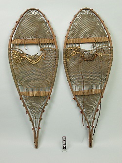
Maliseet Snowshoes, Photo Courtesy & Copyright Hudson Museum, University of Maine
Maliseet Snowshoe
Photo Courtesy & Copyright Hudson Museum, University of Maine

Imagine yourself living in Utah hundreds of years ago – before cars, before horses, before European influences. Summers provide you with abundant game and a multitude of plants for food and other materials, but the winters are harsh and full of snow. How did Native Americans manage to survive winter without modern amenities like snow plows and grocery stores? These hearty individuals owe their ability to hunt and travel in our snowy climate to one important tool – the snowshoe.

Snowshoes have been a part of life for humans in cold-weather climates for at least 6,000 years. From what historians can tell, people living in central Asia learned to strap thin planks of wood to their feet in order to help them travel through deep snow. Snowshoes work by increasing the surface area of the wearer’s foot, which distributes his or her weight across more snow – allowing them to basically float on top of the snow.

Western Subartic Antique Indian Snowshoes. circa 1890 – 1920., Photo Courtesy & Copyright VintageWinter.com
Western Subartic Antique
Indian Snowshoes. circa 1890 – 1920.
Photo Courtesy & Copyright VintageWinter.com

From this common ancestor in central Asia, both snowshoes and skis arose. Over the years, people began to spread out and move to new locations. Those who went west, into Europe, eventually developed the ski and those who went east across Siberia and into the Americas developed the snowshoe. The early snowshoes used by Native Americans were constructed of a wooden frame which was laced with babiche, un-tanned animal hide.

While we will likely never know why that first person decided to strap a plank of wood to their foot, perhaps they took their cue from Mother Nature. You see, humans are not the only ones who have figured out how to keep ourselves afloat on snow – some members of the animal world have too, and Utah holds two standout examples: the aptly named snowshoe hare and the Canada lynx. Both of these animals have extraordinarily large feet, which act much the same as our snowshoes, distributing the animal’s weight across a larger surface area.

Perhaps it’s no coincidence that both snowshoe hares and Canada lynx share this amazing adaptation. These two species are closely connected to each other in a special relationship: that of predator and prey. Leaving us to ponder the question: whose snowshoes came first, the lynx or the hare?

Eastern
Eastern Subartic Indian Snowshoes. circa 1855 – 1900
Photo Courtesy & Copyright VintageWinter.com

For more information and photos of traditional snowshoes, please visit our website at www.wildaboututah.org. Thank you to the Rocky Mountain Power Foundation for supporting the research and development of this Wild About Utah topic.

For the Stokes Nature Center and Wild About Utah, this is Andrea Liberatore.

Credits:

Photos: Courtesy Hudson Museum,
University of Maine
www.umaine.edu/hudsonmuseum/
Nick Thomas, SkiEO, VintageWinter www.vintagewinter.com
Text: Andrea Liberatore, Stokes Nature Center

Click to visit Vintage Snowshoe Slideshow, Courtesy & Copyright VintageWinter.com
Vintage Snowshoe Slideshow
Visit the Vintage Winter Sports Museum
Courtesy & Copyright VintageWinter.com

Additional Reading:

Prater, Gene. 1998. Snowshoeing, 3rd Edition. Seattle: The Mountaineers

Zeveloff, Samuel I. 1988. Mammals of the Intermountain West. Salt Lake City: University of Utah Press