Echoes of Lake Bonneville

Echoes of Lake Bonneville: North Spring, Fish Springs National Wildlife Refuge, Utah. Courtesy Utah Geological Survey
North Spring, Fish Springs National Wildlife Refuge, Utah. Courtesy Utah Geological Survey

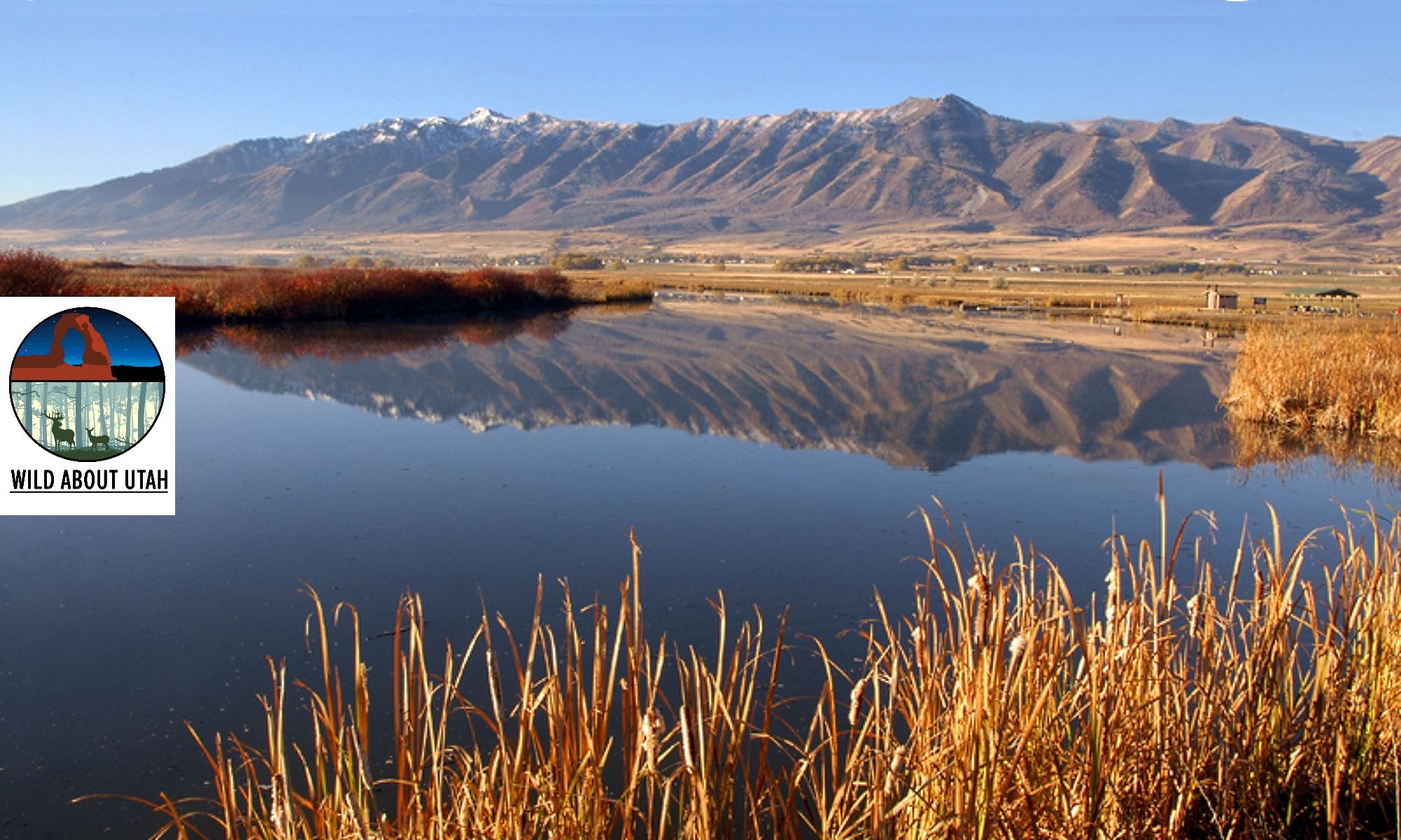
Leland Harris wetlands, Snake Valley, Utah, Courtesy Utah Geological SurveyLeland Harris wetlands
Snake Valley, Utah
Courtesy Utah Geological Survey
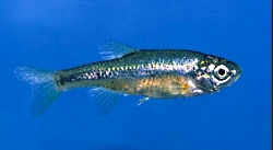
Least Chub, Courtesy and Copyright Mark C. Belk, PhotographerLeast Chub
Courtesy & © Mark C. Belk, Photographer
Echoes of Lake Bonneville

Hi, I’m Holly Strand of the Quinney College of Natural Resources at Utah State University.

Deserts are dry by definition receiving an average of less than 10 inches of precipitation a year. In Utah’s cold West Desert, this skimpy amount of moisture slakes the thirst of sagebrush, saltbush or greasewood, but not much else. However, just like the Sahara, the West Desert has its oases. In certain lowland valleys you’ll find complexes of pools and marshes. There isn’t enough rain to form these freshwater sanctuaries. The water comes from giant underground aquifers.

Underneath the West Desert, the aquifer system acts as a storehouse for runoff from the surrounding mountains. As rainwater or snow melt enters or “recharges” the aquifer system, water pressure can build up in some areas. This pressure moves water through cracks and tunnels within the aquifer, and sometimes this water flows out naturally in the form of springs.

These desert springs–and the resulting pools and marshes–permit concentrations of animals and plants not possible under normal desert conditions. You’ll find sedges, rushes cattails and many other wetland plants. Both migratory and year round birds congregate here. There are even a couple of frog species—the Colombian spotted frog and the northern leopard frog.

But most remarkable are the desert spring residents that have survived from the days when the West Desert formed the floor of giant Lake Bonneville. Surveys have revealed a number of relict snails and other mollusks that still persist from that time. Some, like the Black Canyon Pyrg exist at a single spring complex only; they are found nowhere else on earth.

Certain native fish were also left high and dry by Lake Bonneville’s recession. The least chub is a good example. Now the sole member of its genus, this 3-inch long survivor is an unassuming but attractive little minnow. It is olive-colored on top and sports a gold strip on its steel-blue sides. It swims in dense but orderly schools in either flowing or still water. It can withstand both temperature variations and high salinity. The ability to tolerate different physical conditions has undoubtedly helped the least chub survive the post-Lake Bonneville millennium. Even so, the least chub was hanging on in only six different locations until Utah’s Division of Wildlife Resources reintroduced it to several more sites within its historic range. The Division and its conservation partners are still working to reduce threats to the least chub, to other spring residents and to the spring habitats themselves.

For more information and pictures go to www.wildaboututah.org

Thanks to Chris Keleher of Utah’s Department of Natural Resources for his help in developing this Wild About Utah story.

For Wild About Utah, I’m Holly Strand.

Credits:

Theme: Courtesy & Copyright Don Anderson Leaping Lulu
Image: Least Chub, Mark C. Belk, Professor of Biology, Brigham Young University
Image: Wetlands, Courtesy Utah Geological Survey https://geology.utah.gov/
Text: Holly Strand, Quinney College of Natural Resources at Utah State University

Sources & Additional Reading

Bailey, Carmen L., Kristine W. Wilson Matthew E. Andersen. 2005. CONSERVATION AGREEMENT AND STRATEGY FOR LEAST CHUB (IOTICHTHYS PHLEGETHONTIS) IN THE STATE OF UTAH Publication Number 05-24 Utah Division of Wildlife Resources a division of Utah Department of Natural Resources https://wildlife.utah.gov/pdf/fish/least_chubs.pdf

Jones, Jennifer, Rich Emerson, and Toby Hooker. 2013. Characterizing Condition in At-risk
Wetlands of Western Utah: Phase I UTAH GEOLOGICAL SURVEY a division of Utah Department of Natural Resources,https://geodata.geology.utah.gov/pages/view.php?ref=8364

Nature Serve entry for Least Chub: https://explorer.natureserve.org/servlet/NatureServe?searchName=Iotichthys+phlegethontis

Hanks, Joseph H. and Mark C. Belk. 2004. Threatened fishes of the world: Iotichthys phlegethontis Cope, 1874 (Cyprinidae) in Environmental Biology of Fishes, Vol. 71. N. 4., Kluwer Academic Publishers. https://dx.doi.org/10.1007/s10641-004-1030-x

Sigler W. F. & J. W. Sigler. 1996. Fishes of Utah, A Natural History. University of Utah Press, Salt Lake City. 375 pp. https://www.amazon.com/Fishes-Utah-A-Natural-History/dp/0874804698

Wasatch Front Canyons Geologic Tour, Virtual Tour created from Published Booklet (pdf) Geologic Guide to the Central Wasatch Front Canyons, Utah Geological Survey, State of Utah, https://utahdnr.maps.arcgis.com/apps/MapTour/index.html?appid=5cf1570b998346d98478a5abd50bf096

Geologic guides to the central Wasatch Front Canyons, Utah Geological Survey, 2005, https://geology.utah.gov/popular/utah-landforms/virtual-tour-central-wasatch-front-canyons/ [updated January 2024]
Defining the Great Basin

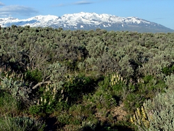
Willow Creek North of Wells, NV. Sagebrush at mid-distance. Route of the California Trail used by pioneers.
Willow Creek north of Wells, NV.
Sagebrush at mid-distance.
Route of the California Trail
used by pioneers.

Courtesy & Copyright
Jim Cane, Photographer

Lupines amid sagebrush north of Wells, NV. Ruby Mountains in backgroundLupines amid sagebrush
north of Wells, NV.
Ruby Mountains in background
Courtesy & Copyright
Jim Cane, Photographer

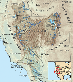
Map delineating the Great basinMap delineating the Great basin
Courtesy Wikimedia, KMusser, Artist
Ref: wikipedia.org/wiki/Great_Basin


The Great Basin is aptly named.  Twice the size of Kansas, it stretches from the watersheds of the Columbia and Snake rivers south to that of the Colorado, and from the crests of the Sierra Nevada and southern Cascades eastward to the Wasatch front.  The Western explorer John Fremont coined its name in 1845.  The rivers and streams of the region that Fremont had seen all ended in sinks, marshes or lakes. None flowed to the Pacific Ocean.  He confirmed this on meeting Joseph Walker at Mountain Meadows in Utah.  Walker had traveled more of the basin’s western margins, dispelling  rumors of a river traversing the Sierra Nevada.  Precipitation that falls in the Great Basin stays in the Great Basin; water leaves only as vapor.  This is the hydrographic Great Basin.

How else to view the vast region between the Rockies and the Sierra Nevada? Geologists speak of the “Basin and Range Province”, so named for its valleys and the towering ranks of north-south mountain ranges that march across the landscapes of Nevada and edges of adjacent states. Unlike the upthrust Rockies and Sierra Nevada, Earth’s crust in the Great Basin appears to be spreading, to be pulling apart. The tilted escarpments of the Wasatch front are the easternmost evidence of this crustal deformation that has built the Basin and Range Province.

Botanists delimit the Great Basin by the hardy flora that clothes this rugged landscape. Great Basin plants tolerate freezing winters and parched summers, and in the valleys, soils of varying salinity.  The so-called Sagebrush Ocean fills many of the basins, as do other shrubs, such as shadscale and greasewood.  Upslope, these give way to juniper woodlands, often mixed with piñon pine.  This floristic Great Basin reaches eastward to central Utah and the Wasatch front, beyond which trees and other plants of the Rockies make their appearance.

The boundaries of all three concepts for the Great Basin — hydrographic, geologic and floristic — largely coincide.  Each recognizes the distinctive attributes of the Great Basin that set it apart from neighboring regions.  The Great Basin is readily recognizable to the trained eye, whether looking at satellite images, river courses, or the native plant communities encountered on a simple walk.

Credits:
Images: Jim Cane
Map: Courtesy Wikimedia, KMusser, Artist, licensed under Creative Commons Attribution-Share Alike 3.0 Unported
Text: Jim Cane

Additional Reading

Frémont, John Charles. 1845. Report of the exploring expedition to the Rocky Mountains in the year 1842 and to Oregon and North California in the years 1843 – 44. Printed by order of the Senate of the United States , Gales & Seaton, 693 pages. –available as a Google eBook scanned from the original published book Grayson, Donald K. 1999. The desert’s past : a natural prehistory of the Great Basin. Smithsonian Institution Press, Washington D.C., 356 pages. –an exceptionally readable, thorough and authoritative overview of the Great Basin, with many maps, photographs and illustrations.https://books.google.com/books?id=W8ICAAAAMAAJ

Intermountain Regional Herbarium Network. searchable plant database representing multiple holdings of herbaria at universities in Utah and Nevada, with maps, images and more https://swbiodiversity.org/seinet/projects/index.php?proj=10

McPhee, John. 1981. Basin and Range. Farrar, Straus, Giroux, New York. 215 pages. –the first of the author’s many engaging books about geology. https://www.amazon.com/Basin-Range-John-McPhee/dp/0374516901

The Amazing Uintas

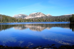
The Amazing Uintas: Mirror Lake in the Unitas, Courtesy Wyoming Department of Transportation, Talbot Hauffe, Photographer
Mirror Lake in the Unitas
Courtesy Wyoming Department
of Transportation
,
Talbot Hauffe, Photographer


The Amazing Uintas: Kings Peak, Courtesy Wikimedia, Hyrum K. Wright, PhotographerKings Peak
Courtesy Wikimedia
Hyrum K. Wright, Photographer
Licensed under GNU Free Documentation License,

Hi, I’m Holly Strand.

Coming from Colorado, I’m something of a mountain snob. So while I always found Utah’s mountains to be agreeable, I admit to thinking they were somewhat petite. Then I saw the Uintas. About 200 miles long and 30-40 miles wide, the Uintas lie south of the Wyoming border primarily in northeastern Utah but with its eastern flank extending into Colorado.

There are several interesting features that make these mountains stand out in my mind.

For one thing, the Uintas are one of very few east-west trending mountain ranges of significant size on the planet. The only other one in N. America is the Brooks Range. This east-westness can feel strange to someone who orients themselves on a north-south axis. Because the path the sun follows the range instead of crossing it, my sense of direction was thrown off. Perhaps this happens to others too and that’s why we often hear about people getting lost in the Uintas.

Glaciation is another interesting aspect. The Uintas were more heavily glaciated than any other part of Utah. The most recent glacial episode was approximately 30,000 to 10,000 years ago. These Pleistocene glaciers left wide-bowl shaped valleys and scooped steep-walled cirques near the main ridge line. Nowadays, sparkling lakes, streams and meadows grace the ice-carved basins and valleys.

Speaking of lakes, even a Minnesotan might be impressed with the density of the Uinta Mountains lakes. Of course, the total number depends upon what you define as a lake. But most sources say there are between 800-1000 heavily concentrated in the High Uintas.

Utahns gets a lot their water from the Uintas. The mountains are an important source for several Wasatch Front rivers and streams including the Bear, the Weber, and the Provo. Precipitation and snowmelt on southern slopes either flow into the Duchesne River or directly into the Green River.

Because they are below 14,000 feet, the Uintas didn’t fit my Colorado-derived definition of “real mountains.” However there are 17 peaks all over 13000 feet–the highest is King’s Peak at 13,528 feet. Considering the beauty and wildness and the water features in these 13ers and their surroundings, the Uintas definitely scored with me. I’m looking forward to returning to explore some more.

For Wild About Utah, I’m Holly Strand.

Credits:


Images: Courtesy Wyoming Department of Transportation, Talbot Hauffe, Photographer
Courtesy Wikimedia, Hyrum K. Wright, Photographer
Text: Holly Strand

Sources & Additional Reading


Map of the Mirror Lake Scenic Byway, https://www.fs.fed.us/wcnf/unit/kamas/mirror_lake_scenic_byway_map.shtml

Guide to the Mirror Lake Scenic Byway, https://www.fs.fed.us/wcnf/unit/kamas/mirror_lake_scenic_byway.shtml

Biek, Bob. Grant Willis, and Buck Ehler. 2010. Utah’s Glacial Geology.
https://geology.utah.gov/surveynotes/articles/pdf/utah_glacial_geology_42-3.pdf

Dehler, C.M., Pederson, J.L., Sprinkel, D.A., and Kowallis, B.J., editors, 2005. Uinta Mountain
Geology: Utah Geological Association Publication 33, 448 p. https://www.utahmapstore.com/uga33.html

Hamblin, Kenneth. 2004. Beyond the Visible Landscape: Aerial Panoramas of Utah’s Geology. Provo: BYU

Jeffrey S. Munroe, Benjamin J.C. Laabs, Joel L. Pederson, and Eric C. Carson. 2005.
From cirques to canyon cutting: New Quaternary research in the Uinta Mountains
Field Guides, 6, p. 53-78. https://fieldguides.gsapubs.org/content/6

Kirkland, Gordon L. Jr. , 1981. The Zoogeography of the Mammals of the Uinta Mountains Region. The Southwestern Naturalist Vol. 26, No. 4.

Shaw, John and James Long. 2007. Forest Ecology and Biogeography of the Uinta Mountains, USA. Arctic, Antarctic and Alpine Research, Research 39(4): 614-628.

Cryptobiotic Soil Crusts

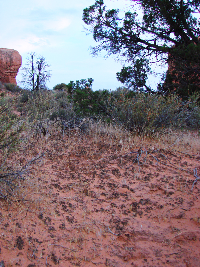
Click to view larger image of Cryptobiotic Soil Crust, Photo Courtesy and Copyright Mark Larese-Casanova
Cryptobiotic Soil Crust
Photo Courtesy & Copyright 2009
Mark Larese-Casanova

Hi, this is Mark Larese-Casanova from the Utah Master Naturalist Program at Utah State University Extension.

Looking out over a Utah desert, we might see relatively few plants- perhaps some sagebrush, maybe a few junipers or Joshua trees, or even some small wildflowers or cacti. What is less noticeable, though, is the living soil crust that holds this entire landscape together. It’s not just sand, but rather an important and vast partnership between bacteria, lichens, algae, and fungi. These soil crusts are often referred to as ‘cryptobiotic’, which means ‘living in suspended animation’. This is a fitting description, considering that water can be so rare in Utah’s deserts.

Cyanobacteria, which is often called blue-green algae, is the backbone of cryptobiotic soil crust. Vast networks of long, microscopic filaments of cyanobacteria and fungi grow in length when they are wet, and leave behind a casing that literally binds the soil together. So, what might otherwise be loose sand not only is less likely to be washed away by water or blown away by wind, but also is able to hold much more water for plants.

Click to view larger image of Cryptobiotic Soil Crust, Photo Courtesy and Copyright Mark Larese-Casanova
Cryptobiotic Soil Crust
Photo Courtesy & Copyright 2009
Mark Larese-Casanova

Cyanobacteria is also extremely useful to desert landscapes for its ability to take Nitrogen out of the air and make it available to plant roots in the soil. Desert soils typically have relatively low nutrients, so this is especially important to desert plants.

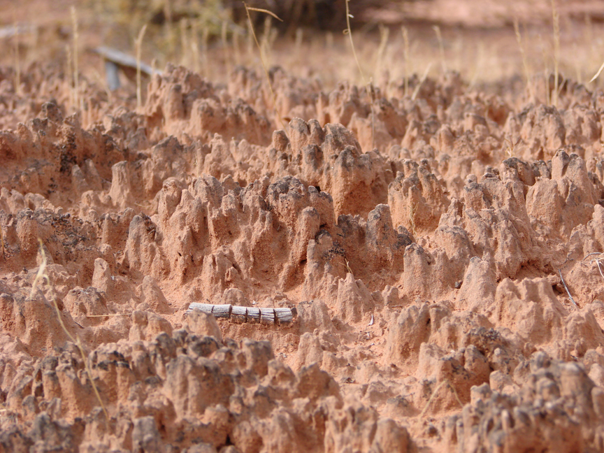
In many Utah deserts, cryptobiotic soil crusts can cover up to 70% of the ground surface. Old soil crust can often look like small mountain ranges with black or white peaks inhabited by lichens or mosses. The little valleys in between the tiny mountains of crust are perfect spots for the seeds of desert plants to grow. Over time, the above ground crust can grow up to ten centimeters, or four inches, thick!

However, cryptobiotic soil crust grows at an alarmingly slow rate of about one millimeter per year. So, any soil crust that is disturbed can take a very long time to recover. Depending on the amount of moisture a desert receives, it can take anywhere between 20 and 250 years for soil crust to grow back.

Next time you’re out in the desert, kneel down and have a close look at the telltale peaks and valleys of cryptobiotic soil crust. If you bring a magnifying glass, you just might be able to see some of the lichens and mosses. Be sure to stay on trail, though, and whatever you do, don’t bust that crust!

For Wild About Utah, I’m Mark Larese-Casanova.

Credits:

Images: Courtesy and copyright Mark Larese-Casanova
Text:     Mark Larese-Casanova, Utah Master Naturalist Program at Utah State University Extension.
Additional Reading:

US Department of Interior. 2001. Biological Soil Crusts: Ecology and Management. Bureau of Land Management Technical Reference 1730-2., https://www.blm.gov/nstc/library/pdf/CrustManual.pdf
Rosentreter, R., M. Bowker, and J. Belnap. 2007. A Field Guide to Biological Soil Crusts of Western U.S. Drylands. U.S. Government Printing Office, Denver, Colorado., https://www.soilcrust.org/