Utah’s Petroglyph Garden

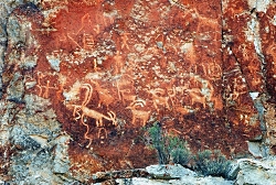
Click to view Petroglyph Panel at the Fremont Indian State Park & Museum, Photo Courtesy Sevier County, Kreig Rasmussen, Photographer
Petroglyph Panel at Fremont Indian State Park & Museum
Photo Courtesy Sevier County
Kreig Rasmussen, Photographer

Hi, I’m Ru Mahoney with Stokes Nature Center in Logan Canyon.

Utah’s culture is rich with vestiges of our pioneer history, and the landscape is accented by visible signs of the European settlers who forged our modern communities. But the tapestry of Utah’s cultural heritage is interwoven with much older threads, as indelible and enduring as the landscape itself.

In the 1980’s, in the southwestern quadrant of central Utah, the construction of interstate 70 unearthed a secret over one thousand years old. The valleys and canyons of what is now Sevier County, already known as a seasonal thoroughfare for the Paiute, had an even older history as home to the largest community of Fremont Indians ever discovered. Influenced by their Anasazi cousins to the southwest, the Fremont culture encompassed a diverse group of tribes that inhabited the western Colorado Plateau and the Great Basin area from roughly 400 to 1350 A.D. Archaeologists tell us they were a people of ingenuity in their engineering, aggression in their social interactions, and lasting creativity in their artistic expression. Divergent theories on their fate suggest they drove the Anasazi out of the Four Corners region and eventually migrated to further landscapes, or that northern groups of Fremont peoples joined with bands of Shoshone and became the Ute Indians of the Uinta. Whatever the truth of their ultimate fate may be, nowhere is their history more tangible than at Fremont Indian State Park just south of Sevier, UT along I-70. This year-round state park offers visitors a treasure trove of artifacts and curated exhibits in an excellent visitor’s center. But the most authentic interaction with these past peoples comes from exploring the surrounding landscape.

Driving the winding road into Clear Creek Canyon, ghostly figures begin to emerge; pictographs painted in shades of ocher and umber, and pale petroglyphs carved into the canyon walls, reveal an archaic and epic account of Utah’s ancestral past. A unique creation story, in which a shrike leads the Fremont people from a dark and cold underworld through the stem of reed into the warm world above, plays out across the canyon walls. A craggy outcrop of rock in the shape of an eagle is said to be watching over the reed to the underworld below to insure nothing wicked escapes into our world. A concentric lunar calendar and an abundance of zoomorphics speak of a cultural identity conceived in relation to the broader astrological world, and a reverence for anthropomorphized neighbors such as bighorn sheep and elk. Spider Woman Rock juxtaposes a powerful figure of Native American mythology with the pedestrian humility of a nursing mother. And Cave of 100 Hands is a visceral exhibition of a humanity simultaneously reminiscent and divergent from our own.

While the Fremont culture is believed to have died out or been absorbed by other modern groups, Clear Creek Canyon and the rock art sites of Fremont Indian State Park are significant among the modern Kanosh and Koosharem Bands of the Paiute who began using the area and leaving their own indelible marks on the canyon walls after the disappearance of the Fremont peoples around 1400 A.D. On the vernal and autumnal equinox (occurring in the third or fourth week of March and September each year) the eagle rock casts its shadow over the reed rock at dawn, breathing life into ancient tales of our ancestral history.

Fremont Indian State Park is a notable destination for those interested in rock art sites, many of which are suited to families of all ages and mobility, including visitors with strollers and wheelchairs. Stop in the visitor’s center to borrow or purchase a guide to the petroglyphs and pictographs for deeper insight into the Fremont culture and an unforgettable glimpse into Utah’s past.

For Wild About Utah and Stokes Nature Center, I’m Ru Mahoney.

Credits:
Images: Courtesy Sevier County, Kreig Rasmussen, Photographer
Text:     Ru Mahoney, Stokes Nature Center in Logan Canyon.


Additional Reading:

https://stateparks.utah.gov/parks/fremont-indian/

https://stateparks.utah.gov/stateparks/wp-content/uploads/sites/26/2015/02/Fremont_IndianBrochure.pdf

https://www.nps.gov/grba/learn/historyculture/fremont-indians.htm

https://www.thefurtrapper.com/fremont_indians.htm

Take the Pledge to Protect the Past, Utah State Historical Preservation Office, Department of Cultural & Community Engagement, State of Utah, https://ushpo.utah.gov/shpo/upan/
A Safari through Utah’s Ice Age

A Safari through Utah’s Ice Age: Wave-cut platforms from Lake Bonneville preserved on Antelope Island, Great Salt Lake, Utah., Photo Courtesy Wikimedia, Mark A. Wilson (Department of Geology, The College of Wooster), Photographer
Wave-cut platforms from
Lake Bonneville preserved on
Antelope Island, Great Salt Lake, Utah.
Photo Courtesy Wikimedia, Mark A. Wilson (Department of Geology, The College of Wooster), Photographer

Ground sloth of the Pleistocene
Paramylodon harlani
Texas Memorial Museum
University of Texas at Austin.
Photo Courtesy Wikimedia
Licensed CCA Share Alike 3.0 Unported

Lake Bonneville compared to the
State of Utah.
Photo Courtesy https://wildlife.utah.gov/gsl/history/


Hi, I’m Ru Mahoney with Stokes Nature Center in Logan Canyon. As winter approaches I find myself anticipating the first really good snow, when our valley floors and mountain passes will be transformed overnight, relinquishing autumn’s riot of color for a glacial monochrome. As little as 12,000 years ago winter white was Utah’s perennial favorite, donned at the launch of the Pleistocene Epoch, a roughly 2 million year long period (give or take 10,000 years) marked by widely recurring glaciations.

The west has a reputation for being vast, but Ice Age Utah was even bigger. The mountains where higher and sharper. And the Great Salt Lake was submerged beneath the glacial waters of Lake Bonneville. At its largest, this massive body of water covered 20,000 square miles and was more than 980 feet deep. To put that into perspective, that measures about 9.5 million football fields wide by 4.5 Salt Lake Temples deep. And the Ice Age wildlife? Well it was much more akin to an African safari than anything you’re likely to find on your favorite shoreline trail these days.

The megafauna of Pleistocene Utah included a menagerie of beasts that are the stuff of legend. Familiar species like bison and big-horn sheep grazed among herds of mammoths and mastodons. Camels and horses – destined for extinction in North America – were the prehistoric prey of dire wolves and saber-toothed cats. Giant ground sloths the size of modern day elephants stood on two powerful hind legs to browse on shoreline foliage. And herds of muskoxen kept a wary eye on Arctodus, the Short-faced bear, a formidable predator more than 50% larger than any bear species living today.

The last 30,000 years of Utah’s Ice Age were characterized by increasingly volatile shifts in climate. The changing norms in temperature and abundance of liquid water created cyclical periods of transitioning habitat. Forests and forest dwellers gave way to deserts and their specialist species, before shifting back to forests again, all in mere millennia. While nomadic and highly adaptable species like muskoxen eventually moved north to more stable climates, the less adaptable fauna of the Ice Age were increasingly relegated to sharing shoreline habitat diminished by the swollen banks of Lake Bonneville.

As fluctuating glaciers pushed southward and then retreated, canyons like Big and Little Cottonwood were gouged into existence. Spring and summer glacier melt carried an abundance of freshwater into the lake, sometimes sweeping along with it the remains of prehistoric animals that had not lasted through the winter, laying them to rest in shoreline deltas where their fossilized remains are now uncovered and studied in alluvial sediment. For many of Utah’s Ice Age animals, the end of the Pleistocene brought extinction.

Today the ancient shoreline of Lake Bonneville is one of the most distinguishable geological features along the Wasatch front. This “bench”, as it’s now commonly known, is easily identifiable in cities all along the Wasatch and frequently boasts fine homes and even finer views. Which might go to show that lakeside property retains its value whether the lake is still there or not. So as you enjoy a winter hike or cross country ski along a shoreline trail this season, think about Utah’s last Ice Age and how our rich fossil record, with some of earth’s largest land mammals, paints a picture of an even wilder west.

For Wild About Utah and Stokes Nature Center, I’m Ru Mahoney.

A Safari through Utah’s Ice Age-Credits:
Image1: Courtesy Wikimedia, Mark A. Wilson (Department of Geology, The College of Wooster), Photographer
Image2: Courtesy Wikimedia,as licensed through Creative Commons Attribution-Share Alike 3.0 Unported
Image3: Courtesy https://wildlife.utah.gov/gsl/history/
Text:     Ru Mahoney, Stokes Nature Center in Logan Canyon.


A Safari through Utah’s Ice Age-Additional Reading:
https://geology.utah.gov/popular/general-geology/ice-age/ice-age-animals-of-utah/

https://serc.carleton.edu/vignettes/collection/37942.html

https://hugefloods.com/Bonneville.html

https://geology.utah.gov/surveynotes/archives/snt42-3.pdf

https://geology.utah.gov/surveynotes/articles/pdf/pleistocene_fossils_42-3.pdf

Best Snow

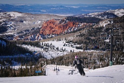
Click to view larger image of a skier at Brian Head, Photo Courtesy USDA Forest Service
Skier at Brian Head
Photo Courtesy USDA Forest Service

As the mountains begin to take on hues of scarlet, gold and russet, many Utahns might be looking eagerly toward the coming months when those slopes will be blanketed in white. The Utah ski industry nurtures a whopping annual income of about $800 million dollars. It’s no surprise, therefore, that the state claims to have the “greatest snow on earth.” In fact, the state of Utah managed to make their slogan a federal trademark in 1995 after winning a lawsuit brought by the Ringling Brothers and Barnum & Bailey circus group, who felt the catchy marketing phrase might be confused with their slogan, the Greatest Show on Earth.

The trademark must have worked, because Utah draws so many visitors to its slopes, it racks up about 4 million skier days annually. But disregard plenty of evidence that we do indeed draw a crowd, and the statement is pretty subjective. So what’s the science behind our legendary powder?

The ideal condition skiers hope for is a deep, fluffy snow that creates the illusion of bottomless powder. And finding it is a bit like the Goldilocks story. Too wet, and you bog down. Too dry, and there’s not enough body to create a floating sensation beneath the ski. If the terrain is too steep, the powder won’t stick. And if it’s not steep enough, you can’t build sufficient momentum to glide over the top.

To get to the bottom of why Utah’s snow is just right, we actually have to look even further westward, toward the slow warm waters of the North Pacific current. As water laden clouds move inland, snow first falls over the Cascades in the north and the Sierra Nevadas further south, with an average moisture content of 12%. Even in areas like Washington’s Mt. Baker, where annual snowfall comes in greater quantities than Utah, the moister maritime snow creates a heavy base that bogs down skis. By the time these winter storms cross the Great Basin and reach the skiers’ Mecca of Alta and the Wasatch Range, the moisture content will have decreased to about 8.5%. And that seems to be the sweet spot. The moisture content of Utah’s intermountain snow is just enough that powder from our first storms settles into a soft but voluminous base. As winter progresses, fresh snow falls in a cold and mostly arid environment, forming very fine, symmetrical crystals called dendrites. The microscopic structure of dendrites allows them to accumulate in well ventilated, incompact drifts, much like the puffy down in your favorite pillow or ski jacket.

And perfect powder isn’t the only advantage Utah’s ski resorts have over their neighbors. Our mountainous topography, with its wealth of winding canyons, means we have an abundance of slopes well protected from strong winds which could compact or carry away fresh snowfall. And while so many cold and overcast days might get you down, it also protects our top powder from radiation and air mass effect, which can create a crust along the surface. And that means our freshly fallen powder sticks around for longer.

So consider that Utah offers 26,000 acres of mountain, blanketed in more than 500 annual inches of perfect intermountain snow, and it’s no wonder we enjoy 5 times the number of “powder days” as our neighbors. “The Greatest Snow on Earth” starts sounding a lot less subjective, and more like truth. In fact, you just might be tempted to make like Goldilocks and make yourself at home.

For Wild About Utah and Stokes Nature Center, I’m Ru Mahoney.

Credits:
Image: Courtesy USDA Forest Service, fs.usda.gov
Text:     Ru Mahoney, Stokes Nature Center in Logan Canyon.


Additional Reading:

Maguire Primrose – A True Utahn Species

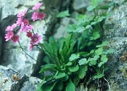
Maguire Primrose
Photo Courtesy US FWS
Larry England, Photographer

Hi, I’m Ru Mahoney with Stokes Nature Center in Logan Canyon. Utah is home to several iconic species – as indelible to our state’s identity as the craggy mountain landscapes and red rock deserts we call home. Gnarled bristlecone pines stand like abstract architecture for multiple millennia. Elusive mountain lions roam our alpine meadows in the north, all the way to our red rock canyons in the south. And curious coyotes – as resourceful as our native and pioneer ancestors – are truly wily wayfarers, as adaptable to suburban environments as to open range. But however pervasive iconic species may be to perceptions about our state, there are lesser known residents that are the true Utahns – species found absolutely nowhere else in the world.

The word “endemic” refers to a plant or animal whose distribution is restricted to a specific region. Utah ranks 6th in the nation for endemic species, with 247 endemic plant species alone. One of these is Primula cusickiana maguirei, or Maguire Primrose. This unassuming reddish violet-blossomed wildflower, standing just 2-4 inches high, makes a living in the cracks and depressions of limestone and quartzite outcrops along a 10 mile corridor through Logan Canyon in northern Utah. And that’s it! You won’t find it anywhere else on the planet. Of that narrow home range, Maguire Primrose is further isolated into two distinct populations within the canyon. Subtle differences in spring temperatures between the canyon walls often lead to one population blooming before the other. And while some species of primrose can survive by occasionally self-pollinating, Maguire Primrose is entirely dependent upon pollinators like bees, moths and the occasional hummingbird for reproduction. Therefore the success of Maguire Primrose requires a precise balance between cool temperatures for development and blooming, warmer temperatures to encourage pollinator activity, and a sufficient number of compatible mates blooming at the right time in the right place. In addition to these natural challenges, the US Forest Service reports that Maguire Primrose is increasingly impacted by recreational rock climbers, who clear cracks and crevices to accommodate permanent anchors along popular routes. Stokes Nature Center, and our forest service partners in the Logan Canyon Children’s Forest, hope to increase community awareness about Maguire Primrose to recruit our fellow nature lovers, including rock climbers and other canyon visitors, to become informed stewards of this rare and vulnerable wildflower.

Wildflower enthusiasts can find Maguire Primrose blooming from mid-April to mid-May at elevations of 4,800 to 6,000 feet. Flowers are more prevalent on north-facing cliffs where moisture from spring snowmelt is abundant and cooler temperatures nurture bud development. Stokes Nature Center, in partnership with the Logan Canyon Children’s Forest, offers seasonal guided field tours where canyon visitors can learn more about natural and human threats to Maguire Primrose, and enjoy a chance to see a true Utahn species found nowhere else in the world.

For Wild About Utah and Stokes Nature Center, I’m Ru Mahoney.

Credits:
Images: Courtesy US FWS, Larry England, Photographer
Text:     Ru Mahoney, Stokes Nature Center in Logan Canyon.


Additional Reading:

Natural History of Maguire Primrose, Primula cusickiana var. Maguirei (Primulaceae)
Jacob B. Davidson and Paul G. Wolf
Western North American Naturalist Nov 2011 : Vol. 71, Issue 3, pg(s) 327-337 doi: 10.3398/064.071.0301

Maguire Primrose Fact Sheet, US Fish & Wildlife Service(FWS), https://www.fws.gov/mountain-prairie/factsheets/MaguirePrimroseFactSheet.pdf

Maguire Primrose, Primula cusickiana maguirei, Utah Rare Plant Guide, Utah Native Plant Society, www.UtahRarePlants.org