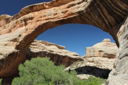
The Raft River Mountains

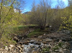
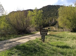
The Raft River Mountains: Clear Creek in Spring
Clear Creek in Spring
Courtesy & Copyright Holly Strand

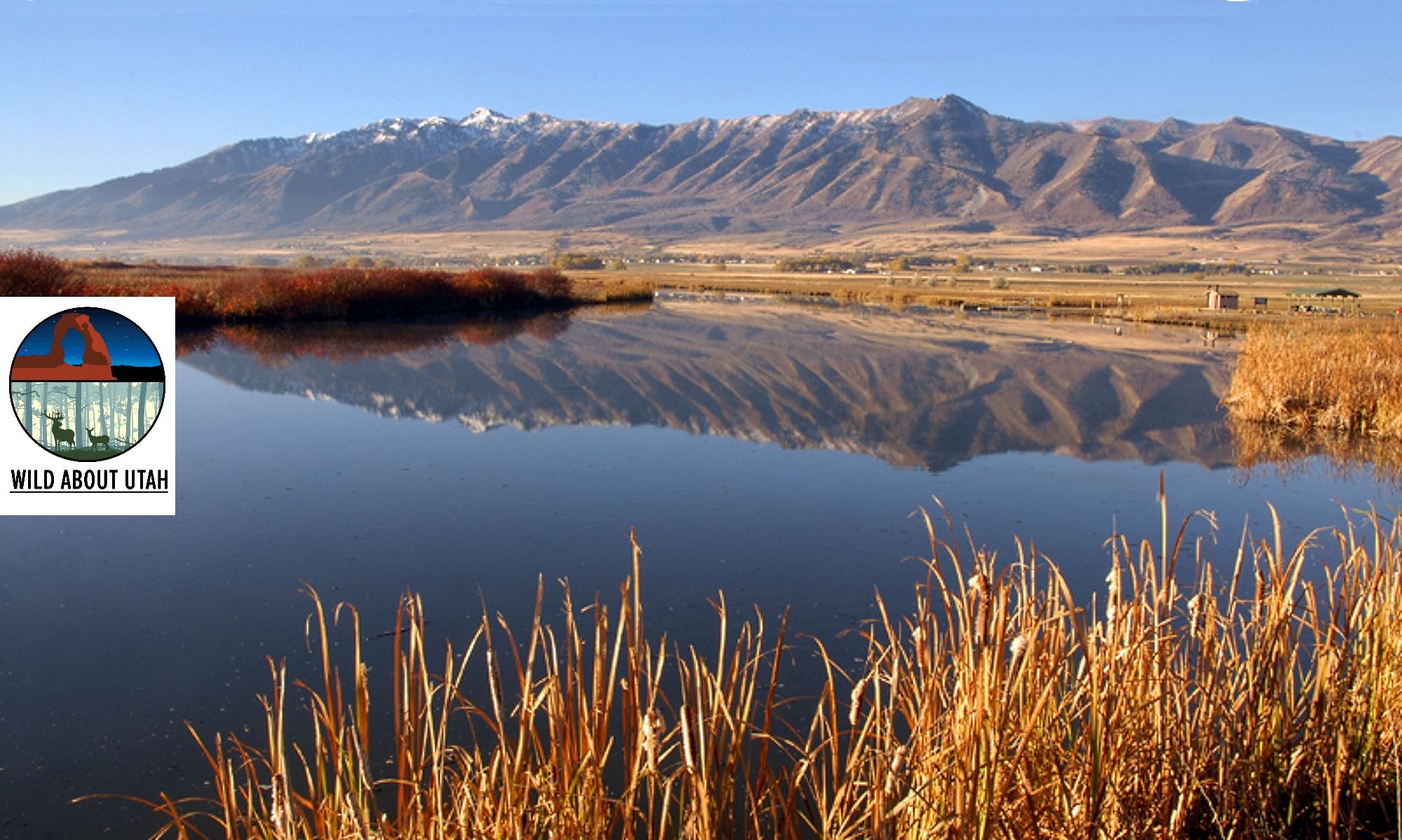
The Raft River Mountains: Raft River MountainsRaft River Mountains
Courtesy & Copyright Holly Strand

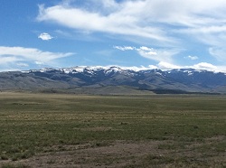
The Raft River Mountains: Near Clear Creek Campground.Near Clear Creek Campground.
Courtesy & Copyright Holly Strand


Hi, I’m Holly Strand of the Quinney College of Natural Resources at Utah State University.

In each of Utah’s six corners you’ll find one or more remarkable natural features. Moreover, each corner represents a totally different geographic environment. No doubt you are familiar with turquoise blue Bear Lake in the upper northeast and the magnificent High Uintas near the angle formed by Wyoming. Flaming Gorge and Dinosaur National Monument flank the lower northeast corner. The ancient ruins and Monument Valley draw international visitors to the southeast corner. The numerous canyon parks in Utah’s southwest corner offer endless opportunities for exploration. 

That’s five corners. But what do you know about the northwest corner of our state? I live in Northern Utah and I had never been there. Resolved to correct this omission I consulted a map as well as Joan Hammer of Box Elder County’s Office of Tourism. I concluded that the Raft River Mountains were worth checking out. The highest point in the County, Bull Mountain is here. And the 40 mile long range defines the southernmost section of Sawtooth National Forest.

The Raft River Mountains are unusual in that they run east-west. The normal pattern for Basin and Range country is north-south. The east-west orientation creates an important geographic dividing line. For Clear Creek drains the northern slopes of the Raft River Mountains. Then Clear Creek joins the Raft River which flows north to the Snake River. Thus the mountains form the sole—and very small—piece of Utah real estate that belongs to the great Colombia River Basin. The southern slopes are part of Great Basin. Rain or snow falling on this side is absorbed into the ground or evaporates.

Another interesting fact: The Raft River Mountains is where you can view some of the oldest rock in Utah. In this region, outcrops of Precambrian material are 2.5 billion years old. The largest and thickest exposures are in the eastern half of the range.

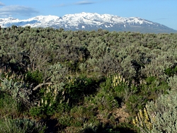
The Raft River Mountain peaks may not make it onto post cards. But when I saw them they were nothing less than beautiful. The lower slopes of sagebrush had the grayish-green tint that emerges all too briefly in the spring. Snow still gleamed on the 8-9000 foot summits. Clear Creek was running full through riparian forest that was just starting to leaf out. There were no people at the campground but wildlife was plentiful. I saw wild turkey, deer, jackrabbits and squirrels. A few pronghorn looked up as I drove out through the sagebrush. All in all, I found Utah’s sixth corner to be well worth a visit.

For pictures and more information about the Raft River Mountains, go to www.wildaboututah.org

For Wild About Utah, and the Quinney College of Natural Resources, I’m Holly Strand.

Credits:

Images: Courtesy and Copyright Holly Strand
Text: Holly Strand

Additional Reading

Doelling, Hellmut H. Geology and Mineral Resources of Box Elder County. Utah Geological and Mineral Survey. 1980. Bulletin 115.,

Stokes, William Lee. 1988. Geology of Utah. Salt Lake City: Utah Museum of Natural History. SummitPost.org Bull Mountain. https://www.summitpost.org/bull-mtn-ut/183282https://www.summitpost.org/bull-mtn-ut/183282 [Accessed May 13, 2014 and July 10, 2020]

USDA Forest Service. Sawtooth National Forest, Raft River Division. https://www.fs.usda.gov/recarea/sawtooth/recarea/?recid=5806 [Accessed May 13, 2014 and July 10, 2020]

Hylland, Rebecca, What are Igneous, Sedimentary & Metamorphic Rocks?, Glad You Asked, Utah Geological Survey, https://geology.utah.gov/map-pub/survey-notes/glad-you-asked/igneous-sedimentary-metamorphic-rocks/

Defining the Great Basin

Willow Creek North of Wells, NV. Sagebrush at mid-distance. Route of the California Trail used by pioneers.
Willow Creek north of Wells, NV.
Sagebrush at mid-distance.
Route of the California Trail
used by pioneers.

Courtesy & Copyright
Jim Cane, Photographer

Lupines amid sagebrush north of Wells, NV. Ruby Mountains in backgroundLupines amid sagebrush
north of Wells, NV.
Ruby Mountains in background
Courtesy & Copyright
Jim Cane, Photographer

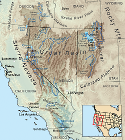
Map delineating the Great basinMap delineating the Great basin
Courtesy Wikimedia, KMusser, Artist
Ref: wikipedia.org/wiki/Great_Basin


The Great Basin is aptly named.  Twice the size of Kansas, it stretches from the watersheds of the Columbia and Snake rivers south to that of the Colorado, and from the crests of the Sierra Nevada and southern Cascades eastward to the Wasatch front.  The Western explorer John Fremont coined its name in 1845.  The rivers and streams of the region that Fremont had seen all ended in sinks, marshes or lakes. None flowed to the Pacific Ocean.  He confirmed this on meeting Joseph Walker at Mountain Meadows in Utah.  Walker had traveled more of the basin’s western margins, dispelling  rumors of a river traversing the Sierra Nevada.  Precipitation that falls in the Great Basin stays in the Great Basin; water leaves only as vapor.  This is the hydrographic Great Basin.

How else to view the vast region between the Rockies and the Sierra Nevada? Geologists speak of the “Basin and Range Province”, so named for its valleys and the towering ranks of north-south mountain ranges that march across the landscapes of Nevada and edges of adjacent states. Unlike the upthrust Rockies and Sierra Nevada, Earth’s crust in the Great Basin appears to be spreading, to be pulling apart. The tilted escarpments of the Wasatch front are the easternmost evidence of this crustal deformation that has built the Basin and Range Province.

Botanists delimit the Great Basin by the hardy flora that clothes this rugged landscape. Great Basin plants tolerate freezing winters and parched summers, and in the valleys, soils of varying salinity.  The so-called Sagebrush Ocean fills many of the basins, as do other shrubs, such as shadscale and greasewood.  Upslope, these give way to juniper woodlands, often mixed with piñon pine.  This floristic Great Basin reaches eastward to central Utah and the Wasatch front, beyond which trees and other plants of the Rockies make their appearance.

The boundaries of all three concepts for the Great Basin — hydrographic, geologic and floristic — largely coincide.  Each recognizes the distinctive attributes of the Great Basin that set it apart from neighboring regions.  The Great Basin is readily recognizable to the trained eye, whether looking at satellite images, river courses, or the native plant communities encountered on a simple walk.

Credits:
Images: Jim Cane
Map: Courtesy Wikimedia, KMusser, Artist, licensed under Creative Commons Attribution-Share Alike 3.0 Unported
Text: Jim Cane

Additional Reading

Frémont, John Charles. 1845. Report of the exploring expedition to the Rocky Mountains in the year 1842 and to Oregon and North California in the years 1843 – 44. Printed by order of the Senate of the United States , Gales & Seaton, 693 pages. –available as a Google eBook scanned from the original published book Grayson, Donald K. 1999. The desert’s past : a natural prehistory of the Great Basin. Smithsonian Institution Press, Washington D.C., 356 pages. –an exceptionally readable, thorough and authoritative overview of the Great Basin, with many maps, photographs and illustrations.https://books.google.com/books?id=W8ICAAAAMAAJ

Intermountain Regional Herbarium Network. searchable plant database representing multiple holdings of herbaria at universities in Utah and Nevada, with maps, images and more https://swbiodiversity.org/seinet/projects/index.php?proj=10

McPhee, John. 1981. Basin and Range. Farrar, Straus, Giroux, New York. 215 pages. –the first of the author’s many engaging books about geology. https://www.amazon.com/Basin-Range-John-McPhee/dp/0374516901

Rock Climbing

Photo Courtesy Wikimedia, Bob Protus (katsrcool) Photographer
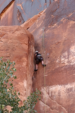
Rock Climbing
on Potash Road, Moab, UT
Courtesy Wikimedia & Bob Protus (katsrcool), Photographer

Hi, this is Justin Lofthouse from the USU Natural Resource Interpretation Class.

Many might think that rock climbing results from a quest for adrenaline and danger. On the contrary, most rock climbers strive for a calm and controlled state of mind. Many participate in rock climbing for reasons such as solitude, adventure, self-exploration, pushing physical limits and accomplishment. The explosion of the number of people participating in rock climbing over the last decade has altered how many obtain these benefits.

As more and more people are climbing in Utah, it has become harder to find solitude and adventure. This increase in numbers has led to Federal land managers taking a closer look at the impacts caused by overuse. A strong wilderness ethic is vital to the future access of climbing areas.

In a recent poll on mountainproject.com, the question was asked, “What are the top 10, best climbing states?” Among the replies, Utah is almost always among the top three. Canyons such as American Fork, Logan, Maple, Little and Big Cottonwood make northern Utah a top competitor. These steep technical faces offer difficult, continuous routes that push the physical realm of the sport. When southern Utah is thrown into the mix, Utah truly stands out as a gem. Places like Zion, Indian Creek, Moab, and St. George have parallel-sided cracks that split sandstone walls for hundreds of feet. These remote desert regions offer a feeling of adventure and solitude that many areas in the U.S. lack. These qualities have put Utah high on the list as a must-visit climbing destination.

Gone are the days when you and your partner were the only people climbing in an area on a weekend. As information about the amazing climbing in Utah has become readily available, people have come by hordes to explore what Utah has to offer. Although rock climbers will have to find new ways to share such a unique resource, no one is doubting that Utah truly has something special to offer when it comes to rock climbing. It will take a concentrated effort on the part of all climbers to help maintain such a wonderful resource for future generations of climbers.

For Wild About Utah, I’m Justin Lofthouse.

Credits:
Image: Courtesy Wikimedia, Bob Protus (katsrcool) Photographer, licensed under Creative Commons Attribution Generic 2.0
Text: Justin Lofthouse

Sources and Additional Reading

Climbing and Canyoneering, Bureau of Land Management, Department of the Interior,
https://www.blm.gov/ut/st/en/fo/st__george/recreation/rock_climbing.html

Rock Climbing, Capital Reef National Park, National Park Service, https://www.nps.gov/care/planyourvisit/rockclimbing.htm

Why is it Colder at Higher Elevations?

The age old question: Why is it Colder at Higher Elevations? Click to view a larger photograph of view from the Nebo Loop, Photo Courtesy and Copyright Lyle Bingham
It is cooler at higher altitudes
Looking Southeast from the Nebo Loop
Photo Courtesy & Copyright 2011
Lyle Bingham

Hi, this is Mark Larese-Casanova from the Utah Master Naturalist Program at Utah State University Extension.

If the old saying that “hot air rises” is true, then why is it colder at the top of a mountain? Let’s think about it in terms inflating a bicycle tire. If we were to use a bicycle pump, it would compress the surrounding air to a greater pressure as the tire is inflated. This causes air molecules to collide at a greater rate, releasing energy in the form of heat. As a result, the bicycle pump would feel warmer to the touch.

Alternatively, if a CO2 cartridge is used to inflate the tire, compressed air is released, resulting in a cooling effect as molecules rapidly move farther apart. On a warm day, the CO2 cartridge will feel cold to the touch, even frosty. So, the greater the air pressure, the warmer the temperature.

The air around us doesn’t feel like it weighs much, but it’s obvious that it has some mass whenever a helium balloon is released. The balloon, filled with a gas that is lighter than the air in our atmosphere, floats up into the sky. If we think about the amount of air sitting on top of the ground at Utah’s lowest elevation of 2,178 feet above sea level at Beaver Dam Wash in the southwest corner of the state, and compare it to Utah’s highest elevation of 13,538 feet at King’s Peak, that’s an extra 11,360 feet of air! As a result, air pressure is about one and a half times as much at Beaver Dam Wash as it is at King’s Peak. With that increased pressure at lower elevations comes increased temperatures. In fact, with every thousand feet lower in elevation, average temperatures increase about 3.5 degrees Fahrenheit.

On average, annual temperatures are about 15 degrees Fahrenheit warmer in Salt Lake City than up at the Town of Alta, just ten miles up Little Cottonwood Canyon. Even early pioneers noticed this, and decided to settle along the warmer foothills of the Wasatch Mountains. To this day, most of Utah’s population along the Wasatch Front benefits from longer growing seasons and lower heating bills, while taking advantage of higher, cooler elevations for hiking on a summer day or skiing in winter.

For Wild About Utah, I’m Mark Larese-Casanova.

Credits:
Images: Courtesy and Copyright Mark Larese-Casanova
Text:     Mark Larese-Casanova

Additional Reading:

Altitude.org Air Pressure Calculator. https://www.altitude.org/air_pressure.php

If hot air rises, why is it cold in the mountains? Colorado State University Little Shop of Physics. https://littleshop.physics.colostate.edu/tenthings/ExpansionCooling.pdf

Joule-Thomson Effect. Princeton University. https://www.princeton.edu/~achaney/tmve/wiki100k/docs/Joule%E2%80%93Thomson_effect.html

Utah’s basement — Beaver Dam Wash is state’s lowest elevation. Deseret News. Sept. 3, 2006. https://www.deseretnews.com/article/645197370/Utahs-basement–Beaver-Dam-Wash-is-states-lowest-elevation.html?pg=all

Western Regional Climate Center. https://www.wrcc.dri.edu/