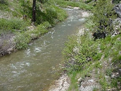
Courtesy USDA Forest Service
usda-forest_service_bear_river-250×188
I’ve quenched my thirst from the countless springs found in our eastern canyons and basins, always a reminder of our good fortune. One might ask, what set of circumstances allow Cache Valley to be so well watered? What follows are my hypotheses. A combination of geology, and climate.
The Bear River range, a subset of the Wasatch, is close to 20 miles wide, and averages well over 8,000 feet in elevation, topping just shy of 10,000 feet at Naomi Peak. Its height and width allow it to capture an abundant snowpack in normal years. The regional climate may be partially responsible as well. Extreme cold temperatures compared to surrounding mountains, the second coldest measured in the 48 states, atop Logan Canyon, enhance precipitation.
Geologically this mountain range is composed primarily of limestone and dolostone, both are excellent formations for absorbing water, which reappears as springs forming the headwaters of its numerous streams. As snow melts, water seeps through the broken limestone, referred to as Karst topography, until it hits an impervious layer of shale or mudstone, where it collects and eventually punches through a fractured seam of rock, to surface as a spring.
All are tributaries of the Bear River, plummeting from the north slope of the Uintah’s, a unique river system with its headwaters and mouth close to the same latitude. It provides nearly 2/3rds of the service water flowing into the Great Salt Lake. This is the longest river in North America which doesn’t end up in an ocean. With a changing climate proposed, further impoundment and diversions of these waters, the future of our unique hydrology is under constant threat. I wish us great wisdom in how we chose to manage this vital resource.
This Is Jack Green, and Yes, I’m wild about Utah.
Credits:
Pictures: Bear River Courtesy USDA Forest Service
Sound: Courtesy Kevin Colver
Text: Jack Greene, Bridgerland Audubon Society
Additional Reading:
Lopez, Tom, Bear River Range, IDAHO: A Climbing Guide, https://www.idahoaclimbingguide.com/bookupdates/bear-river-range/
Sempler, Ryhan, Menuz, Diane, Emerson, Richard, Mapping Wetlands in the Upper Bear River Watershed, Glad You Asked, Utah Geological Survey, https://geology.utah.gov/map-pub/survey-notes/mapping-wetlands-upper-bear-river/
Hylland, Rebecca, What are Igneous, Sedimentary & Metamorphic Rocks?, Glad You Asked, Utah Geological Survey, https://geology.utah.gov/map-pub/survey-notes/glad-you-asked/igneous-sedimentary-metamorphic-rocks/
