
Ringtails

Ringtail (Bassariscus astutus), Photo Courtesy US FWS
Ringtail (Bassariscus astutus)
Photo Courtesy US FWS
San Andres NWR
I’ve long been intrigued by ringtail cats. I wasn’t quite sure where they fit in the grand scheme of things until I did some research while working in Zion N.P. where they were known to vandalize building contents and other mischievous behaviors.
These “mystery” cats are mostly nocturnal, highly secretive, very bright, and full of tricks and athletic feats that place them in an elite animal category. I was intent on seeing one but knew my chances were slight. On a midmorning hike into Hidden Canyon I was startled by something not far ahead of me scrambling up giant boulders. To my amazement, there they were- two ringtails hightailing in broad daylight- my first, and possibly last, sighting of these amazing animals!
The name “ringtail” comes from the seven or eight black rings on the animal’s tail. Although they are not related to cats, people have referred to them as miner’s cat, civet cat, and cacomistle (an Aztec Nahuatl term meaning half mountain lion). Along with raccoons and coatimundis, ringtails are members of the Procyonidae (raccoon) family. The scientific name, Bassariscus astusus, comes from bassar (fox), isc (little), and astut (cunning).

If one were to design an animal to climb along ledges and up vertical cliffs, the ringtail might be it. Their large tail provides balance for narrow ledges and limbs, even allowing them to reverse directions by doing a cartwheel. They can rotate their hind feet 180 degrees to quickly climb back down cliffs or trees as well as cacti. Furthermore, ringtails can ascend narrow passages by stemming (pressing all feet on one wall and their back against the other or pressing both right feet on one wall and both left feet on the other), and wider cracks or openings by ricocheting between the walls.

A ringtail’s total length ranges between inches with a tail length of 12 to 17 inches. They weigh two pounds or so. Vocalizations include squeaks, metallic chirps, whimpers, chitters, chucking, hisses, grunts, growls, and howls.
Like most omnivores, these hunters eat a wide variety of food. They have a seasonal diet, with plants and insects the favorite fall food, mammals and birds more common in winter, and insects dominate in summer. Preferred mammals include mice, woodrats, squirrels and rabbits. Ringtails also feed on nectar from agaves. Great horned owls are their major predator, along with coyotes, raccoons and bobcats.

Primarily nocturnal, ringtails don’t like daylight at a young age. Ringtails inhabit rough, rocky habitat, usually not too far from water, although they can subsist without free water if their diet consists of high protein prey or fruit and insects. In addition, they occur in semi-arid landscapes such as pinyon-juniper pygmy forests and oak woodlands. Ringtails den in tree hollows, rock crevices, other animals’ abandoned burrows or even abandoned buildings. Except in bad weather, they move frequently, rarely spending more than three straight nights in one den.

Mating occurs between February and May with one to four, hairless young born in May or June. Eyes open and fur covers their bodies by five to six weeks. They are weaned by fall and can mate near the end of their second year. Ringtails range across the southwestern USA and most of Mexico with outliers in northern California, Nebraska, Missouri and extreme southwest Wyoming.The genus Bassariscus consists of only one other species which lives in Central America. Because ringtails do not walk on the soles of their feet, unlike coatis or raccoons, they are sometimes placed in their own family, Bassariscidae. The ringtail became the State Mammal 1986.

For Wild About Utah, this is Jack Greene.

Credits:

Pictures: Courtesy US FWS, San Andres NWR
Text: Jack Greene, Bridgerland Audubon Society

Additional Reading:

Animal Fact Sheet: Ringtail, Arizona-Sonora Desert Museum, https://www.desertmuseum.org/kids/oz/long-fact-sheets/Ringtail.php

Ringtail (Bassariscus astutus), Wildscreen Arkive, https://www.arkive.org/ringtail/bassariscus-astutus/
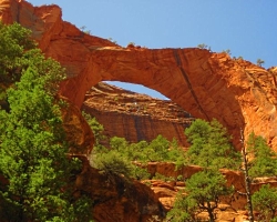
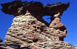
The Arches of Zion National Park

Kolob Arch
Zions National Park
Photo Courtesy NPS

Hoodoo Arch
Zions National Park
Photo Courtesy NPS

Historic Crawford Arch
Zions National Park
Photo Courtesy NPS

Hidden Arch
Zions National Park
Photo Courtesy NPS


Though another national park in Utah is famous for arches, Zion National Park has more than you might imagine.

Doubt it? Next time you visit the park, take a good look around. All the elements for arch building are readily on hand in Zion.

A natural arch is formed when deep cracks penetrate into a sandstone layer. Erosion wears away the exposed rock layers and the surface cracks expand, isolating narrow sandstone walls, or fins. Water, frost, and the release of tensions in the rock cause crumbling and flaking of the porous sandstone and eventually cut through some of the fins. The resulting holes become enlarged to arch proportions by rockfalls and weathering.

Worldwide, arches number in the tens of thousands, and probably no place is more suited for their creation than the Colorado Plateau, home of Zion National Park. The vast geology of Zion has created environments as widespread and varied as the topography of the park itself.

Hidden in its geologic grandeur are dozens, perhaps hundreds, of freestanding arches of all shapes and sizes. Although freestanding arches may be found in many different types of geologic formations, the Navajo Sandstone formation, which makes up the magnificent cliffs of Zion, provides a fertile setting for the creation of these ribbons of rock.

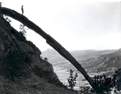
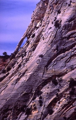
Among the many arches in Zion, two stand out: Crawford Arch and Kolob Arch. Crawford Arch is the most visible, clinging to the base of Bridge Mountain a thousand feet above the Zion Canyon floor. It’s frequently pointed out to casual observers by an interpretive sign located on the front patio of the Human History Museum.

The other famous arch in Zion is not so easily seen. Located deep in the backcountry of the national park’s Kolob Canyons District — it takes a seven-mile hike in to reach– Kolob Arch is hidden in a small side canyon, perched high on the canyon wall.

For most of the 20th century, many believed that Kolob was in fact the world’s largest freestanding arch, leading to years of debate and the motivation for various parties of adventurous thrill seekers to climb on and around the massive span in hopes of securing a defensible measurement.

The Natural Arch and Bridge Society long has pondered this question, and using lasers and an agreed upon definition of what should be measured says Landscape Arch is the world’s longest stone arch. But don’t be surprised if the debate continues.

The definition used by the society centers on the “maximum horizontal extent of the opening.” That opening beneath Landscape Arch measures right around 290.1 (plus or minus 0.8 feet) feet across.

The opening beneath Zion National Park’sKolob Arch, which long had been in the running for world’s largest, measures 287.4 feet (plus or minus 2 feet), according to the group.

Despite its isolated location, Kolob Arch has become a favorite backcountry destination for thousands of visitors to Zion. They discover what most arch seekers will tell you: while beauty awaits every seeker at the end of the path, the reward begins unfolding at the trailhead.

Anxious to see another arch, but not ready for a 14-mile roundtrip hike? Then head for Double Alcove ARch. A 5-mile roundtrip along the Taylor Creek Trail takes you into a narrow box canyon toward the Double Arch Alcove, where erosion has carved out natural openings in the Navajo sandstone.

For Wild About Utah and National Parks Traveler, I’m Kurt Repanshek.

Credits:
Images: Courtesy and Copyright Kurt Repanshek, www.nationalparkstraveler.com
Text:     Kurt Repanshek/, NationalParksTraveler.com.


Additional Reading:

https://www.nationalparkstraveler.com/browse/Arches%20National%20Park

https://www.nps.gov/zion/index.htm

Western Banded Gecko

Western Banded Gecko, Courtesy NPS
Western Banded Gecko
Courtesy NPS

They might catch your eye as they dart under sagebrush. Or maybe startle you with their pushups on a boulder. Odds are, you won’t leave Arches or Canyonlands national parks without seeing a Western Banded Gecko.

These lizards can grow to six inches in length, though that’s on the large side, and half of that length might be their tail. Pale-pink and brown-banded translucent skin distinguishes Western Banded Geckos from all other lizards that live in the same desert surroundings, and their heads and bodies are speckled with light brown. The brown bands are vibrant in young Western Banded Geckos, and then change into blotches, or spots, with age.

The small scales that cover their body are soft to touch, and their slender toes leave no room for pads. Movable eyelids and vertical pupils also set them apart.

The Western Banded Gecko typically are spotted in rocky or sandy desert areas in the American Southwest. They are fond of open, dry deserts, desert grasslands, and catching the sun in the canyons. You can spot them, or one of the eight subspecies, in Glen Canyon National Recreation Area, as well as in Arches and Canyonlands.

Like other geckos, these lizards generally avoid the day heat and prefer the cool night air. They seek shelter during the day near or under rocks, burrows, and spaces beneath vegetative debris, and even trash piles if necessary. They frequent rodent burrows as they hunt insects, spiders, small arthropods, and baby scorpions.

The Western Banded Gecko stalks its prey, capturing and crushing it with its jaws in a final, fatal lunge. The small gecko is one of the few reptiles credited with controlling the scorpion population, by eating their young. The Western Banded Gecko can also mimic a scorpion, by turning its tail upwards, and waving it to repel predators.

In addition to this deception, Western Banded Geckos use other methods to divert predators. Be forewarned: if you plan on catching a Western Banded Gecko, be prepared to hear a squeak or chirp in disagreement. You may even see them detach their tail. Their tail has particular fracture planes, allowing the lizard to easily detach and escape, similar to other lizards. Blood vessels surrounding the tail rapidly close, so they can prevent blood loss. Regrowth of their tails happens quickly, as it is mostly made up of cartilage.

Though the tail serves as an easy escape route, it means a lot to a Western Banded Gecko: that’s where it stores its food and water. Their tail allows these animals to survive during lean times, up to nine months. As you can imagine, losing a tail puts their life in danger, so look but don’t touch.

For Wild About Utah and National Parks Traveler, I’m Kurt Repanshek.

Credits:
Image: Courtesy and Copyright Kurt Repanshek, www.nationalparkstraveler.com
Text:     Kurt Repanshek, NationalParksTraveler.com.


Additional Reading:

Utah’s Petroglyph Garden

Petroglyph Panel at Fremont Indian State Park & Museum
Photo Courtesy Sevier County
Kreig Rasmussen, Photographer

Hi, I’m Ru Mahoney with Stokes Nature Center in Logan Canyon.

Utah’s culture is rich with vestiges of our pioneer history, and the landscape is accented by visible signs of the European settlers who forged our modern communities. But the tapestry of Utah’s cultural heritage is interwoven with much older threads, as indelible and enduring as the landscape itself.

In the 1980’s, in the southwestern quadrant of central Utah, the construction of interstate 70 unearthed a secret over one thousand years old. The valleys and canyons of what is now Sevier County, already known as a seasonal thoroughfare for the Paiute, had an even older history as home to the largest community of Fremont Indians ever discovered. Influenced by their Anasazi cousins to the southwest, the Fremont culture encompassed a diverse group of tribes that inhabited the western Colorado Plateau and the Great Basin area from roughly 400 to 1350 A.D. Archaeologists tell us they were a people of ingenuity in their engineering, aggression in their social interactions, and lasting creativity in their artistic expression. Divergent theories on their fate suggest they drove the Anasazi out of the Four Corners region and eventually migrated to further landscapes, or that northern groups of Fremont peoples joined with bands of Shoshone and became the Ute Indians of the Uinta. Whatever the truth of their ultimate fate may be, nowhere is their history more tangible than at Fremont Indian State Park just south of Sevier, UT along I-70. This year-round state park offers visitors a treasure trove of artifacts and curated exhibits in an excellent visitor’s center. But the most authentic interaction with these past peoples comes from exploring the surrounding landscape.

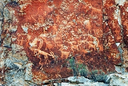
Driving the winding road into Clear Creek Canyon, ghostly figures begin to emerge; pictographs painted in shades of ocher and umber, and pale petroglyphs carved into the canyon walls, reveal an archaic and epic account of Utah’s ancestral past. A unique creation story, in which a shrike leads the Fremont people from a dark and cold underworld through the stem of reed into the warm world above, plays out across the canyon walls. A craggy outcrop of rock in the shape of an eagle is said to be watching over the reed to the underworld below to insure nothing wicked escapes into our world. A concentric lunar calendar and an abundance of zoomorphics speak of a cultural identity conceived in relation to the broader astrological world, and a reverence for anthropomorphized neighbors such as bighorn sheep and elk. Spider Woman Rock juxtaposes a powerful figure of Native American mythology with the pedestrian humility of a nursing mother. And Cave of 100 Hands is a visceral exhibition of a humanity simultaneously reminiscent and divergent from our own.

While the Fremont culture is believed to have died out or been absorbed by other modern groups, Clear Creek Canyon and the rock art sites of Fremont Indian State Park are significant among the modern Kanosh and Koosharem Bands of the Paiute who began using the area and leaving their own indelible marks on the canyon walls after the disappearance of the Fremont peoples around 1400 A.D. On the vernal and autumnal equinox (occurring in the third or fourth week of March and September each year) the eagle rock casts its shadow over the reed rock at dawn, breathing life into ancient tales of our ancestral history.

Fremont Indian State Park is a notable destination for those interested in rock art sites, many of which are suited to families of all ages and mobility, including visitors with strollers and wheelchairs. Stop in the visitor’s center to borrow or purchase a guide to the petroglyphs and pictographs for deeper insight into the Fremont culture and an unforgettable glimpse into Utah’s past.

For Wild About Utah and Stokes Nature Center, I’m Ru Mahoney.

Credits:
Images: Courtesy Sevier County, Kreig Rasmussen, Photographer
Text:     Ru Mahoney, Stokes Nature Center in Logan Canyon.


Additional Reading:

https://stateparks.utah.gov/parks/fremont-indian/

https://stateparks.utah.gov/stateparks/wp-content/uploads/sites/26/2015/02/Fremont_IndianBrochure.pdf

https://www.nps.gov/grba/learn/historyculture/fremont-indians.htm

https://www.thefurtrapper.com/fremont_indians.htm

Take the Pledge to Protect the Past, Utah State Historical Preservation Office, Department of Cultural & Community Engagement, State of Utah, https://ushpo.utah.gov/shpo/upan/