The Geology of Canyonlands National Park

Chesler Park
Canyonlands National Park
Photo Courtesy and Copyright Kurt Repanshek, Photographer
Chesler Park
Canyonlands National Park
Photo Courtesy and Copyright Kurt Repanshek, Photographer

Baked by time like some multi-layer geologic tort, Canyonlands National Park in southeastern Utah features a landscape cut by canyons, rumpled by upthrusts, dimpled by grabens, and even pockmarked, some believe, by ancient asteroids.

Just outside of Moab rises a kaleidoscope of tilted and carved geology laid down over the eons. There’s the red and white Cedar Mesa sandstone, the grayish-green Morrison Formation, pinkish Entrada sandstone, and tawny Navajo sandstone, just to name some of the geologic layers. Stacked like pancakes, they help make Canyonlands the most rugged national park in the Southwest and, quite possibly, if you find yourself deep in the park’s Maze District, in the entire Lower 48 states.

In each of the park’s districts — Island in the Sky, Needles, Maze and Horseshoe Canyon — the remarkable effects of geologic time and its endless erosion on this sedimentary landscape rise about you.

If you could turn back the geologic clock, you would see the landscape flooded by oceans, crisscrossed by rivers, covered by mudflats and buried by sand. At various times through the millennia, the climate has resembled a tropical coast, an interior desert, and everything in between.

For hundreds of millions of years, material was deposited. Layer upon layer of sedimentary rock formed as buried materials were cemented by precipitates in the ground water. Each layer contains clues to its origin, such as patterns or fossils, which reveals the environment when it was deposited. For example, the colorful Cedar Mesa Sandstone occurred when periodic floods of iron-rich debris from nearby mountains inundated coastal dunes of white sand.

Along with sedimentation, movements in the earth’s crust altered surface features. The North American continent migrated north from the equator and the local climate and environment here changed dramatically.

Peer into the ragged maw of Canyonlands from the Island in the Sky District on the northern end of the park, and it’s no mystery how the park came by its name.

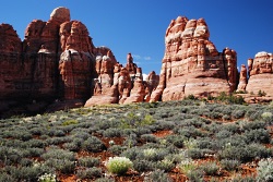
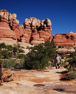
Spend the night at the Squaw Flat Campground in the Needles District and a morning hike into Chesler Park surrounds you with Creamsicle-hued minarets towering high above, like a king’s crown.

Though Canyonlands covers less than 350,000 acres, which is less than one-seventh the size of Yellowstone National Park, it feels much larger. No doubt it’s the park’s vastness and openness — you won’t find any forests here. Indeed, one old timer said that, “On a clear day, you can see the back of your own head.”

Spend a few minutes contemplating the natural forces, and the hundreds of millions of years that laid down these sediments and compressed these layers of rock. It’s really only recently that these layers have eroded to form the remarkable landscape seen today in Canyonlands National Park.

For Wild About Utah and National Parks Traveler, I’m Kurt Repanshek.

Credits:
Image: Courtesy and Copyright Kurt Repanshek, www.nationalparkstraveler.com
Text:     Kurt Repanshek, NationalParksTraveler.com.


Additional Reading:

Canyonlands National Park, National Parks Service,

Exploring The Parks: Musings From Island In The Sky At Canyonlands National Park, NationalParksTraveler.com Article – Lee Dalton – 06/24/2014

Exploring The Parks: Musings From The Needles District In Canyonlands National Park, NationalParksTraveler.com Article – Lee Dalton – 06/19/2014

Reflections Of Time In Canyonlands, NationalParksTraveler.com Article – Lee Dalton – 06/19/2014

https://www.nationalparkstraveler.com/search/apachesolr_search/canyonlands, NationalParksTraveler.com Canyonlands Articles

Hylland, Rebecca, What are Igneous, Sedimentary & Metamorphic Rocks?, Glad You Asked, Utah Geological Survey, https://geology.utah.gov/map-pub/survey-notes/glad-you-asked/igneous-sedimentary-metamorphic-rocks/
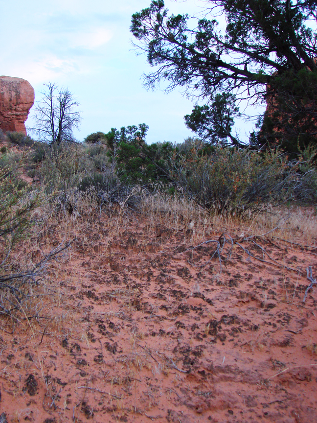
Cryptobiotic Soil Crusts

Click to view larger image of Cryptobiotic Soil Crust, Photo Courtesy and Copyright Mark Larese-Casanova
Cryptobiotic Soil Crust
Photo Courtesy & Copyright 2009
Mark Larese-Casanova

Hi, this is Mark Larese-Casanova from the Utah Master Naturalist Program at Utah State University Extension.

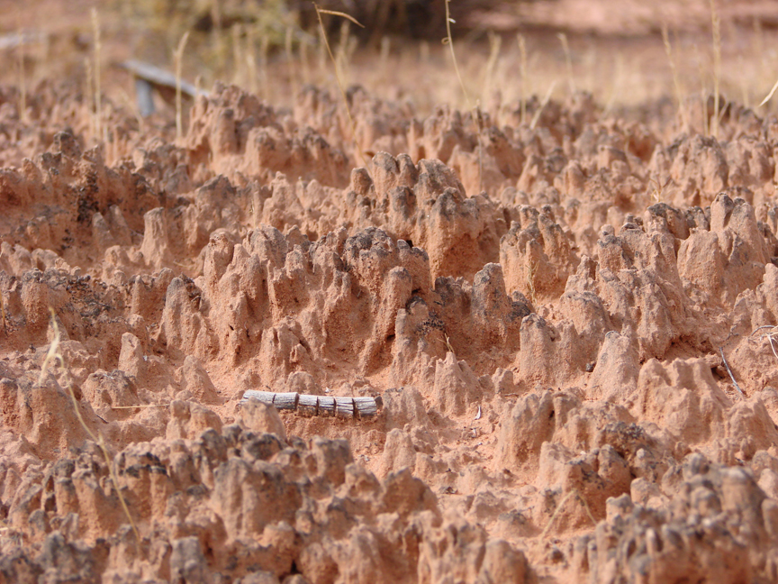
Looking out over a Utah desert, we might see relatively few plants- perhaps some sagebrush, maybe a few junipers or Joshua trees, or even some small wildflowers or cacti. What is less noticeable, though, is the living soil crust that holds this entire landscape together. It’s not just sand, but rather an important and vast partnership between bacteria, lichens, algae, and fungi. These soil crusts are often referred to as ‘cryptobiotic’, which means ‘living in suspended animation’. This is a fitting description, considering that water can be so rare in Utah’s deserts.

Cyanobacteria, which is often called blue-green algae, is the backbone of cryptobiotic soil crust. Vast networks of long, microscopic filaments of cyanobacteria and fungi grow in length when they are wet, and leave behind a casing that literally binds the soil together. So, what might otherwise be loose sand not only is less likely to be washed away by water or blown away by wind, but also is able to hold much more water for plants.

Click to view larger image of Cryptobiotic Soil Crust, Photo Courtesy and Copyright Mark Larese-Casanova
Cryptobiotic Soil Crust
Photo Courtesy & Copyright 2009
Mark Larese-Casanova

Cyanobacteria is also extremely useful to desert landscapes for its ability to take Nitrogen out of the air and make it available to plant roots in the soil. Desert soils typically have relatively low nutrients, so this is especially important to desert plants.

In many Utah deserts, cryptobiotic soil crusts can cover up to 70% of the ground surface. Old soil crust can often look like small mountain ranges with black or white peaks inhabited by lichens or mosses. The little valleys in between the tiny mountains of crust are perfect spots for the seeds of desert plants to grow. Over time, the above ground crust can grow up to ten centimeters, or four inches, thick!

However, cryptobiotic soil crust grows at an alarmingly slow rate of about one millimeter per year. So, any soil crust that is disturbed can take a very long time to recover. Depending on the amount of moisture a desert receives, it can take anywhere between 20 and 250 years for soil crust to grow back.

Next time you’re out in the desert, kneel down and have a close look at the telltale peaks and valleys of cryptobiotic soil crust. If you bring a magnifying glass, you just might be able to see some of the lichens and mosses. Be sure to stay on trail, though, and whatever you do, don’t bust that crust!

For Wild About Utah, I’m Mark Larese-Casanova.

Credits:

Images: Courtesy and copyright Mark Larese-Casanova
Text:     Mark Larese-Casanova, Utah Master Naturalist Program at Utah State University Extension.
Additional Reading:

US Department of Interior. 2001. Biological Soil Crusts: Ecology and Management. Bureau of Land Management Technical Reference 1730-2., https://www.blm.gov/nstc/library/pdf/CrustManual.pdf
Rosentreter, R., M. Bowker, and J. Belnap. 2007. A Field Guide to Biological Soil Crusts of Western U.S. Drylands. U.S. Government Printing Office, Denver, Colorado., https://www.soilcrust.org/

National Park or National Monument?

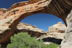
National Park or National Monument: Sipapu Natural Bridge, Natural Bridges National Monument, Courtesy and Copyright Anna Bengston
Sipapu Natural Bridge
Natural Bridges National Monument
Courtesy & Copyright Anna Bengston

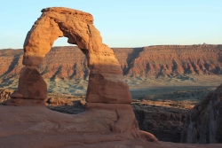
National Park or National Monument: Delicate Arch, Arches National Park, Courtesy and Copyright Anna BengstonDelicate Arch
Arches National Park
Courtesy & Copyright Anna Bengston

Established in 1916 the National Park Service manages all properties included in the National Park System. This system includes over 400 areas that encompass more than 84 million acres of land. These areas can go by one of 31 different titles. Within this system, Utah boasts 1 national historic site, 2 national recreation areas, 7 national monuments, and 5 national parks. While the reason for some of these titles is self-explanatory, the reason for others is less clear. National Park or National Monument?

For example, what makes one area a “national park” and another a “national monument?” Most people – including myself – would probably guess that the difference is in size. And while this is sometimes true, the primary difference is the reason for which each is established, because these two designations grew from historically separate concepts. The notion of the national park, which was simply the idea of large-scale natural preservation for public enjoyment, grew in popularity throughout the 1800s. As a result you can typically think of a national park as a spectacular scenic feature or natural phenomena preserved for inspirational, educational, and recreational value.

On the other hand, the idea of the national monument arose as a result of the need and desire to also protect prehistoric cliff dwellings, pueblo remains, and other historic ruins found by explorers of the American West and Southwest. Efforts to protect these sites resulted in the passing of the Antiquities Act of 1906. Therefore a national monument is usually designated to preserve objects of prehistoric, historic, cultural, and/or scientific interest. However, the Antiquities Act has been used more widely to preserve natural features as well, meaning the content of national monuments can be quite varied from wilderness areas to military sites to buildings and ruins.

There are also a couple of legal differences between these two designations. National parks are established through acts of Congress, whereas national monuments are established by Presidential proclamation. Administratively, the National Park Service manages all national parks. While national monuments, depending on their location and content, can fall under not only under the jurisdiction of the National Park Service, but also that of the U.S. Forest Service, the U.S. Fish and Wildlife Service, the National Oceanic and Atmospheric Administration, the Department of Defense, or the Bureau of Land Management.

So, it’s not just size that makes the difference, its intent, content, process of establishment, and administration. The next time you visit one of Utah’s national parks or monuments, will you be able to tell the difference?

For Wild About Utah, I’m Anna Bengtson of Park City.

Arches National Park
Bryce Canyon National Park
Capitol Reef National Park
Canyonlands National Park
Zion National Park

Golden Spike National Historic Site
Cedar Breaks National Monument
Dinosaur National Monument
Grand Staircase National Monument
Hovenweep National Monument
Natural Bridges National Monument
Pipe Spring National Monument(Border Utah/Arizona)
Rainbow Bridge National Monument
Timpanogos Cave National Monument

Flaming Gorge National Recreation Area
Glen Canyon National Recreation Area

Credits:
Image: Courtesy and Copyright Anna Bengston
Text: Anna Bengston

Additional Reading:

Biggers, Ashley. “National Parks Versus National Monuments.” Outside Online. 22 Apr. 2014. Web. 8 June 2014. https://www.outsideonline.com/adventure-travel/escapes/travel-agent/The-Difference-between-National-Parks-and-National-Monuments.html.

McDonnell, Janet. The national parks: shaping the system. 3rd ed. Washington, D.C.: U.S. Dept. of the Interior, 2005. Web, 8 June 2014. https://www.nps.gov/parkhistory/online_books/shaping/index.htm.

O’Connor, Mary. “Killing A Bill that Could Save National Parks.” Outside Online. N.p., 14 Apr. 2014. Web. 8 June 2014. https://www.outsideonline.com/outdoor-adventure/the-current/footprint/Five-Treasures-We-Owe-to-the-Imperiled-Antiquities-Act.html.

“Parks and Monuments.” Utah. N.p., n.d. Web. 8 June 2014. https://www.visitutah.com/parks-monuments/.

Righter, Robert. “National Monuments to National Parks:
The Use of the Antiquities Act of 1906”, National Park Service History: National Monuments to National Parks. N.p., Aug. 1989. Web. 8 June 2014. https://www.nps.gov/parkhistory/hisnps/npshistory/righter.htm.

United States. National Park Service. “National Park Service History: National Park System Nomenclature.” National Parks Service. U.S. Department of the Interior, n.d. Web. 8 June 2014. https://www.nps.gov/history/history/hisnps/NPSHistory/nomenclature.html.

United States. National Park Service. “Frequently Asked Questions.” National Parks Service. U.S. Department of the Interior, 28 May 2014. Web. 8 June 2014. https://www.nps.gov/faqs.htm.

Yard, Robert Sterling, and Isabelle F. Story. “Parks vs. Monuments.” The national parks portfolio. 6th ed. Washington: U.S. Government Printing Office, 1931. Web, 8 June 2014. https://www.nps.gov/history/history/online_books/portfolio/portfolio0b.htm.

-Wetlands-What’s in a name?

-Wetlands-What’s in a name?

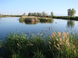
-Wetlands-What's in a name? Click to view larger view of a Pond and marsh showing wetland plants with Canada geese goslings and pelicans. Photo Courtesy and Copyright Mark Larese-Casanova
Pond and marsh showing
wetland plants with
Canada geese goslings and pelicans.
Courtesy & Copyright ©
Mark Larese-Casanova

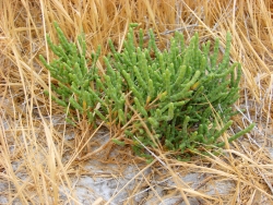
-Wetlands-What's in a name? Click to view larger view of Pickleweed growing in a salt playa is adapted to growing in saline soils. Photo Courtesy and Copyright Mark Larese-Casanova
Pickleweed growing in a salt playa
is adapted to growing in saline soils.
Courtesy & Copyright ©
Mark Larese-Casanova
Hi, this is Mark Larese-Casanova from the Utah Master Naturalist Program at Utah State University Extension.-Wetlands-What’s in a name?

A wetland really is more than just ‘land that is wet’. There are certain key ingredients that need to go into a wetland for it to truly be a wetland. Of course, water needs to be present for at least part of the growing season. It can simply be in the form of temporarily saturated soils or even standing water a few feet deep.

As soil becomes saturated with water, oxygen levels are greatly reduced. Quite often, bacteria in saturated soils will create hydrogen sulfide, giving wetland soils that stinky odor of rotten eggs. As plants grow in a wetland over several years, their decaying matter helps to create a thick, dark layer of organic soil.

The presence of water in a wetland encourages the growth of hydrophytes, or ‘water-loving’ plants, that are specially adapted to living in wet environments. Many wetland plants have open spaces within the leaves and stems- often referred to as aerenchyma. This allows oxygen to diffuse down to the roots, sometimes creating an oxygen-rich environment in the soil around a plant. Also, many wetland plants reproduce both by floating or wind-dispersed seeds and by rhizomes, which are underground roots that can travel great distances. Some plants that grow in salty wetlands around Great Salt Lake are able to control the salt in their tissues by depositing it on the outside of the leaf or containing it in chambers within their cells.

Like plants, specially adapted animals also call wetlands their home. Mammals and birds have oily fur or feathers that allow them to swim in cold water without losing much body heat. They also often have webbed feet to aid in swimming. Other animals, such as fish, amphibians, and insects, have gills to breathe in water.

Despite being the second driest state in the country, Utah has a high diversity of wetlands. Vast marshes surround the Great Salt Lake, providing habitat to enormous populations of migratory birds. Less obvious wet meadows provide unique habitat to butterflies and other insects. Salty playas which are shallow basins with no outlet, are found throughout the West Desert, creating unique ecosystems of highly adapted plants. Riparian wetlands can grow along the edges of rivers, providing a unique transition between the swift water and upland habitats. Southern Utah is home to some peculiar wetlands such as potholes and hanging gardens, both associated with sandstone bedrock. A hanging garden clings to the side of a moist cliff, creating a microhabitat for rare plants, such as orchids and monkeyflower. Potholes can simply be eroded basins in the sandstone where water collects in spring. A pothole is an oasis that provides water for desert wildlife and a home for fairy shrimp and spadefoot toads.

Spring is the perfect time of year to visit a wetland. The constant chorus of birds, insects, and amphibians are a testament to the importance of wetlands, teeming with life in the middle of a desert.

For Wild About Utah, I’m Mark Larese-Casanova.

Credits:

Images: Courtesy & Copyright © Mark Larese-Casanova

Text:     Mark Larese-Casanova, Utah Master Naturalist Program at Utah State University Extension.
Additional Reading:

Mitsch, W.J., and J.W. Gosselink. (1993). Wetlands. Van Nostrand Rheinhold.

Tiner, R. W. (1999). Wetland Indicators: A Guide to Wetland Identification, Delineation, Classification, and Mapping. CRC Press

Utah Division of Wildlife Resources. (1995). Playas to Marshes…Where Water Meets Land. Growing WILD Newsletter. https://www.wildlife.utah.gov/education/newsletters/95spring-gw.pdf

Utah Division of Wildlife Resources. (2003). Utah’s Wonderful Wetlands Activity Guide. https://wildlife.utah.gov/education/pdf/wetlands_activity_guide.pdf

-Wetlands-What’s in a name?