Rainwater Harvesting

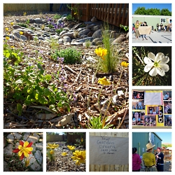
Click to view Moab Charter School Permaculture Garden, Photo Courtesy & © Roslynn Brain, Photographer
Permaculture Garden
Moab Charter School
Photo Courtesy & © Roslynn Brain, Photographer


Click to view Moab Charter School Permaculture Rain Garden, Photo Courtesy & © Roslynn Brain, PhotographerBefore and After
Permaculture Rain Garden
USU Moab
Photo Courtesy & © Roslynn Brain, Photographer
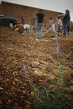


Click to view Rain Tank with Basins and Overflow Swales, Photo Courtesy & © Roslynn Brain, PhotographerRain Tank with
Basins and Overflow Swales
Albuquerque Open Space Visitor Ctr
Photo Courtesy & © Roslynn Brain, Photographer


Click to view Rain Water Storage Tank, Photo Courtesy & © Roslynn Brain, PhotographerRain Water Storage Tank
Private Residence in New Mexico
Installed by Jeff Adams of Terrasophia
Photo Courtesy & © Roslynn Brain, Photographer
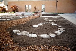


Click to view Development, Permaculture Rain Garden, USU Logan, Photo Courtesy & © Roslynn Brain, PhotographerDevelopment
Permaculture Rain Garden
USU Logan
Photo Courtesy & © Roslynn Brain, Photographer

A common saying in the west is “Whiskey is for drinkin’ and water is for fightin.’” As drought forecasts and associated water scarcity grow, many are turning towards water harvesting as a way to not only save money, but to also be more self sufficient. In Utah, thanks to a revised House Bill 36 in 2013, residents on any parcel of land can install a rainwater harvesting system and use that water on the same parcel. The total volume of rainwater that can be harvested is 2,500 gallons. Containers are recommended to be covered, primarily to reduce mosquito outbreaks, and can be above or below ground.

So how do you go about installing a rainwater harvesting system?

First, analyze your landscape and estimate your water needs by doing a water budget calculation. The Environmental Protection Agency’s WaterSense program has a landscape water budget tool that you can use to help determine your water needs. This is calculated as gallons per month based on your landscaped area, plant types, and associated water demand per plant type. In Brad Lancaster’s book, Rainwater Harvesting For Drylands and Beyond volume 1, you can find formulas for calculating how much rainwater your roof can yield, based on yearly or monthly rainfall. This can also be found in USU Extension’s permaculture fact sheet. Once you have these two numbers – your approximate landscape water demand, and the approximate rainwater your roof can provide per year, you can better estimate a practical size for your rainwater container – also called a tank or cistern. Also consider the room you have, likelihood of using harvested water, and ease of use, in addition to your landscape needs.

Now you are ready to either purchase or build your rainwater harvesting system. Remember, each tank needs an overflow and that overflow should ideally be aimed towards plants with higher water needs. For recommendations on how to install and or build rainwater harvesting containers in Utah search “Rain Barrels in Utah” through USU Extension.

If you are putting in new landscaping, search Water Harvesting Earthworks for ideas of how to design in a way that best slows, spreads, and sinks rainwater. Or look up “Plant the Water before the Tree” by the Watershed Management Group as a starting point.

No matter what size of tank you choose to install, the beauty lies in actually using harvested water from your tank, especially during periods of drought.

As watershed management consultant Jeff Adams says, “It is what you can fill, fit and afford based on your patterns of use.”

This is Roslynn Brain of Utah State University Extension Sustainability.

Credits:
Images: Courtesy & Copyright Roslynn Brain, Photographer
Text:     Roslynn Brain, Extension.usu.edu


Additional Reading:

Watersense, Environmental Protection Agency https://www3.epa.gov/watersense/

Lancaster, Brad, Rainwater Harvesting Drylands and Beyond, https://www.amazon.com/Rainwater-Harvesting-Drylands-Beyond-2nd/dp/0977246434/ref=sr_1_1?s=books&ie=UTF8&qid=1445316738&sr=1-1&keywords=rainwater+harvesting+for+drylands+and+beyond

Plant the Water Before the Tree – Help Your Tree Grow and Thrive with Rainwater!, Watershed Management Group, https://watershedmg.org/document/plant-water-tree-help-your-tree-grow-and-thrive-rainwater

Rain Barrels in Utah, USU Extension, https://digitalcommons.usu.edu/cgi/viewcontent.cgi?article=1746&context=extension_curall

YCC Team, Lush Utah garden makes the most of a small amount of rain, Yale Climate Connections, July 25, 2022, https://yaleclimateconnections.org/2022/07/lush-utah-garden-makes-the-most-of-a-small-amount-of-rain/
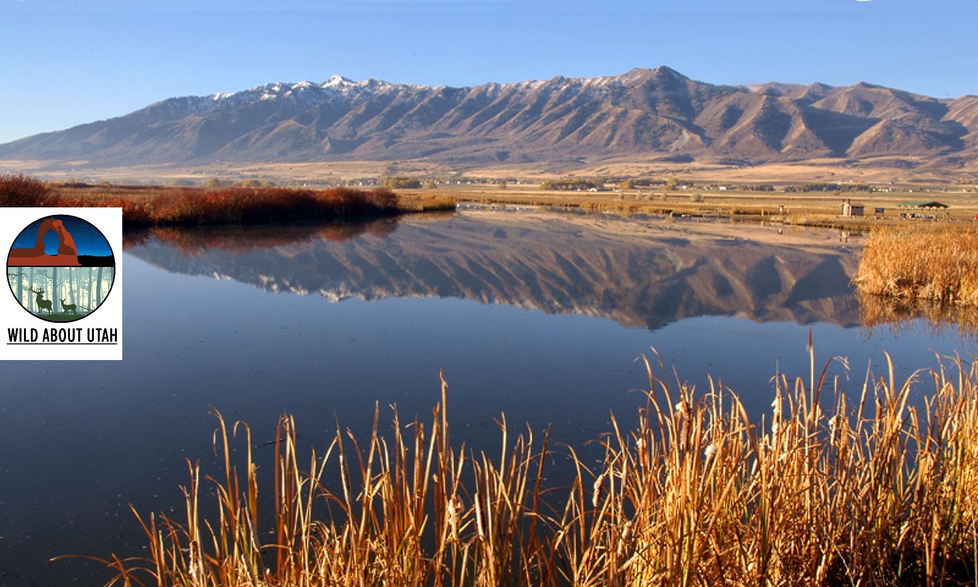
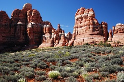
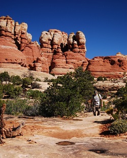
The Geology of Canyonlands National Park

Chesler Park
Canyonlands National Park
Photo Courtesy and Copyright Kurt Repanshek, Photographer

Chesler Park
Canyonlands National Park
Photo Courtesy and Copyright Kurt Repanshek, Photographer

Baked by time like some multi-layer geologic tort, Canyonlands National Park in southeastern Utah features a landscape cut by canyons, rumpled by upthrusts, dimpled by grabens, and even pockmarked, some believe, by ancient asteroids.

Just outside of Moab rises a kaleidoscope of tilted and carved geology laid down over the eons. There’s the red and white Cedar Mesa sandstone, the grayish-green Morrison Formation, pinkish Entrada sandstone, and tawny Navajo sandstone, just to name some of the geologic layers. Stacked like pancakes, they help make Canyonlands the most rugged national park in the Southwest and, quite possibly, if you find yourself deep in the park’s Maze District, in the entire Lower 48 states.

In each of the park’s districts — Island in the Sky, Needles, Maze and Horseshoe Canyon — the remarkable effects of geologic time and its endless erosion on this sedimentary landscape rise about you.

If you could turn back the geologic clock, you would see the landscape flooded by oceans, crisscrossed by rivers, covered by mudflats and buried by sand. At various times through the millennia, the climate has resembled a tropical coast, an interior desert, and everything in between.

For hundreds of millions of years, material was deposited. Layer upon layer of sedimentary rock formed as buried materials were cemented by precipitates in the ground water. Each layer contains clues to its origin, such as patterns or fossils, which reveals the environment when it was deposited. For example, the colorful Cedar Mesa Sandstone occurred when periodic floods of iron-rich debris from nearby mountains inundated coastal dunes of white sand.

Along with sedimentation, movements in the earth’s crust altered surface features. The North American continent migrated north from the equator and the local climate and environment here changed dramatically.

Peer into the ragged maw of Canyonlands from the Island in the Sky District on the northern end of the park, and it’s no mystery how the park came by its name.

Spend the night at the Squaw Flat Campground in the Needles District and a morning hike into Chesler Park surrounds you with Creamsicle-hued minarets towering high above, like a king’s crown.

Though Canyonlands covers less than 350,000 acres, which is less than one-seventh the size of Yellowstone National Park, it feels much larger. No doubt it’s the park’s vastness and openness — you won’t find any forests here. Indeed, one old timer said that, “On a clear day, you can see the back of your own head.”

Spend a few minutes contemplating the natural forces, and the hundreds of millions of years that laid down these sediments and compressed these layers of rock. It’s really only recently that these layers have eroded to form the remarkable landscape seen today in Canyonlands National Park.

For Wild About Utah and National Parks Traveler, I’m Kurt Repanshek.

Credits:
Image: Courtesy and Copyright Kurt Repanshek, www.nationalparkstraveler.com
Text:     Kurt Repanshek, NationalParksTraveler.com.


Additional Reading:

Canyonlands National Park, National Parks Service,

Exploring The Parks: Musings From Island In The Sky At Canyonlands National Park, NationalParksTraveler.com Article – Lee Dalton – 06/24/2014

Exploring The Parks: Musings From The Needles District In Canyonlands National Park, NationalParksTraveler.com Article – Lee Dalton – 06/19/2014

Reflections Of Time In Canyonlands, NationalParksTraveler.com Article – Lee Dalton – 06/19/2014

https://www.nationalparkstraveler.com/search/apachesolr_search/canyonlands, NationalParksTraveler.com Canyonlands Articles

Hylland, Rebecca, What are Igneous, Sedimentary & Metamorphic Rocks?, Glad You Asked, Utah Geological Survey, https://geology.utah.gov/map-pub/survey-notes/glad-you-asked/igneous-sedimentary-metamorphic-rocks/

Wilderness 16 Feb 2015

Wilderness. The word conjures up romantic images of wide open landscapes teeming with birds, beasts, and plants. I imagine places untouched by human influence – truly wild and free. Places that are exotic and far away.

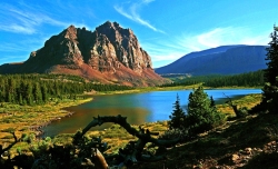
High Unitas Wilderness, Utah, Courtesy Wilderness.net, Copyright 2009 Cordell Andersen, Photographer www.cordellmandersen.com
High Unitas Wilderness, Utah
Courtesy Wilderness.net
Copyright © 2009 Cordell Andersen, Photographer

Red Butte Wilderness, Utah, Courtesy Wilderness.net, Copyright 2011 Paul Gooch, PhotographerRed Butte Wilderness, Utah
Courtesy
Wilderness.net
Copyright © 2011 Paul Gooch, Photographer

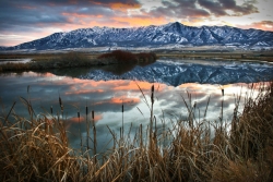
Wellsville Mountain Wilderness, Utah, Courtesy Wilderness.net, Copyright 2011, Dusty Vaughn, PhotographerWellsville Mountain Wilderness, Utah
Courtesy Wilderness.net
Copyright © 2011 Dusty Vaughn, Photographer

Paria Canyon, Vermilion Cliffs Wilderness, Courtesy Wilderness.net, Copyright © 2011 Mike Salamacha, Paria Ranger, BLM, PhotographerParia Canyon
Vermilion Cliffs Wilderness
Courtesy Wilderness.net
Copyright © 2011 Mike Salamacha, Paria Ranger, BLM, Photographer


But wilderness exists much closer than you may think.

The United States Congress adopted the Wilderness Act with a nearly unanimous vote in 1964. Ours was the first country in the world to define and designate wilderness areas – lands valued enough to be set aside for the purpose of protection.

Currently, the Wilderness Act protects 757 individual wilderness areas across the United States – totaling more than 109 million acres. Thirty-three wilderness areas are found in Utah, and they protect a variety of unique landscapes from the red rock desert found in Red Butte Wilderness to the alpine forests of the High Uintas Wilderness. While the landscapes may look incredibly different from one wilderness area to the next, these lands share a number of qualities which can be described by adjectives such as peaceful, quiet, untouched, and pristine.

These areas protect some of the most unique and incredible landscapes that Utah has to offer, but that doesn’t mean they’re off limits. Our wilderness areas are just that – ours. They are public lands, accessible to anyone who wants to visit – so long as you tread lightly.

Areas that fall under its protection are described in the Wilderness Act as “lands designated for preservation and protection in their natural condition…” which “…shall be devoted to the public purposes of recreation, scenic, scientific, educational, conservation and historic use.” These amazing lands were set aside in 1964 with an eye to the future and because of it, should still be around for your grandchildren’s grandchildren to enjoy.

There is an ongoing effort to educate Americans about the immense value of preserving wilderness areas. For without education, they may one day be selfishly reclaimed and lost. One of these educational opportunities is coming to Logan on April 13th and 14th. The Arthur Carhart National Wilderness Training Center will be hosting a teacher training workshop in conjunction with the Stokes Nature Center and the Utah Society for Environmental Education. The workshop is aimed at teachers in grades 5-8, though anyone is welcome to attend. For more information, please contact the Stokes Nature Center at www.logannature.org

Not a teacher? The best way to learn about wilderness areas is to go visit one! Information, and photos of Utah Wilderness Areas, can be found at www.wildaboututah.org

For the Stokes Nature Center and Wild About Utah, this is Andrea Liberatore.

Credits:

Photos: Courtesy Wilderness.net, Steve Archibald, (Individual Copyrights noted)
Text:    Andrea Liberatore, Stokes Nature Center, logannature.org

Additional Reading:
The Arthur Carhart National Wilderness Training Center:
wilderness.net

Wilderness Investigations teacher training workshop:
logannature.org/wi_workshop

Capitol Reef

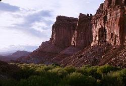
Fruita and the Wingate Cliffs
Capitol Reef National Park
Photo Courtesy US NPS

Orchard
Capitol Reef National Park
Photo Courtesy US NPS

Early settlers to the landscape we know as Capitol Reef National Park in south-central Utah planted cherry, apricot, peach, pear, apple, and walnut trees as a cash crop for survival along the Fremont River bottoms. Visitors today are often surprised by the fruit trees in light of the surrounding desert climate, and campers can pick apples and peaches from their campsites in the orchards. But the green fields and fruit trees also attract deer, marmots, and other small critters, which are easy to spot and are comfortable with humans in their environment.

Though the deer roam free in the tall grass between apple trees, there are other species that are a bit more dangerous lurking nearby. Mountain lions and black bears skillfully stalk around this historic district of Fruita without being seen. Mountain lions have been spotted within a half-mile of the popular campground, yet little is known about the species within the confines of Capitol Reef. With so many questions unanswered about the predator and prey relationship in the unique landscape, the park has received a Disney Nature Impact Grant to enlighten us.

Lori Rome, the park’s chief of interpretation, says, “We are setting up 10-20 infrared motion detected camera traps in surrounding areas. This is a non-invasive way to learn basic information about the species.”

The cameras will provide useful evidence and reveal the patterns of the quiet predators in the park. The public will be engaged through a citizen science project using social media and public interpretive programming, for example helping to survey deer populations.

If you’ve seen Disney Nature’s movie Bears, you, too, helped contribute to the Disney Nature Impact Grants program. Fourteen national parks are receiving funding via proceeds from the movie. Disney Nature has pledged a contribution to the National park Foundation, the official charity of America’s national parks, through the Disney Worldwide Conservation Fund, for each person who saw the film during its first week in theaters.

This type of support helps preserve and protect Capitol Reef and the rest of the National Park System. The Disney Nature Impact Grant enables parks to conduct much-needed conservation projects, such as studying mountain lions at Capitol Reef.

Each park selected to receive a grant through this program had to demonstrate a clear need for the money, and how it would make a profound difference in habitat restoration, wildlife protection or conservation research. With this assistance, we should be able understand predator’s actions in Capitol Reef National Park.

For Wild About Utah and National Parks Traveler, I’m Kurt Repanshek.

Credits:
Image: Courtesy and Copyright Kurt Repanshek, www.nationalparkstraveler.com
Text:     Kurt Repanshek, NationalParksTraveler.com.


Additional Reading:

Capitol Reef And 13 Other National Parks Receive Impact Grants From Disney Nature’s Movie “Bears”, Submitted by Carli Jones, June 26, 2014, NationalParksTraveler.comhttps://www.nationalparkstraveler.com/2014/06/capitol-reef-and-13-other-national-parks-receive-impact-grants-disney-natures-movie-bears25263

Capital Reef National Park, https://www.nationalparkstraveler.com/park/capitol-reef-national-park

Capital Reef National Park, https://www.nps.gov/care/index.htm

Mammals in Capital Reef National Park, https://www.nps.gov/care/naturescience/mammalchecklist.htm
Amphibians in Capital Reef National Park, https://www.nps.gov/care/naturescience/amphibians.htm
Fish in Capital Reef National Park, https://www.nps.gov/care/naturescience/fish.htm
Birds in Capital Reef National Park, https://www.nps.gov/care/naturescience/birds.htm
Reptiles in Capital Reef National Park, https://www.nps.gov/care/naturescience/reptiles.htm