You, Too, Can Teach Outside!

A few months ago, I shared a piece on this program called “Why I Teach Outside.” In it, I discussed the academic research and my personal anecdotes that reaffirm the education community’s movement toward experiential learning and learning beyond the four walls of a classroom. But it was mostly theoretical—an explanation more of WHY experiential learning in nature works than HOW it can be implemented. Then, my third graders were sent home for the year. And I started getting emails. Parents needed ideas to supplement the online curriculum and to ultimately get their children unplugged on a regular and healthy basis. So, here are a few of my ideas.

There is probably no greater privilege as an educator than to witness the natural and emphatic curiosity of youngsters. Use that to your advantage. You’ll find that it’s rather simple. Let’s start with that most boisterous and emphatically curious age group of all—the lower elementary students: Kindergarten through 2nd grade. Science is the low-hanging curricular fruit for this age group outside, but it’s also rich with wonder—things in the natural world that make kids say “Huh?! What? WHY? HOW?” We call those things phenomena, and you can find them in your backyard. Have your Kindergartner explore the plant life around your home, making observations about the similarities and differences they notice between the various species. Ask guiding questions of them to help them arrive at an explanation for those patterns they find in nature. Help your first grader investigate the various sounds made by natural objects found in your yard or neighborhood. Why, for instance, does a rock make a sharp, high-pitched cracking sound when hit against another rock but creates a dull, low-pitched thud when dropped onto the ground? Second graders can move into more complex explorations of properties of matter. Have your child make a house out of leaves and sticks. Then, have them explain why they used particular materials in specific ways? What is their reasoning?

Upper elementary students in grades 3 through 5 or 6 can begin making connections between the natural world and their own lives. Moving beyond the science curriculum, I sent my third graders on a socially-distanced driving tour of Cache Valley. Without leaving their vehicles, students were able to study their communities and identify necessary natural resources that humans in the area require to survive. Fourth grade social studies curriculum is focused on Utah. Wherever you live, there is an important and noteworthy social artifact nearby that you can explore while also observing conservative social distancing measures. That research I mentioned earlier tells us definitively that even just being outside helps our brains make new connections and create better understandings. Fifth and sixth grade social studies focus in part on the rights and responsibilities of humans. What better time to sit beneath a tree and think and write about those questions of liberty and social responsibility. That journal will become a primary resource for future generations eagerly asking, “What was it like? How did you handle everything?” I for one, have to get out into the bright, green world to be able to handle life quarantined indoors.

We can’t forget socialization, either, which is one of the most important parts of middle and high school. How do we combine the natural world, social networking, and social distancing?! My school’s staff discussed Earth Day activities recently as a way of getting kids and families unplugged and active. Have your older students brainstorm with friends via video conference, text messaging, phone calls, or social media ways in which they can, individually but as a group, promote the welfare and stewardship of our planet. Pick up trash around the neighborhood; plant a garden; write a letter to a legislator. They will find what’s important to them.

These suggestions are not an exhaustive list of course. But, no matter what you end up doing with whichever age group children you have, remember, more important than the academic rigor of your homeschooling is the physical, mental, and emotional well-being of your children. Help them flourish during this difficult time. Unplug the computer. Get them outside.

I’m Josh Boling, and though I’m stuck at home, I’m still Wild About Utah!
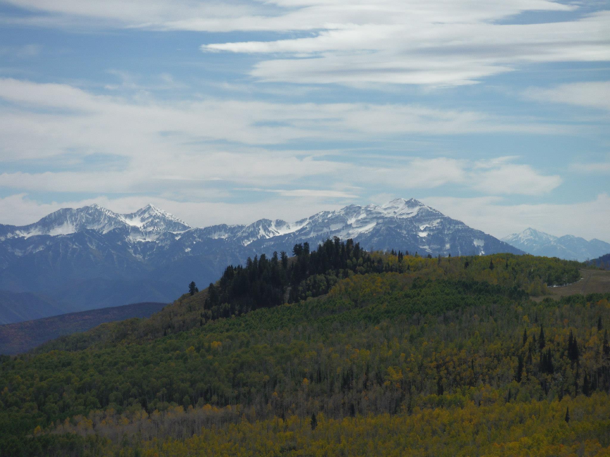
Credits:

Photos: Courtesy & Copyright Josh Boling
Sound: Courtesy & Copyright
Text: Josh Boling, 2018

Additional Reading

Boling, Josh, Why I Teach Outside, Wild About Utah, November 11, 2019, https://wildaboututah.org/why-i-teach-outside/

OutdoorClassroomDay.com, https://outdoorclassroomday.com/resources/

Third Grade Nature Activities, Education.com, Inc, a division of IXL Learning, https://www.education.com/activity/third-grade/nature-activities/

40 Wet and Wild Outdoor Science Projects and Activities, wearteachers.com, Shelton, CT, https://www.weareteachers.com/contact-weareteachers/

Imaginary Wanderings

Imaginary Wanderings: The edge of the Great Basin, top of the Bear River Range Courtesy & Copyright Josh Boling, Photographer
The edge of the Great Basin, top of the Bear River Range
Courtesy & Copyright Josh Boling, Photographer
I’ve fancied a certain type of wandering lately—to grab my pack and boots and walk the lines of Utah’s political border—a trail made not of dirt and stone, but of imaginary lines of latitude and longitude. But, as of yet, I haven’t found the time or resources to do so beyond my own imagination and the 3 or 4 minutes I have with you now. Come join me in a stroll around Utah, at least the way I’ve imagined it.

Walking north out of Logan, I’ll wander through the grid-patterned neighborhoods that pepper the flanks of the Bear River Range, the still-snowy peaks that serve as sentinels over my daily commute and the adventure on which I embark now. They serve another, greater purpose, too, though. Without the Bear Rivers, the Rocky Mountains would be otherwise dissected. The snowy peaks I adore and which now pass in slow motion over my right shoulder form the only range of mountains that connect the northern and southern Rockies. Though they only measure about 70 miles in length, they provide a critical ecological thoroughfare from the south end of Cache Valley, Utah, north to Soda Springs, Idaho.

I won’t follow them that far, though. I’ll turn left (west) at the Idaho border toward the Great Basin.

I’m technically already there. We all are if we live along the Wasatch Front. And there are just a few minor ranges—the Clarkston Range, Blue Spring Hills, and the northern fingerling ridges of the Promontory Mountains—to wander across before reaching the Great Basin proper.

My favorite hidden gem of this often-overlooked portion of Utah are the Raft River Mountains. Like the mighty Uintas to the east, the Raft Rivers run East-to-West. So, despite being a stone’s throw from the Great Salt Lake, the tributaries running off their northern flanks drain not into the Great Basin and the Great Salt Lake, but north onto the Snake River Plain toward the Columbia River and, eventually, the Pacific Ocean.

The Tri Corners Landmark is a simple granite pillar sticking 3 or 4 feet out of the sand amongst wind-whipped sage brush. It’s easy to miss, but marks some interesting irregularities. Utah’s political border is not, in fact, made up of straight lines. According to cartographer Dave Cook, surveyors who created the state’s initial boundaries hastily covered ground with their crude survey instruments. They were paid by the mile, so they were more interested in finishing quickly than correcting any errors they made along the way.

The border wiggles at least four times by my calculations—one of which comprises two right angles—as it wanders across ridgelines and through the dusty draws of the basin and range mountains toward the Mojave Desert of southwest Utah.

Imaginary Wanderings: The wrinkled topography if the Colorado Plateau Courtesy & Copyright Josh Boling, Photographer
The wrinkled topography if the Colorado Plateau
Courtesy & Copyright Josh Boling, Photographer
I won’t be there for long, though. The border only runs for roughly 50 miles along the two legs of the right triangle that constitutes Utah’s allotment of the Mojave Desert before it climbs up onto the Colorado plateau. Ed Abbey famously compared the wrinkled topography of Utah, particularly his beloved canyon country of the Colorado Plateau, to the two largest of our states. “Alaska is our biggest, buggiest, boggiest state,” Abbey wrote. “Texas remains our largest unfrozen state. But mountainous Utah, if ironed out flat, would take up more space on a map than either.” Ropes, technical climbing and canyoneering gear, and a fair amount of fortitude would be required here.

The eastern border we share with Colorado is a varied expanse of high desert plateaus, rugged cliffs, out-of-place riparian zones, and a few spectacular snow-capped mountain ranges leading through some of the most beautiful and gloriously desolate places on the planet. The Book Cliffs, Dinosaur National Monument, and the La Sal Mountains come to mind.

A short walk distance-wise would require heaps of route finding across the Green River’s Flaming Gorge and along the northern toes of the Uinta Mountains. Here is perhaps the greatest of Utah’s geologic juxtapositions. Low basins adjacent the Intermountain West’s highest peaks.

Imaginary Wanderings: A view of the high Uintas from their northern foothills Courtesy & Copyright Josh Boling, Photographer
A view of the high Uintas from their northern foothills Courtesy & Copyright Josh Boling, Photographer
I’ll take my first right turn at the western edge of the Uinta foothills. Here I might skip the formalities of a longitudinal walk—stick my thumb out instead, and make a bee-line for Bear Lake, Logan Canyon, and home: the walks I’ve already known for some time.

Perhaps you’re inspired now to know parts of this walk better yourself.

I’m Josh Boling, and I’m Wild About Utah!

Credits:

Imaginary Wanderings:
Photos: Courtesy and Copyright Josh Boling, Photographer
Audio: Includes audio from
Text: Josh Boling, 2020, Edith Bowen Laboratory School, Utah State University

Sources & Additional Reading

Boling, Josh, Why I Teach Outside, Wild About Utah, November 11, 2019, https://wildaboututah.org/why-i-teach-outside/

Kiffel-Alcheh, Utah, National Geographic Kids, https://kids.nationalgeographic.com/explore/states/utah/

The Geography of Utah, NSTATE LLC, https://www.netstate.com/states/geography/ut_geography.htm

Fisher, Albert L, Physical Geography of Utah, History to Go, Utah Division of State History, https://historytogo.utah.gov/physical-geography-utah/

Snowshoes and Adaptations

Snowshoes and Adaptations: Receiving Instructions in Snowshoeing Courtesy & Copyright Josh Boling, Photographer
Receiving Instructions in Snowshoeing
Courtesy & Copyright Josh Boling, Photographer
“No, no, no!”

“Don’t try to help me up yet,” I instructed, choking back laughter through a face full of snow.

Third graders teetered in their snowshoes on the edge of the tree well with mixed emotions written on their faces—equal parts concern and confusion. I was sunk to my armpits in snow, insisting that they not help me out of it. The learning had begun.

Snowshoes and Adaptations: Stomping a flat, hard-pack clearing into the deep snow Courtesy & Copyright Josh Boling, Photographer
Stomping a flat, hard-pack clearing into the deep snow
Courtesy & Copyright Josh Boling, Photographer
We were in the trees, high in the canyon, there to discuss the winter adaptations of local wildlife while an inch an hour of fresh powder fell from above. I had stepped onto a shallow layer of snow that covered a spruce sapling just as I was explaining the similarities between the snowshoes on our boots and the feet of the snowshoe hare. The timing was impeccable.

“I guess we’re not as good as the snowshoe hare,” one student quipped as a flurry of helpful hands and a borrowed ski pole finally freed me from the hole.

Stomping a flat, hard-pack clearing into the deep snow Courtesy & Copyright Josh Boling, Photographer
Stomping a flat, hard-pack clearing into the deep snow
Courtesy & Copyright Josh Boling, Photographer
“No, I guess not,” was my reply. “So how do we survive here, then?”
Snow continued to fall while students offered up their hypotheses: “We have tools, like coats and snowshoes and ski poles”; “we help each other, like a community!” “We don’t have special body parts, so we have to try new things to survive.”

Someone mentioned “structural adaptations.” A familiar murmur of agreement as someone used another science term, “behavioral adaptations,” language maybe once thought too complex for 9-year-olds. But it was language students had developed over the course of a few months closely studying the wildlife of Utah—language they were putting to work now, constructing new understandings of the world in real time.

Enjoying the Snow, Courtesy & Copyright Josh Boling, Photographer
Enjoying the Snow,
Courtesy & Copyright Josh Boling, Photographer
We needed to keep moving, so my colleague and co-wilderness-guide for the day introduced the kids to another behavioral adaptation used by herds of deer. Minutes later, 13 energetic bodies were performing the mule deer “snow dance,” stomping a flat, hard-pack clearing into the deep snow. “No more post-holing,” he told the kids. He let the new vocabulary word sink in while we rested and ate a snack, much like a mule deer might.

As a matter of state law, the Utah State Board of Education expects third graders to, quote, “Engage in argument from evidence that in a particular habitat…some organisms can survive well, some survive less well, and some cannot survive at all” (UT SEEd Standards, 3.2.5, 2019).

Our Class The Joy of Teaching Outdoors Courtesy & Copyright Josh Boling, Photographer
Our Class
The Joy of Teaching Outdoors
Courtesy & Copyright Josh Boling, Photographer
Learning outdoors helps students connect academic content to lived experiences in real time. These students certainly had an argument to make as to how well-prepared an animal needs to be in order to survive a mountain winter. They lived the experiences themselves.

I’m Josh Boling, and I’m Wild About Utah.

Snowshoes and Adaptations-Credits:
Snowshoes and Adaptations
Photos: Courtesy and Copyright Josh Boling, Photographer
Audio: Includes audio from Josh Boling
Text: Josh Boling, 2020,

Snowshoes and Adaptations-Additional Reading

Boling, Josh, Why I Teach Outside, Wild About Utah, November 11, 2019, https://wildaboututah.org/why-i-teach-outside/

Strand, Holly, Shoeshoe Hare, Wild About Utah, November 18, 2010, https://wildaboututah.org/snowshoe-hare/

The Henry Mountain Bison

The Henry Mountain Bison: American Bison Courtesy US FWS Ryan Moehring, Photographer
American Bison
Courtesy US FWS
Ryan Moehring, Photographer
The Henry Mountains of southeast Utah are famous for being the last mountain range in the contiguous United States to have been officially mapped. Indeed, before they were mapped, they were often referred to as the “Unknown Mountains.” Another relative unknown detail about this range is that it harbors one of only five genetically pure, free roaming bison herds on North American public lands.

In 1941, a seed herd of 18 American Plains Bison (B. b. bison) were transplanted from Yellowstone National Park to the arid desert of Utah’s Robbers Roost. A year later, five more bulls were introduced to the herd in hopes of sufficiently diversifying the gene pool and sustaining the herd. The bison must not have found Robbers Roost as appealing as Butch Cassidy had, though, because this new Wild Bunch set out for literal greener pastures that very same year.

The small herd forded the Dirty Devil River and travelled southwest toward the Burr Desert. The herd stopped here for a while, enjoying their newfound buffet atop the Aquarius Plateau. 21 years later, though, in 1963, the still small herd grew tired of the desert and abandoned it altogether for the higher, more verdant snow fed meadows of the nearby Henry Mountains. Here, the herd thrived and quickly swelled in numbers.

Today, the herd’s population is estimated to be between 300 and 400 animals, which ecologists and wildlife biologists regard as the maximum carrying capacity of their Henry Mountain range. The Utah Division of Wildlife Resources has responded accordingly. In an effort to perpetuate the health of the herd and their range, the DWR began issuing “Once-in-a-lifetime” permits to hunters hoping to fulfill not only a tag but also a burning sense of adventure. The Henry Mountains, after all, were mapped last for a reason. They remain one of the most rugged and remote places in a state known for its rugged and remote places.

Fittingly, quite unlike their more quintessential Plains Bison brethren, the Henry Mountains bison can be found almost anywhere in the Henrys between the desert lowlands and timberline. Apparently no one has told the herd that Plains Bison don’t typically like high elevations or steep mountain slopes. This unique proclivity of the Henry Mountains herd to cast off behavioral stereotypes works in their favor when hunting season rolls around and they abandon the high, open meadows for steep, wooded canyons and thick groves of aspen and evergreens.

This highly adaptive nature unique to the Henry Mountains herd made it an obvious candidate to serve as a seed population in early 2010 when 39 individuals were transplanted from the Henry Mountains to the Book Cliffs along the Utah-Colorado border. These 39 animals were to serve as a genetic supplement to a relatively new herd first reintroduced to the Book Cliffs by the Ute Indian Tribe in 1986. The now 600-strong Book Cliffs herd is well on its way to reestablishing the American Plains Bison’s historic range in the Book Cliffs.

The story of the Book Cliffs and Henry Mountains Bison give us reason to hope that one day soon, the American Bison might reclaim its territory, a historic range that once ran from Alaska through the Canadian territories and the Great Plains to the Eastern Seaboard and the Gulf of Mexico. And, if so, the role the Henry Mountains herd will play in that expansion may be a significant one.

I’m Josh Boling, and I’m Wild About Utah.

The Henry Mountain Bison-Credits:

Photos: Courtesy US FWS, Ryan Moehring, Photographer
Audio: Includes audio from
Text: Josh Boling, 2019

The Henry Mountain Bison-Additional Reading

Wild About Utah pieces authored by Josh Boling

Utah’s Book Cliffs Herd, Bison Bellows Series, National Park Service, June 30, 2016, https://www.nps.gov/articles/bison-bellows-6-30-16.htm

How scientists brought bison back to Banff, National Public Radio, Feb 28, 2017, https://www.pbs.org/newshour/show/scientists-brought-bison-back-banff

Buffalo (Bison) on the Henry Mountains, Capitol Reef Country, Wayne County Tourism, https://capitolreef.org/blog/buffalo-bison-on-the-henry-mountains/

Henry Mountains, Utah.com, https://utah.com/henry-mountains

Bison Unit Management Plan, Unit #15 Henry Mountains, Utah Division of Wildlife Management, https://wildlife.utah.gov/hunting/biggame/pdf/bison_15.pdf

Gilman, Don, Rare, genetically-pure bison found in Utah’s Henry Mountains, St George News, Jan 12, 2016, https://www.stgeorgeutah.com/news/archive/2016/01/12/djg-genetically-pure-bison-found-in-utahs-henry-mountains/#.XB7nRs9KjfY

Henry Mountain Outfitters, HuntersTrailhead, https://www.hunterstrailhead.com/index.php?ID=147

Brian, Jayden, Utah Henry Mountain Bison Hunts, Bull Mountain Outfitters, LLC, https://henrymtnbisonhunts.com/

Henry Mountains bison herd, Wikipedia, https://en.wikipedia.org/wiki/Henry_Mountains_bison_herd