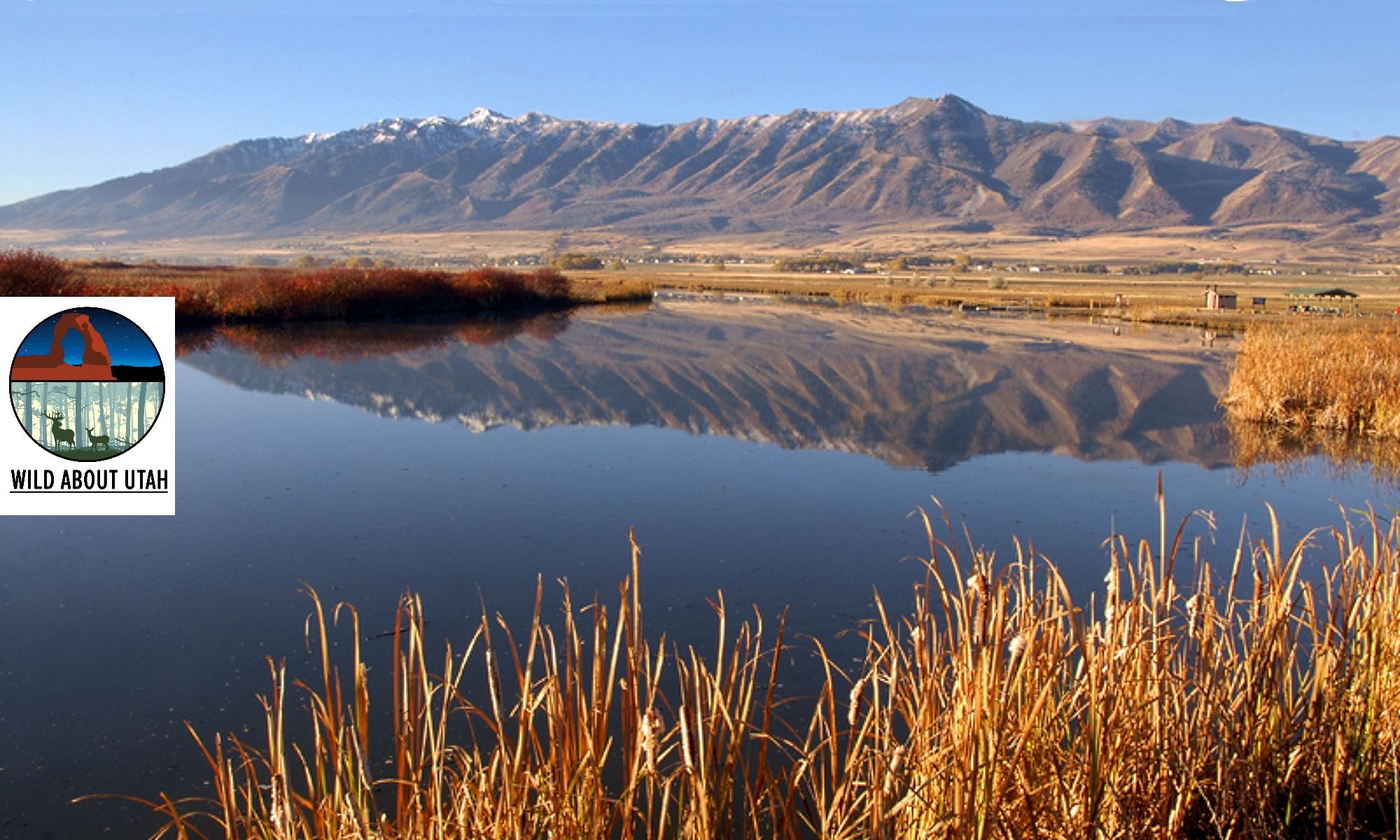

Courtesy & Copyright Mary Heers, Photographer
Wanting to know more, I dropped into the Honeyland store in Cache Valley and was soon mesmerized by the active cut-away hive on display. It was a teacher’s dream come true – hundreds of bees – all diligently on task. Wide-eyed, I watched as a bee flew in at the bottom of the screen through a tunnel under the window looking very much like a bike rider with two full paniers She deposited the full sacks of pollen and then she began to dance. This took me quickly to the internet to learn more.. The bees dance is called a “waggle dance” – a straight line calibrated to communicate how far away the food source is, and a circular return arc to orient the path to the food. The waggle dancing bee can direct her sisters to a food source up to five miles away.
I soon returned to the store’s cut away hive and finally found the queen – a bit tricky as she looks like all the others except she’s one and a half times bigger. I watched as she dipped her tail into one hexagonal cell after another. On a good day a queen will lay 2,000 eggs.
Busy, busy bees working together to set aside enough honey to feed themselves during the winter.
The poet Dick Paetzke once called honey “the soul of a field of flowers”
Mountain honey looks and tastes a little different than honey made by bees pollinating Cache Valley alfalfa. Both are incredibly delicious.
Aristotle got it right: “Honey is the nectar of the gods.”
This is Mary Heers and I am Wild About Utah.
Credits:
Photos: Courtesy & Copyright © Mary Heers
Text: Mary Heers
Additional Reading
https://thehoneybeeconservancy.org/
Burlew, Rusty, Honeybee Suite, https://honeybeesuite.com/
Honeybee, National Geographic Kids, https://www.nationalgeographic.com/animals/invertebrates/h/honeybee/
About The Honeybee, American Beekeeping Federation, https://www.abfnet.org/page/PollinatorFacts
Utah Beekeepers Association, https://www.utahbeekeepers.com/
Moab Bee Inspired Gardens, Utah State University, https://beeinspired.usu.edu/about/
Bee Fest 2020, Sponsored by Catalyst Magazine and Utah Museum of Natural History,
Recorded Facebook Livestream: https://www.facebook.com/events/2719162278365095/?post_id=2757236484557674&view=permalink
SLC Bee Fest Homepage: https://slcbeefest.com/?fbclid=IwAR3xJ4E-WMNm5hizCKiajsmu0brmG1kMKEwgS0IcWij0RwpjLYTdOu4bODs
Lower San Juan – Piute Farms Waterfall
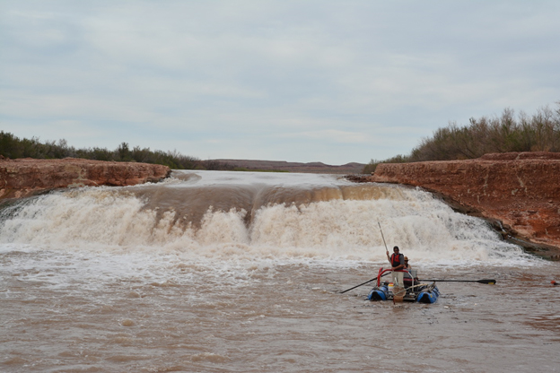
Courtesy & Copyright Mark McKinstry, Photographer
Piute Farms waterfall is a 25-ft high cascade that has formed along the San Juan River and spans its entire width. The location is a remote spot in an upstream arm of Lake Powell reservoir.
To reach the falls it takes a rough two-hour drive from Mexican Hat, or a 100-mile-boat ride from Bullfrog Marina in Lake Powell.
It formed when the tributary re-routed itself, cut through a thick layer of sediment, and began flowing over a bedrock cliff.
Scientists call this phenomenon superimposition.
Jack Schmidt, Janet Quinney Lawson Chair of Colorado River Studies in the Quinney College of Natural Resources at USU explains, “When reservoirs are created by the construction of dams, the sediment load of inflowing rivers is deposited in the most upstream part of the reservoir. In Lake Powell…the deposits in the…San Juan arm of the reservoir are as much as 80ft thick.”
“[If} reservoirs…drop…the inflowing rivers erode into the accumulated sediment. There is no guarantee the location of the new channel will be in the same place as…the original channel.”
The San Juan River’s original route was buried under the thick layer of sediment. The river’s response was to form a new channel one mile south of the original route and over the ridge.
Schmidt continues, “A [similar] thing…happened in Lake Mead reservoir where an unrunnable rapid formed near Pearce Ferry where the new Colorado River flows over a lip… [of] consolidated sediment. Although not a vertical waterfall, Pearce Ferry Rapid is sometimes more dangerous to boating than any rapid in the Grand Canyon!”
With future droughts, we can expect reservoirs to be at low levels for extended periods, and superimposition will continue to occur forming additional waterfalls and obstructions. Managers monitor the positive and negative effects of these changes.
One impact of the Piute Farms waterfall is a novel subpopulation of endangered razorback suckers which are now blocked from swimming upstream to spawn.

Captured near Piute Farms Waterfall
Courtesy & Copyright Mark McKinstry, Photographer
Zach Ahrens, Native Aquatics Biologist at Utah Division of Wildlife Resources and graduate student at USU says, “The razorback and other native fishes in the Colorado River basin have evolved over millions of years to play their roles in spite of the extremes of temperature and flow in their riverine environment. Given the uncertainty of future climate and water resources…it’s important to do what we can to ensure their continued survival.”
Before the waterfall formed, managers were not sure what percentage of razorback suckers travelled this far upstream.

Captured near Piute Farms Waterfall
Courtesy & Copyright Mark McKinstry, Photographer
Mark McKinstry, Biological Scientist from the Bureau of Reclamation, explains, “It took perseverance, technology, and dedication of a lot of different folks to find where…the Razorbacks are and understand the fish’s life history strategy.”
Peter MacKinnon with the Quinney College of Natural Resources at Utah State University and Biomark Inc. provided the technical expertise to set up a method to insert Razorback suckers with pit tags (similar to those used in cats and dogs) then track them with antennas placed below the falls.
With this tracking method, managers and researchers identified more than 1000 razorback suckers below the falls, apparently trying to ascend the waterfall. Approximately 2000-4000 suckers live in the San Juan River. It is estimated about 25% of the razorbacks are unable to spawn – because the waterfall blocks fish passage. This could influence the population of the endangered fish.
The Bureau of Reclamation consulted with experts on how to help razorback suckers get past the waterfall so they can move upstream and spawn. The most feasible suggestion seems to be, to build a naturalized fish passage around the side of the waterfall. Managers and volunteers would build a trap location on the upstream side of the passage where fish moving upstream could be captured; volunteers could then release the captured razorbacks and other native fish upstream where they choose to spawn.
Phaedra Budy, professor in the Watershed Sciences Department and Unit Leader for U.S. Geological Survey Cooperative Fish & Wildlife Research Unit said, “The Razorback sucker has intrinsic value to the San Juan River and beyond, is a critical member of the ecosystem, and deserves every effort for recovery.”
Managers and researchers hope their information gained and recovery efforts will give the endangered razorback suckers an increased chance for survival in its changing environment.
This is Shauna Leavitt and I’m Wild About Utah.
Credits:
Photos: Courtesy & Copyright © Mark McKinstry
Audio: Courtesy Western Soundscape Archive, University of Utah, Sound provided by The National Park Service, licensed under CCA-ND
Text: Shauna Leavitt, Utah Cooperative Fish and Wildlife Research Unit, Quinney College of Natural Resources, Utah State University
Sources & Additional Reading
Waterfall Still Blocks San Juan River, River Runners for Wilderness(RRFW), https://rrfw.org/riverwire/waterfall-still-blocks-san-juan-river
https://www.americansouthwest.net/utah/monument_valley/piute_farms.html
Razorback Sucker(Page 68), Utah’s Endandengered Fish, 2018 Utah Fishing Guidebook, Utah Division of Wildlife Services, https://wildlife.utah.gov/guidebooks/2018_pdfs/2018_fishing.pdf
Fish Ecology Lab, Utah State University,
https://www.usu.edu/fel/
The Colorado Plateau
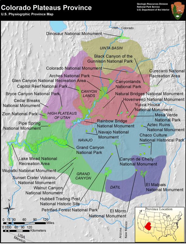
Colorado Plateaus Province
US Physiographic Province
Courtesy US National Park Service
If you have ever been to a museum you have witnessed historical items that may be hundreds, or thousands of years old. When we look outdoors at the natural geology of our planet earth, we may be witnessing things that are hundreds of thousands, or even millions of years old.
I realize that there are some people who disagree with the aging with which some scientists label various mountains and canyons, so let’s just settle on the fact that some of these places are very, very old.
There is only one place in the United States where a person can put his feet and hands in four different States at the same time, and that place is called The Four Corners. The story behind this incredible area deals with the formation of what is known as the Colorado Plateau. This area covers 130,000 square miles in Utah, Colorado, New Mexico, and Arizona. If you have ever been to any of Utah’s Mighty Five National Parks you are on the Colorado Plateau, but it’s much more than that. There are 3 national recreation areas, 10 national parks, and 16 national monuments all included in that amazing geologic formation.
Scientists say that millions of years ago tropical seas covered the Plateau region where layers of limestone, sandstone, silt and shale were continually deposited. When upheavals began to lift the plateau, and mountain-building events occurred, volcanic eruptions also accented the western area. Eras of various rivers, lakes, and inland seas continued to leave sediment deposits known as the Chinle, Moenave and Kayenta layers. Later, a huge desert formed the Navajo, Temple-Cap and Carmel formations.
Tectonic activity began to uplift the Plateau nearly two miles high and slightly tilt it to the west. Rivers and streams responded with increased downcutting and erosion which revealed scenic wonders from narrow slot-canyons to huge cuts in the earth’s surface. Perhaps you have heard the term “Grand Staircase” which describes the descent in altitude from Bryce Canyon down to Zion Canyon and further down to the Grand Canyon in Arizona. About ninety percent of the area is drained by just a few rivers including the Colorado, Green, San Juan, Little Colorado and the Rio Grand.
Why emphasize the geology? Besides climate, think how the soil and rock formations determine water retention and flow directions. How water and soil then determines the plant life in an area. And finally, how all three of those components determine what wildlife will exist in that same area.
So the next time you visit Utah’s Mighty Five: Arches, Bryce Canyon. Canyonlands, Capitol Reef, or Zion Canyon, try to picture yourself atop a huge natural table-top with incomparable scenery.
This is Ron Hellstern, and I am Wild About Utah.
Credits:
Images: Courtesy & Copyright
Audio: Courtesy and Copyright Kevin Colver
Text: Ron Hellstern, Cache Valley Wildlife Association
Additional Reading
Colorado Plateaus Province, Physiographic Provinces, National Park Service, https://www.nps.gov/articles/coloradoplateaus.htm
Geologic Provinces of the United States: Colorado Plateau Province, USGS Geology in the Parks, USGS, https://archive.usgs.gov/archive/sites/geomaps.wr.usgs.gov/parks/province/coloplat.html
Annerino, John, Colorado Plateau Wild and Beautiful, Farcounty Press, April 1, 2014, https://www.amazon.com/Colorado-Plateau-Wild-Beautiful-Annerino/dp/156037585X
Hylland, Rebecca, What are Igneous, Sedimentary & Metamorphic Rocks?, Glad You Asked, Utah Geological Survey, https://geology.utah.gov/map-pub/survey-notes/glad-you-asked/igneous-sedimentary-metamorphic-rocks/
The River
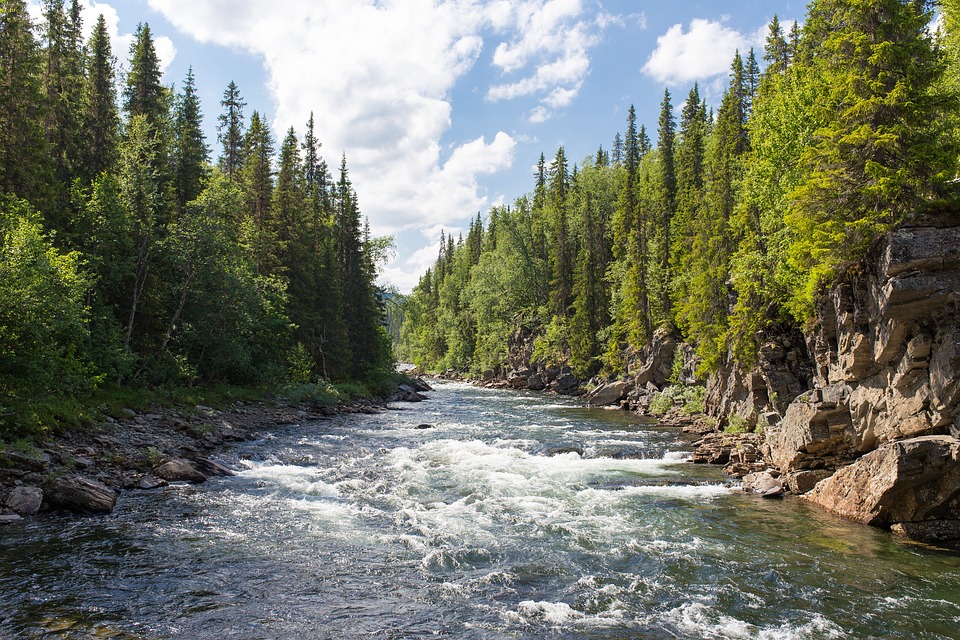
Per Josh Boling
See:
https://pixabay.com/photos/river-rapids-gulch-water-stream-1209025/
There were three of us in the boat, friends who had met guiding rivers back east nearly a decade before. We had brought an 11-foot bucket-raft against one of the gnarlier western rivers at high spring runoff—a dinghy taking on a white whale. You can always hear the whitewater before you finally see it, especially the big rapids. We had come upon it faster than anticipated. Limestone outcroppings constricted the river into a bottleneck here where it makes a dog-leg to the left; and, at 20,000 cubic-feet-per-second, the river curls back onto itself at the crest of a frothing wave. There is no formula for it; no predictability. “What do I do?” the one in back steering shouted at me. “I don’t know!” I shouted back. We tilted down into the trough of the wave.
A river is never the same twice. Fluvial geomorphology says so. Fluvial geomorphology is the study of the ways in which a river moves, changes, and interacts with its channel and the landscape around it. People who study this sort of thing talk about the character of a river and how it changes with the smallest variability. A misplaced cobble of the riverbed causes a riffle where there once wasn’t one previously; an eddy develops, changes directional flow; the river is never the same again. I have always been fascinated by this. The fluid mechanics at work in a river must be respected and understood, even if they can’t always be predicted.
We rode the wave to its frothy crest where we were thrown like rag dolls, luckily, to the center of the boat rather than overboard. At the apex of the wave, we were stuck like glue to the water as it boiled in all directions—inward, outward, upstream, and back down. “Paddle hard!” one of us shouted as we scrambled back into position, jamming our paddles into the teeth of the wave. We spun this way and that and almost back down the wave before the river released us. We shouted in triumph for the sheer thrill of experience, and because we had all managed to stay in the boat. Something I wouldn’t have predicted.
If you could freeze time and analyze the cross-sections of a whitewater wave, you might come up with a formula to explain water’s frozen movements; but the formula would never be the same twice. The river says so.
I’m Josh Boling, and I’m Wild About Utah!
Credits:
Image: Courtesy & Copyright Josh Boling
Sound: Courtesy Friend Weller, Utah Public Radio
Text: Josh Boling, 2019, Bridgerland Audubon Society
Sources & Additional Reading
Utah Water Research Laboratory, Utah State University, https://uwrl.usu.edu/