Utah’s Petroglyph Garden

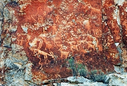
Click to view Petroglyph Panel at the Fremont Indian State Park & Museum, Photo Courtesy Sevier County, Kreig Rasmussen, Photographer
Petroglyph Panel at Fremont Indian State Park & Museum
Photo Courtesy Sevier County
Kreig Rasmussen, Photographer

Hi, I’m Ru Mahoney with Stokes Nature Center in Logan Canyon.

Utah’s culture is rich with vestiges of our pioneer history, and the landscape is accented by visible signs of the European settlers who forged our modern communities. But the tapestry of Utah’s cultural heritage is interwoven with much older threads, as indelible and enduring as the landscape itself.

In the 1980’s, in the southwestern quadrant of central Utah, the construction of interstate 70 unearthed a secret over one thousand years old. The valleys and canyons of what is now Sevier County, already known as a seasonal thoroughfare for the Paiute, had an even older history as home to the largest community of Fremont Indians ever discovered. Influenced by their Anasazi cousins to the southwest, the Fremont culture encompassed a diverse group of tribes that inhabited the western Colorado Plateau and the Great Basin area from roughly 400 to 1350 A.D. Archaeologists tell us they were a people of ingenuity in their engineering, aggression in their social interactions, and lasting creativity in their artistic expression. Divergent theories on their fate suggest they drove the Anasazi out of the Four Corners region and eventually migrated to further landscapes, or that northern groups of Fremont peoples joined with bands of Shoshone and became the Ute Indians of the Uinta. Whatever the truth of their ultimate fate may be, nowhere is their history more tangible than at Fremont Indian State Park just south of Sevier, UT along I-70. This year-round state park offers visitors a treasure trove of artifacts and curated exhibits in an excellent visitor’s center. But the most authentic interaction with these past peoples comes from exploring the surrounding landscape.

Driving the winding road into Clear Creek Canyon, ghostly figures begin to emerge; pictographs painted in shades of ocher and umber, and pale petroglyphs carved into the canyon walls, reveal an archaic and epic account of Utah’s ancestral past. A unique creation story, in which a shrike leads the Fremont people from a dark and cold underworld through the stem of reed into the warm world above, plays out across the canyon walls. A craggy outcrop of rock in the shape of an eagle is said to be watching over the reed to the underworld below to insure nothing wicked escapes into our world. A concentric lunar calendar and an abundance of zoomorphics speak of a cultural identity conceived in relation to the broader astrological world, and a reverence for anthropomorphized neighbors such as bighorn sheep and elk. Spider Woman Rock juxtaposes a powerful figure of Native American mythology with the pedestrian humility of a nursing mother. And Cave of 100 Hands is a visceral exhibition of a humanity simultaneously reminiscent and divergent from our own.

While the Fremont culture is believed to have died out or been absorbed by other modern groups, Clear Creek Canyon and the rock art sites of Fremont Indian State Park are significant among the modern Kanosh and Koosharem Bands of the Paiute who began using the area and leaving their own indelible marks on the canyon walls after the disappearance of the Fremont peoples around 1400 A.D. On the vernal and autumnal equinox (occurring in the third or fourth week of March and September each year) the eagle rock casts its shadow over the reed rock at dawn, breathing life into ancient tales of our ancestral history.

Fremont Indian State Park is a notable destination for those interested in rock art sites, many of which are suited to families of all ages and mobility, including visitors with strollers and wheelchairs. Stop in the visitor’s center to borrow or purchase a guide to the petroglyphs and pictographs for deeper insight into the Fremont culture and an unforgettable glimpse into Utah’s past.

For Wild About Utah and Stokes Nature Center, I’m Ru Mahoney.

Credits:
Images: Courtesy Sevier County, Kreig Rasmussen, Photographer
Text:     Ru Mahoney, Stokes Nature Center in Logan Canyon.


Additional Reading:

https://stateparks.utah.gov/parks/fremont-indian/

https://stateparks.utah.gov/stateparks/wp-content/uploads/sites/26/2015/02/Fremont_IndianBrochure.pdf

https://www.nps.gov/grba/learn/historyculture/fremont-indians.htm

https://www.thefurtrapper.com/fremont_indians.htm

Take the Pledge to Protect the Past, Utah State Historical Preservation Office, Department of Cultural & Community Engagement, State of Utah, https://ushpo.utah.gov/shpo/upan/
An Arizona Road Trip Back Into the Past

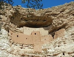
Montezuma Castle, Courtesy US NPS
Montezuma Castle
Courtesy US NPS
 
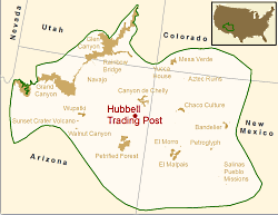
Location of Hubbell Trading Post NHS in the Southern Colorado Plateau Network,  Courtesy US NPSLocation of Hubbell Trading Post NHS in the Southern Colorado Plateau Network
https://science.nature.nps.gov/im/units/scpn/parks/hutr.cfm/[Nov 2, 2015]
Courtesy US NPS
 
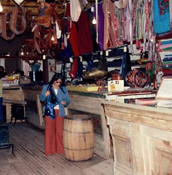
Hubbell Trading Post, Courtesy US NPSHubbell Trading Post Interior
Courtesy US NPS

Arizona is rich in history — from the 1800s all the way back to the Late Triassic Period. You can stitch together a road trip that winds out of Flagstaff to Montezuma Castle National Monument, to Petrified Forest National Park, and ends at Hubbell Trading Post National Historic Site. Along the way you’ll experience fascinating chapters of geologic and cultural history.

At Montezuma Castle, 45 minutes south of Flagstaff and just off Interstate 17 (Exit 289), a short walk places you in front of a 5-story-tall cliff dwelling that offered safety from invaders: it stands 100 feet above the valley floor, nestled into an alcove.

The site was misnamed Montezuma Castle in the late 1800s by whites who thought the structure had been built by the Aztec people. The original owners, members of the Southern Sinagua (seen aug wah) people, called this area home from roughly 1100-1425 A.D.

Stroll the short trail that loops around a vegetated landscape below the “castle,” and you’ll find great views as well of the remains of Castle A. That dwelling once rose 60 feet and was home to about 100 residents.

From Montezuma’s Castle, it’s 95 miles via Arizona 87 to Winslow, and then 34 miles east on Interstate 40 to Holbrook. Finally, another 19 miles southeast on Arizona 180 leads you into Petrified Forest National Park and its unusual landscape.

There’s no lodging within the park, and you have to leave by sundown, so you will need to make some tough decisions if you have just one day. Do you take time to tour the Rainbow Forest Museum with its dinosaur displays, or hike out to Agate House?

A building built of petrified wood is pretty cool, so stretch your legs with a walk to the house. Then head north and deeper into the park to the Crystal Forest Trail. Wander this path and you’ll find yourself surrounded by petrified wood with its hues of yellow, red, and green, black and white.

Blue Mesa is another great stop. There’s a trail that takes you down into another colorful landscape of badlands and chunks, logs, and even slabs of petrified wood in shades of red, blue, yellow and black.

The northern end of the park road is anchored by the Painted Desert, a great place for sunset photos. Here you’ll also see the Painted Desert Inn, which some day could put the Park Service back into the lodging business but today is just a museum piece.

Back on Interstate 40, drive 22 miles east to Chambers, and then north on U.S. 191 for about 38 miles to Ganado and Hubbell Trading Post. This authentic trading post was opened by John Lorenzo Hubbell in 1878 on the Navajo Reservation.

Although it was added to the National Park System in 1967, Hubbell is not a museum piece but an active trading post. As such, it still holds richly woven Navajo rugs, jewelry, and other Native American artworks for purchase.

Schedule your visit to Hubbell Trading Post for May and you just might be able to attend the annual Native American Art Auction. Check with the park (928-755-3475) for the exact date.

If you have a little more free time, you could extend your your trip by heading 39 miles north on 191 to Canyon de Chelly National Monument.

For Wild About Utah and National Parks Traveler, I’m Kurt Repanshek.

Credits:
Image: Courtesy and Copyright Kurt Repanshek, www.nationalparkstraveler.com
Text:     Kurt Repanshek, NationalParksTraveler.com.


Additional Reading:

Montezuma Castle National Monument, NationalParksTraveler.com, https://www.nationalparkstraveler.com/2012/03/visiting-montezuma-castle-national-monument-arizona9636

Montezuma Castle National Monument, US National Park Service, https://www.nps.gov/moca/index.htm

Geographic Area covered by the State of Deseret and Utah Territory, International Society Daughters of Utah Pioneers, https://www.dupinternational.org/dyn_page.php?pageID=54

An Arizona Road Trip Back Into the Past

Montezuma Castle, Courtesy US NPS
Montezuma Castle
Courtesy US NPS
 
Location of Hubbell Trading Post NHS in the Southern Colorado Plateau Network,  Courtesy US NPSLocation of Hubbell Trading Post NHS in the Southern Colorado Plateau Network
Courtesy US NPS
 
Hubbell Trading Post, Courtesy US NPSHubbell Trading Post Interior
Courtesy US NPS

Arizona is rich in history — from the 1800s all the way back to the Late Triassic Period. You can stitch together a road trip that winds out of Flagstaff to Montezuma Castle National Monument, to Petrified Forest National Park, and ends at Hubbell Trading Post National Historic Site. Along the way you’ll experience fascinating chapters of geologic and cultural history.

At Montezuma Castle, 45 minutes south of Flagstaff and just off Interstate 17 (Exit 289), a short walk places you in front of a 5-story-tall cliff dwelling that offered safety from invaders: it stands 100 feet above the valley floor, nestled into an alcove.

The site was misnamed Montezuma Castle in the late 1800s by whites who thought the structure had been built by the Aztec people. The original owners, members of the Southern Sinagua (seen aug wah) people, called this area home from roughly 1100-1425 A.D.

Stroll the short trail that loops around a vegetated landscape below the “castle,” and you’ll find great views as well of the remains of Castle A. That dwelling once rose 60 feet and was home to about 100 residents.

From Montezuma’s Castle, it’s 95 miles via Arizona 87 to Winslow, and then 34 miles east on Interstate 40 to Holbrook. Finally, another 19 miles southeast on Arizona 180 leads you into Petrified Forest National Park and its unusual landscape.

There’s no lodging within the park, and you have to leave by sundown, so you will need to make some tough decisions if you have just one day. Do you take time to tour the Rainbow Forest Museum with its dinosaur displays, or hike out to Agate House?

A building built of petrified wood is pretty cool, so stretch your legs with a walk to the house. Then head north and deeper into the park to the Crystal Forest Trail. Wander this path and you’ll find yourself surrounded by petrified wood with its hues of yellow, red, and green, black and white.

Blue Mesa is another great stop. There’s a trail that takes you down into another colorful landscape of badlands and chunks, logs, and even slabs of petrified wood in shades of red, blue, yellow and black.

The northern end of the park road is anchored by the Painted Desert, a great place for sunset photos. Here you’ll also see the Painted Desert Inn, which some day could put the Park Service back into the lodging business but today is just a museum piece.

Back on Interstate 40, drive 22 miles east to Chambers, and then north on U.S. 191 for about 38 miles to Ganado and Hubbell Trading Post. This authentic trading post was opened by John Lorenzo Hubbell in 1878 on the Navajo Reservation.

Although it was added to the National Park System in 1967, Hubbell is not a museum piece but an active trading post. As such, it still holds richly woven Navajo rugs, jewelry, and other Native American artworks for purchase.

Schedule your visit to Hubbell Trading Post for May and you just might be able to attend the annual Native American Art Auction. Check with the park (928-755-3475) for the exact date.

If you have a little more free time, you could extend your your trip by heading 39 miles north on 191 to Canyon de Chelly National Monument.

For Wild About Utah and National Parks Traveler, I’m Kurt Repanshek.

Credits:
Image: Courtesy and Copyright Kurt Repanshek, www.nationalparkstraveler.com
Text:     Kurt Repanshek, NationalParksTraveler.com.


Additional Reading:

Montezuma Castle National Monument, NationalParksTraveler.com, https://www.nationalparkstraveler.com/2012/03/visiting-montezuma-castle-national-monument-arizona9636

Montezuma Castle National Monument, US National Park Service, https://www.nps.gov/moca/index.htm

Geographic Area covered by the State of Deseret and Utah Territory, International Society Daughters of Utah Pioneers, https://www.dupinternational.org/dyn_page.php?pageID=54

Arches Wildlife

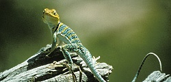
Western Collared Lizard
Arches National Park
Photo Courtesy US NPS

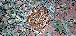
Spadefoot Toad
Arches National Park
Photo Courtesy US NPS

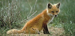
Red Fox
Arches National Park
Photo Courtesy US NPS
Lee Kaiser, Photographer

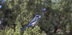
Western Scrub Jay
Arches National Park
Photo Courtesy US NPS
Neal Herbert, Photographer

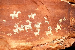
Petroglyphs
Arches National Park
Photo Courtesy and Copyright Kurt Repanshek, Photographer
NationalParksTraveler.com

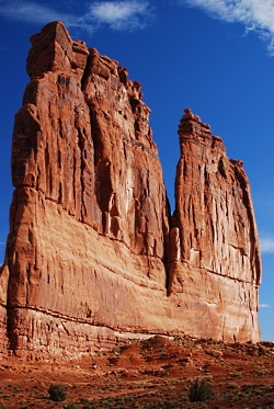
The Organ
Arches National Park
Photo Courtesy and Copyright Kurt Repanshek, Photographer
NationalParksTraveler.com

Stairs to Window Arch
Arches National Park
Photo Courtesy and Copyright Kurt Repanshek, Photographer
NationalParksTraveler.com


As with its neighbor, Canyonlands National Park, Arches National Park conceals most of its wildlife from visitors. That said, lizards are easy to spot, as are mule deer in the cool times of the day. And if you spend a little time before breakfast, or after dinner, you just might see coyotes, porcupines, desert cottontails, black-tailed jackrabbits, and many songbirds.

Because of the high heat during the summer months, most of these animals will be most visible when humans are not typically out and about. Desert animals have a variety of adaptations to deal with the hot weather and aridity. A key adaptation is that most animals are nocturnal, being most active at night. Nocturnal animals in Arches include kangaroo rats, woodrats (also called packrats), and other small desert rodents, skunks, ringtails, foxes, bobcats, mountain lions, bats and owls.

Some desert animals are “diurnal”, or primarily active during the day. These include rock squirrels, antelope squirrels, chipmunks, lizards, snakes, hawks, and eagles.

Many animals have are only active in certain temperature ranges, and they alter their active times of day depending upon the season. During winter months, snakes and lizards are in an inactive state of “torpor,” or sluggishness or even dormancy. But they become active during the day during the late spring and early fall, and then become “crepuscular,” or active mainly during the nighttime hours, to avoid the daytime heat of summer.

Insects, too, alter their times of activity. Mosquitoes, as you no doubt know, may be out from dawn through dusk, depending on the temperatures. But they are not active after the sun goes down.

In spite of Arches’ rather inhospitable appearance, almost 50 species of mammals live in the park’s landscape. But the hot climate and lack of water favors small mammals. Because of their size, these animals are less able to migrate, but have an easier time finding shelter, and require less food and water to live. Rodents are numerous: there are eleven species of mice and rats.

Desert bighorn sheep are one of the larger mammal species to be seen. They are frequently spotted along Highway 191 south of the park visitor center, and call Arches home all year long. They roam the talus slopes and side canyons near the Colorado River, forage for plants, and negotiate the steep, rocky terrain with the greatest of ease.

While Arches may not be considered a prime bird watching hot spot, 273 species have been seen in the park, which includes seasonal, year-round residents, and migrants.

Much of this diversity is due to the riparian corridors like Courthouse Wash and the Colorado River (which forms the park’s southern boundary). Mornings along these corridors often are filled with birdsongs during spring and summer. You might spot blue grosbeaks, yellow-breasted chats, and spotted towhees. Listen carefully and you’ll hear the trill of the canyon wren echoing from the sandstone walls. Great blue herons hunt the shallows for fish, while Cooper’s hawks deftly maneuver through the tangle of trees beyond the riverbanks.

There is life in the desert, if you know where, and more importantly, when, to look for it.

For Wild About Utah and National Parks Traveler, I’m Kurt Repanshek.

Credits:
Images: Courtesy US NPS
Images: Courtesy and Copyright Kurt Repanshek, www.nationalparkstraveler.com
Text:     Kurt Repanshek/Patrick Cone, NationalParksTraveler.com.


Additional Reading:

https://www.nationalparkstraveler.com/browse/Arches%20National%20Park

https://www.nps.gov/arch/index.htm