NOAA National Weather Service
Western Regional Headquarters
Hi I’m Holly Strand.
On a recent camping trip on Utah’s Colorado Plateau, my brother and I were buffeted by strong sand-blasting winds for two days straight. Setting up camp was nearly impossible. Strong gusts ripped the tent away from us. Catching only the guylines, we flew the big green tent like a kite through the sagebrush. Eventually we pulled it down and got stakes in the ground. Unable to make a fire, we ate a cold dinner and tried to sleep –until the tent collapsed under the persistent onslaught of meteorological Furies. The next day, the sand-infused wind whipped us painfully as we descended into Horseshoe Canyon. Dust devils pursued us along the canyon floor.
Arriving home I read up on the cause of our discomfort. In simplest terms wind is caused by air moving from high to low pressure. The steeper the air pressure gradient—that is –the change in air pressure per unit distance–the stronger the resulting wind speed. Differences in air pressure are often caused by localized warming of air temperature. The warm air rises creating a spot of relatively low pressure ; then cooler air from a high pressure region rushes in to replace it.
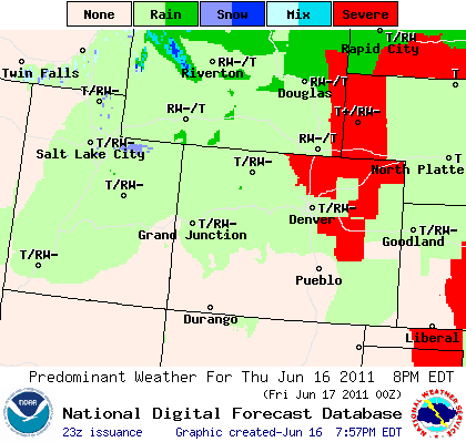
Wind tends to blow much more forcefully near a frontal boundary. And our camp was located very close to the low pressure center of a stationary front. Although the wind was a nuisance, it was probably only blowing around 35 miles an hour. Meanwhile the record in Utah is 124 miles an hour –a wind gust measured at 11000 feet Snowbird. The strongest wind gust here in Logan was 94 miles an hour. Compare this to the highest wind on record anywhere—a gust measuring 253 miles per hour on Australia’s Barrow Island during a tropical cyclone. The record in the United States is 231 miles per hour on top of Mt. Washington in New Hampshire. Higher wind speeds than these may occur in tornadoes, but anemometers tend to malfunction at extreme speeds .
Luckily, we don’t have to worry much about tornadoes. Utah ranks very low in terms of tornado frequency. We average 2-33 a year with most of them occurring May through August. Utah tornadoes tend to be small and not last very long. Whirlwinds or dust devils are much more common. About 90% of them occur in the West Desert where there is plenty of loose, dry dust and sand to swirl around in the air.
Thanks to Marty Booth of the Utah Climate Center for help in developing this Wild About Utah episode.
For Wild About Utah, I’m Holly Strand.
Credits:
Photos: Courtesy US NOAA
Text: Holly Strand
Sources & Additional Reading:
National Weather Service (NOAA) “Dust Devils” https://www.wrh.noaa.gov/fgz/science/dustdvl.php?wfo=fgz [Accessed June 15, 2011]
National Weather Service (NOAA) Jetstream Online School for Weather. “Origin of Wind” https://www.srh.noaa.gov/srh/jetstream/synoptic/wind.htm [Accessed June 15, 2011]
National Weather Service (NOAA) Daily weather maps https://www.hpc.ncep.noaa.gov/dailywxmap/ [Accessed June 15, 2011]
Utah Climate Center https://climate.usurf.usu.edu/
Pope, Dan and Clayton Brough (eds.) Utah’s Weather and Climate. 1996. Salt Lake City: Publisher’s Press. https://www.amazon.com/Utah-Weather-Climate-D-Pope/dp/1567131743
