Capitol Reef

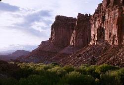
Fruita and the Wingate Cliffs
Capitol Reef National Park
Photo Courtesy US NPS

Orchard
Capitol Reef National Park
Photo Courtesy US NPS

Early settlers to the landscape we know as Capitol Reef National Park in south-central Utah planted cherry, apricot, peach, pear, apple, and walnut trees as a cash crop for survival along the Fremont River bottoms. Visitors today are often surprised by the fruit trees in light of the surrounding desert climate, and campers can pick apples and peaches from their campsites in the orchards. But the green fields and fruit trees also attract deer, marmots, and other small critters, which are easy to spot and are comfortable with humans in their environment.

Though the deer roam free in the tall grass between apple trees, there are other species that are a bit more dangerous lurking nearby. Mountain lions and black bears skillfully stalk around this historic district of Fruita without being seen. Mountain lions have been spotted within a half-mile of the popular campground, yet little is known about the species within the confines of Capitol Reef. With so many questions unanswered about the predator and prey relationship in the unique landscape, the park has received a Disney Nature Impact Grant to enlighten us.

Lori Rome, the park’s chief of interpretation, says, “We are setting up 10-20 infrared motion detected camera traps in surrounding areas. This is a non-invasive way to learn basic information about the species.”

The cameras will provide useful evidence and reveal the patterns of the quiet predators in the park. The public will be engaged through a citizen science project using social media and public interpretive programming, for example helping to survey deer populations.

If you’ve seen Disney Nature’s movie Bears, you, too, helped contribute to the Disney Nature Impact Grants program. Fourteen national parks are receiving funding via proceeds from the movie. Disney Nature has pledged a contribution to the National park Foundation, the official charity of America’s national parks, through the Disney Worldwide Conservation Fund, for each person who saw the film during its first week in theaters.

This type of support helps preserve and protect Capitol Reef and the rest of the National Park System. The Disney Nature Impact Grant enables parks to conduct much-needed conservation projects, such as studying mountain lions at Capitol Reef.

Each park selected to receive a grant through this program had to demonstrate a clear need for the money, and how it would make a profound difference in habitat restoration, wildlife protection or conservation research. With this assistance, we should be able understand predator’s actions in Capitol Reef National Park.

For Wild About Utah and National Parks Traveler, I’m Kurt Repanshek.

Credits:
Image: Courtesy and Copyright Kurt Repanshek, www.nationalparkstraveler.com
Text:     Kurt Repanshek, NationalParksTraveler.com.


Additional Reading:

Capitol Reef And 13 Other National Parks Receive Impact Grants From Disney Nature’s Movie “Bears”, Submitted by Carli Jones, June 26, 2014, NationalParksTraveler.comhttps://www.nationalparkstraveler.com/2014/06/capitol-reef-and-13-other-national-parks-receive-impact-grants-disney-natures-movie-bears25263

Capital Reef National Park, https://www.nationalparkstraveler.com/park/capitol-reef-national-park

Capital Reef National Park, https://www.nps.gov/care/index.htm

Mammals in Capital Reef National Park, https://www.nps.gov/care/naturescience/mammalchecklist.htm
Amphibians in Capital Reef National Park, https://www.nps.gov/care/naturescience/amphibians.htm
Fish in Capital Reef National Park, https://www.nps.gov/care/naturescience/fish.htm
Birds in Capital Reef National Park, https://www.nps.gov/care/naturescience/birds.htm
Reptiles in Capital Reef National Park, https://www.nps.gov/care/naturescience/reptiles.htm
Arches Wildlife

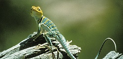
Western Collared Lizard
Arches National Park
Photo Courtesy US NPS

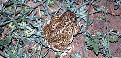
Spadefoot Toad
Arches National Park
Photo Courtesy US NPS

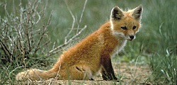
Red Fox
Arches National Park
Photo Courtesy US NPS
Lee Kaiser, Photographer

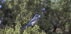
Western Scrub Jay
Arches National Park
Photo Courtesy US NPS
Neal Herbert, Photographer

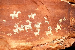
Petroglyphs
Arches National Park
Photo Courtesy and Copyright Kurt Repanshek, Photographer
NationalParksTraveler.com

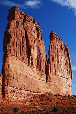
The Organ
Arches National Park
Photo Courtesy and Copyright Kurt Repanshek, Photographer
NationalParksTraveler.com

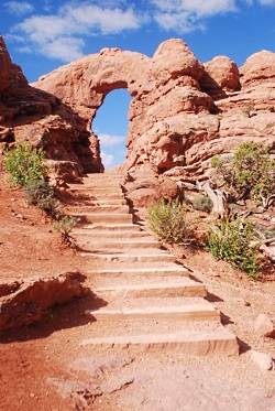
Stairs to Window Arch
Arches National Park
Photo Courtesy and Copyright Kurt Repanshek, Photographer
NationalParksTraveler.com


As with its neighbor, Canyonlands National Park, Arches National Park conceals most of its wildlife from visitors. That said, lizards are easy to spot, as are mule deer in the cool times of the day. And if you spend a little time before breakfast, or after dinner, you just might see coyotes, porcupines, desert cottontails, black-tailed jackrabbits, and many songbirds.

Because of the high heat during the summer months, most of these animals will be most visible when humans are not typically out and about. Desert animals have a variety of adaptations to deal with the hot weather and aridity. A key adaptation is that most animals are nocturnal, being most active at night. Nocturnal animals in Arches include kangaroo rats, woodrats (also called packrats), and other small desert rodents, skunks, ringtails, foxes, bobcats, mountain lions, bats and owls.

Some desert animals are “diurnal”, or primarily active during the day. These include rock squirrels, antelope squirrels, chipmunks, lizards, snakes, hawks, and eagles.

Many animals have are only active in certain temperature ranges, and they alter their active times of day depending upon the season. During winter months, snakes and lizards are in an inactive state of “torpor,” or sluggishness or even dormancy. But they become active during the day during the late spring and early fall, and then become “crepuscular,” or active mainly during the nighttime hours, to avoid the daytime heat of summer.

Insects, too, alter their times of activity. Mosquitoes, as you no doubt know, may be out from dawn through dusk, depending on the temperatures. But they are not active after the sun goes down.

In spite of Arches’ rather inhospitable appearance, almost 50 species of mammals live in the park’s landscape. But the hot climate and lack of water favors small mammals. Because of their size, these animals are less able to migrate, but have an easier time finding shelter, and require less food and water to live. Rodents are numerous: there are eleven species of mice and rats.

Desert bighorn sheep are one of the larger mammal species to be seen. They are frequently spotted along Highway 191 south of the park visitor center, and call Arches home all year long. They roam the talus slopes and side canyons near the Colorado River, forage for plants, and negotiate the steep, rocky terrain with the greatest of ease.

While Arches may not be considered a prime bird watching hot spot, 273 species have been seen in the park, which includes seasonal, year-round residents, and migrants.

Much of this diversity is due to the riparian corridors like Courthouse Wash and the Colorado River (which forms the park’s southern boundary). Mornings along these corridors often are filled with birdsongs during spring and summer. You might spot blue grosbeaks, yellow-breasted chats, and spotted towhees. Listen carefully and you’ll hear the trill of the canyon wren echoing from the sandstone walls. Great blue herons hunt the shallows for fish, while Cooper’s hawks deftly maneuver through the tangle of trees beyond the riverbanks.

There is life in the desert, if you know where, and more importantly, when, to look for it.

For Wild About Utah and National Parks Traveler, I’m Kurt Repanshek.

Credits:
Images: Courtesy US NPS
Images: Courtesy and Copyright Kurt Repanshek, www.nationalparkstraveler.com
Text:     Kurt Repanshek/Patrick Cone, NationalParksTraveler.com.


Additional Reading:

https://www.nationalparkstraveler.com/browse/Arches%20National%20Park

https://www.nps.gov/arch/index.htm

The Geology of Canyonlands National Park

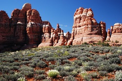
Chesler Park
Canyonlands National Park
Photo Courtesy and Copyright Kurt Repanshek, Photographer

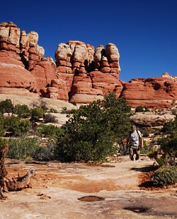
Chesler Park
Canyonlands National Park
Photo Courtesy and Copyright Kurt Repanshek, Photographer

Baked by time like some multi-layer geologic tort, Canyonlands National Park in southeastern Utah features a landscape cut by canyons, rumpled by upthrusts, dimpled by grabens, and even pockmarked, some believe, by ancient asteroids.

Just outside of Moab rises a kaleidoscope of tilted and carved geology laid down over the eons. There’s the red and white Cedar Mesa sandstone, the grayish-green Morrison Formation, pinkish Entrada sandstone, and tawny Navajo sandstone, just to name some of the geologic layers. Stacked like pancakes, they help make Canyonlands the most rugged national park in the Southwest and, quite possibly, if you find yourself deep in the park’s Maze District, in the entire Lower 48 states.

In each of the park’s districts — Island in the Sky, Needles, Maze and Horseshoe Canyon — the remarkable effects of geologic time and its endless erosion on this sedimentary landscape rise about you.

If you could turn back the geologic clock, you would see the landscape flooded by oceans, crisscrossed by rivers, covered by mudflats and buried by sand. At various times through the millennia, the climate has resembled a tropical coast, an interior desert, and everything in between.

For hundreds of millions of years, material was deposited. Layer upon layer of sedimentary rock formed as buried materials were cemented by precipitates in the ground water. Each layer contains clues to its origin, such as patterns or fossils, which reveals the environment when it was deposited. For example, the colorful Cedar Mesa Sandstone occurred when periodic floods of iron-rich debris from nearby mountains inundated coastal dunes of white sand.

Along with sedimentation, movements in the earth’s crust altered surface features. The North American continent migrated north from the equator and the local climate and environment here changed dramatically.

Peer into the ragged maw of Canyonlands from the Island in the Sky District on the northern end of the park, and it’s no mystery how the park came by its name.

Spend the night at the Squaw Flat Campground in the Needles District and a morning hike into Chesler Park surrounds you with Creamsicle-hued minarets towering high above, like a king’s crown.

Though Canyonlands covers less than 350,000 acres, which is less than one-seventh the size of Yellowstone National Park, it feels much larger. No doubt it’s the park’s vastness and openness — you won’t find any forests here. Indeed, one old timer said that, “On a clear day, you can see the back of your own head.”

Spend a few minutes contemplating the natural forces, and the hundreds of millions of years that laid down these sediments and compressed these layers of rock. It’s really only recently that these layers have eroded to form the remarkable landscape seen today in Canyonlands National Park.

For Wild About Utah and National Parks Traveler, I’m Kurt Repanshek.

Credits:
Image: Courtesy and Copyright Kurt Repanshek, www.nationalparkstraveler.com
Text:     Kurt Repanshek, NationalParksTraveler.com.


Additional Reading:

Canyonlands National Park, National Parks Service,

Exploring The Parks: Musings From Island In The Sky At Canyonlands National Park, NationalParksTraveler.com Article – Lee Dalton – 06/24/2014

Exploring The Parks: Musings From The Needles District In Canyonlands National Park, NationalParksTraveler.com Article – Lee Dalton – 06/19/2014

Reflections Of Time In Canyonlands, NationalParksTraveler.com Article – Lee Dalton – 06/19/2014

https://www.nationalparkstraveler.com/search/apachesolr_search/canyonlands, NationalParksTraveler.com Canyonlands Articles

Hylland, Rebecca, What are Igneous, Sedimentary & Metamorphic Rocks?, Glad You Asked, Utah Geological Survey, https://geology.utah.gov/map-pub/survey-notes/glad-you-asked/igneous-sedimentary-metamorphic-rocks/

Best Snow

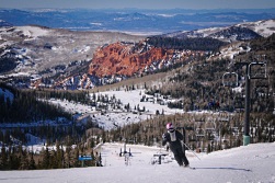
Skier at Brian Head
Photo Courtesy USDA Forest Service

As the mountains begin to take on hues of scarlet, gold and russet, many Utahns might be looking eagerly toward the coming months when those slopes will be blanketed in white. The Utah ski industry nurtures a whopping annual income of about $800 million dollars. It’s no surprise, therefore, that the state claims to have the “greatest snow on earth.” In fact, the state of Utah managed to make their slogan a federal trademark in 1995 after winning a lawsuit brought by the Ringling Brothers and Barnum & Bailey circus group, who felt the catchy marketing phrase might be confused with their slogan, the Greatest Show on Earth.

The trademark must have worked, because Utah draws so many visitors to its slopes, it racks up about 4 million skier days annually. But disregard plenty of evidence that we do indeed draw a crowd, and the statement is pretty subjective. So what’s the science behind our legendary powder?

The ideal condition skiers hope for is a deep, fluffy snow that creates the illusion of bottomless powder. And finding it is a bit like the Goldilocks story. Too wet, and you bog down. Too dry, and there’s not enough body to create a floating sensation beneath the ski. If the terrain is too steep, the powder won’t stick. And if it’s not steep enough, you can’t build sufficient momentum to glide over the top.

To get to the bottom of why Utah’s snow is just right, we actually have to look even further westward, toward the slow warm waters of the North Pacific current. As water laden clouds move inland, snow first falls over the Cascades in the north and the Sierra Nevadas further south, with an average moisture content of 12%. Even in areas like Washington’s Mt. Baker, where annual snowfall comes in greater quantities than Utah, the moister maritime snow creates a heavy base that bogs down skis. By the time these winter storms cross the Great Basin and reach the skiers’ Mecca of Alta and the Wasatch Range, the moisture content will have decreased to about 8.5%. And that seems to be the sweet spot. The moisture content of Utah’s intermountain snow is just enough that powder from our first storms settles into a soft but voluminous base. As winter progresses, fresh snow falls in a cold and mostly arid environment, forming very fine, symmetrical crystals called dendrites. The microscopic structure of dendrites allows them to accumulate in well ventilated, incompact drifts, much like the puffy down in your favorite pillow or ski jacket.

And perfect powder isn’t the only advantage Utah’s ski resorts have over their neighbors. Our mountainous topography, with its wealth of winding canyons, means we have an abundance of slopes well protected from strong winds which could compact or carry away fresh snowfall. And while so many cold and overcast days might get you down, it also protects our top powder from radiation and air mass effect, which can create a crust along the surface. And that means our freshly fallen powder sticks around for longer.

So consider that Utah offers 26,000 acres of mountain, blanketed in more than 500 annual inches of perfect intermountain snow, and it’s no wonder we enjoy 5 times the number of “powder days” as our neighbors. “The Greatest Snow on Earth” starts sounding a lot less subjective, and more like truth. In fact, you just might be tempted to make like Goldilocks and make yourself at home.

For Wild About Utah and Stokes Nature Center, I’m Ru Mahoney.

Credits:
Image: Courtesy USDA Forest Service, fs.usda.gov
Text:     Ru Mahoney, Stokes Nature Center in Logan Canyon.


Additional Reading: