Climb Grand Teton…Virtually

Grand Teton virtual climb

Click to view larger image of Grand Teton virtual climb, Photo Courtesy NPS Photo Courtesy NPS, K Kanes, Photographer
.

Photo Courtesy NPS
K Kanes, Photographer
 
Begin Tour
(Requires Adobe Flash Player)

Scaling “the Grand,” that picturesque mountain that hangs over Jackson, Wyoming, along with its battleship-gray sisters in the Teton Range, was a ridiculous thought that found harbor in the back of my mind in the spring of 1985 when I first glanced up at the peak.

Along with a dozen or so other neighboring peaks that rise above 10,000 feet, the Tetons form a ponderous, jagged stretch of rock that is the Lower 48’s most arresting mountain range. The soul of Grand Teton National Park, the Grand as it’s known harbors world-class climbs.

Some climbers tackle the mountain on their own, while neophytes such as myself are herded ever upward under the watchful guidance of one of Jackson’s two resident climbing outfitters, Exum Mountain Guides and Jackson Hole Mountain Guides.

To me, an Easterner by birth, the 13,770-foot tall Grand Teton is a breathtaking, and incredibly tall, mountain. But climb it? Not only am I usually most comfortable with both feet firmly planted flat on the ground, but the thought of only a thin rope and a precarious hand- or toe-hold between me and an incredible long way down scared the hell out of me, quite frankly.

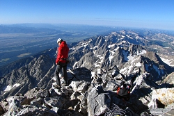
The view from atop the Grand Teton is incredible. To the west, the Jedediah Smith Wilderness stands. To the north, Yellowstone National Park. To the east, Jackson Hole, with the moraine that is Timbered Island so very well defined.

Now, if you haven’t climbed to the roof of Grand Teton National Park, or can’t, you can still enjoy the view.

A new virtual tour produced by the park staff takes you from the Jackson Hole Valley to the summit from the comfort of your living room or office. No cold or pelting rain, no thunder claps or lightning strikes, just a nice mix of interactive still photos and video cuts that take you to the top.

This virtual mountaineering excursion—or eClimb, as the park dubs it—provides an introduction to the features, geology, history, and excitement of scaling the granite ledges and spires that form the Grand Teton massif: the highest peak in the Teton Range and second highest mountain in Wyoming. This web-based tour introduces viewers to the various elements (rocky terrain, plants and wildlife) that exist in Grand Teton’s forest and alpine communities.

As an eClimber you can control images and sounds at each stop along your virtual tour, and you can activate videos to explore the human and natural history related to each location along the climbing route. By hovering your mouse over a photograph, hidden images will be revealed through the click of a button.

eClimbers can also use videos to imagine scrambling over boulder fields and wedging through rocky alcoves as they experience the thrill of climbing and drama of a mountain rescue in a virtual landscape.

To find this virtual climb, go to Grand Teton’s website (www.nps.gov/grte) and click on  “Grand Teton eClimb” near the bottom of the home page.

For Wild About Utah, this is Kurt Repanshek with National Parks Traveler

Credits:
Image: Courtesy USGS, www.usgs.gov
Image: Courtesy and Copyright Kurt Repanshek, www.nationalparkstraveler.com
Text:     Kurt Repanshek, NationalParksTraveler.com.

 
Additional Reading:

Grand Teton National Park

Grand Teton eClimb

NationalParksTraveler.com

National Parks Traveler: Climb The Grand Teton…Virtually!


National Park or National Monument?

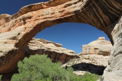
National Park or National Monument: Sipapu Natural Bridge, Natural Bridges National Monument, Courtesy and Copyright Anna Bengston
Sipapu Natural Bridge
Natural Bridges National Monument
Courtesy & Copyright Anna Bengston

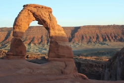
National Park or National Monument: Delicate Arch, Arches National Park, Courtesy and Copyright Anna BengstonDelicate Arch
Arches National Park
Courtesy & Copyright Anna Bengston

Established in 1916 the National Park Service manages all properties included in the National Park System. This system includes over 400 areas that encompass more than 84 million acres of land. These areas can go by one of 31 different titles. Within this system, Utah boasts 1 national historic site, 2 national recreation areas, 7 national monuments, and 5 national parks. While the reason for some of these titles is self-explanatory, the reason for others is less clear. National Park or National Monument?

For example, what makes one area a “national park” and another a “national monument?” Most people – including myself – would probably guess that the difference is in size. And while this is sometimes true, the primary difference is the reason for which each is established, because these two designations grew from historically separate concepts. The notion of the national park, which was simply the idea of large-scale natural preservation for public enjoyment, grew in popularity throughout the 1800s. As a result you can typically think of a national park as a spectacular scenic feature or natural phenomena preserved for inspirational, educational, and recreational value.

On the other hand, the idea of the national monument arose as a result of the need and desire to also protect prehistoric cliff dwellings, pueblo remains, and other historic ruins found by explorers of the American West and Southwest. Efforts to protect these sites resulted in the passing of the Antiquities Act of 1906. Therefore a national monument is usually designated to preserve objects of prehistoric, historic, cultural, and/or scientific interest. However, the Antiquities Act has been used more widely to preserve natural features as well, meaning the content of national monuments can be quite varied from wilderness areas to military sites to buildings and ruins.

There are also a couple of legal differences between these two designations. National parks are established through acts of Congress, whereas national monuments are established by Presidential proclamation. Administratively, the National Park Service manages all national parks. While national monuments, depending on their location and content, can fall under not only under the jurisdiction of the National Park Service, but also that of the U.S. Forest Service, the U.S. Fish and Wildlife Service, the National Oceanic and Atmospheric Administration, the Department of Defense, or the Bureau of Land Management.

So, it’s not just size that makes the difference, its intent, content, process of establishment, and administration. The next time you visit one of Utah’s national parks or monuments, will you be able to tell the difference?

For Wild About Utah, I’m Anna Bengtson of Park City.

Arches National Park
Bryce Canyon National Park
Capitol Reef National Park
Canyonlands National Park
Zion National Park

Golden Spike National Historic Site
Cedar Breaks National Monument
Dinosaur National Monument
Grand Staircase National Monument
Hovenweep National Monument
Natural Bridges National Monument
Pipe Spring National Monument(Border Utah/Arizona)
Rainbow Bridge National Monument
Timpanogos Cave National Monument

Flaming Gorge National Recreation Area
Glen Canyon National Recreation Area

Credits:
Image: Courtesy and Copyright Anna Bengston
Text: Anna Bengston

Additional Reading:

Biggers, Ashley. “National Parks Versus National Monuments.” Outside Online. 22 Apr. 2014. Web. 8 June 2014. https://www.outsideonline.com/adventure-travel/escapes/travel-agent/The-Difference-between-National-Parks-and-National-Monuments.html.

McDonnell, Janet. The national parks: shaping the system. 3rd ed. Washington, D.C.: U.S. Dept. of the Interior, 2005. Web, 8 June 2014. https://www.nps.gov/parkhistory/online_books/shaping/index.htm.

O’Connor, Mary. “Killing A Bill that Could Save National Parks.” Outside Online. N.p., 14 Apr. 2014. Web. 8 June 2014. https://www.outsideonline.com/outdoor-adventure/the-current/footprint/Five-Treasures-We-Owe-to-the-Imperiled-Antiquities-Act.html.

“Parks and Monuments.” Utah. N.p., n.d. Web. 8 June 2014. https://www.visitutah.com/parks-monuments/.

Righter, Robert. “National Monuments to National Parks:
The Use of the Antiquities Act of 1906”, National Park Service History: National Monuments to National Parks. N.p., Aug. 1989. Web. 8 June 2014. https://www.nps.gov/parkhistory/hisnps/npshistory/righter.htm.

United States. National Park Service. “National Park Service History: National Park System Nomenclature.” National Parks Service. U.S. Department of the Interior, n.d. Web. 8 June 2014. https://www.nps.gov/history/history/hisnps/NPSHistory/nomenclature.html.

United States. National Park Service. “Frequently Asked Questions.” National Parks Service. U.S. Department of the Interior, 28 May 2014. Web. 8 June 2014. https://www.nps.gov/faqs.htm.

Yard, Robert Sterling, and Isabelle F. Story. “Parks vs. Monuments.” The national parks portfolio. 6th ed. Washington: U.S. Government Printing Office, 1931. Web, 8 June 2014. https://www.nps.gov/history/history/online_books/portfolio/portfolio0b.htm.

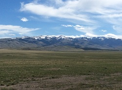
The Raft River Mountains

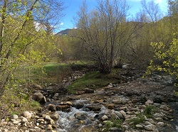
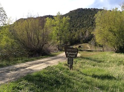
The Raft River Mountains: Clear Creek in Spring
Clear Creek in Spring
Courtesy & Copyright Holly Strand

The Raft River Mountains: Raft River MountainsRaft River Mountains
Courtesy & Copyright Holly Strand

The Raft River Mountains: Near Clear Creek Campground.Near Clear Creek Campground.
Courtesy & Copyright Holly Strand


Hi, I’m Holly Strand of the Quinney College of Natural Resources at Utah State University.

In each of Utah’s six corners you’ll find one or more remarkable natural features. Moreover, each corner represents a totally different geographic environment. No doubt you are familiar with turquoise blue Bear Lake in the upper northeast and the magnificent High Uintas near the angle formed by Wyoming. Flaming Gorge and Dinosaur National Monument flank the lower northeast corner. The ancient ruins and Monument Valley draw international visitors to the southeast corner. The numerous canyon parks in Utah’s southwest corner offer endless opportunities for exploration. 

That’s five corners. But what do you know about the northwest corner of our state? I live in Northern Utah and I had never been there. Resolved to correct this omission I consulted a map as well as Joan Hammer of Box Elder County’s Office of Tourism. I concluded that the Raft River Mountains were worth checking out. The highest point in the County, Bull Mountain is here. And the 40 mile long range defines the southernmost section of Sawtooth National Forest.

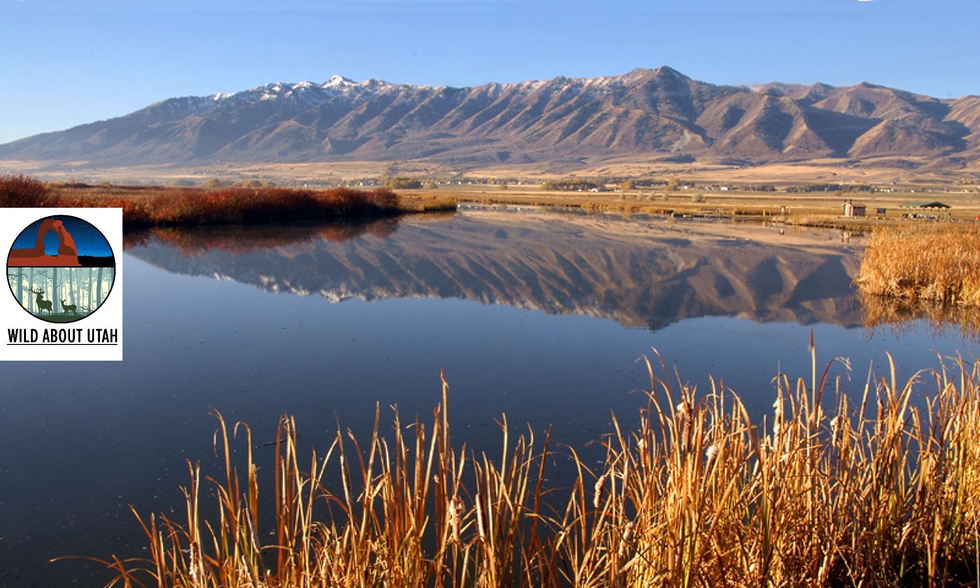
The Raft River Mountains are unusual in that they run east-west. The normal pattern for Basin and Range country is north-south. The east-west orientation creates an important geographic dividing line. For Clear Creek drains the northern slopes of the Raft River Mountains. Then Clear Creek joins the Raft River which flows north to the Snake River. Thus the mountains form the sole—and very small—piece of Utah real estate that belongs to the great Colombia River Basin. The southern slopes are part of Great Basin. Rain or snow falling on this side is absorbed into the ground or evaporates.

Another interesting fact: The Raft River Mountains is where you can view some of the oldest rock in Utah. In this region, outcrops of Precambrian material are 2.5 billion years old. The largest and thickest exposures are in the eastern half of the range.

The Raft River Mountain peaks may not make it onto post cards. But when I saw them they were nothing less than beautiful. The lower slopes of sagebrush had the grayish-green tint that emerges all too briefly in the spring. Snow still gleamed on the 8-9000 foot summits. Clear Creek was running full through riparian forest that was just starting to leaf out. There were no people at the campground but wildlife was plentiful. I saw wild turkey, deer, jackrabbits and squirrels. A few pronghorn looked up as I drove out through the sagebrush. All in all, I found Utah’s sixth corner to be well worth a visit.

For pictures and more information about the Raft River Mountains, go to www.wildaboututah.org

For Wild About Utah, and the Quinney College of Natural Resources, I’m Holly Strand.

Credits:

Images: Courtesy and Copyright Holly Strand
Text: Holly Strand

Additional Reading

Doelling, Hellmut H. Geology and Mineral Resources of Box Elder County. Utah Geological and Mineral Survey. 1980. Bulletin 115.,

Stokes, William Lee. 1988. Geology of Utah. Salt Lake City: Utah Museum of Natural History. SummitPost.org Bull Mountain. https://www.summitpost.org/bull-mtn-ut/183282https://www.summitpost.org/bull-mtn-ut/183282 [Accessed May 13, 2014 and July 10, 2020]

USDA Forest Service. Sawtooth National Forest, Raft River Division. https://www.fs.usda.gov/recarea/sawtooth/recarea/?recid=5806 [Accessed May 13, 2014 and July 10, 2020]

Hylland, Rebecca, What are Igneous, Sedimentary & Metamorphic Rocks?, Glad You Asked, Utah Geological Survey, https://geology.utah.gov/map-pub/survey-notes/glad-you-asked/igneous-sedimentary-metamorphic-rocks/

Defining the Great Basin

Willow Creek North of Wells, NV. Sagebrush at mid-distance. Route of the California Trail used by pioneers.
Willow Creek north of Wells, NV.
Sagebrush at mid-distance.
Route of the California Trail
used by pioneers.

Courtesy & Copyright
Jim Cane, Photographer

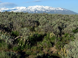
Lupines amid sagebrush north of Wells, NV. Ruby Mountains in backgroundLupines amid sagebrush
north of Wells, NV.
Ruby Mountains in background
Courtesy & Copyright
Jim Cane, Photographer

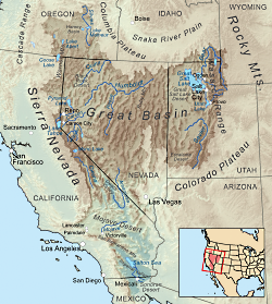
Map delineating the Great basinMap delineating the Great basin
Courtesy Wikimedia, KMusser, Artist
Ref: wikipedia.org/wiki/Great_Basin


The Great Basin is aptly named.  Twice the size of Kansas, it stretches from the watersheds of the Columbia and Snake rivers south to that of the Colorado, and from the crests of the Sierra Nevada and southern Cascades eastward to the Wasatch front.  The Western explorer John Fremont coined its name in 1845.  The rivers and streams of the region that Fremont had seen all ended in sinks, marshes or lakes. None flowed to the Pacific Ocean.  He confirmed this on meeting Joseph Walker at Mountain Meadows in Utah.  Walker had traveled more of the basin’s western margins, dispelling  rumors of a river traversing the Sierra Nevada.  Precipitation that falls in the Great Basin stays in the Great Basin; water leaves only as vapor.  This is the hydrographic Great Basin.

How else to view the vast region between the Rockies and the Sierra Nevada? Geologists speak of the “Basin and Range Province”, so named for its valleys and the towering ranks of north-south mountain ranges that march across the landscapes of Nevada and edges of adjacent states. Unlike the upthrust Rockies and Sierra Nevada, Earth’s crust in the Great Basin appears to be spreading, to be pulling apart. The tilted escarpments of the Wasatch front are the easternmost evidence of this crustal deformation that has built the Basin and Range Province.

Botanists delimit the Great Basin by the hardy flora that clothes this rugged landscape. Great Basin plants tolerate freezing winters and parched summers, and in the valleys, soils of varying salinity.  The so-called Sagebrush Ocean fills many of the basins, as do other shrubs, such as shadscale and greasewood.  Upslope, these give way to juniper woodlands, often mixed with piñon pine.  This floristic Great Basin reaches eastward to central Utah and the Wasatch front, beyond which trees and other plants of the Rockies make their appearance.

The boundaries of all three concepts for the Great Basin — hydrographic, geologic and floristic — largely coincide.  Each recognizes the distinctive attributes of the Great Basin that set it apart from neighboring regions.  The Great Basin is readily recognizable to the trained eye, whether looking at satellite images, river courses, or the native plant communities encountered on a simple walk.

Credits:
Images: Jim Cane
Map: Courtesy Wikimedia, KMusser, Artist, licensed under Creative Commons Attribution-Share Alike 3.0 Unported
Text: Jim Cane

Additional Reading

Frémont, John Charles. 1845. Report of the exploring expedition to the Rocky Mountains in the year 1842 and to Oregon and North California in the years 1843 – 44. Printed by order of the Senate of the United States , Gales & Seaton, 693 pages. –available as a Google eBook scanned from the original published book Grayson, Donald K. 1999. The desert’s past : a natural prehistory of the Great Basin. Smithsonian Institution Press, Washington D.C., 356 pages. –an exceptionally readable, thorough and authoritative overview of the Great Basin, with many maps, photographs and illustrations.https://books.google.com/books?id=W8ICAAAAMAAJ

Intermountain Regional Herbarium Network. searchable plant database representing multiple holdings of herbaria at universities in Utah and Nevada, with maps, images and more https://swbiodiversity.org/seinet/projects/index.php?proj=10

McPhee, John. 1981. Basin and Range. Farrar, Straus, Giroux, New York. 215 pages. –the first of the author’s many engaging books about geology. https://www.amazon.com/Basin-Range-John-McPhee/dp/0374516901